Spring
Spring below Packova Kýčera (north-west slope)
Slovakia · Bieszczady range · 699 m
Condition
Not verifiedNo recent reports. Carry water and, if you pass by, tell us what you saw.
Last edited on the OSM map 24.08.2026
- 699 m
- Flows all year
- Marked as drinkable
About
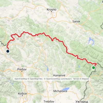
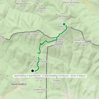
Bieszczady range, about 700 m above sea level. Mount Kamienna (Kamenná lúka) (1 201 m) is about 2 km away. 2 of the site’s trails pass nearby, including “Východokarpatská magistrála”.
The spring is known to flow in summer too. The water is marked as drinkable on the map, but nobody guarantees its quality.
On the map
Coordinates: 49.07377, 22.53896
How to get there
Trails nearby
Report the condition
Been here recently? Tell us what you saw and add photos — your report appears on the page right away with today’s date.
No photos yet — send yours together with a condition report.
