Condition
Weak flowWeak flow — slow to fill, may disappear in hot weather.
Last edited on the OSM map 11.08.2025
- 1 137 m
- Dries out in summer or drought
About
Gorgany range, about 1 140 m above sea level. The nearest settlement is Zelena, about 3.7 km in a straight line. 3 of the site’s trails pass nearby, including “Pasichna village – Pereslop Pass”.
This spring dries out in summer or in dry years, so do not rely on it as your only water. The flow is weak: filling a bottle takes time. There is no confirmation that the water is drinkable — boil or filter it first. The nearest hut or shelter is “Mountain shelter on Mount Pasichanka”, 100 m away.
In an emergency in the mountains call the rescuers: 101 or 112.
Comments
Travellers’ experience: reports, tips, questions.
No one has written here yet. Be the first — your experience helps others.
On the map
Coordinates: 48.53208, 24.41036
How to get there
Trails nearby
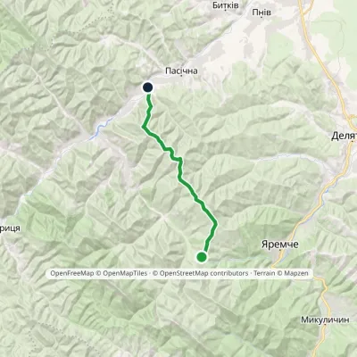 ModerateOne-dayMarkedPasichna village Pereslop PassElevation profile548–1 324 m17.3 kmascent 1 085 m≈ 6 h walking
 HardOne-dayMarkedPasichna village to Yaremchevia Mount SyniachkaElevation profile516–1 400 m26.7 kmascent 1 156 m≈ 8.5 h walking
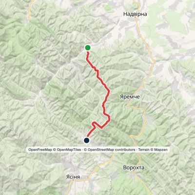 Hard1–2 daysPasichna village to Polianytsia villagevia Mount Syniak, Mount Malyi HorhanElevation profile556–1 665 m33.8 kmascent 2 099 m≈ 12 h walking
Nearest settlement: Zelena, about 3.7 km in a straight line.
Report the condition
Been here recently? Tell us what you saw and add photos — your report appears on the page right away with today’s date.
No photos yet — send yours together with a condition report.
