Condition
Weak flowWeak flow — slow to fill, may disappear in hot weather.
- 1 905 m
- Dries out in summer or drought
About
Chornohora range, about 1 910 m above sea level. Mount Menchul (1 998 m) is about 680 m away. The nearest settlement is Dzembronia, about 7.1 km in a straight line. 8 of the site’s trails pass nearby, including “Zaroslyak base, via Mount Turkul, Mount Dzembronia and Mount Pip Ivan Chornohirskyi to Shybene village”.
This spring dries out in summer or in dry years, so do not rely on it as your only water. The flow is weak: filling a bottle takes time.
On the map
Coordinates: 48.09047, 24.58648
How to get there
Trails nearby
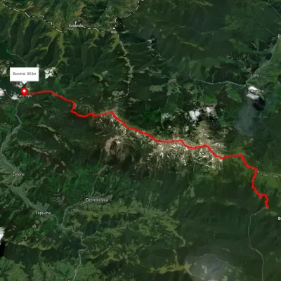 HardMulti-dayUnmarkedZaroslyak base to Shybene villagevia Mount Turkul, Mount Dzembronia +1Elevation profile846–2 003 m31.1 kmascent 1 483 m≈ 10.5 h walking
 HardMulti-dayUnmarkedDzembronia village to Kryvopillia villagevia Mount Pip Ivan Chornohirskyi, Mount ShpytsiElevation profile825–2 004 m44 kmascent 2 277 m
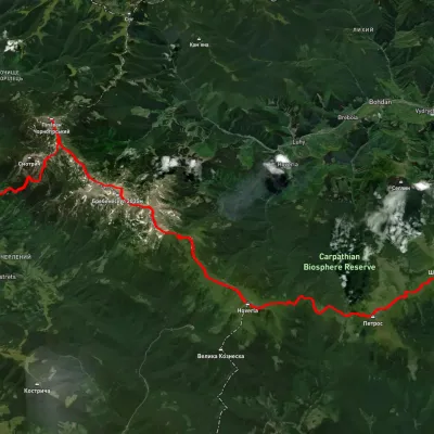 HardMulti-dayUnmarkedIltsi village to Kvasy villagevia Dzembronia village, Mount Pip Ivan Chornohirskyi +2Elevation profile535–2 037 m68.2 kmascent 3 105 m
 HardMulti-dayMarkedTranscarpathian Tourist TrailElevation profile198–2 031 m393.2 kmascent 30 283 m
 ModerateOne-dayUnmarkedMount Pip Ivan Chornohirskyi to Lake Nesamovytevia Mount Dzembronia, Mount RebraElevation profile1 742–2 011 m13.3 kmascent 476 m≈ 4.5 h walking
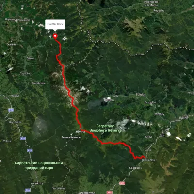 HardMulti-dayUnmarkedKvasy village to Shybene villagevia Mount Petros, Mount Hoverla +2Elevation profile540–2 042 m51.1 kmascent 3 307 m
Nearest settlement: Dzembronia, about 7.1 km in a straight line.
Report the condition
Been here recently? Tell us what you saw and add photos — your report appears on the page right away with today’s date.
No photos yet — send yours together with a condition report.
