Condition
Not verifiedNo recent reports. Carry water and, if you pass by, tell us what you saw.
Last edited on the OSM map 24.07.2012
- 1 095 m
About
Skole Beskids range, about 1 100 m above sea level. Mount Lopata (1 211 m) is about 1.4 km away. The nearest settlement is Hrebeniv, about 3.8 km in a straight line. 4 of the site’s trails pass nearby, including “Skole, via Mount Lopata and Kamianka Waterfall to Dubyna village”.
There is no confirmation that the water is drinkable — boil or filter it first. The nearest hut or shelter is “Weather shelter (Hrebeniv)”, 1.8 km away.
In an emergency in the mountains call the rescuers: 101 or 112.
Comments
Travellers’ experience: reports, tips, questions.
No one has written here yet. Be the first — your experience helps others.
On the map
Coordinates: 48.97689, 23.52284
How to get there
Trails nearby
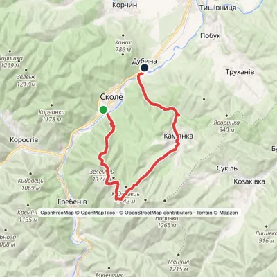 HardOne-daySkole to Dubyna villagevia Mount Lopata, Kamianka WaterfallElevation profile418–1 211 m25.7 kmascent 986 m≈ 8 h walking
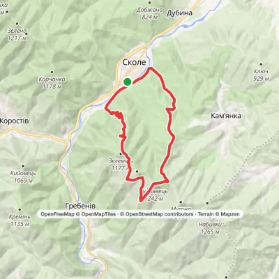 HardOne-daySkole loopvia Mount Kudriavets, Mount LopataElevation profile437–1 242 m21.2 kmascent 986 m≈ 7 h walking
 ModerateOne-dayHrebeniv village to Skolevia Kudriavets village, Lopata villageElevation profile437–1 242 m16.9 kmascent 779 m≈ 5.5 h walking
 ModerateOne-dayHrebeniv village to Skolevia Mount Kudriavets, Mount LopataElevation profile437–1 242 m18 kmascent 780 m≈ 6 h walking
Nearest settlement: Hrebeniv, about 3.8 km in a straight line.
Report the condition
Been here recently? Tell us what you saw and add photos — your report appears on the page right away with today’s date.
No photos yet — send yours together with a condition report.
