Condition
Has waterLatest report: there is water.
- 1 791 m
- Dries out in summer or drought
- Marked as drinkable
About
Chornohora range, about 1 790 m above sea level. Mount Gutin Tomnatik (2 016 m) is about 390 m away. The nearest settlement is Dzembronia, about 8.7 km in a straight line. 8 of the site’s trails pass nearby, including “Luhy village, via Mount Hutyn Tomnatyk, Lake Brebeneskul, Lake Nesamovyte and Mount Hoverla to Luhy village”.
This spring dries out in summer or in dry years, so do not rely on it as your only water. The water is marked as drinkable on the map, but nobody guarantees its quality.
On the map
Coordinates: 48.10102, 24.56117
How to get there
Trails nearby
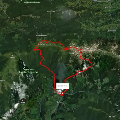 HardMulti-dayUnmarkedLuhy village loopvia Mount Hutyn Tomnatyk, Lake Brebeneskul +2Elevation profile650–2 039 m45.4 kmascent 3 607 m
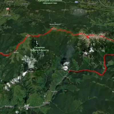 HardMulti-dayUnmarkedLuhy village to Kvasy villagevia Mount Pip Ivan Chornohirskyi, Mount Rebra +3Elevation profile532–2 023 m58.8 kmascent 3 435 m
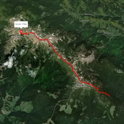 ModerateOne-dayUnmarkedVesnarka polonyna to Lake Brebeneskulvia Mount Pip Ivan Chornohirskyi, Mount DzembroniaElevation profile1 498–2 022 m13.2 kmascent 937 m≈ 5 h walking
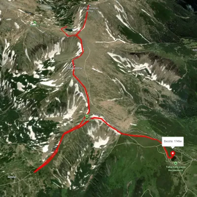 EasyOne-dayUnmarkedLake Brebeneskul to Lake Nesamovytevia Mount Rebra, Mount ShpytsiElevation profile1 737–1 999 m7 kmascent 421 m≈ 2.5 h walking
 HardMulti-dayUnmarkedLazeshchyna village, Mount Petros, Mount Hoverla, Mount Dzembronia, Mount Smotrych and Mount Pip Ivan Chornohirskyi to Shybene villageElevation profile703–2 053 m70.2 kmascent 3 435 m
 HardMulti-dayUnmarkedYasinia to Luhy villagevia Mount Petros, Mount Hoverla +1Elevation profile625–2 033 m61.4 kmascent 3 171 m
Nearest settlement: Dzembronia, about 8.7 km in a straight line.
Report the condition
Been here recently? Tell us what you saw and add photos — your report appears on the page right away with today’s date.
No photos yet — send yours together with a condition report.
