Condition
RuinedRuined or burnt — do not count on it for the night.
- 1 403 m
About
Gorgany range, about 1 400 m above sea level. Mount Yayko-Ilemske (1 680 m) is about 1.1 km away. The nearest settlement is Myslivka, about 13 km in a straight line. The trail “Myslivka village, via Mount Yayko Ilemske and Mount Horhan Ilemskyi to Myslivka village” passes nearby.
According to the latest reports, the building is ruined or burnt. The nearest known spring is 100 m away.
On the map
Coordinates: 48.69943, 23.85408
How to get there
Trails nearby
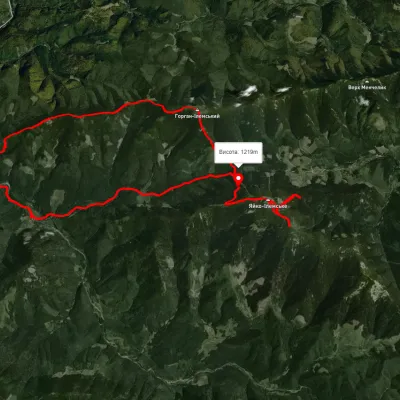
Nearest settlement: Myslivka, about 13 km in a straight line.
Report the condition
Been here recently? Tell us what you saw and add photos — your report appears on the page right away with today’s date.
No photos yet — send yours together with a condition report.
