Mountain shelter
Ďurková Shelter
Slovakia · Low Tatras range · 1 623 m


- Photo: Pavouk · CC BY-SA 4.0 · Wikimedia Commons
- Photo: Michal Klajban · CC BY-SA 3.0 · Wikimedia Commons
- Photo: Jerzy Opioła · CC BY-SA 4.0 · Wikimedia Commons
- Photo: I would appreciate being notified if you use my work outside Wikimedia. More of my work can be found in my personal gallery. · CC BY-SA 4.0 · Wikimedia Commons
Condition
StandingNo hikers’ reports yet. According to open data the hut is open all year — check its website or call before setting out.
Last edited on the OSM map 01.08.2024
- 1 623 m
- Sleeps up to 33
- Meals served
- All year
- Paid overnight stay
Practical info
- Run by: KST (odbor Jasenie)
- Local name: Útulňa Ďurková pod Chabencom
- Season: All year
- Food: Kitchen or buffet
- Built: 2001
- Contacts: nizketatry.sk
About
Ďurková Shelter (Útulňa Ďurková pod Chabencom) is a simple mountain hut in the Low Tatras at about 1620 m, at the head of the Lomnistá dolina below the south-eastern slope of Ďurková peak. It stands in a wide alpine meadow just below the main ridge and is clearly visible from the red ridge trail.
A shepherds' hut once stood here and hikers used it as an emergency shelter, so older maps mark the spot as Salaš pod Chabencom. Construction of the present hut began on its site in 2001; it was built by the Banská Bystrica regional council of the Slovak Tourist Club (KST) and is looked after by the KST branch from Jasenie.
Under the rules of the Low Tatras National Park, overnight stops on the ridge traverse are allowed only at a few designated places, and Ďurková is one of them. It has bunks for about 33 people (bring a sleeping bag), a veranda, a dry toilet and a reliable drinking-water spring nearby; soup and tea are usually on sale. The shelter is open in summer and winter. Mountain rescue (HZS): 18 300.
On the map
Coordinates: 48.93107, 19.46678
How to get there
from Jasenie up the Lomnistá dolina via Struhárske sedlo, about 4 h 25 min; from Magurka via the Ďurková saddle; about 15 min down from the red main-ridge trail.
Trails nearby
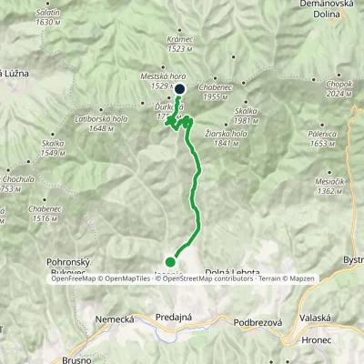 ModerateTwo-dayMarkedJunction above Ďurková Saddle JasenieElevation profile519–1 745 m16.7 kmascent 1 226 m≈ 6.5 h walking
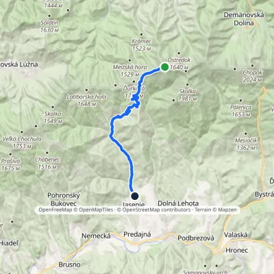 ModerateOne-dayMarkedJasenie, PD ChabenecElevation profile519–1 947 m17.8 kmascent 14 m≈ 4.5 h walking
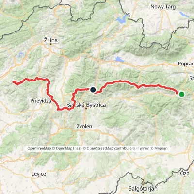 HardMulti-dayMarkedHorná Poruba, U Brdárov Pred ČuntavouElevation profile309–2 004 m241.6 kmascent 15 694 m
Report the condition
Been here recently? Tell us what you saw and add photos — your report appears on the page right away with today’s date.
