Condition
Not verifiedNo recent reports. Carry water and, if you pass by, tell us what you saw.
- 804 m
- Flows all year
- Mineral water
About
Gorgany range, about 800 m above sea level. The nearest settlement is Bystrytsia, about 6 km in a straight line. 4 of the site’s trails pass nearby, including “Osmoloda village, via Mount Ihrovets, Mount Syvulia, Bystrytsia village, Mount Bratkivska, Mount Ruska and Mount Dohiaska to Dragobrat”.
The spring is known to flow in summer too. The water is mineral, with a distinct taste.
On the map
Coordinates: 48.44944, 24.20415
How to get there
Trails nearby
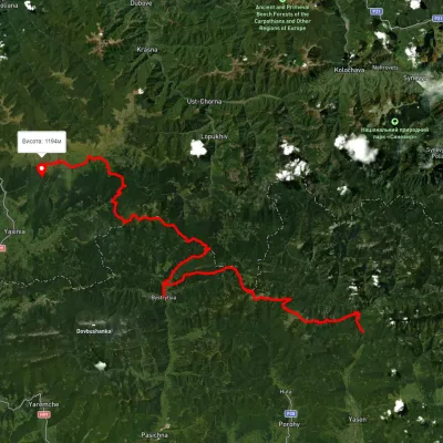 HardMulti-dayUnmarkedOsmoloda village to Dragobratvia Mount Ihrovets, Mount Syvulia +4Elevation profile687–1 824 m116.7 kmascent 4 557 m
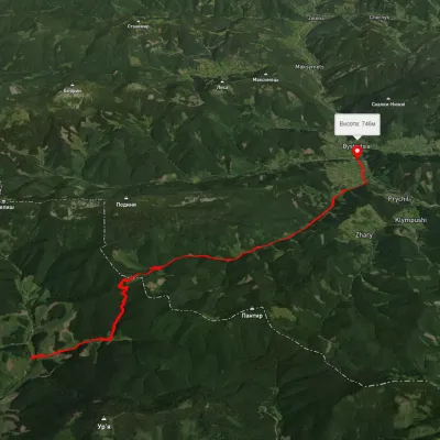 ModerateTwo-dayMarkedBystrytsia village Legioniv PassElevation profile748–1 112 m14.5 kmascent 735 m≈ 5 h walking
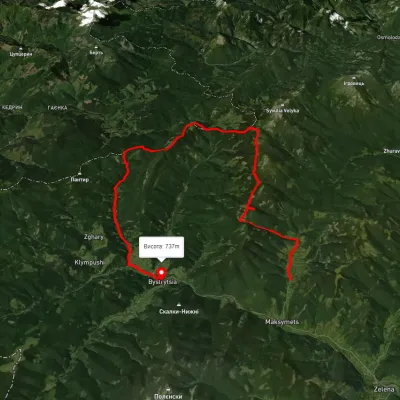 HardMulti-dayUnmarkedMaksymets village to Bystrytsia villagevia Mount Hechura, Perenyz Pass +1Elevation profile732–1 457 m34.4 kmascent 1 612 m≈ 12 h walking
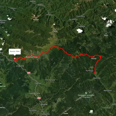 HardMulti-dayUnmarkedBystrytsia village to Kvasy villagevia Mount Durnia, Mount Bratkivska +2Elevation profile541–1 875 m64.5 kmascent 3 188 m
Nearest settlement: Bystrytsia, about 6 km in a straight line.
Report the condition
Been here recently? Tell us what you saw and add photos — your report appears on the page right away with today’s date.
No photos yet — send yours together with a condition report.
