Vânturarița Mare
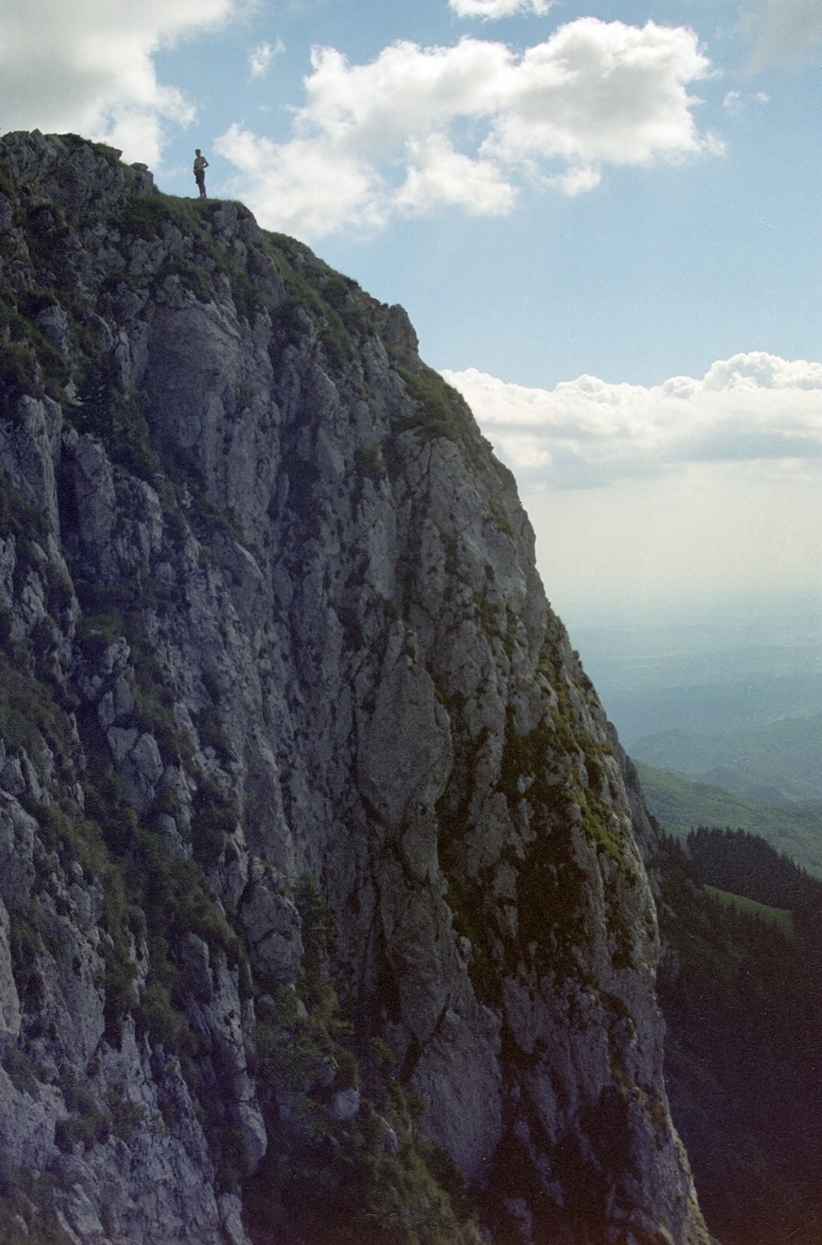
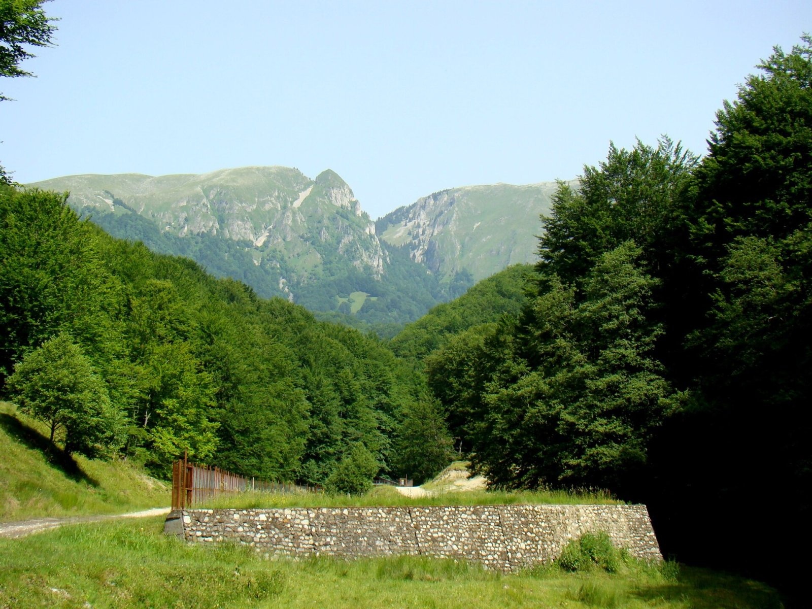
Vânturarița Mare (Romanian Vârful Vânturarița Mare) is the highest summit of the Buila-Vânturarița massif, at 1,885 m, in the Căpățânii Mountains (Southern Carpathians, Romania), in Vâlcea County. According to the national park administration, unlike the rest of the Căpățânii this massif is a linear, island-like limestone ridge: the main crest is about 14 km long, rising from 550 m where the Bistrița leaves its gorge to 1,885 m on Vânturarița Mare. Only two small areas exceed 1,800 m – around the Buila and Vânturarița peaks.
The ridge is continuous only between the Costești and Cheia gorges, with a small break at the Curmătura Builei saddle, where erosion has removed the limestone cover down to the metamorphic rocks. The rest of the crest is cut by the gorges of four rivers – from west to east the Bistrița, Costești, Cheia and Olănești – which separate the Arnota massif to the south-west and the Stogu massif to the north-east. The ridge looks stepped: some summits are rounded (Piatra, Buila), others sharp, like Vânturarița itself. The northern part is sharp and jagged, and on the western slope erosion has left rock towers and needles up to 35 m high.
How to get there / trails
According to the park rules, the access points are at Costești (Bistrița and Pietreni), Bărbătești, Cheia and Băile Olănești. Two trails marked with a red stripe lead to the summit: from the Cheia hut via the Curmătura Oale saddle, and along the main ridge from the south-west – from the Prislop valley over Muntele Cacova, Piatra peak and the Curmătura Builei saddle. About 500 m from the summit stands the Piscul cu Brazi refuge. In the park, walking is allowed only on waymarked trails (stripe, triangle, cross or dot marks in blue, red and yellow on white) and on approved climbing routes.
What you can see from the summit
The sources give no detailed description of the panorama. According to the park, the short side ridges drop steeply in steps to the east, and Vânturarița is one of the sharp peaks of the stepped crest, so it offers a view along the Buila ridge.
Nature and history
Buila-Vânturarița National Park was created in 2004; with 4,186 ha it is the smallest national park in Romania. Geologically the massif is a rare remnant of the sedimentary cover of the Getic nappe, preserved from erosion. The park's natural sights include the Bistrița, Costești, Cheia (among the narrowest and wildest in the country) and Olănești gorges, the Liliecilor and Urșilor caves, the Casa de Piatră natural arch near Pătrunsa, the yew reserve at Cheia and the orchid meadows of the Cheia valley.
Bear, wolf, lynx, chamois, red deer, capercaillie and wallcreeper live here, and plants include edelweiss, lady's slipper orchid and Siberian ligularia. Many legends are tied to the massif: Matei Basarab, before he became ruler of Wallachia, is said to have escaped the Turks by swapping clothes with his arnăut (bodyguard) – hence the name of Mount Arnota and its monastery; and the Pătrunsa hermitage supposedly stands where the fugitive Parascheva Modoran was “pierced” by labour pains and gave birth to the future bishop Climent.
Safety, season and rules
The park may be visited only with a ticket: it is sold at the Bistrița, Pietreni, Bărbătești, Cheia and Băile Olănești access points or checked by park staff; children under 7 are exempt, and children aged 7–14, pupils, students and pensioners pay half. Tents may be pitched only at marked sites – among them the Curmătura Builei and Curmătura Comarnice saddles, near the Cheia hut and in the Pahomie clearing. The ridge is rocky and narrow in places, so it is dangerous in rain, fog and thunderstorms.
Bears are common in these mountains. Salvamont advises walking in a group and talking, not hiking in the evening or at night, keeping dogs on a leash, not leaving food in or near your tent and moving away from a bear cub. In an emergency call the national dispatch 0SALVAMONT – 0725 826 668 or 112. Park rules are on the website of Buila-Vânturarița National Park.
Photos: Petr Vodička, CC BY-SA 4.0; The original uploader was Compactforever at Romanian Wikipedia., CC BY 2.5 — Wikimedia Commons.
Getting there from Ukraine
Border crossings
- Porubne – Siret — road and pedestrian, 24/7
- Diakivtsi – Racovăț — road and pedestrian, 24/7 No freight traffic.
- Krasnoilsk – Vicovu de Sus — road and pedestrian, 08:00–20:00 Cars up to 3.5 t and pedestrians only; not 24/7.
- Solotvyno – Sighetu Marmației — road and pedestrian, 24/7 Passenger traffic only: vehicles up to 3.5 t with up to 9 seats, pedestrians.
- Diakove – Halmeu — road, 24/7 No pedestrian crossing.
By car
Rakhiv – Petroșani ≈450 km, ≈6 h 36 min (via Solotvyno – Sighetu Marmației); Ivano-Frankivsk – Petroșani ≈584 km, ≈8 h 55 min (via Solotvyno – Sighetu Marmației); Chernivtsi – Petroșani ≈539 km, ≈9 h 19 min (via Krasnoilsk – Vicovu de Sus). Times without border queues, our road routing (GraphHopper, OSM).
Checked 03.11.2026; border crossing hours and timetables change — check before you travel.
Comments
Travellers’ experience: reports, tips, questions.
No one has reported on this trail yet. Been here lately? Tell others what it is like now.
Location on the map
Water and shelter nearby
- Piscul cu Brazi Hut500 m · Not verified · 1 596 m
- Pahomie Spring1.8 km · Not verified · 868 m
- Spring below Cracul Seciului1.9 km · Not verified · 857 m
- Curmătura Builei Hut2.2 km · Not verified · 1 559 m
- Spring below Țucla (north slope)2.2 km · Not verified · 1 518 m
- Spring below Cracul Piciorul Mărului (north-west slope)2.2 km · Not verified · 999 m
- Bonovanul cu Apa Spring2.3 km · Not verified · 1 450 m
- Spring2.3 km · Not verified · 1 504 m
- Spring below Țucla (north-west slope)2.4 km · Not verified · 1 474 m
- Spring below Cracul Piciorul Mărului (west slope), 1 023 m2.5 km · Not verified · 1 023 m
- Spring below Cracul Piciorul Mărului (west slope), 1 025 m2.7 km · Not verified · 1 025 m
Nearby attractions
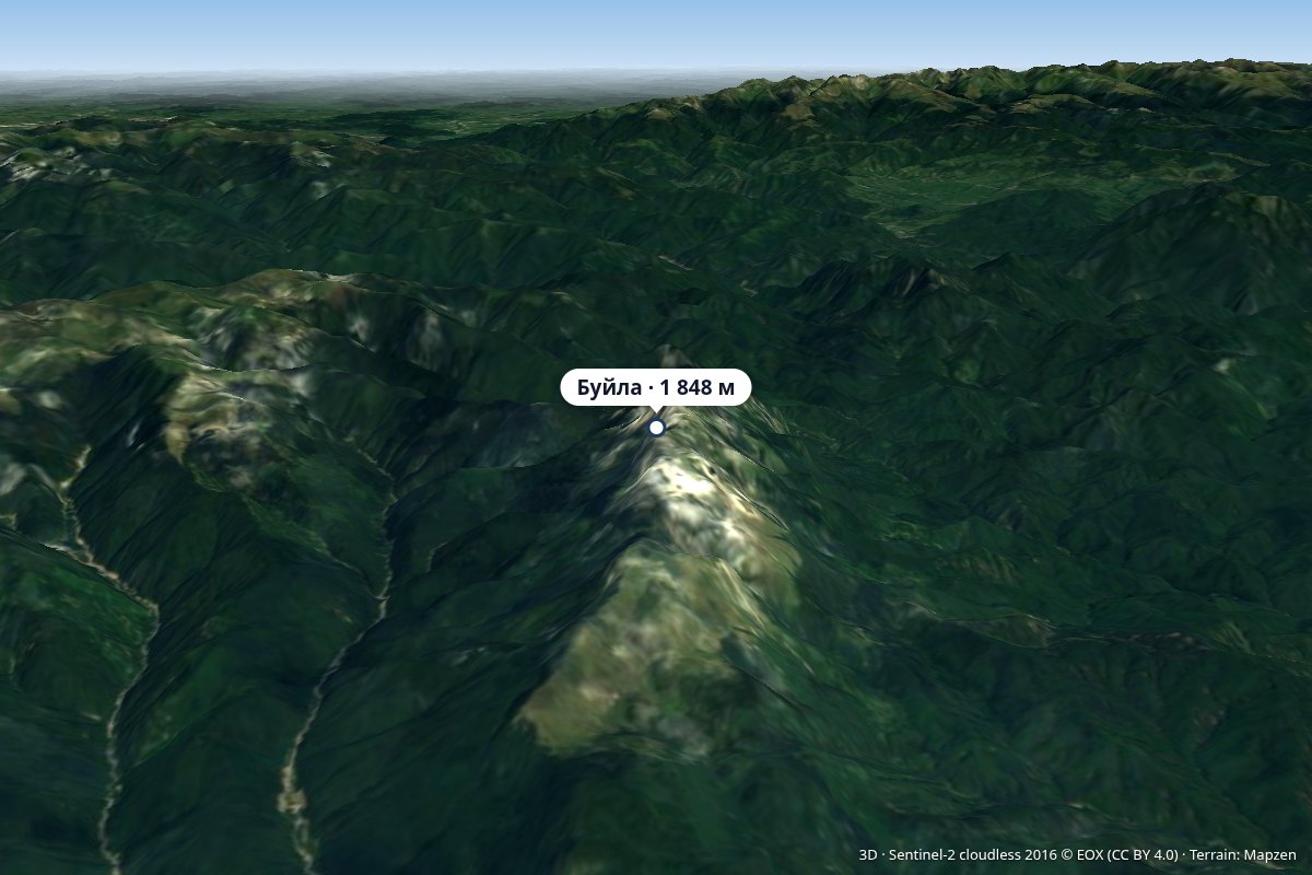 PeakBuila PeakPietrenialtitude 1 848 munder 1 km from Vânturarița MareVârful Buila) is a 1,848 m summit in the limestone Buila-Vânturarița massif, part of the Căpățânii Mountains (Southern Carpathians), in Vâlcea County.
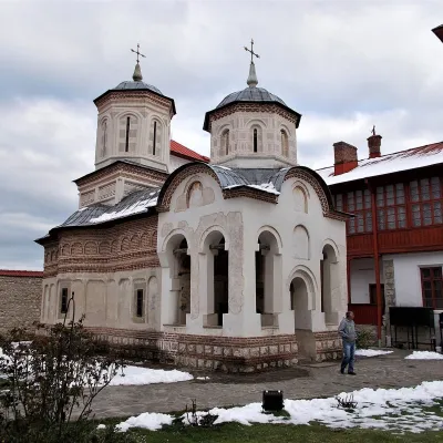 ChurchArnota Monastery: Matei Basarab's mountain mausoleumPietreni7.3 km from Vânturarița MareArnota Monastery (Mănăstirea Arnota) sits on a small plateau of Mount Arnota above the Bistrița river valley, within Bistrița village in Costești commune, Vâlcea County.
Craft nearby
All craft places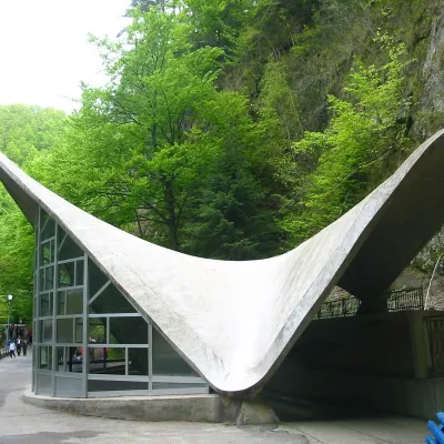 Water parks & thermal poolsBăile Olănești: sulphur and iodine springs of VâlceaBăile Olănești12 km from Vânturarița MareBăile Olănești is a mineral-water spa in Vâlcea County, in the valley of the Olănești river, at about 450 m and roughly 20 km north-west of the town of Râmnicu Vâlcea.
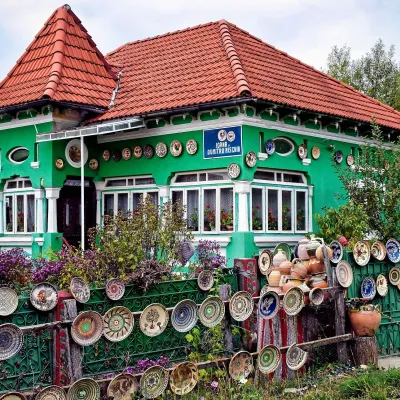 Crafts & workshopsOlari Street, Horezu: the UNESCO potters’ workshopsOlari14 km from Vânturarița MareThe heart of the craft is Olari Street (Strada Olari) in the part of town of the same name, about 2 km from the centre.
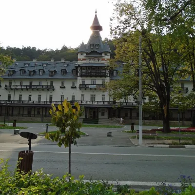 Water parks & thermal poolsCălimănești-Căciulata: thermal pools and springs in the Olt gorgePăușa17 km from Vânturarița MareCălimănești-Căciulata is one of Romania's best-known spas, stretching along both banks of the Olt where the river enters its gorge between the Cozia massif and the...
