Condition
Not verifiedNo recent reports. Bring a tent and, if you pass by, tell us what you saw.
Last edited on the OSM map 13.05.2026
- 1 303 m
About
Gorgany range, about 1 300 m above sea level. The nearest settlement is Polianytsia (Bukovel), about 5.9 km in a straight line. 7 of the site’s trails pass nearby, including “Stara Huta village, via Mount Syvulia, Legioniv Pass, Mount Bratkivska, Mount Chorna Kleva, Mount Ploska and Mount Dovha to Polianytsia village”.
The nearest known spring is 240 m away.
In an emergency in the mountains call the rescuers: 101 or 112.
Comments
Travellers’ experience: reports, tips, questions.
No one has written here yet. Be the first — your experience helps others.
On the map
Coordinates: 48.38644, 24.33501
How to get there
Trails nearby
 HardMulti-dayStara Huta village to Polianytsia villagevia Mount Syvulia, Legioniv Pass +4Elevation profile706–1 836 m67.5 kmascent 3 807 m
 HardMulti-dayKvasy village to Polianytsia villagevia Mount Blyznytsia, Mount Bratkivska +1Elevation profile540–1 883 m57.2 kmascent 3 881 m
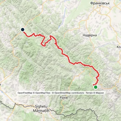 HardMulti-dayMarkedEast Carpathian Tourist TrailElevation profile643–1 836 m278.1 kmascent 8 455 m
 HardMulti-dayYablunytsia village to Polianytsia villagevia Khomiakiv polonyna, Mount Syniak +3Elevation profile795–1 754 m56.5 kmascent 2 614 m
 HardMulti-dayDilove village to Yablunytsia villagevia Mount Pip Ivan Marmaroskyi, Mount Hoverla +4Elevation profile346–2 035 m156.7 kmascent 9 949 m
 HardTwo-dayBystrytsia village to Polianytsia villagevia Mount Hropa, Mount Bratkivska +1Elevation profile737–1 788 m42 kmascent 1 974 m≈ 14 h walking
Nearest settlement: Polianytsia (Bukovel), about 5.9 km in a straight line.
Report the condition
Been here recently? Tell us what you saw and add photos — your report appears on the page right away with today’s date.
No photos yet — send yours together with a condition report.
