Condition
RuinedRuined or burnt — do not count on it for the night.
- 1 359 m
About
Gorgany range, about 1 360 m above sea level. Mount Sinyak (1 665 m) is about 740 m away. The nearest settlement is Polianytsia (Bukovel), about 4.1 km in a straight line. 8 of the site’s trails pass nearby, including “Polianytsia village, via Mount Syniak and Mount Yavirnyk to Yaremche”.
According to the latest reports, the building is ruined or burnt. The nearest known spring is 80 m away.
On the map
Coordinates: 48.38261, 24.45235
How to get there
Trails nearby
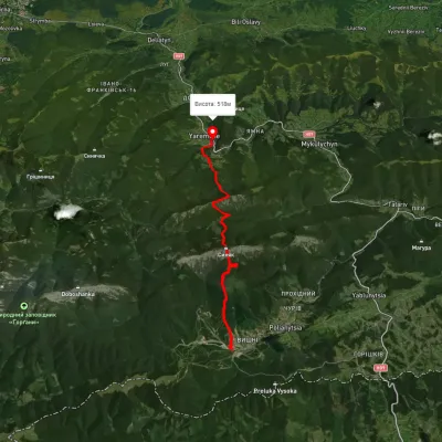 HardTwo-dayUnmarkedPolianytsia village to Yaremchevia Mount Syniak, Mount YavirnykElevation profile526–1 653 m21.2 kmascent 1 353 m≈ 8 h walking
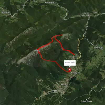 ModerateOne-dayUnmarkedPolianytsia village loopvia Mount Khomiak, Mount SyniakElevation profile864–1 656 m14.1 kmascent 1 089 m≈ 5.5 h walking
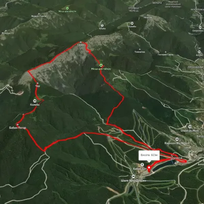 HardOne-dayUnmarkedPolianytsia village loopvia Mount Malyi Horhan, Mount SyniakElevation profile892–1 660 m18.8 kmascent 1 248 m≈ 7 h walking
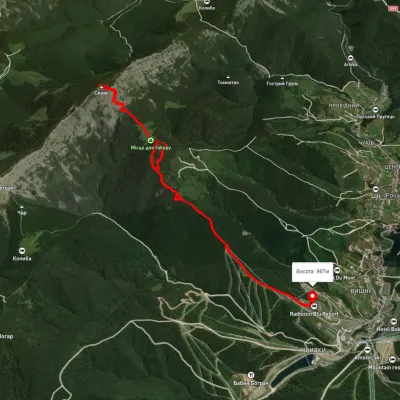 ModerateOne-dayUnmarkedPolianytsia village loopvia Mount SyniakElevation profile969–1 667 m11.9 kmascent 837 m≈ 4.5 h walking
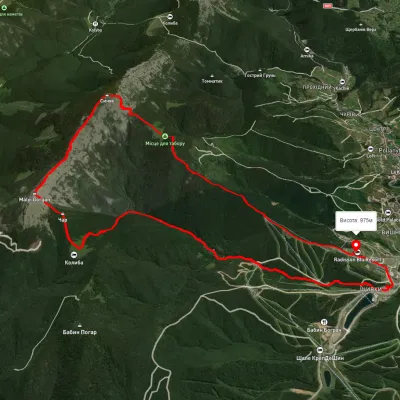 ModerateTwo-dayUnmarkedPolianytsia village loopvia Mount Malyi Horhan, Mount SyniakElevation profile900–1 664 m15.6 kmascent 979 m≈ 6 h walking
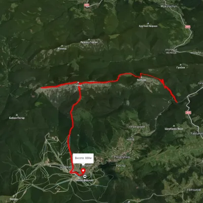 HardTwo-dayUnmarkedTatariv village to Polianytsia villagevia Mount Khomiak, Mount Syniak +1Elevation profile770–1 650 m20.4 kmascent 1 398 m≈ 8 h walking
Nearest settlement: Polianytsia (Bukovel), about 4.1 km in a straight line.
Report the condition
Been here recently? Tell us what you saw and add photos — your report appears on the page right away with today’s date.
No photos yet — send yours together with a condition report.
