Condition
Not verifiedNo recent reports. Carry water and, if you pass by, tell us what you saw.
- 1 140 m
- Flows all year
- Marked as drinkable
About
Polonyna Rivna range, about 1 140 m above sea level. Mount Ostra Gora (1 405 m) is about 1.5 km away. The nearest settlement is Perekhresnyi, about 3.7 km in a straight line. 5 of the site’s trails pass nearby, including “Preluka tract, via Mount Ostra Hora, Mount Lysyna and Nyzky Pass to Preluka tract”.
The spring is known to flow in summer too. The water is marked as drinkable on the map, but nobody guarantees its quality.
On the map
Coordinates: 48.84929, 22.86122
How to get there
Trails nearby
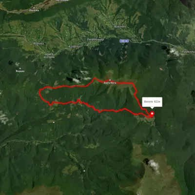 ModerateTwo-dayUnmarkedPreluka tract loopvia Mount Ostra Hora, Mount Lysyna +1Elevation profile781–1 434 m18.1 kmascent 918 m≈ 6.5 h walking
 ModerateOne-dayUnmarkedPreluka tract to Roztoka villagevia Mount Ostra HoraElevation profile848–1 402 m9.5 kmascent 582 m≈ 3.5 h walking
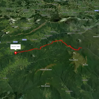 HardTwo-dayMarkedMount Hostra PrelukyElevation profile664–1 385 m19.4 kmascent 1 407 m≈ 7.5 h walking
 HardMulti-dayUnmarkedLumshory village loopvia Runa polonyna, Pashkivtsi village +5Elevation profile448–1 464 m72.2 kmascent 4 162 m
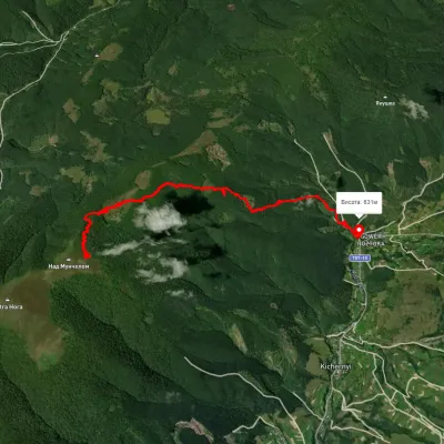 EasyOne-dayUnmarkedRoztoka village Mount HostraElevation profile644–1 245 m7.6 kmascent 41 m≈ 2 h walking
Nearest settlement: Perekhresnyi, about 3.7 km in a straight line.
Report the condition
Been here recently? Tell us what you saw and add photos — your report appears on the page right away with today’s date.
No photos yet — send yours together with a condition report.
