Mountain shelter
Hala Ornak Hut
Poland · Western Tatras range · 1 100 m


- Photo: Cybularny · CC0 · Wikimedia Commons
- Photo: Marfryd6360 · CC BY-SA 3.0 · Wikimedia Commons
- Photo: Sammler · CC BY-SA 3.0 · Wikimedia Commons
- Photo: Margoz · CC BY-SA 4.0 · Wikimedia Commons
Condition
StandingNo hikers’ reports yet. According to open data the hut is open — check its website or call before setting out.
Last edited on the OSM map 06.07.2025
- 1 100 m
- Sleeps up to 49
- Meals served
Practical info
- Run by: PTTK
- Local name: Schronisko górskie PTTK na Hali Ornak im. Walerego Goetla
- Food: Kitchen or buffet
- Built: 1948
- Contacts: schronisko-ornak.pl
About
The Hala Ornak Hut stands on Mała Polanka Ornaczańska in the upper part of Dolina Kościeliska in the Western Tatras, at about 1,100 m. It is surrounded by strictly protected forest, and its windows look out on Kominiarski Wierch, Bystra and Błyszcz.
The Zakopane-style building went up in 1947–1948 to replace the hut on Hala Pyszna, burned by the Germans during the Second World War. In 1973 it was named after the geologist Professor Walery Goetel. It has 49 beds in rooms for two to eight people, a dining room, buffet and kitchen, and by old tradition boiling water is given to hikers free of charge.
The green trail comes up the valley floor from Kiry and continues through Dolina Tomanowa to the Czerwone Wierchy; the yellow trail climbs to Iwaniacka Przełęcz, and the black one reaches Smreczyński Staw in half an hour. Horse carts (sledges in winter) run as far as Polana Pisana. Mountain rescue: 985 or +48 601 100 300.
On the map
Coordinates: 49.22915, 19.85869
How to get there
from Kiry on the green trail along the floor of Dolina Kościeliska, about 1 h 40 min.
Trails nearby
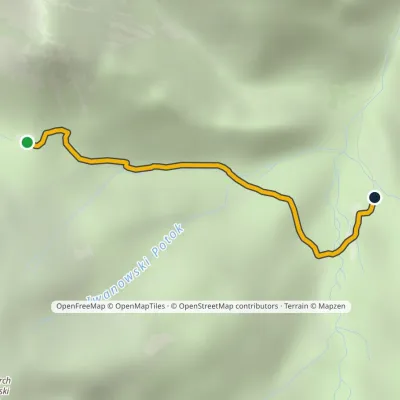 EasyOne-dayMarkedIwaniacka Pass Hala OrnakElevation profile1 100–1 462 m2.3 kmascent 23 m≈ 30 min walking
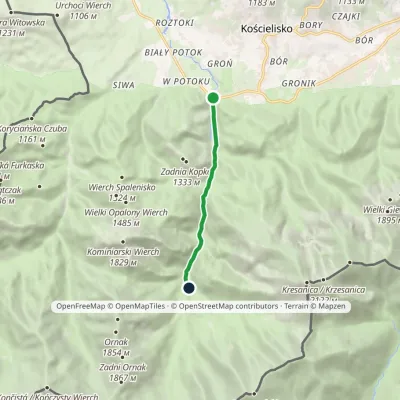 EasyOne-dayMarkedKiry Hala Ornak (Kościeliska Valley)Elevation profile928–1 125 m5.4 kmascent 221 m≈ 2 h walking
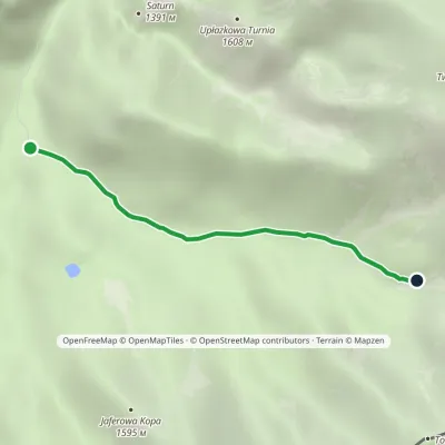 EasyOne-dayMarkedHala Ornak Tomanowy PotokElevation profile1 125–1 480 m2.9 kmascent 355 m≈ 1.5 h walking
Report the condition
Been here recently? Tell us what you saw and add photos — your report appears on the page right away with today’s date.
