Mountain shelter
Hala Łabowska Hut
Poland · Sądecki Beskids range · 1 061 m


- Photo: Jerzy Opioła · CC BY-SA 4.0 · Wikimedia Commons
- Photo: Pudelek · CC BY-SA 3.0 · Wikimedia Commons
Condition
StandingNo hikers’ reports yet. According to open data the hut is open — check its website or call before setting out.
Last edited on the OSM map 13.11.2025
- 1 061 m
- Open fire inside (smoke hut)
- Staffed
Practical info
- Run by: PTTK
- Local name: Schronisko PTTK na Hali Łabowskiej im. Władysława Stendery
- Built: 1953
- Contacts: halalabowska.pttk.pl
About
The Hala Łabowska Hut stands on a broad mountain pasture in the central part of the Jaworzyna range of the Sądecki Beskids, at 1,061 m. It is surrounded by Poprad Landscape Park with three nature reserves nearby, and there is a spring and information boards by the hut.
Its story began in 1953, when the Nowy Sącz branch of PTTK built a small shelter with one room and a kitchen. It was later enlarged to sleep 40, and in 1973–1980 it took on roughly its present form. In 1995 it was named after Władysław Stendera, long-time president of the PTTK «Beskid» branch and the main driving force behind the hut.
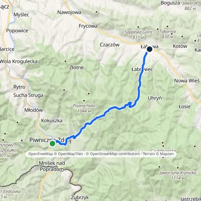
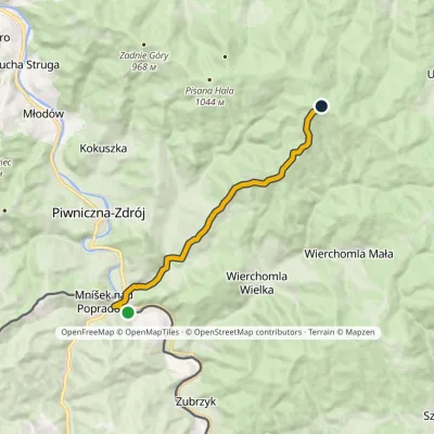
The hut is not connected to the grid: a generator supplies power only in the evening, roughly from 6 to 8 pm, so bring a torch and a power bank. The red Main Beskid Trail crosses the pasture; blue trails come from Łabowa and Piwniczna-Zdrój, and a yellow one from Łomnica-Zdrój. Mountain rescue: 985 or +48 601 100 300.
On the map
Coordinates: 49.47288, 20.81046
How to get there
from Łabowa on the blue trail, about 1 h 45 min.
Trails nearby

Report the condition
Been here recently? Tell us what you saw and add photos — your report appears on the page right away with today’s date.
