Mountain shelter
Chata pod Chlebom (Hut under Chleb)
Slovakia · Lesser Fatra range · 1 423 m


- Photo: Michal Klajban · CC BY-SA 4.0 · Wikimedia Commons
- Photo: Fallaner · CC BY 4.0 · Wikimedia Commons
- Photo: Daniel Baránek · CC BY-SA 3.0 · Wikimedia Commons
- Photo: Michal Klajban · CC BY-SA 3.0 · Wikimedia Commons
Condition
StandingNo hikers’ reports yet. According to open data the hut is open all year — check its website or call before setting out.
Last edited on the OSM map 01.08.2024
- 1 423 m
- Meals served
- All year
Practical info
- Local name: Chata pod Chlebom
- Season: All year
- Food: Kitchen or buffet
- Built: 1930
About
Chata pod Chlebom is the highest year-round hikers' hut in the Malá Fatra. It stands at 1423 m on the southern spur of Chleb in the Malá Fatra National Park, with wide views of Veľký Kriváň and the Turiec basin. The cable car from the Vrátna valley to Snilovské sedlo ends close by.
The Czechoslovak Tourist Club built the hut with the insurance money from its hut on Veľká Rača, which burnt down in 1929; materials were hauled up the Snilovská dolina on people's backs and on two-wheeled carts, and the first guests arrived on 21 December 1930. German troops burnt it in November 1944; it was rebuilt in 1945–1948 and burnt again on Easter Monday 1982, after which a smaller hut was built on the site of the surviving outbuilding. The latest renovation, keeping its shape, took place in 2021.
The hut offers rooms and meals. The yellow trail climbs to the main ridge at Hromové, the Mojžišove pramene springs are half an hour away and the 38 m Šútovo waterfall about an hour and a half. Mountain rescue (HZS): 18 300.
On the map
Coordinates: 49.18118, 19.04931
How to get there
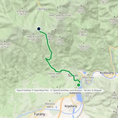
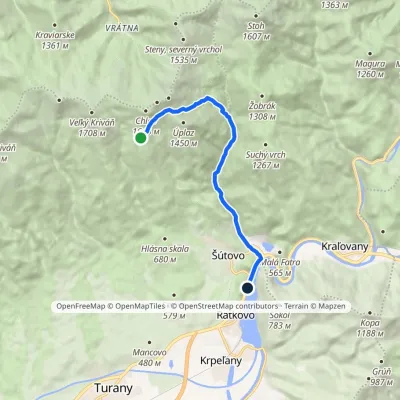
from the top station of the cable car from Chata Vrátna to Snilovské sedlo on the green trail (a short walk); on foot from Chata Vrátna via Snilovské sedlo about 2 h 15 min; or from Šútovo on the blue trail past the Šútovo waterfall.
Trails nearby
Report the condition
Been here recently? Tell us what you saw and add photos — your report appears on the page right away with today’s date.
