Mountain shelter
Borišov Hut
Slovakia · Greater Fatra range · 1 312 m


- Photo: Michal Klajban · CC BY-SA 4.0 · Wikimedia Commons
- Photo: Jerzy Opioła · CC BY-SA 4.0 · Wikimedia Commons
- Photo: Pe3kZA · CC BY-SA 3.0 · Wikimedia Commons
Condition
StandingNo hikers’ reports yet. According to open data the hut is open all year — check its website or call before setting out.
Last edited on the OSM map 27.08.2024
- 1 312 m
- Sleeps up to 20
- Meals served
- All year
Practical info
- Run by: KST
- Local name: Chata pod Borišovom
- Season: All year
- Food: Kitchen or buffet
- Built: 1942
- Contacts: chatapodborisovom.eu
About
Borišov Hut is a traditional wooden mountain hut in the very heart of the Veľká Fatra. It stands in the saddle between Borišov and Ploská; at 1312 m according to the hut itself. Being so remote, it is a goal for proper mountain hikes and a base for the main ridge — Borišov, Ploská, Ostredok and Krížna.
The Martin branch of the Czechoslovak Tourist Club began building it in 1937 and, because access was so hard, finished only in 1942. During the war it sheltered mostly partisans, and nearby treeless Ploská was a drop zone for weapons. The hut escaped destruction by chance; volunteers repaired it and it reopened to hikers in July 1949. Today it belongs to the Slovak Tourist Club (KST).
The hut is open all year, with 20 beds in four attic rooms and, if needed, floor space in the dining room. There is a kitchen and a dining room; with no access road, supplies are carried up by porters. Mountain rescue (HZS): 18 300.
On the map
Coordinates: 48.94055, 19.09741
How to get there
from the Ľubochnianska dolina, from Belá-Dulice up the Belianska dolina or from Necpaly up the Necpalská dolina; along the ridge from Ploská, or from the south via Kľak and Javorina — all long approaches, as the hut is far from any road.
Trails nearby
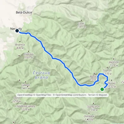 ModerateOne-dayMarkedNecpaly ChyžkyElevation profile500–1 341 m17.1 kmascent 72 m≈ 4.5 h walking
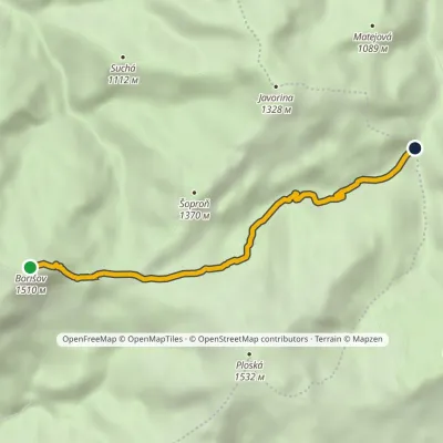 EasyOne-dayMarkedMočidlo BorišovElevation profile868–1 510 m4.6 kmascent 6 m≈ 1 h walking
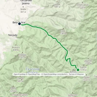 ModerateOne-dayMarkedChata pod Borišovom, junction BeláElevation profile494–1 278 m14.1 kmascent 15 m≈ 3.5 h walking
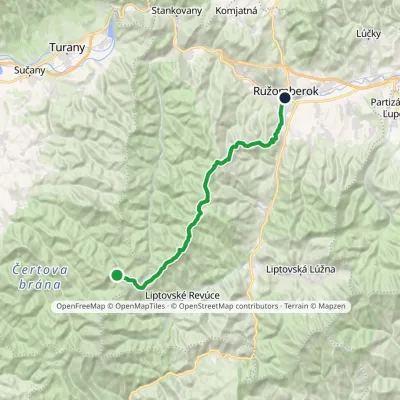 HardTwo-dayMarkedRužomberok, A Hlinka Square Hut under Borišov, junctionElevation profile494–1 567 m30 kmascent 889 m≈ 9.5 h walking
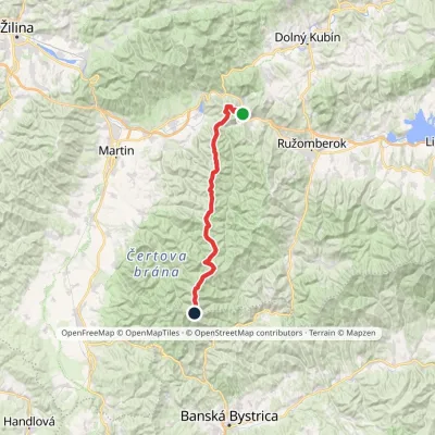 HardMulti-dayMarkedVeľkofatranská magistrálaElevation profile439–1 595 m42 kmascent 3 071 m
Report the condition
Been here recently? Tell us what you saw and add photos — your report appears on the page right away with today’s date.
