Bohdan village – Rohnieska polonyna
Trail map
Where to stay nearby
About the trail
Route Bohdan village – Rohnieska polonyna. Has yellow marking (short routes, connecting paths, shortcuts). Along the route you will see: Mount Sheshul, Polonyna Rognieska.
At a glance
A one-day route of 23.4 km with 1,318 m of ascent from Bohdan village to Rohnieska polonyna. Estimated walking time: about 8 h, not counting stops. Difficulty: hard. Waymarking: yellow.
Route stages
- 0–2 kmAlong the ridge at 1,570–1,610 m, past Mount Sheshul
- 2–13 kmDescent of 770 m to Carpathian Biosphere Reserve checkpoint
- 13–23 kmGentle ups and downs at 550–820 m
Steepest kilometre: km 10–11, a descent of 140 m (≈13%), near Hut by the Rohneskul stream.
Water and overnight stays
Springs near the trail: at km 0, 2, 6, 15 and 21. There are no springs between km 6 and 15 — carry at least 2 l of water. Some springs run low or dry up in late summer.
Huts and shelters near the trail: Eco point “Rohneska” (hut) (km 4), Hut below Mount Sheshul (3) (km 6), Hut on Polonyna Rohnieska (km 6), Hut by the Rohneskul stream (km 12), Carpathian Biosphere Reserve checkpoint (cabin) (km 13).
When to go
Best time: June to September. In winter only for experienced hikers with proper gear: avalanche danger is possible. About 3 km of the route runs above 1,500 m, where the weather changes quickly — check the forecast.
Getting there
Start: Bohdan village. This is a one-way route: the finish is 13 km from the start in a straight line, so plan your way back in advance.
FAQ
- How long does the route take?
- Estimated walking time: about 8 h, not counting stops.
- Is there water on the route?
- Springs near the trail: at km 0, 2, 6, 15 and 21. There are no springs between km 6 and 15 — carry at least 2 l of water. Some springs run low or dry up in late summer.
- Where can I stay overnight?
- Huts and shelters near the trail: Eco point “Rohneska” (hut) (km 4), Hut below Mount Sheshul (3) (km 6), Hut on Polonyna Rohnieska (km 6), Hut by the Rohneskul stream (km 12), Carpathian Biosphere Reserve checkpoint (cabin) (km 13).
Water and shelter on the route
- Spring below Mount Sheshul (15)km 0.4 from the start · Not verified · 1 594 m
- Spring below Mount Sheshul (18)km 1.1 from the start · Not verified · 1 592 m
- Spring below Mount Sheshul (22)km 1.8 from the start · 200 m off the path · Not verified · 1 649 m
- Spring below Mount Sheshul (24)km 2.4 from the start · 60 m off the path · Not verified · 1 581 m
- Eco point “Rohneska” (hut)km 3.8 from the start · Not verified · 1 479 m
- Hut below Mount Sheshul (3)km 5.9 from the start · Not verified · 1 358 m
- Spring below Mount Sheshul (23)km 6.1 from the start · Not verified · 1 340 m
- Hut on Polonyna Rohnieskakm 6.2 from the start · 50 m off the path · Not verified · 1 344 m
- Hut by the Rohneskul streamkm 11.6 from the start · 280 m off the path · Not verified · 864 m
- Carpathian Biosphere Reserve checkpoint (cabin)km 13.4 from the start · Not verified · 791 m
- Mineral spring (Luhy)km 15.3 from the start · 100 m off the path · Not verified · 766 m
- Spring (Breboia)km 20.6 from the start · Not verified · 629 m
Comments
What to see on the trail
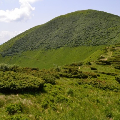 Mount Sheshulaltitude 1 726 mSheshul is a 1,726-meter peak of the Ukrainian Carpathians, which is located in the western part of the Chornohora mountain range within the...
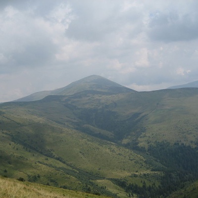 Polonyna Rognieskaaltitude 1 429 mRognieska is a meadow on the Chornohora mountain range (Ukrainian Carpathians), in the Rakhiv district of Zakarpattia region.
Trails nearby
All trails HardMulti-dayMarkedTranscarpathian Tourist TrailElevation profile198–2 031 m393.2 kmascent 30 283 m
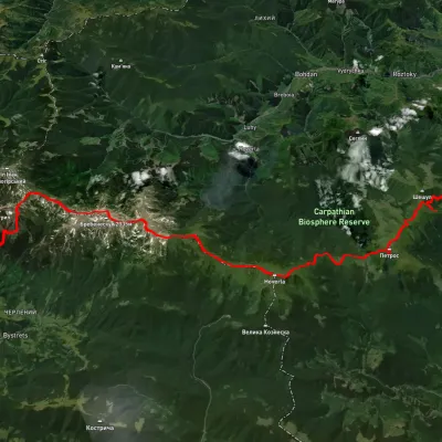 HardMulti-dayUnmarkedKvasy village to Topolche villagevia Mount Petros, Mount Hoverla +2Elevation profile538–2 054 m55.4 kmascent 3 233 m
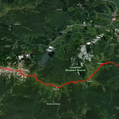 HardMulti-dayUnmarkedMount Pip Ivan Chornohirskyi to Kvasy villagevia Mount Hoverla, Mount PetrosElevation profile540–2 028 m39.7 kmascent 1 720 m≈ 13.5 h walking