Vorokhta village – Rizhi Pass
Trail map
Where to stay nearby
About the trail
Route Vorokhta village – Rizhi Pass. Has green marking (local routes). Along the route you will see: Church of the Nativity of the Virgin Mary XVII-XVIII, Vorokhta, Museum of History and Local Lore, Vorokhta.
At a glance
A one-day route of 8.8 km with 879 m of ascent from Vorokhta village to Rizhi Pass. Estimated walking time: about 3.5 h, not counting stops. Difficulty: moderate. Waymarking: green.
Route stages
- 0–6 kmClimb of 480 m (up to 1,249 m)
- 6–9 kmGentle ups and downs at 1,210–1,270 m
Steepest kilometre: km 5–6, a climb of 140 m (≈14%).
Water and overnight stays
Springs near the trail: at km 0.5, 2, 5 and 8.
Huts and shelters near the trail: Hut (Vorokhta) (km 4.5), Shepherds' hut on Polonyna Rizhi (km 8). Places to stay near the start and finish: Vorokhta.
When to go
Best time: May to October. In winter deep snow is possible, so experience and winter gear are needed.
Getting there
Start: Vorokhta village. Most places to stay near the start are in Vorokhta. This is a one-way route: the finish is 7 km from the start in a straight line, so plan your way back in advance.
FAQ
- How long does the route take?
- Estimated walking time: about 3.5 h, not counting stops.
- Is there water on the route?
- Springs near the trail: at km 0.5, 2, 5 and 8.
- Where can I stay overnight?
- Huts and shelters near the trail: Hut (Vorokhta) (km 4.5), Shepherds' hut on Polonyna Rizhi (km 8). Places to stay near the start and finish: Vorokhta.
Water and shelter on the route
- Spring (Vorokhta, 10)km 0.6 from the start · 140 m off the path · Not verified · 783 m
- Spring (Vorokhta, 12)km 1.9 from the start · 220 m off the path · Not verified · 879 m
- Hut (Vorokhta)km 4.4 from the start · Not verified · 1 062 m
- Spring (Vorokhta, 17)km 5.2 from the start · Not verified · 1 128 m
- Shepherds' hut on Polonyna Rizhikm 7.8 from the start · Not verified · 1 201 m
- Spring (Volova)km 7.8 from the start · Not verified · 1 196 m
- Spring (Volova, 3)km 8.7 from the start · 50 m off the path · Not verified · 1 209 m
Comments
What to see on the trail
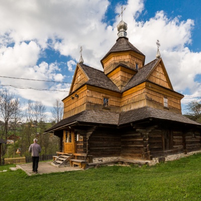 Church of the Nativity of the Virgin Mary XVII-XVIII, Vorokhtaaltitude 754 mThe Church of the Nativity of the Virgin Mary in Vorokhta of the seventeenth and eighteenth centuries is a traditional Hutsul church built without...
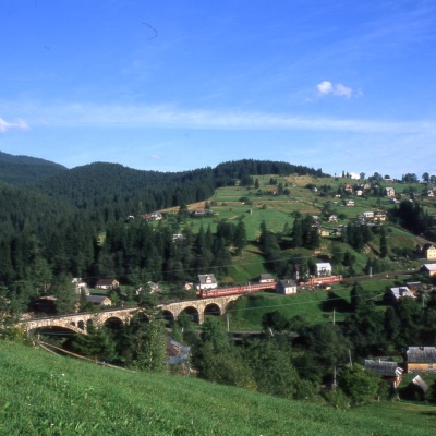 Museum of History and Local Lore, Vorokhtaaltitude 754 mThe museum was inaugurated on January 21, 2007. The museum reveals the processes of the settlement's emergence, the Oprishka movement in the...
Trails nearby
All trails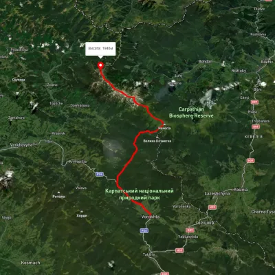 HardMulti-dayUnmarkedVorokhta to Mount Pip Ivan Chornohirskyivia Zaroslyak base, Mount Hoverla +2Elevation profile746–2 043 m42.2 kmascent 2 377 m
 HardMulti-dayMarkedEast Carpathian Tourist TrailElevation profile635–1 819 m278.1 kmascent 14 105 m
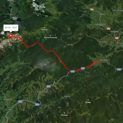 HardMulti-dayUnmarkedVorokhta to Lake Brebeneskulvia Mount Shpytsi, Mount RebraElevation profile734–1 981 m28.3 kmascent 1 662 m≈ 10.5 h walking