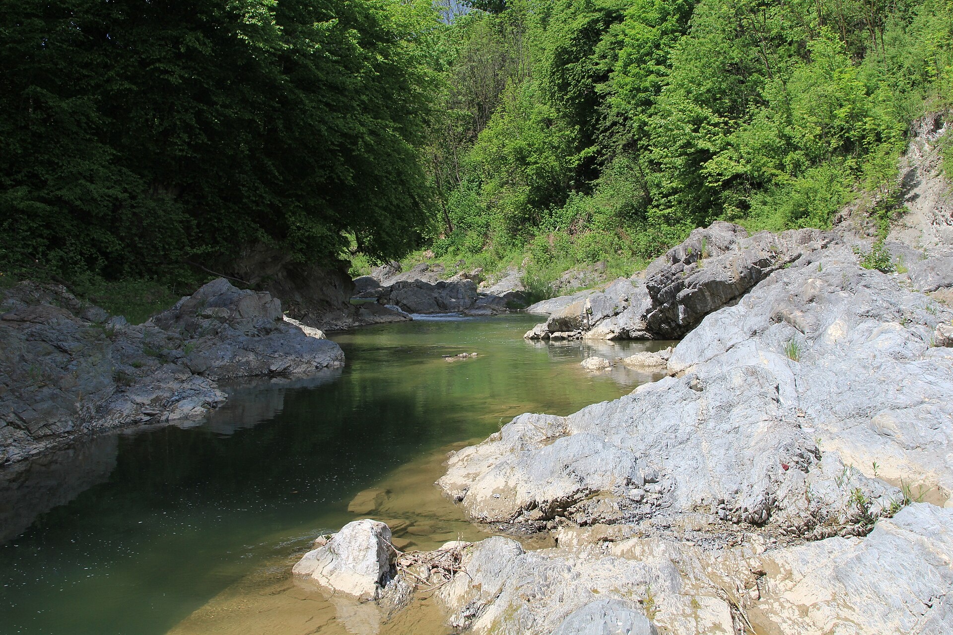
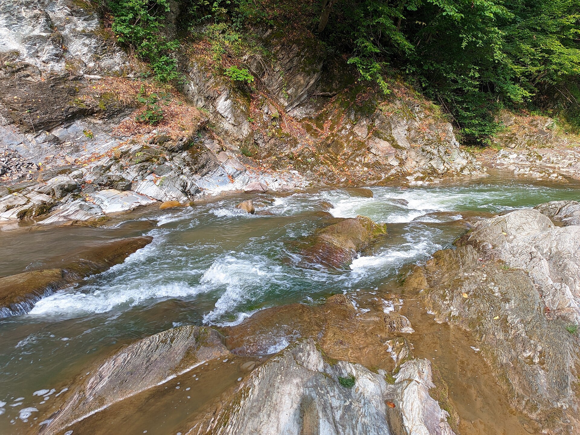
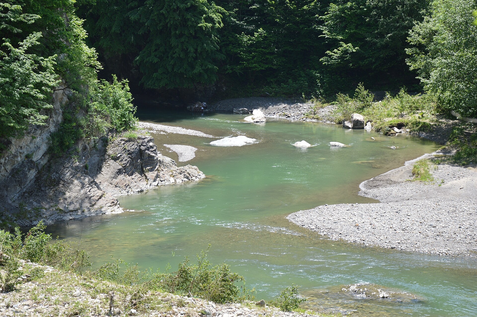
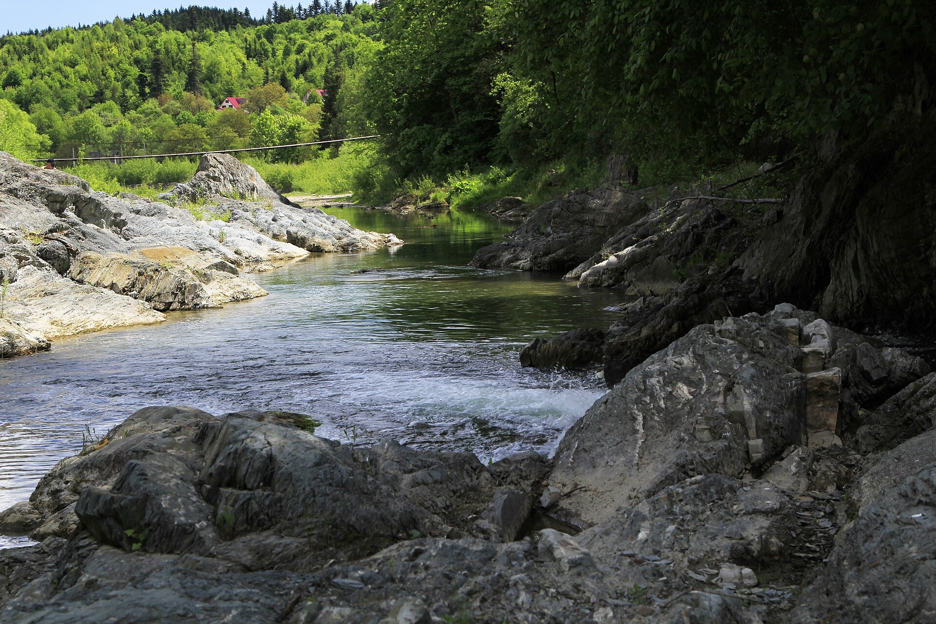
The Pistynka is a 56-km mountain tributary of the Prut. It rises on the eastern slopes of Mount Versalem in the Pokuttia-Bukovyna Carpathians and flows through Kosmach, Prokurava, Brustury, Sheshory, Pistyn, Mykytyntsi and Spas, joining the Prut opposite the southern part of Kolomyia. Its upper reaches lie in the Hutsulshchyna National Nature Park.
The best-known spot on the river is the Sheshory waterfalls — the Great and Small Huk cascades in Sheshory — with the Syniplyaso pool below them. Kosmach in the upper valley is one of the largest Hutsul villages. Along the Pistynka there are also geological monuments, the Menilite Shales and the Limestone Outcrop. The river from its source to Mykytyntsi and from Spas to the mouth is protected as two hydrological reserves.
The fish of the Pistynka are poorly studied. A 2009 survey found chub, spirlin and minnow here, as well as the Red Book nase and Kessler’s gudgeon; popular sources also mention trout near Sheshory. The spawning closure runs from 1 April to 20 May, and trout may not be taken from 10 October to 1 March. Do not confuse the Pistynka with the neighbouring Rybnytsia, which is closed to fishing all year. More in the fishing section and on Fishing in the Carpathians.
- Length: 56 km
- Catchment: 661 km²
- Source: slopes of Mount Versalem (1,406 m)
- Mouth: the Prut near Kolomyia
- Oblast: Ivano-Frankivsk
Photos: Zybikok, CC BY-SA 3.0; Бондар Володимир, CC BY-SA 4.0; Yur dmytruk, CC BY-SA 4.0; Zybikok, CC BY-SA 3.0 — Wikimedia Commons.
Location on the map
Fishing on the Pistynka
The Pistynka is a small mountain tributary of the Prut running from below Kosmach through Sheshory and Pistyn to Kolomyia. Its fish are poorly studied: chub is documented, and the Red Book nase lives alongside it.
Can I fish now?
- Brown trout — closed until 1 MarchTrout spawning: closed from 10 October to 1 March in the Zakarpattia, Ivano-Frankivsk, Lviv and Chernivtsi regions.Each illegally caught fish costs UAH 7,225 in damages on top of the fine.
- Other species — allowed within the daily limitKeep to the minimum sizes and the daily limit; release protected species.
Limits and rules
During spawning the stretch of the Prut within 300 m of the Pistynka mouth is also closed (according to the 2018 patrol list; the list is updated every year).
Hutsulshchyna National Park and hydrological reserves
The upper Pistynka flows through the Hutsulshchyna National Park: fishing there is only possible in the regulated recreation zone, and the park publishes no rules or stretches. From the source to Mykytyntsi (845 ha) and from Spas to the mouth (275 ha), the river with its bank strip forms local hydrological reserves (since 1996); their public documents contain no fishing ban. Check the regime with the Ivano-Frankivsk fisheries patrol before fishing.
What to catch
 Chubmiddle and lower course (2009 survey)allowed
 Brown troutthe mountain stretch near Sheshory (according to popular sources) · closed from 10 October to 1 Marchclosed until 1 March
The 2009 survey also found the Red Book Kessler’s gudgeon in the Pistynka, along with spirlin, minnow, gudgeon and stone loach. There is no scientific fish list for this river, and the state did not stock it in 2018–2025. The neighbouring Rybnytsia (also a Prut tributary) is closed to fishing all year — do not confuse them.
 Nase
NaseRed Book of Ukraine species: if one bites, unhook it carefully and release it. Taking one means a fine and compensation for damages.
Bite forecast near Pistyn
- TodaygoodSteady pressure, moderate wind1025 hPa · wind up to 18 km/h · 7…10 °C
- TomorrowgoodSteady pressure, moderate wind1025 hPa · wind up to 16 km/h · 6…8 °C
- Saturday, 17 OctobergoodSteady pressure, light wind1019 hPa · wind up to 14 km/h · 6…9 °C
For species open now: chub. Brown trout closed. Based on pressure, wind, temperature and cloud — an estimate, not a guarantee.
Fishing spots 60
Places where you can drive up to the water: fish markers on the page map and the list below. Look at the satellite view before you go — the bank may be steep or overgrown.
Closed right now: brown trout — until 1 March.
- Stream mouth on the PistynkaAbout 150 m to the water from a dirt road. Nearest village (straight line): Volova, 5.3 km.
- Dirt-road access on the PistynkaAbout 100 m to the water from a dirt road. Nearest village (straight line): Volova, 6.2 km.
- Dirt-road access on the PistynkaThe road comes almost to the water. Nearest village (straight line): Kosmach, 6.4 km.
- Stream mouth on the PistynkaAbout 60 m to the water from a dirt road. Nearest village (straight line): Kosmach, 5.5 km.
- Local-road access, Kosmach (4.7 km)The road comes almost to the water. Nearest village (straight line): Kosmach, 4.7 km.
- Local-road access, Kosmach (3.9 km)About 40 m to the water from a local road. Nearest village (straight line): Kosmach, 3.9 km.
- Local-road access, Kosmach (3.1 km)About 100 m to the water from a local road. Nearest village (straight line): Kosmach, 3.1 km.
- Local-road access, Kosmach (2.2 km)About 50 m to the water from a local road. Nearest village: Kosmach, 2.2 km.
Show all spots (60)
- By the bridge, KosmachAbout 40 m to the water from the street. A bridge is right here. Nearest village: Kosmach, 1.4 km.
- By the bridge, KosmachThe road comes almost to the water. Bridge 70 m away. Village: Kosmach.
- Access road to the water, KosmachAbout 60 m to the water from an access road. Village: Kosmach.
- By the road, KosmachAbout 70 m to the water from the road. Nearest village: Kosmach, 900 m.
- Access from a village street, KosmachThe road comes almost to the water. Nearest village: Kosmach, 1.5 km.
- Access from a village street, Kosmach (2.0 km)About 110 m to the water from the street. Nearest village: Kosmach, 2.0 km.
- By the bridge, Kosmach (2.5 km)About 30 m to the water from the street. Bridge 100 m away. Nearest village: Kosmach, 2.5 km.
- Access from a village street, Brustury (3.2 km)The road comes almost to the water. Nearest village (straight line): Brustury, 3.2 km.
- By the road, Prokurava (2.5 km)About 40 m to the water from the road. Nearest village: Prokurava, 2.5 km.
- By the road, Prokurava (2.1 km)About 40 m to the water from the road. Nearest village: Prokurava, 2.1 km.
- By the road, ProkuravaAbout 50 m to the water from the road. Nearest village: Prokurava, 1.4 km.
- Access road to the water, ProkuravaAbout 70 m to the water from an access road. Village: Prokurava.
- Access road to the water, ProkuravaThe road comes almost to the water. Village: Prokurava.
- Access road to the water, ProkuravaAbout 100 m to the water from an access road. Nearest village: Prokurava, 1.1 km.
- Stream mouth, Prokurava (1.5 km)About 130 m to the water from an access road. Nearest village: Prokurava, 1.5 km.
- Dirt-road access, Prokurava (2.4 km)About 140 m to the water from a dirt road. Nearest village: Prokurava, 2.4 km.
- Access from a village street, Prokurava (3.1 km)About 80 m to the water from the street. Nearest village (straight line): Prokurava, 3.1 km.
- Stream mouth, Prokurava (3.7 km)About 60 m to the water from the road. Nearest village (straight line): Prokurava, 3.7 km.
- By the bridge, Sheshory (3.2 km)About 40 m to the water from the street. Bridge 40 m away. Nearest village (straight line): Sheshory, 3.2 km.
- Access from a village street, Sheshory (2.8 km)About 70 m to the water from the street. Nearest village: Sheshory, 2.8 km.
- By the road, Sheshory (2.0 km)About 60 m to the water from the road. Nearest village: Sheshory, 2.0 km.
- By the bridge, SheshoryAbout 30 m to the water from a dirt road. Bridge 40 m away. Nearest village: Sheshory, 1.3 km.
- Stream mouth, SheshoryAbout 50 m to the water from the street. Bridge 110 m away. Village: Sheshory.
- Access from a village street, SheshoryAbout 120 m to the water from the street. Village: Sheshory.
- Stream mouth, SheshoryAbout 150 m to the water from the street. Nearest village: Sheshory, 930 m.
- Dirt-road access, Sheshory (1.5 km)About 40 m to the water from a dirt road. Nearest village: Sheshory, 1.5 km.
- Mouth of the Ardan Nyzhnii tributary, Pistyn (1.6 km)About 130 m to the water from an access road. Bridge 110 m away. Nearest village: Pistyn, 1.6 km.
- Access from a village street, PistynThe road comes almost to the water. Nearest village: Pistyn, 810 m.
- By the bridge, PistynAbout 40 m to the water from the street. Bridge 60 m away. Village: Pistyn.
- Access from a village street, PistynAbout 50 m to the water from the street. Nearest village: Pistyn, 1.2 km.
- Access from a village street, Pistyn (1.8 km)About 90 m to the water from the street. Nearest village: Pistyn, 1.8 km.
- Access from a village street, Pistyn (2.3 km)About 50 m to the water from the street. Nearest village: Pistyn, 2.3 km.
- By the bridge, Mykytyntsi (2.5 km)About 70 m to the water from the street. Bridge 110 m away. Nearest village: Mykytyntsi, 2.5 km.
- Access from a village street, Mykytyntsi (2.1 km)About 140 m to the water from the street. Nearest village: Mykytyntsi, 2.1 km.
- Access from a village street, Mykytyntsi (1.6 km)About 120 m to the water from the street. Nearest village: Mykytyntsi, 1.6 km.
- By the bridge, MykytyntsiThe road comes almost to the water. Bridge 60 m away. Village: Mykytyntsi.
- Stream mouth, MykytyntsiAbout 140 m to the water from the street. Village: Mykytyntsi.
- Dirt-road access, MykytyntsiThe road comes almost to the water. Nearest village: Mykytyntsi, 1.3 km.
- Stream mouth, Mykytyntsi (1.6 km)About 100 m to the water from the road. Nearest village: Mykytyntsi, 1.6 km.
- By the bridge, Mykytyntsi (2.4 km)About 90 m to the water from the road. Bridge 110 m away. Nearest village: Mykytyntsi, 2.4 km.
- Access from a village street, Spas (2.4 km)About 150 m to the water from the street. Nearest village: Spas, 2.4 km.
- Access from a village street, Spas (1.9 km)About 40 m to the water from the street. Nearest village: Spas, 1.9 km.
- Access from a village street, SpasAbout 50 m to the water from the street. Nearest village: Spas, 1.0 km.
- By the bridge, SpasAbout 30 m to the water from a dirt road. Bridge 40 m away. Village: Spas.
- Access road to the water, SpasAbout 120 m to the water from an access road. Nearest village: Spas, 970 m.
- Access from a village street, Spas (2.1 km)About 130 m to the water from the street. Nearest village: Spas, 2.1 km.
- Dirt-road access, Spas (2.7 km)The road comes almost to the water. Nearest village: Spas, 2.7 km.
- Access from a village street, Spas (3.5 km)About 50 m to the water from the street. Nearest village (straight line): Spas, 3.5 km.
- Dirt-road access, Nyzhnii Verbizh (3.3 km)About 40 m to the water from a dirt road. Nearest village (straight line): Nyzhnii Verbizh, 3.3 km.
- Dirt-road access, Nyzhnii Verbizh (2.4 km)About 30 m to the water from a dirt road. Nearest village: Nyzhnii Verbizh, 2.4 km.
- Access from a village street, Nyzhnii Verbizh (2.2 km)About 100 m to the water from the street. Nearest village: Nyzhnii Verbizh, 2.2 km.
- Dirt-road access, Voskresintsi (2.4 km)About 60 m to the water from a dirt road. Nearest village: Voskresintsi, 2.4 km.
Spots are marked from open data (roads and ways to the water, OpenStreetMap); if a spot is inconvenient or inaccessible, let us know. © OpenStreetMap, ODbL.
Springs: Recreational Fishing Rules (Order No. 700 of the Ministry of Agrarian Policy); State Fisheries Agency, Ivano-Frankivsk: trout spawning; State Fisheries Agency, Ivano-Frankivsk: spawning ban; Fisheries patrol: places open during the spawning ban; Law on the Nature Reserve Fund of Ukraine, art. 16, 18, 21; Wikipedia (uk): Pistynka; Hutsulshchyna National Park: rivers; Hutsulshchyna National Park: Sheshory waterfalls; Wikipedia (uk): Pistynka River hydrological reserves; Novyny.live: which fish live in the Carpathians; Kutsokon Y., Roman A. Own findings of fish of Ukraine 2001–2021 (GBIF, CC BY 4.0); State Fisheries Agency: fish stocking, data.gov.ua (CC BY); Red Book of Ukraine animal list (Ministry of Environment Order No. 29, 2021); Weather forecast: MET Norway (CC BY 4.0). Rules may change — check the current orders of the fisheries patrol.
Comments
Where anglers can stay
Stays offering fishing within 2 km of the river
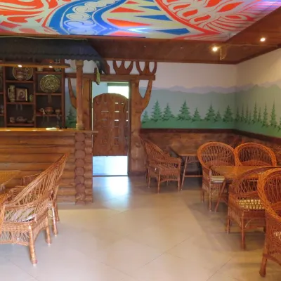 HomesteadHomestead "Vyshyvanka"Sheshoryunder 1 km from the riverSaunaBBQParkingNearby: Polonyna Rosokhata 3.4 kmLake Lebedyn 4.8 km1 trail
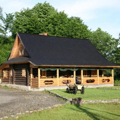 HotelComplex "Stara Khata"Sheshoryunder 1 km from the riverSaunaKitchenTransferNearby: Dead Lake 2.0 kmPolonyna Rosokhata 2.3 km1 trail
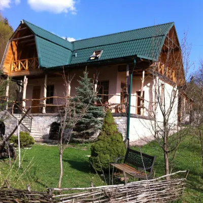 HotelGuest House "Sikityra" SheshorySheshoryunder 1 km from the riverPoolSaunaBBQNearby: Polonyna Rosokhata 3.5 kmLake Lebedyn 5.0 km1 trail
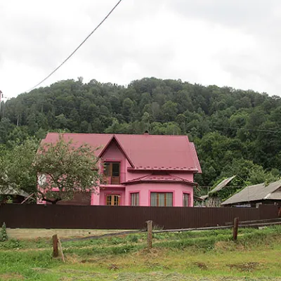 HotelCадиба "Межибріддя"Sheshoryunder 1 km from the riverPoolSaunaBBQNearby: Polonyna Rosokhata 1.2 kmDead Lake 2.9 km1 trail
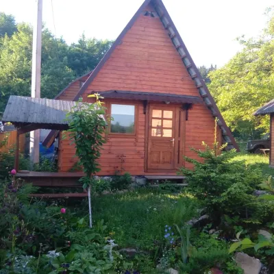 HotelHotel Complex "Karpaty Rai" Sheshory (herbal bath with pool)Sheshoryunder 1 km from the riverHot tubPoolSaunaNearby: Polonyna Rosokhata 4.9 kmLake Lebedyn 5.6 km1 trail
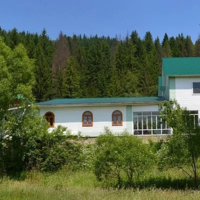 HomesteadПриватна садиба "Облаз" Космач (риболовля біля річки)Kosmachunder 1 km from the riverBBQKitchenKidsNearby: Oleksa Dovbush Museum 600 mChurch of St. Paraskeva 1000 m2 trails
Trails nearby
All trails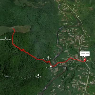 EasyOne-dayMarkedSheshory RosokhataElevation profile464–680 m1.6 kmascent 61 m≈ 30 min walking6.8 km from Pistynka River
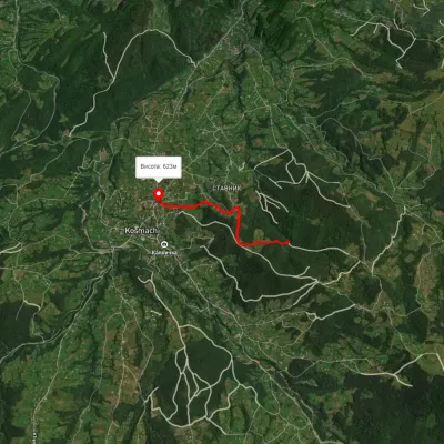 EasyOne-dayMarkedOpryshky RoadElevation profile625–762 m2.5 kmascent 77 m≈ 45 min walking15 km from Pistynka River
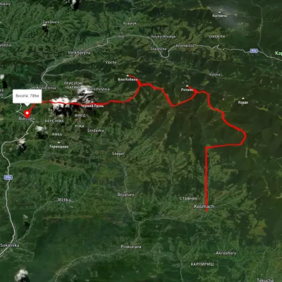 HardMulti-dayUnmarkedKosmach village to Bukovets villagevia Mount Rotylo, Mount Hrehit +1Elevation profile612–1 461 m40.2 kmascent 1 739 m≈ 13.5 h walking16 km from Pistynka River
Nearby attractions
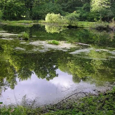 LakeLake Lebedyn (Sheshory)Sheshory6.4 km from Pistynka RiverLake Lebedyn (Lebedine) is located at an altitude of 650 m amidst beech forests and has been a protected area since 1978.
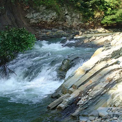 WaterfallKosivskyi Huk WaterfallKosiv6.6 km from Pistynka RiverKosivskyi Huk - one of the most beautiful waterfalls in the Ukrainian Carpathians (in the Pokuttya-Bukovyna Carpathians massif), a geological natural monument of local...
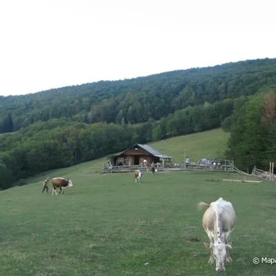 Mountain meadowPolonyna Rosokhata (Sheshory)Sheshoryaltitude 860 m6.7 km from Pistynka RiverWhy is the meadow called "Rosokhata"? The two parts of the field that form the branches look like dewdrops.