Shybene village — to Mount Pip Ivan Chornohirskyi, via Vesnarka polonyna
Unmarked trailmore
It may be partly marked. Unmarked trails have no information boards, signposts or auxiliary signs (water, campsite, etc.). The decision to walk the trail is entirely your own responsibility.
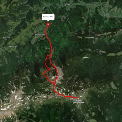
Trail map
Where to stay nearby
About the trail
Route Shybene village, via Vesnarka polonyna to Mount Pip Ivan Chornohirskyi. Along the route you will see: Polonyna Vesnarka, Zelenne, Lake Maricheyka, Mount Shurin, Mount Pip Ivan of Chornohora (Pip Ivan, Black Mountain), The White Elephant Observatory on Mount Pip Ivan Chornohirsky.
At a glance
A one-day route of 11.9 km with 1,874 m of ascent from Shybene village to Mount Pip Ivan Chornohirskyi. Estimated walking time: about 6 h, not counting stops. Difficulty: hard. Waymarking is missing or partial.
Route stages
- 0–6 kmDescent of 610 m to Hut “Maricheika”
- 6–12 kmClimb of 1,650 m to Mount Pip Ivan of Chornohora (2,028 m)
Steepest kilometre: km 7–8, a climb of 1,060 m (≈94%), near Lake Maricheyka.
Water and overnight stays
Springs near the trail: at km 5, 7 and 9.
Huts and shelters near the trail: Hut on Polonyna Vesnarka (4) (km 5), Hut “Maricheika” (km 6), Mountain shelter “White Elephant” (km 12).
When to go
Best time: June to September. In winter only for experienced hikers with proper gear: avalanche danger is possible. About 4 km of the route runs above 1,500 m, where the weather changes quickly — check the forecast.
Getting there
Start: Shybene village. This is a one-way route: the finish is 6 km from the start in a straight line, so plan your way back in advance.
FAQ
- How long does the route take?
- Estimated walking time: about 6 h, not counting stops.
- Is there water on the route?
- Springs near the trail: at km 5, 7 and 9.
- Where can I stay overnight?
- Huts and shelters near the trail: Hut on Polonyna Vesnarka (4) (km 5), Hut “Maricheika” (km 6), Mountain shelter “White Elephant” (km 12).
Water and shelter on the route
- Spring on Polonyna Vesnarka (3)km 4.2 from the start · 120 m off the path · Not verified · 1 501 m
- Hut on Polonyna Vesnarka (4)km 4.3 from the start · 190 m off the path · Standing · 1 459 m
- Hut “Maricheika”km 5.5 from the start · 50 m off the path · Standing · 1 533 m
- Spring below Mount Shuryn (6)km 6.1 from the start · Not verified · 1 530 m
- Spring below Mount Shuryn (5)km 6.9 from the start · Not verified · 1 515 m
- Spring below Mount Shurynkm 7.9 from the start · Not verified · 1 661 m
- Mountain shelter “White Elephant”km 10.5 from the start · Not verified · 2 003 m
Comments
What to see on the trail
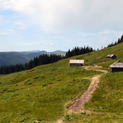 Polonyna Vesnarka, Zelennealtitude 785 m"Vesnarka is a meadow on the Chornohora ridge in the Ukrainian Carpathians. It is located on the road between the village of Zelene and the...
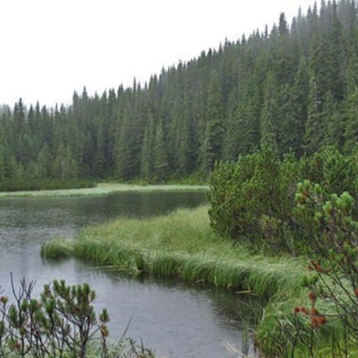 Lake Maricheykaaltitude 1 510 mLake Maricheyka is one of the most picturesque high-altitude glacial lakes in the Carpathians, located on the northeastern slope of Mount Shuryn,...
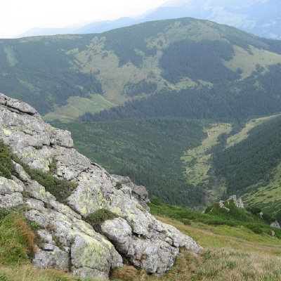 Mount Shurinaltitude 1 772 mMount Shuryn, with a height of 1772 meters, is a peak of the Ukrainian Carpathians located in the southeastern part of the Chornohora mountain range.
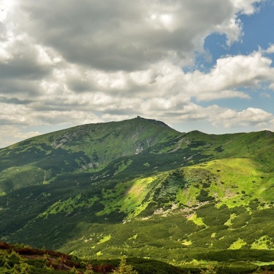 Mount Pip Ivan of Chornohora (Pip Ivan, Black Mountain)altitude 2 028 mPip Ivan Chornohirsky (also known as "Pip Ivan" and "Black Mountain") is the third highest mountain (2028 m) after Hoverla (2061 m) and Brebeneskul...
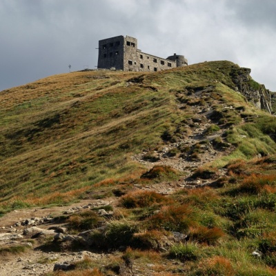 The White Elephant Observatory on Mount Pip Ivan Chornohirskyaltitude 2 028 mThe construction of the White Elephant Observatory on Mount Pip-Ivan Chornohirsky(the route along the Chornohirsky ridge starts from this two...
Trails nearby
All trails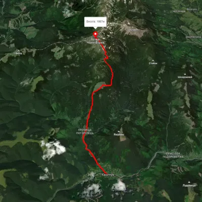 ModerateOne-dayMarkedShybene village Mount Pip Ivanvia Vesnarka polonyna, Lake MaricheikaElevation profile856–2 002 m11 kmascent 1 565 m≈ 6 h walking
 HardMulti-dayUnmarkedDzembronia village to Kryvopillia villagevia Mount Pip Ivan Chornohirskyi, Mount ShpytsiElevation profile825–2 004 m44 kmascent 2 277 m
 HardTwo-dayUnmarkedDzembronia village loopvia Mount Vukhatyi Kamin, Mount Pip Ivan Chornohirskyi +1Elevation profile822–2 048 m21.3 kmascent 1 556 m≈ 8.5 h walking