Mountain shelter
Žiarska Hut
Slovakia · Western Tatras range · 1 289 m


- Photo: Jerzy Opioła · CC BY-SA 4.0 · Wikimedia Commons
- CC BY-SA 3.0 · Wikimedia Commons
- Photo: Slovan88 · Public domain · Wikimedia Commons
Condition
StandingNo hikers’ reports yet. According to open data the hut is open — check its website or call before setting out.
Last edited on the OSM map 22.09.2026
- 1 289 m
- Sleeps up to 40
- Meals served
Practical info
- Run by: TJ Družba Smrečany-Žiar
- Local name: Žiarska chata
- Food: Kitchen or buffet
- Built: 1939
- Contacts: ziarskachata.com
About
Žiarska Hut stands in the middle of the Žiarska dolina in the Western Tatras, about 5.5 km from the valley mouth. A survey mark on its wall gives 1289 m (guidebooks quote other figures too). It is a popular base for hikes to Baníkov, Baranec, Plačlivé and Ostrý Roháč.
The first hut was built in 1937–1939 by the people of Žiar and Smrečany and opened on 1 July 1939. In 1944 it housed a partisan headquarters, and in December that year it was looted and burnt during fighting. A temporary post-war barrack was enlarged several times; in 2006 it was demolished and a new building went up in a single summer, opening on 2 September 2006. In March 2009 a huge avalanche damaged the hut, but it held.
The hut has about 40 beds in double and four-bed rooms, a dining room and a buffet. Next to it are a mountain rescue station and the Symbolic Cemetery of victims of the Western Tatras. The blue trail continues to Smutné sedlo and the green one to Žiarske sedlo. Mountain rescue (HZS): 18 300.
On the map
Coordinates: 49.18107, 19.71948
How to get there
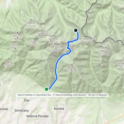
from the mouth of the Žiarska dolina on the blue trail along the Smrečianka stream (a paved road), about 1 h 30 min.
Trails nearby
Report the condition
Been here recently? Tell us what you saw and add photos — your report appears on the page right away with today’s date.
