Mountain shelter
Ťatliak Hut
Slovakia · Western Tatras range · 1 393 m


- Photo: Arvedui89 · CC BY-SA 4.0 · Wikimedia Commons
- Photo: Jerzy Opioła · CC BY-SA 3.0 · Wikimedia Commons
- Photo: Ján Sokoly · CC BY 2.0 · Wikimedia Commons
Condition
StandingNo hikers’ reports yet. According to open data the hut is open — check its website or call before setting out.
Last edited on the OSM map 22.09.2026
- 1 393 m
- Sleeps up to 25
- Meals served
Practical info
- Local name: Ťatliakova chata
- Food: Kitchen or buffet
- Built: 1941
About
Ťatliak Hut stands at about 1390 m at the end of the paved road up the Roháčska dolina in the Western Tatras, beside the shallow Ťatliakovo jazero pond. It is a busy trail junction for the Roháčske plesá tarns, the Zábrať saddle, Rákoň, Smutné sedlo and the Roháče ridge.
A small cabin stood here as early as 1883. On the initiative of the Orava tourism activist Ján Ťatliak a two-storey hut in the style of Orava cottages was built in 1937–1941, but German troops burnt it in December 1944. Its post-war successor with 100 beds was destroyed by a lightning fire on 28 May 1963; only the ski store survived and for decades served as a hikers' buffet. After a long extension finished in 2017 the hut again has attic rooms (25 beds) and a dining room.
The road is closed to cars. The old building houses a mountain rescue station, and an obelisk to Ján Ťatliak stands nearby. Mountain rescue (HZS): 18 300.
On the map
Coordinates: 49.21371, 19.74744
How to get there
from Zverovka along the paved road up the Roháčska dolina (red trail), about 1 h 15–30 min; from the Pod Spálenou car park about 50 min.
Trails nearby
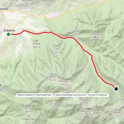 ModerateOne-dayMarkedZuberec Tatliakove plieskoElevation profile760–1 377 m12.8 kmascent 620 m≈ 4.5 h walking
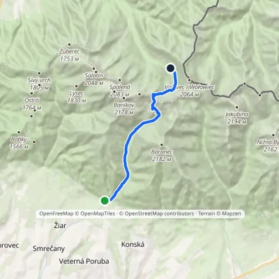 ModerateOne-dayMarkedTatliak Tarn Mouth of Žiarska ValleyElevation profile882–1 963 m11.5 kmascent 1 082 m≈ 5 h walking
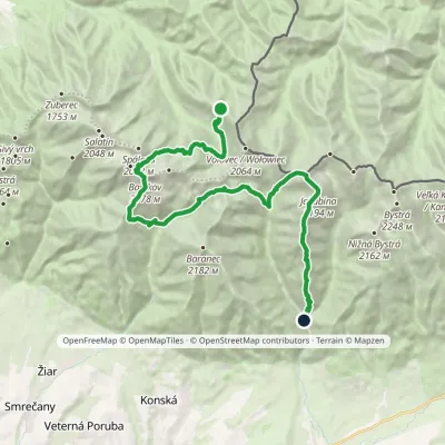 HardMulti-dayMarkedSedlo Zábrať Junction of Jamnická and Račková ValleysElevation profile962–2 194 m26.6 kmascent 2 635 m≈ 12 h walking
Report the condition
Been here recently? Tell us what you saw and add photos — your report appears on the page right away with today’s date.
