Bubnishche
The picturesque mountain village of Bubnyshche belongs to the Bolekhiv City Council of the Dolyna district of Ivano-Frankivsk region. It is located in the east of Ivano-Frankivsk region within the Carpathian region and the Sukil River valley. Near the village there is a monument of national importance - Dovbush Rocks.
The village of Bubnyshche is located along the Bubnyshche tract, which is home to the stream of the same name that flows into the Sukil River. The village is located not far from the town of Bolekhiv (15 kilometers northeast of its center), and borders the villages of: Trukhaniv (in the Lviv region) and Polianytsia (in the south) and Tysiv (in the north). Living in a mountainous area, most of the villagers work in forestry, provide tourist services, and work on their farms, as well as have the opportunity to work at the enterprises of Bolekhiv.
In the vicinity of the village, in the Bubnyshche tract, there is a famous rock and cave complex called Dovbush's Rocks, a unique historical and natural monument of the post-glacial period. It is named after the equally famous opryshok Oleksa Dovbush. And not far away, in the neighboring Lviv region, in the village of Urych, Skole district, there is the stone fortress of Tustan, and in Stryi district, the Rock Cave Monastery, a small mountain range in the village of Rozgirche.
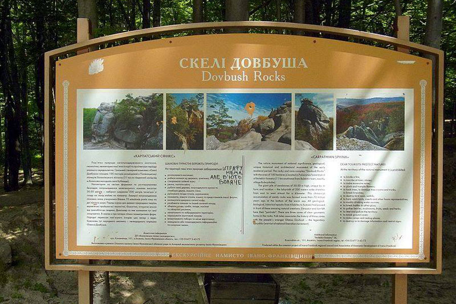
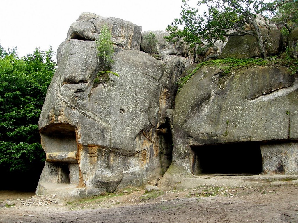
The geological natural monument "Dovbush's Rocks" is a natural fortress dating back to the tenth century and is located at an altitude of 668 meters above sea level. These are rocky sandstone outcrops up to 80 m high, formed more than 70 million years ago at the bottom of the sea. The 200-meter-wide stone labyrinth stretches from east to west for almost 1 km, with beech and spruce forests above it. In the X-XII centuries BC, there was a pagan sanctuary here - a paleo observatory. According to legend, in the XVII-XVIII centuries, opryshky camped here and used the caves as a hiding place. This is a unique in its shape and location pile of giant rocks, stones resembling amazing creatures, and shallow, always dark gorges, pits, secret passages and paths.
The village of Bubnyshche is smaller than almost all the villages of the Bolekhiv City Council (except for Polianytsia, Bukovets, and Taniava) and covers only 230 hectares (7% of the total area of the village councils subordinated to the Bolekhiv City Council). The village is located in the foothills of the Skole B eskydy (the so-called Boykivske Pidhiria). In relation to the district center of Bolekhiv, the village of Bubnyshche is located in the west at a distance of 15 km; and in relation to the regional center - the city of Ivano-Frankivsk - in the northwest at a distance of 90 km. The transportation situation in the village is not very favorable.
A little history of Bubnyshche village
The exact date of the village foundation is unknown. Approximately, it can be the end of the XV - beginning of the XVI century, when the Tatar detachments attacked Prykarpattia. This is evidenced by the rock defensive complexes near the villages of Bubnyshche and Urych. Thus, the history of the village is inextricably linked to their history.
Many historical events took place near Dovbush's Rocks, which are reflected in numerous legends and books. In 1241, the Tatar Mongol horde was defeated by a large detachment of Boyky living in the area while crossing into Zakarpattia. This significant event interested Ivan Franko and later formed the basis of his historical novel The Rising Hawk. Near the caves in Bubnyshche, broken bricks with cannels, tiles and fragments of eighteenth-century dishes, beads, even a cleaver for chiseling rocks, a plate with illegible or incomprehensible inscriptions, etc. were found more than once. Occasionally, we came across ancient Roman and Polish coins here and in the neighborhood.
Our famous historiographer and source scholar A. Petrushevych, in his consolidated Galician-Rus' Chronicle for 1772-1813, published in 1887, states that "the fortifications in Urych and Bubnyshche were built during the rule of the Galician-Volyn princes and were destroyed in the second half of the fourteenth century during the Polish-Hungarian wars of conquest." Petrushevych claims that the forest in the Sklyky area was called Horodyshche. Perhaps he was referring to the area of Zakamen between Bolekhiv and Tysiv, on a hill between two streams, opposite the former forestry. Here is an excerpt from this chronicle: "In the village of Bubnyshche there are the largest rocks with caves hollowed out of them; with an ancient fortification where Hungarian governors, like in Urych, entrenched with troops, resisted the capture of Galician Rus by the Poles at the end of the fourteenth century." There are also some references to battles with Lithuanians in 1369.
The second half of the nineteenth century was very generous in the search for clues. In 1860, the famous writer J. Kraszewski used the image of Bubnyshche in his description of a pagan shrine on the island of Lednytsia in his historical novel Ancient Legend. Bubnyshche was then explored by archaeologist A. Kirkor. These people adhered to the most archaic origin of the caves and were ready to attribute them to the times of Celtic druids or White Croatian pagans in deep prehistoric times. In the 1980s, anthropologist I. Copernicus and archaeologist G. Ossowski expressed their vision. Some of them (Vahylevych, Holovatsky, Belevsky, Kirkor) agreed on three periods in the history of the Bubnyshche caves: pagan shrines, defense against the Tatars, and a refuge for the opryshky. Particular attention should be paid to the opinions of Ivan Franko, who visited the caves quite often from the first half of the 1970s to the mid-1980s. He put forward a version of the cave monastery in princely times.
We have many ideas about Bubnyshche from legends and tales. One of them says that during the famous Tatar-Mongol invasion led by Batu Khan, Bubnyshche was used by the enemies as a temporary storage for property looted in the neighborhood, which was later transported to the Golden Horde. A Tatar outpost allegedly stood here and forced slaves to forge caves and a "well" to imprison the disobedient. Elsewhere we come across a legend that states that near the rocks, the oldest of the Slavic gods, the all-powerful Perun, allowed the pre-Christian magician to sacrifice five heaps of salt and forty sheep, which were sacrificed by Princes Andriyovych and Ratilla.
Some of the villagers of Bubnyshcha recall a powerful nobleman from Voynyliv who, having no heart, oppressed people so much that he forced them to chisel these rocks at his whim. Or maybe there is at least a tiny bit of truth in the legend about two leaders who were brothers but could not finish the fortresses because one of them died a premature death... And so on and so forth: legend after legend, especially of Dovbush's theme. Human imagination and mysterious reality are always close by.
Having clarified the historical and architectural aspect of the monument, we can come to certain conclusions. Relying on more moderate tendencies in relation to some of their predecessors and folk legends allows a number of scholars (V. Baran, V. Savych, I. Huniovskyi, K. Herenchuk, and some others) to join the opposition to the biggest supporters of archaicism and argue that Bubnyshche will not yield materials from prehistoric times. Indeed, this group of versions remains a problem today, requiring at least some evidence. The answer to the question about the rock monastery in Bubnyshche seems hasty, because no signs or traces have been found and, obviously, will not be found on the rocks themselves, as is the case in neighboring Rozhirch or even in Urych, where a small chapel or cell was an integral part of the castle complex. Here, the church could stand alone, perhaps on a post and not necessarily for monks.
A bit about the "bohatyr outpost". Lviv ethnographer M. Huts, who visited Bubnyshche in 1962, tried to specify that the caves and fortifications were made in the time of Danylo Halytskyi, because on one of the steep cliffs there is an artificially modified silhouette of a lion, as if in honor of his heir, his son Lev. Of course, this is not enough. The same version by A. Petrushevych and V. Honcharov has additional, but also insufficient, motivations, although in principle they cannot be denied, because it was a real medieval rock castle, a mountain defensive fortress, and a signal outpost or village on the trade route to the passes. As for this path, we even have some evidence: finds of ancient coins and remnants of microtoponymy-the Lavra and Tower near the village of Bryazy (now Kozakivka), a Lavra-type cave in Sukel, and stories about the Giants. Then it ran through the ancient villages of Skole, Syniavidske, and Tustan until it reached the famous Princely Road, or Ruska Shlyakh, which led to all directions. As for the castle, the only question is: princely or noble, military-strategic or domestic-defensive with a bias toward economic, hunting, or recreational purposes? And again, it is possible that there were two or more stages of this or that purpose.
Comparing different data, it seems that Bubnyshche went through at least two or three periods during its functioning. The castle was designed for long-term use, so it was not the work of insurgent groups or opryshky, who could have been here by chance or temporarily. It was built thoroughly, apparently before the use of firearms, in two plans: domestic (outbuildings, household items) and defensive (moat, embankment, palisade, drawbridge, gate, loophole, tower, well-tank), and three defense belts are visible-two below and one on the rocks.
But whatever this site is, it is a monument to the hard-working hands of our ancestors, which has served as a defense more than once. In addition, Bubnyshche is the place where the Sich Riflemen, units of the Ukrainian Insurgent Army, and many prominent people were stationed.
Famous Galician wake-up callers such as Markiyan Shashkevych, Ivan Vahylevych, and Yakiv Holovatsky visited Bubnyshche and studied the region. Ivan Franko and Mykhailo Hrushevsky also visited the area. In 1881 Ivan Franko wrote the poems "Hello" and "Bubnyshche". Bubnyshche was well known and visited by well-known historians V. Antonovych, I. Sharanevych, S. Tomashevsky, M. Korduba, T. Kostruba, I. Krypiakevych, and others, but unfortunately, we do not have their works. Much attention was paid to Dovbush's Rocks by scientists and archaeologists of the 20s and 30s, such as B. Janusz, T. Sulimirsky, M. Smishko, Y. Pasternak, and Y. Pelensky; in the 50s and 60s, K. Berniakevych, V. Honcharov, O.Ratych, P. Rapoport, V. Baran; our contemporaries M. Rozhko, B. Tomenchuk, M. Bandrivskyi, but none of them pleased us with a fundamental work about Dovbush's Rocks in Bubnyshche.
In August 1925, the second regional Plast meeting was held near the Rocks in Bubnyshche, attended by 205 participants (the first was in 1924 at Pysanyi Kamen near Zhabia - now Verkhovyna- and attended by future well-known public and political figures of Ukraine Mykhailo Horbovyn from Kosiv, Stepan Bandera, Ivan Chmola, Yaroslav and Roman Raky, and others. The third and last regional meeting was held in July 1926 on Mount Sokil near Pidliuty).
From Dovbush 's Rocks, the Plast units went to the famous Mount Makivka, where they honored the memory and organized the graves of the Sich Riflemen. Here, the future Commander-in-Chief of the Ukrainian Insurgent Army Roman Shukhevych and Ivan Seniv hung a blue and yellow flag on a high and very steep rock called "Vezha", thus adding an interesting page to the history of Ukrainian Carpathian mountaineering...
After studying the caves, log cabins, grooves, and steps carved into the stones, scientists concluded that the rocks were used by people who lived here in the tenth century as dwellings and as a fortress. The cave rooms have clear geometric shapes, correct proportions, flat surfaces of vertical walls, fairly precise rectangularity, and clean ceiling decoration.
In the 10th-12th centuries AD there was a pagan sanctuary here - a paleoobservatory. The settlement is surrounded by rocks on three sides and is bounded on the fourth side by a rampart and a 10-meter-wide inner moat. The diameter of the site is 40 m. There is a well carved into the rock, which is accessed by a stone staircase. The well (2 x 2 m, current depth 5-6 m) does not reach the water. Three caves with preserved log grooves are carved into the rocks. The rocks depict solar signs, palm-shaped depressions, and faces. Nearby is a large mound burial ground consisting of mounds 5 m in diameter and less than 1 m high.
The remains of 80% of the building traces will allow us to recreate the complex in its most probable form - to create a single complex of wooden rock fortifications that will certainly impress and capture the imagination of tourists and excursionists, and add to the attractiveness of the unique natural phenomenon.
The folk etymology of the village name is also interesting. To defend themselves against the Tatars, the villagers posted sentries who would sound the alarm when the enemy approached. Thus, the village got the name Bubnyshche. One of the folk legends says: "A huge force of Turks came to capture Ukrainian prisoners, strong rowers on galleys, and chests filled with gold. But the people did not surrender to them. And then, when their strength was already gone, the brave avenger, a charming beauty, went to the enemy. "What are you doing, beautiful?" someone could not resist. No one could even guess what she was up to.
And she, the daughter of the green mountains, approached the extreme rock, which was like a forest Goliath, and looked at the blood, the slaughter, the fight. "You are strong and unshakable," she said, "you have not betrayed your land for centuries, you stand in every storm. People, we will also stand! If we die, the rocks will tell our descendants...
The Turks rushed to the beauty. And when she was about to fall victim to the enemy, the rock opened and hid her. The native land was covered with bones, but the highlanders drove the enemy away. And then the rock would open, and a beautiful woman would come out and look around to see if the enemy was coming to destroy her land again. And if he did, she would inform people by beating a tambourine. They say that this is where the name of the village came from - Bubnyshche."
Most likely, however, the name comes from the name of the founder, the first landowner, or the first settler. The picturesque area and free land attracted fugitives from the lord's oppression.
The village of Bubnyshche is located within the mountainous part, which is characterized by a mid-mountainous type of relief. The relief of the village is diverse: near the Sukil River it is flat (the extreme southern part of Predkarpattia), and with the rise to the village and to the Dovbush Rocks it gradually turns into the northern slopes of the Skole Beskydy. Bubnyshche is located in a small valley between the mountains. The prevailing altitude in the village of Bubnyshche is 500-600 meters above sea level.
Among the green sea of trees in the Zalomy tract, at an altitude of 600 meters above sea level, there are bizarre clusters of stone giants that impress with their size and shape. This work of nature consists of sandy rocks (like the Yamnenska sandstone near Yaremche) 20 to 30 meters high, which are stretched out in a semicircle, as if in a merry Hutsul dance, and have frozen forever, resembling fantastic creatures with their shapes. Winds and rains have diligently polished the mighty sides of the rocks, and the inexorable years and centuries have aged them, covering them with many wrinkles and cracks.
Dovbush Rocks is a complex natural monument of national importance. This rock massif is popularly associated with the name of the legendary opryshky leader Oleksa Dovbush. Millions of years ago, the ancient sea was lapping here. Later, the water receded, revealing bizarre rocks. This landscape monument of nature impresses with its majestic beauty, mystery, and excites everyone from the moment they touch it. They consist of sandstones and are part of the Skole Beskydy, which cover the territory of Dolyna district of Ivano-Frankivsk region and Skole, Drohobych and Turka districts of Lviv region. This is a group of yellow-gray fine-grained sandstones formed as a sedimentary (with shell rock) layer on the former seabed at the turn of the Mesozoic and Cenozoic eras, at the end of the Cretaceous period (Yamnenska sandstones) or the younger Eocene horizon (Vyhoda sandstones), at least 67 million years ago. As a result of tectonic faults and landslides during mountain formation, natural caves were formed in the underground parts, for example, on the slopes of Sokolova Hora, and the surface parts up to 30 meters high have acquired extremely amazing shapes as a result of water and atmospheric actions.
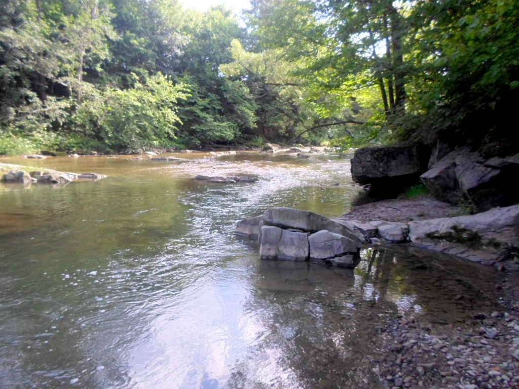
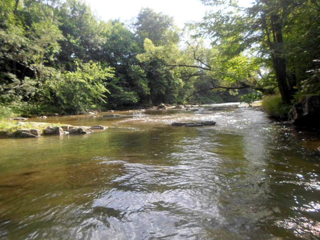
The majesty of the Bubnyshchyna rocks is fascinating, and those who have visited here at least once will certainly want to come back here again and again. Because the impressions of what they saw, the huge explosion of emotions and adrenaline will remain in their hearts and souls forever. That's why thousands of tourists come here every year to walk the Dovbush trails, breathe in the heady aroma of fresh mountain air, touch the ancient times with their hands, ride a horse, choose the best Hutsul souvenir as a gift, take a picture in traditional Hutsul clothes, taste mushroom soup and banosh in hospitable kolyba accompanied by three musicians. And then life will really seem like an earthly paradise. Not far from the trout farm, on the left side of the Sukeli river (below the bridge over the river), a large meadow often hosts regional gatherings of young tourists, competitions and contests in tourism techniques and orienteering.
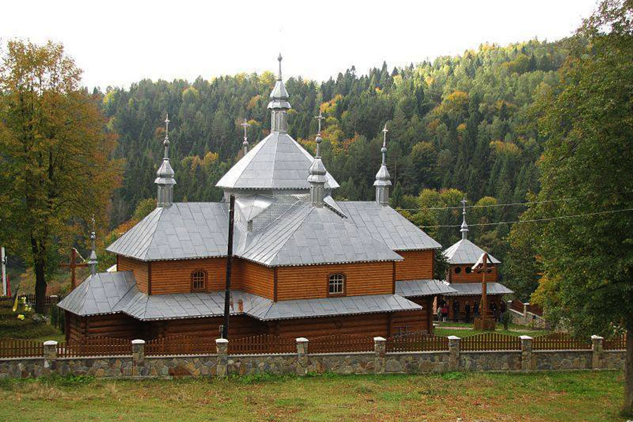
In the village of Bubnyshche there is a wooden church of St. Paraskevia, which was built in 1891. On October 26, 1983, the church was closed by the communist authorities and turned into a warehouse until 1988. In the twenty-first century, the church was expanded and restored, but in 2015, as a result of a fire, the interior of the church burned to the ground.
The village also has significant tourist resources that need to be properly and rationally utilized. Further development of tourist and recreational complexes, construction of ecological and educational trails is a great prospect. Creating the right conditions for a long vacation. The enchanting nature of the evergreen Carpathians, the lungs of Ukraine, the melodious sound of crystal streams and waterfalls, picturesque mountain landscapes and interesting natural monuments constantly attract people from all over the world. It is here that they can enrich themselves with new impressions of what they have seen and heard, feel the breath of stone giants, and see for themselves how the earth is shedding its gray slumber.
But perhaps the greatest impression on visitors is made by a unique natural and rock architecture monument in the Carpathians - the famous Dovbush Rocks. First of all, they need state protection, partial conservation and partial restoration. Real archaeological and scientific research will also be needed. Much can be accomplished through paid tourism, because even in Poland, such revenues were used to keep a constant watch over destruction.
Dovbush's Rocks are located near the village of Bubnyshche in the Carpathians, which can be reached by private or public transportation. The Dovbush Rocks rock and cave complex is located 15 kilometers from the town of Bolekhiv, Ivano-Frankivsk Oblast. From Bolekhiv, there is a bus that will take you to the turnoff to Dovbush Rocks. Then you have to walk about 4 km.
77221, Ivano-Frankivsk region, Bolekhiv City Council, Polianytsia village, tel. +380 03437 3-94-09


Accommodation in Bubnishche, with:
Are there places with a fully equipped kitchen for cooking in Bubnishche?
If you are interested in places with an equipped kitchen for cooking in Bubnishche, check out these options: Tourist Complex "SKELYA" Bubnyshche
Planning to grill a barbecue and spend time with friends outdoors in Bubnishche?
If you are interested in venues with a gazebo in Bubnishche, take a look: Tourist Complex "SKELYA" Bubnyshche
Looking for a cottage with a sauna and a plunge pool or tub in Bubnishche?
If you are interested in venues with a sauna and a plunge pool or tub in Bubnishche, check out these options: Tourist Complex "SKELYA" Bubnyshche
Which hiking trails pass through or near Bubnishche?
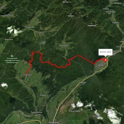
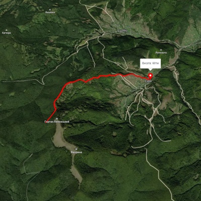
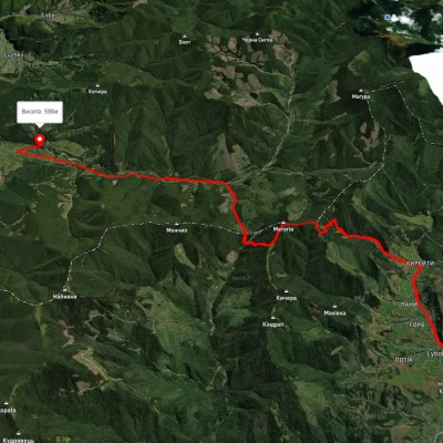
We suggest these hiking trails through or near Bubnishche: Trukhaniv village, via Mount Kliuch, Lake Zhuravlyne and Kamianka Waterfall to Skole, Lypa village – Yavoryna – Robert's Bunker, Lybokhora village, via Mount Matahiv to Kozakivka village, Skole, via Mount Lopata, Mount Khom, Kamianka village, Kamianka Waterfall and Dubyna village to Skole, Skole, via Mount Parashka, Hurkalo Waterfall and Korchyn village to Verkhnie Synovydne village, Skole, via Mount Parashka, Hurkalo Waterfall and Korchyn village to Verkhnie Synovydne village