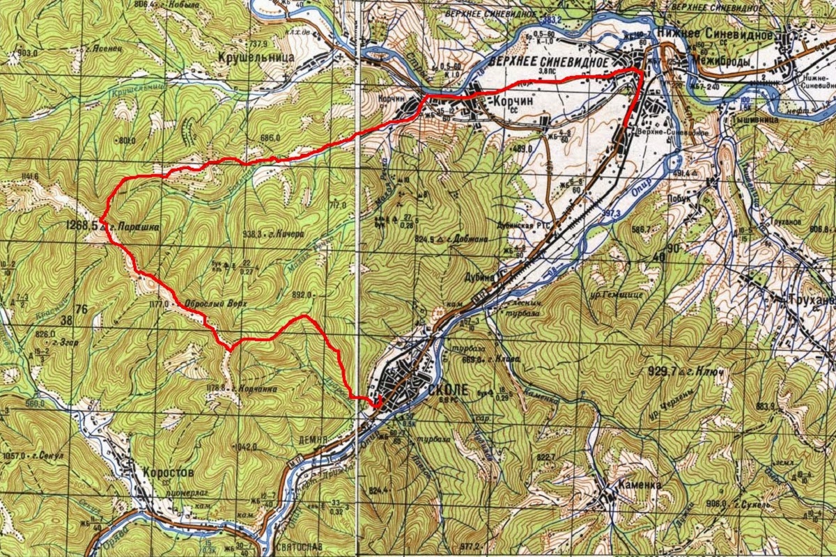
Weekend hike. Route #2: Skole - mt. Parashka - Gurkalo - Korchyn village - Verkhne Synevydne village (25 km)
There are a lot ofroutes in the Ukrainian Carpathians - for every taste, duration, and different categories of difficulty. Someone is looking for options that are as difficult as possible - for several days and, on top of that, on unmarked trails... And for someone, such hikes are not acceptable: either they don't have enough free time, or their level of physical fitness doesn't allow it, or they decided to go hiking with children. If you belong to the second category of tourists, then a hike to Mount Parashka from the city of Skole is the best option.
Parashka and its popularity
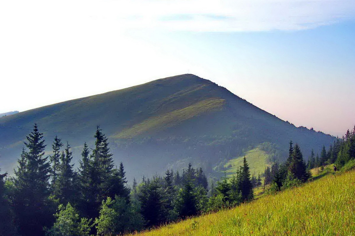
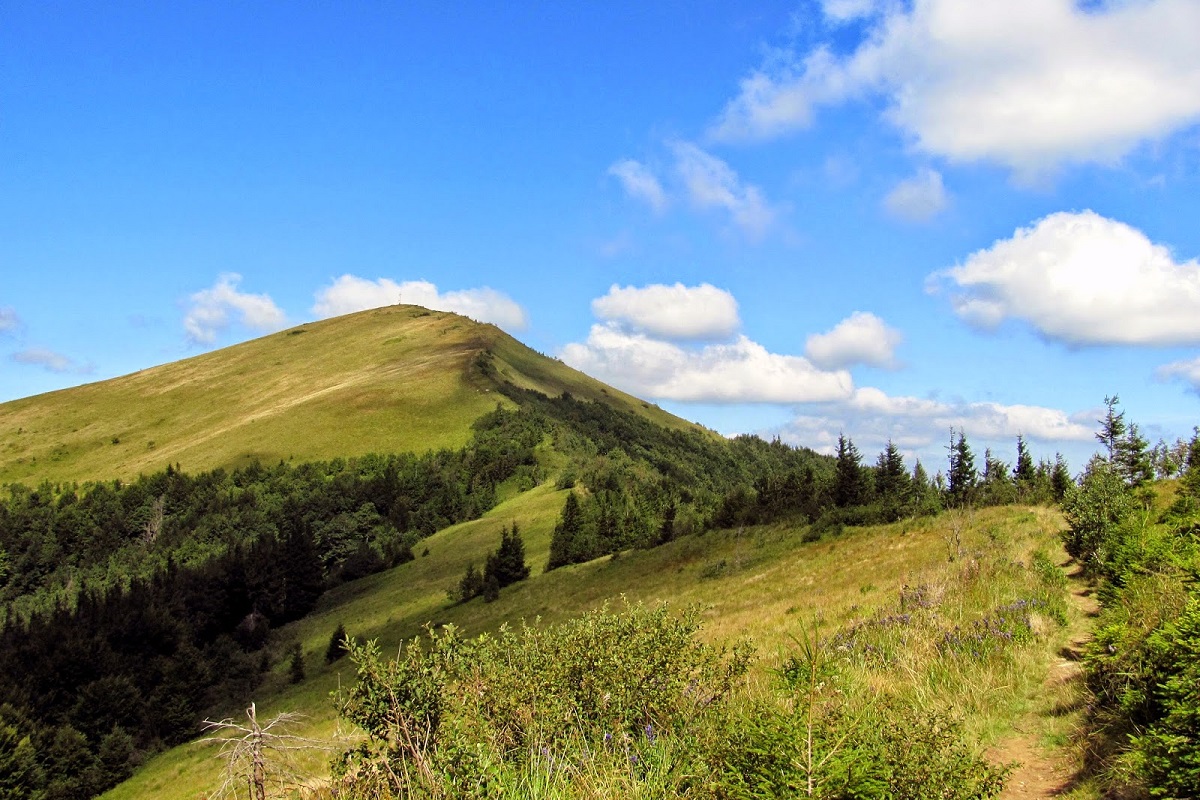
Parashka (1271 m), being the highest mountain in the Lviv region, is a very popular peak among tourists of all levels. This is explained by the following:
- Parashka is, relatively speaking, "accessible" to everyone, because even children can climb the mountain;
- the starting point of the climb - m. Skole is very easy to reach, both by car and by rail;
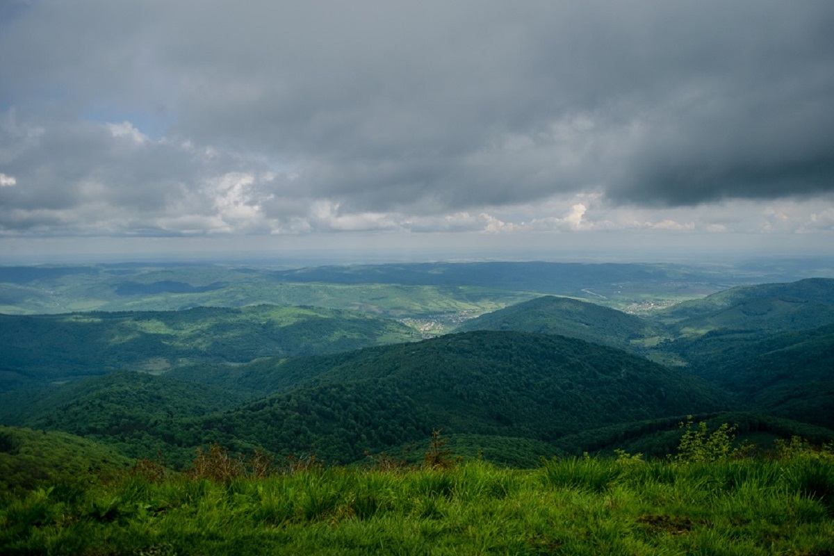
- in clear, cloudless weather, Parashka offers magnificent views - all the surrounding peaks are visible as if in the palm of your hand.
Given the popularity of the route, on fine days you can meet numerous tourist groups here - from schoolchildren, families and scouts to outdoor enthusiasts. However, this does not bother anyone at all.

From Skole to Parashka
We got to Skole by train 827D Lviv-Mukachevo, which departs from Lviv at 07:15 (a backup option, if we didn't catch the first train, is the 6187 Lviv-Mukachevo, which departs at 09:06). We arrived in the city at 08:50. The weather was a little disappointing, it was drizzling, but nothing could change our plans.
So, Skole. The railway station. Here we decided to buy water and bread. Although we could have taken our time, since the route starts near the Rukavychka supermarket, which is located along the Kyiv-Chop highway.
In order not to wander for a long time in search of the beginning of the route and not to blindly believe the navigator (who wanted to deceive us into an extra 1-1.5 km, forcing us to make a "hook"), it is better to ask the locals where you can "cut" around the city to shorten the journey.
The beginning of the ascent begins approximately 300-400 meters from the "Rukachka" along the road in the direction of Chop. We turn right and go out on a well-trodden path that runs rapidly upwards. Although at the beginning the ascent will be quite steep, it will not last long. Don't worry too much))
Then we follow the trail in a northwestern direction, constantly climbing up the ridge line. After about 3 km, we come to the edge of the forest, where the trail changes direction, first to the west and then to the southwest.
Attention : Halfway to Parashka, there will be only one spring, so you should fill all your water bottles here. Later on, especially in hot summers, there will be no place, up to the river that feeds the Gurkalo waterfall, where you can replenish your water supplies.
After taking a break and refreshing ourselves with sandwiches/cookies/candy, we continue to climb. Unfortunately, when we come out of the forest and onto the ridge, we can't really enjoy the views, as we are covered by thick, heavy gray clouds.
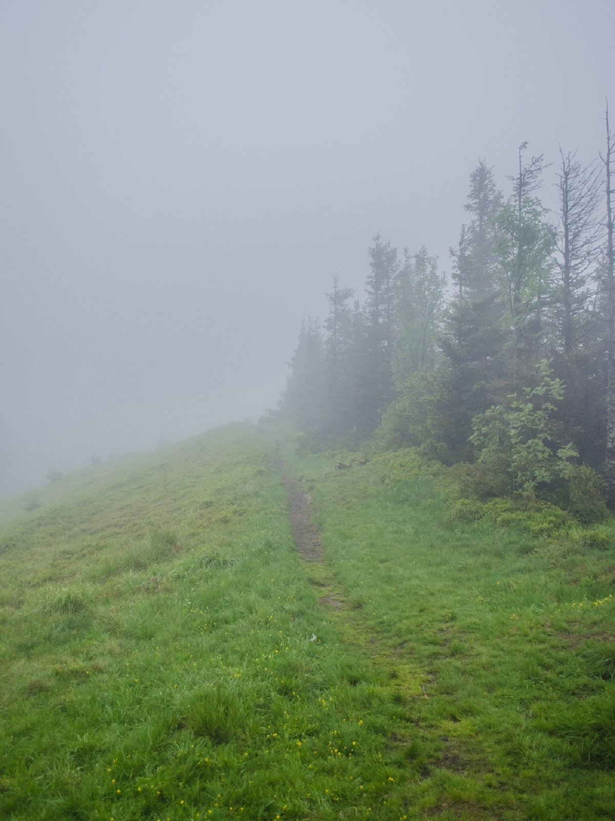
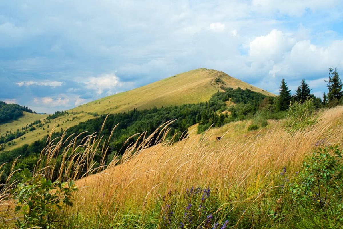
A little more and we are at the foot of the mountain. The last climb, a jerk - that's it, we are at the top of Parashka. The weather gives us a gift, disperses the clouds, and for a few minutes the conquerors of the highest mountain in Lviv region have a magnificent view.
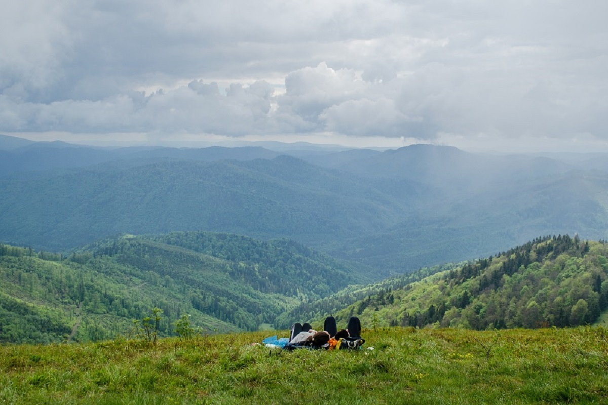
After admiring the beauty of the Skole Beskydy, taking 1000 and 1 photos as a souvenir, we decided to start the descent to the Gurkalo waterfall. So to speak, "time was running out".
Parashka - Gurkalo
Attention : A very important point - after descending from the top of Parashka about 100-200 meters down, do not miss the turn to the right (if you take your time and keep an eye on the path, you will not miss it), which, although hidden in the bushes, is quite visible.
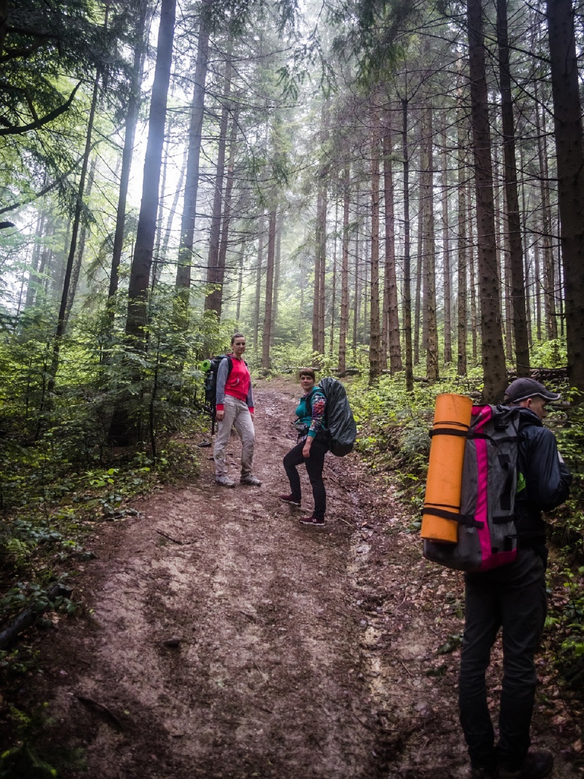
Taking into account the steep descent and the wet forest with slippery paths, the trip down took us a little longer than planned. The descent was especially steep as soon as we left the meadow and entered the forest - sometimes we had to cover the distance by short runs from tree to tree, leaning against them like a wall to avoid "flying" down. If you take your time, you can avoid falls and injuries.
The descent is steep, which means that you quickly lose the height that was so difficult to gain before lunch... The trail is well understood and there are no problems with orientation. At one point, white markers appear on the trees along the road. As we later found out, when we got to the river valley, they led from Parashka to civilization - the village of Korchyn.
After going down, we head along the river to the second object of our hike - the Gurkalo waterfall. We walk along a good trail, which once, apparently, was a road for timber trucks. Sometimes we have to cross a river with a rather rapid flow in a ford (tourists will not face this problem when they plan their hike for the second half of summer).
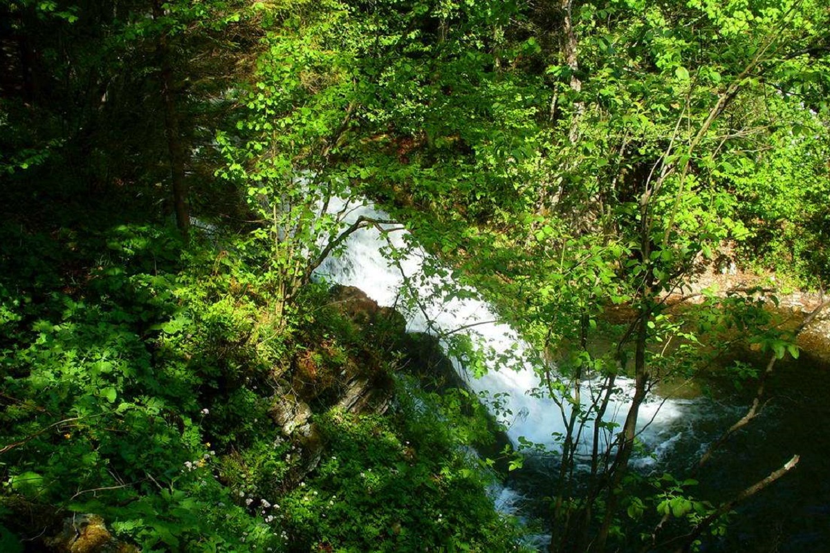
A few kilometers later, and we are at the waterfall. And indeed, in spring, the full-flowing Gurkalo lives up to its name - its roar can be heard quite far away.
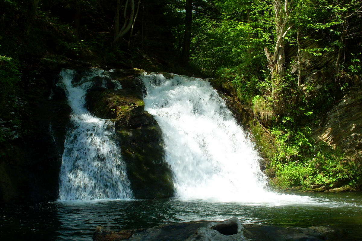
Having taken a few more photos near this majestic natural water attraction, we decide to look for a place to spend the night - there is no point in rushing to Korchyn, and from there to Verkhnye Syniovydne - we are unlikely to catch a bus. There are plenty of places to spend the night in this place, so we had no problems finding it.
Hurkalo - Korchyn - Verkhne Synevydne
We did not plan to wake up with the dawn. Therefore, after a good night's sleep, breakfast/lunch, we went to the village of Korchyn.

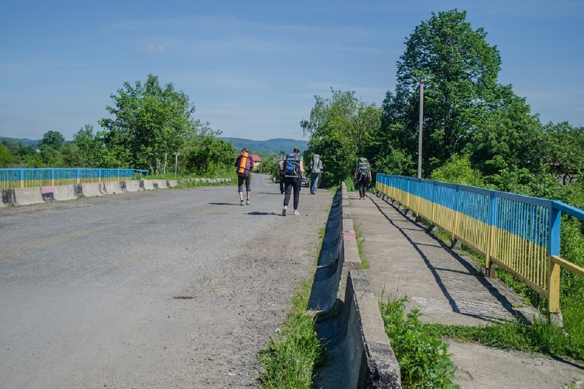
A beautiful field road, sometimes forcing us to overcome water obstacles, led to the highway itself, along which we had to walk all the way to Verkhnye Synevydne (we didn't have time to catch any buses, and we also had to get to Stryi/Lviv).
The road led us to a bridge at a bend in Verkhnye Syniovydne. It was here that we had to "hunt" for minibuses for about 1.5-2 hours. True, there was an alternative option to go to the train station and wait for the train there, but it was about 3.5 km away, and our legs refused to cover such a distance )))