Kvasy village, via Mount Blyznytsia, Mount Stih, Mount Velykyi Kotel and Chorna Tysa village to Yasinia
About the route:
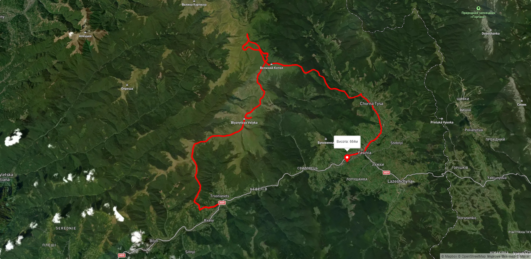
Route Kvasy village, via Mount Blyznytsia, Mount Stih, Mount Velykyi Kotel and Chorna Tysa village to Yasinia. Warning! This route is unmarked (it may be partially marked)! Unmarked routes are not equipped with: information boards; signposts; auxiliary signs (water, campsite, etc.). The decision to take the route is entirely your own responsibility! Trail length 51741m. Lowest point - 566m., highest point - 1846m. Total elevation gain 2900m. Along the route you will see: Mount Bliznytsia, Mount Stig (Dragobrat), Mount Bolshoi Kotel, Lake Vorozheskaya, Lake Gereshaska (Dogyaska), Mount Dogyaska, Mount Trojaska, Strukivska (Ascension) Church, Yasinia.
🎮 3D hike
Walk this route in 3D
Real terrain, satellite map, Carpathian forests
Play →
To add a comment you can: login or register.
What to see along the route:
48.22246757211175,24.23123984805909 | Altitude: 1883м
Mount Bliznytsia
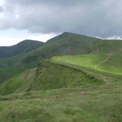 Blyznytsia (also called Bliznytsia, Blyzhnytsia) are two mountains of the Ukrainian Carpathians, located in the eastern part of the Svydovets mountain range. The peaks are located in Rakhiv district of Zakarpattia regionbetween the valleys of the Chorna Tysa and Kosivska rivers.
... More...
Blyznytsia (also called Bliznytsia, Blyzhnytsia) are two mountains of the Ukrainian Carpathians, located in the eastern part of the Svydovets mountain range. The peaks are located in Rakhiv district of Zakarpattia regionbetween the valleys of the Chorna Tysa and Kosivska rivers.
... More...
48.25093720615327,24.22398715488282 | Altitude: 1704м
Mount Stig (Dragobrat)
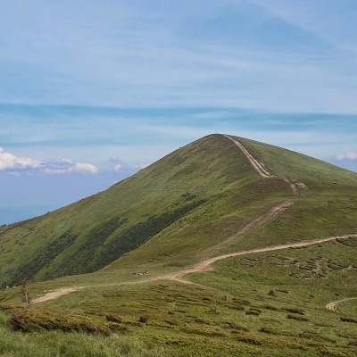 Stig (locally known as Stug) is a peak of the Ukrainian Carpathians, located in the Rakhiv district of Zakarpattia region in the northeastern part of the Svydovets mountain range.
... More...
Stig (locally known as Stug) is a peak of the Ukrainian Carpathians, located in the Rakhiv district of Zakarpattia region in the northeastern part of the Svydovets mountain range.
... More...
48.270336640806306,24.202701144140633 | Altitude: 1771м
Mount Bolshoi Kotel
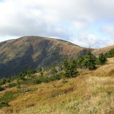 Mount Velykyi Kotel is the peak of the Ukrainian Carpathians, which lies within the Svydovets mountain range. It is located in Rakhiv district of Zakarpattia region. The height of the mountain is 1771 m (other data - 1774 m).
... More...
Mount Velykyi Kotel is the peak of the Ukrainian Carpathians, which lies within the Svydovets mountain range. It is located in Rakhiv district of Zakarpattia region. The height of the mountain is 1771 m (other data - 1774 m).
... More...
48.27620546667069,24.192720454565418 | Altitude: 1460м
Lake Vorozheskaya
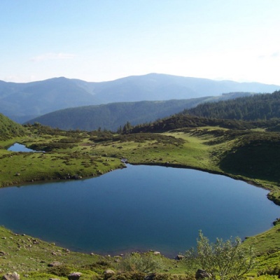 The real pearl of the Carpathians - Lake Vorozheska (other names - Vorozheska, Triton ) - is a hydrological natural monument of local importance, a high-mountain lake of glacial origin in the Ukrainian Carpathians at an altitude of 1460 m. It is located within the Rakhiv district of the Zakarpattia region, in the Carpathian Biosphere Reserve on the Svydovets massif. The NGO "Carpathian Trails" has installed a protective sign near the lake.
... More...
The real pearl of the Carpathians - Lake Vorozheska (other names - Vorozheska, Triton ) - is a hydrological natural monument of local importance, a high-mountain lake of glacial origin in the Ukrainian Carpathians at an altitude of 1460 m. It is located within the Rakhiv district of the Zakarpattia region, in the Carpathian Biosphere Reserve on the Svydovets massif. The NGO "Carpathian Trails" has installed a protective sign near the lake.
... More...
48.27014733243597,24.165279865313718 | Altitude: 1577м
Lake Gereshaska (Dogyaska)
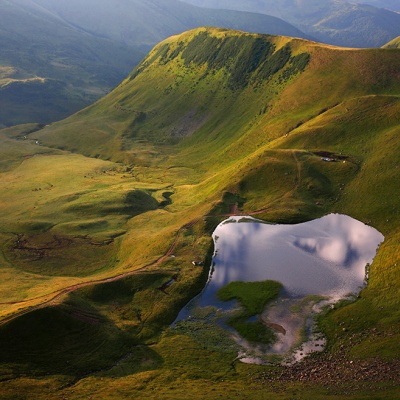 Gerashaska (another name - Dogyaska ) is a high-mountain lake in the Ukrainian Carpathians, within the Rakhiv district of Zakarpattia region. It is a hydrological natural monument of local significance (according to the decision of the Transcarpathian Regional Executive Committee of 23.10.1984, No. 253), with an area of 1.35 hectares, where it is referred to as "Lake Gereshavske". The organization responsible for its protection is the Kosiv-Polyanske Village Council.
... More...
Gerashaska (another name - Dogyaska ) is a high-mountain lake in the Ukrainian Carpathians, within the Rakhiv district of Zakarpattia region. It is a hydrological natural monument of local significance (according to the decision of the Transcarpathian Regional Executive Committee of 23.10.1984, No. 253), with an area of 1.35 hectares, where it is referred to as "Lake Gereshavske". The organization responsible for its protection is the Kosiv-Polyanske Village Council.
... More...
48.266994406058664,24.162661127966317 | Altitude: 1761м
Mount Dogyaska
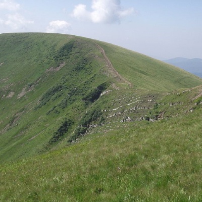 Dogyaska is a peak in the Ukrainian Carpathians, located in the central part of the Svydovets mountain range. The mountain is located in Rakhiv district of Zakarpattia region.
... More...
Dogyaska is a peak in the Ukrainian Carpathians, located in the central part of the Svydovets mountain range. The mountain is located in Rakhiv district of Zakarpattia region.
... More...
48.283960412710385,24.14583831302491 | Altitude: 1702м
Mount Trojaska
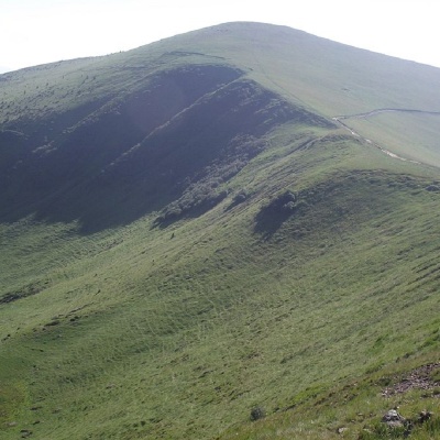 Troiaska is a 1702-meter peak of the Ukrainian Carpathians. The mountain is located in Rakhiv district of Zakarpattia region within the central part of the Svydovets mountain range.
... More...
Troiaska is a 1702-meter peak of the Ukrainian Carpathians. The mountain is located in Rakhiv district of Zakarpattia region within the central part of the Svydovets mountain range.
... More...
48.2595628,24.345073700000057 | Altitude: 663м
Strukivska (Ascension) Church, Yasinia
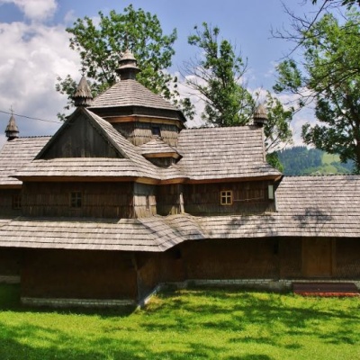 The Church of the Ascension or Strukiv is the real pride of the village of Yasinia and the entire Hutsul region. It was built in the beginning of 1824 on the slopes of Kosterivka, a surprisingly beautiful mountain.
... More...
The Church of the Ascension or Strukiv is the real pride of the village of Yasinia and the entire Hutsul region. It was built in the beginning of 1824 on the slopes of Kosterivka, a surprisingly beautiful mountain.
... More...


