Chornyi Cheremosh River
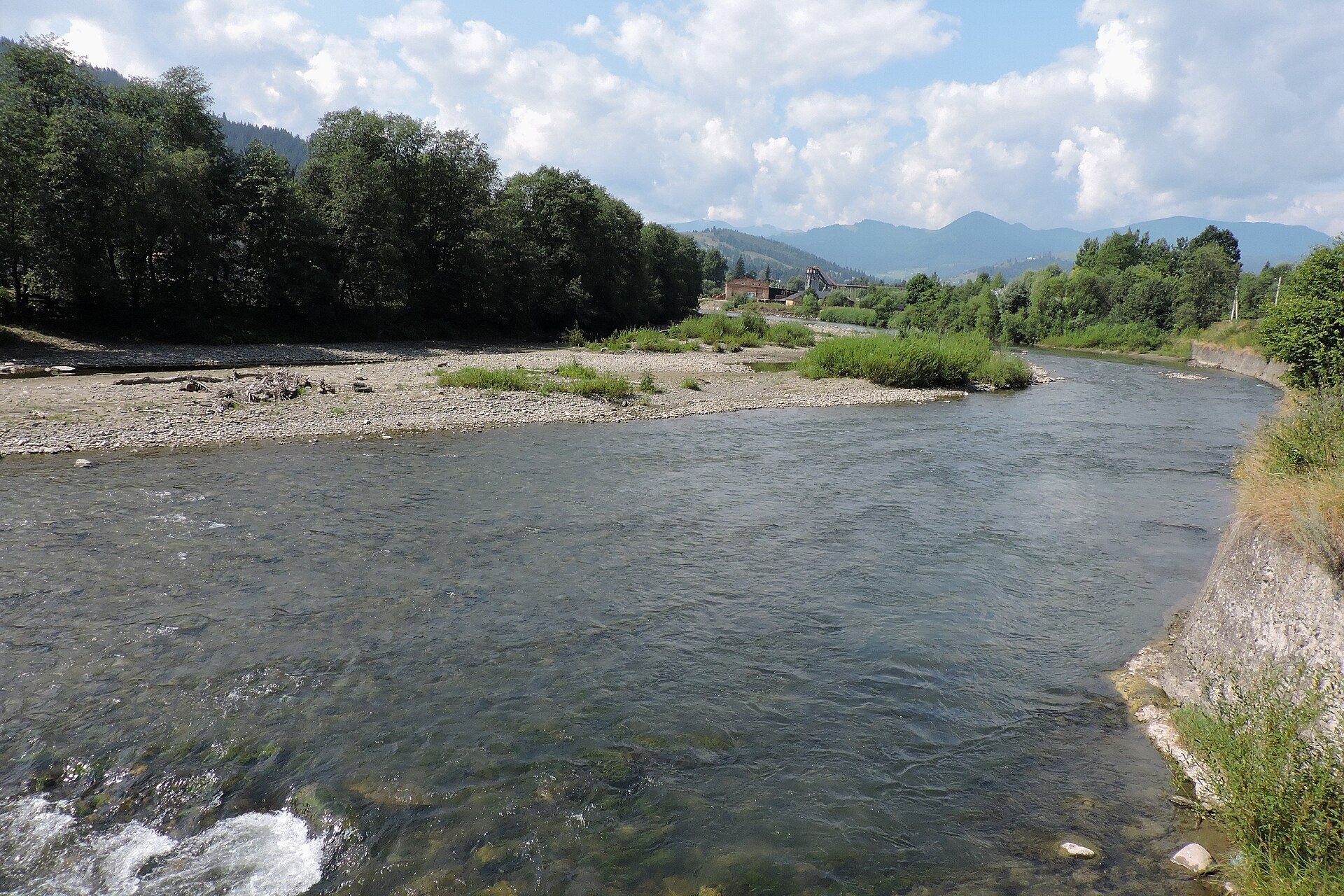
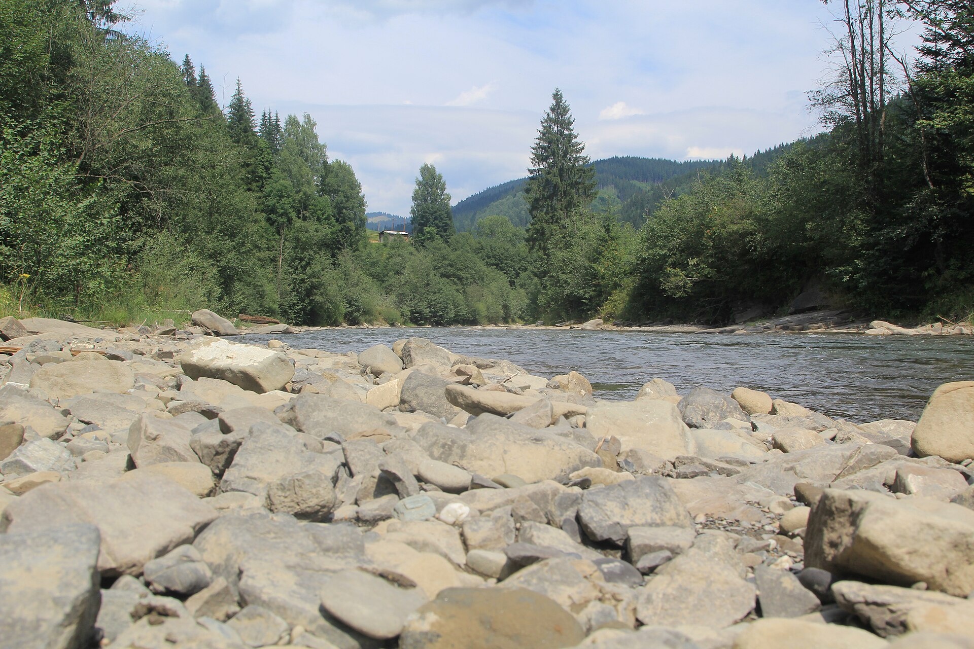
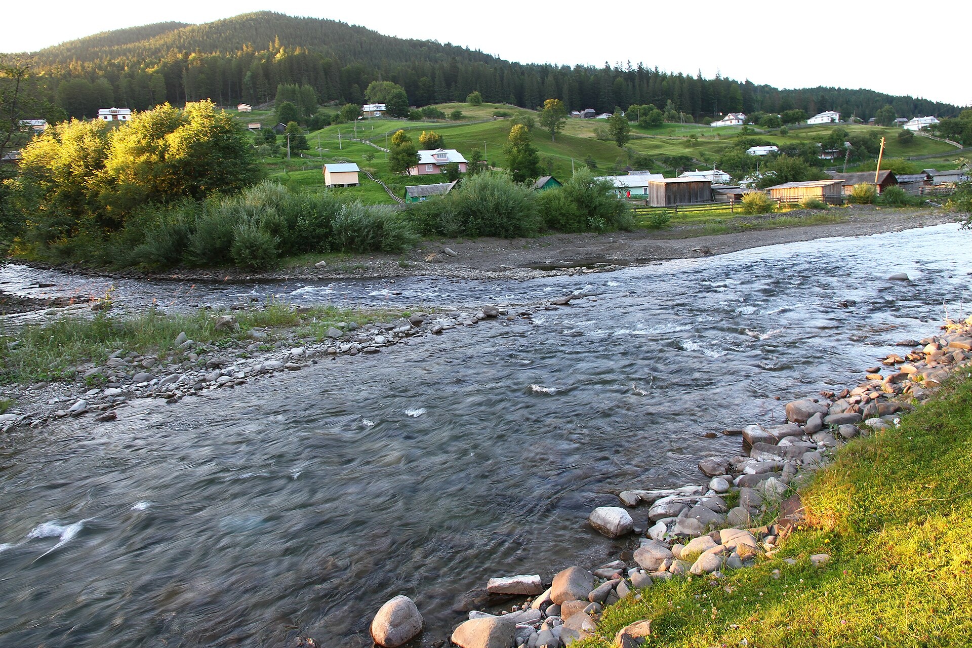
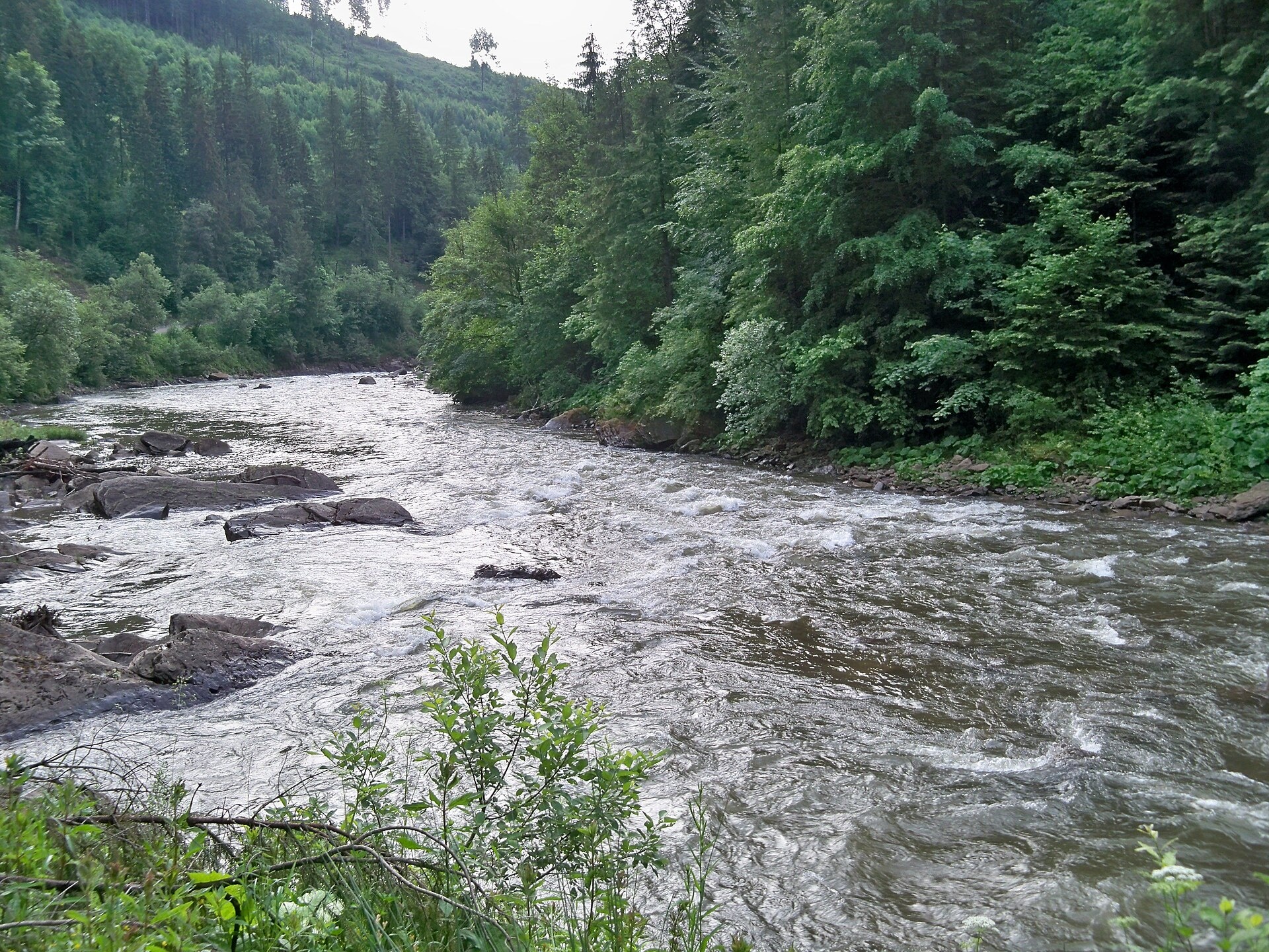
The Chornyi Cheremosh rises south-east of Burkut on the slopes of the Chyvchyn Mountains, the most remote corner of the Verkhovynskyi National Nature Park. Over 87 km it runs north past Yavirnyk, Zelene, Krasnyk, Iltsi, Verkhovyna and Kryvorivnia, and near Usteriky it meets the Bilyi Cheremosh to form the Cheremosh.
It is a fast mountain river with a rocky bed. The ten-kilometre stretch from Dzembronia to Krasnyk, with the Dzembronia, Didiv Likot, Bila Kobyla, Huchok and Huk rapids, is the most popular rafting run in the Carpathians. Verkhovyna and Kryvorivnia are Hutsul villages right on the water, good bases for trips into the mountains or simple walks along the bank.
The main fish of the Chornyi Cheremosh is brown trout; surveys have found it near Burkut and Baltahora. Near Verkhovyna live the Red Book Danube salmon and Carpathian barbel, and the hydrological reserve along the river was created to protect trout, grayling and barbel. The spawning closure runs from 1 April to 20 May, and trout are protected from 10 October to 1 March. Inside the park you may only fish on permitted stretches. Details are in the fishing section; other rivers and lakes are on Fishing in the Carpathians.
- Length: 87 km
- Catchment: 856 km²
- Source: Chyvchyn Mountains, south-east of Burkut
- Mouth: confluence with the Bilyi Cheremosh near Usteriky
- Oblast: Ivano-Frankivsk
Photos: Olexandr Ghryb, CC BY-SA 4.0; Zybikok, CC BY-SA 4.0; Віталій Попков, CC BY-SA 4.0; Neovitaha777, CC BY-SA 4.0 — Wikimedia Commons.
Location on the map
Fishing on the Chornyi Cheremosh
The Chornyi Cheremosh is a fast mountain river of the Verkhovyna area with cold water and rapids. Its main fish is brown trout; Danube salmon and Carpathian barbel are protected.
Can I fish now?
- Brown trout — closed until 1 MarchTrout spawning: closed from 10 October to 1 March in the Zakarpattia, Ivano-Frankivsk, Lviv and Chernivtsi regions.Each illegally caught fish costs UAH 7,225 in damages on top of the fine.
- Other species — allowed within the daily limitKeep to the minimum sizes and the daily limit; release protected species.
Limits and rules
Verkhovynskyi National Nature Park
23.5 km of the Chornyi Cheremosh flow inside the park. Recreational fishing is only possible on stretches of the regulated recreation zone, and the park does not publish a list of them — contact the park administration before fishing. In addition, the river with its bank strip is a local hydrological reserve (1,740 ha, since 1996) created to protect trout, grayling and barbel; its public documents contain no fishing ban.
What to catch
 Brown troutthe whole mountain course: Burkut, Baltahora, Verkhovyna · closed from 10 October to 1 Marchclosed until 1 March
Near Verkhovyna, Zelene and Krasnyk surveyors often find the European bullhead, a small bottom-dwelling fish not worth targeting. Grayling is named among the valuable fish of the hydrological reserve (1996), but there are no recent records. The state did not stock the Chornyi Cheremosh itself in 2018–2025.
 Danube salmon (huchen)
 Barbel
 Grayling
Red Book of Ukraine species: if one bites, unhook it carefully and release it. Taking one means a fine and compensation for damages.
Bite forecast near Verkhovyna
- TodayfairHigh pressure, moderate wind1025 hPa · wind up to 16 km/h · 3…7 °C
- TomorrowfairSteady pressure, moderate wind, cold1025 hPa · wind up to 15 km/h · 2…5 °C
- Saturday, 17 OctobergoodSteady pressure, light wind1019 hPa · wind up to 9 km/h · 3…8 °C
Brown trout closed. Based on pressure, wind, temperature and cloud — an estimate, not a guarantee.
Fishing spots 90
Places where you can drive up to the water: fish markers on the page map and the list below. Look at the satellite view before you go — the bank may be steep or overgrown.
Closed right now: brown trout — until 1 March.
- Dirt-road access on the Chornyi CheremoshAbout 70 m to the water from a dirt road. Nearest village (straight line): Nyzhnii Yalovets, 12 km.National park — fishing only in designated sections, check with the park
- Dirt-road access on the Chornyi CheremoshAbout 50 m to the water from a dirt road. Nearest village (straight line): Nyzhnii Yalovets, 11 km.National park — fishing only in designated sections, check with the park
- Dirt-road access on the Chornyi CheremoshThe road comes almost to the water. Nearest village (straight line): Nyzhnii Yalovets, 10 km.National park — fishing only in designated sections, check with the park
- Dirt-road access on the Chornyi CheremoshThe road comes almost to the water. Nearest village (straight line): Nyzhnii Yalovets, 9.9 km.National park — fishing only in designated sections, check with the park
- Dirt-road access on the Chornyi CheremoshThe road comes almost to the water. Nearest village (straight line): Nyzhnii Yalovets, 9.6 km.National park — fishing only in designated sections, check with the park
- Dirt-road access on the Chornyi CheremoshThe road comes almost to the water. Nearest village (straight line): Nyzhnii Yalovets, 10 km.National park — fishing only in designated sections, check with the park
- Dirt-road access on the Chornyi CheremoshAbout 40 m to the water from a dirt road. Nearest village (straight line): Nyzhnii Yalovets, 11 km.National park — fishing only in designated sections, check with the park
- Dirt-road access on the Chornyi CheremoshAbout 130 m to the water from a dirt road. Nearest village (straight line): Holoshyna, 11 km.National park — fishing only in designated sections, check with the park
Show all spots (90)
- Stream mouth on the Chornyi CheremoshThe road comes almost to the water. Nearest village (straight line): Hramotne, 11 km.National park — fishing only in designated sections, check with the park
- Dirt-road access on the Chornyi CheremoshAbout 60 m to the water from a dirt road. Nearest village (straight line): Hramotne, 11 km.National park — fishing only in designated sections, check with the park
- Dirt-road access on the Chornyi CheremoshThe road comes almost to the water. Nearest village (straight line): Hramotne, 10 km.National park — fishing only in designated sections, check with the park
- Dirt-road access on the Chornyi CheremoshAbout 40 m to the water from a dirt road. Nearest village (straight line): Hramotne, 9.8 km.National park — fishing only in designated sections, check with the park
- Dirt-road access on the Chornyi CheremoshAbout 40 m to the water from a dirt road. Nearest village (straight line): Hramotne, 9.4 km.National park — fishing only in designated sections, check with the park
- Stream mouth on the Chornyi CheremoshAbout 80 m to the water from a dirt road. Nearest village (straight line): Hramotne, 9.3 km.National park — fishing only in designated sections, check with the park
- Dirt-road access on the Chornyi CheremoshAbout 80 m to the water from a dirt road. Nearest village (straight line): Hramotne, 9.1 km.National park — fishing only in designated sections, check with the park
- Dirt-road access on the Chornyi CheremoshAbout 60 m to the water from a dirt road. Nearest village (straight line): Hramotne, 9.0 km.National park — fishing only in designated sections, check with the park
- Dirt-road access on the Chornyi CheremoshAbout 40 m to the water from a dirt road. Nearest village (straight line): Probiinivka, 9.3 km.National park — fishing only in designated sections, check with the park
- Dirt-road access on the Chornyi CheremoshAbout 50 m to the water from a dirt road. Nearest village (straight line): Probiinivka, 8.7 km.National park — fishing only in designated sections, check with the park
- Stream mouth on the Chornyi CheremoshAbout 60 m to the water from a dirt road. Nearest village (straight line): Probiinivka, 9.2 km.National park — fishing only in designated sections, check with the park
- Stream mouth on the Chornyi CheremoshAbout 50 m to the water from a dirt road. Nearest village (straight line): Burkut, 6.7 km.National park — fishing only in designated sections, check with the park
- Dirt-road access on the Chornyi CheremoshAbout 120 m to the water from a dirt road. Nearest village (straight line): Burkut, 6.1 km.National park — fishing only in designated sections, check with the park
- Dirt-road access on the Chornyi CheremoshThe road comes almost to the water. Nearest village (straight line): Burkut, 5.5 km.
- Dirt-road access, Burkut (4.7 km)The road comes almost to the water. Nearest village (straight line): Burkut, 4.7 km.
- Dirt-road access, Burkut (4.1 km)About 40 m to the water from a dirt road. Nearest village (straight line): Burkut, 4.1 km.
- Dirt-road access, Burkut (3.6 km)About 50 m to the water from a dirt road. Nearest village (straight line): Burkut, 3.6 km.
- Dirt-road access, Burkut (2.9 km)About 40 m to the water from a dirt road. Nearest village: Burkut, 2.9 km.
- Dirt-road access, Burkut (2.2 km)The road comes almost to the water. Nearest village: Burkut, 2.2 km.
- Dirt-road access, Burkut (1.8 km)About 50 m to the water from a dirt road. Nearest village: Burkut, 1.8 km.
- Dirt-road access, BurkutThe road comes almost to the water. Nearest village: Burkut, 810 m.
- Stream mouth, BurkutAbout 80 m to the water from a local road. Bridge 80 m away. Village: Burkut.
- Local-road access, BurkutAbout 60 m to the water from a local road. Nearest village: Burkut, 920 m.
- Local-road access, Burkut (1.8 km)The road comes almost to the water. Nearest village: Burkut, 1.8 km.
- Local-road access, Yavirnyk (3.1 km)About 60 m to the water from a local road. Nearest village (straight line): Yavirnyk, 3.1 km.
- Local-road access, Yavirnyk (2.3 km)About 40 m to the water from a local road. Nearest village: Yavirnyk, 2.3 km.
- Local-road access, YavirnykAbout 80 m to the water from a local road. Nearest village: Yavirnyk, 1.4 km.
- Local-road access, YavirnykThe road comes almost to the water. Village: Yavirnyk.
- Local-road access, YavirnykThe road comes almost to the water. Village: Yavirnyk.
- By the bridge, YavirnykAbout 30 m to the water from a local road. Bridge 110 m away. Nearest village: Yavirnyk, 1.3 km.National park — fishing only in designated sections, check with the park
- Local-road access, Yavirnyk (2.2 km)About 30 m to the water from a local road. Nearest village: Yavirnyk, 2.2 km.National park — fishing only in designated sections, check with the park
- Local-road access, Yavirnyk (2.9 km)The road comes almost to the water. Nearest village: Yavirnyk, 2.9 km.National park — fishing only in designated sections, check with the park
- Local-road access, Yavirnyk (3.6 km)About 70 m to the water from a local road. Nearest village (straight line): Yavirnyk, 3.6 km.
- Local-road access, Zelene (3.7 km)The road comes almost to the water. Nearest village (straight line): Zelene, 3.7 km.
- Local-road access, Zelene (3.0 km)About 80 m to the water from a local road. Nearest village (straight line): Zelene, 3.0 km.
- Access from a village street, Zelene (2.2 km)About 150 m to the water from the street. Nearest village: Zelene, 2.2 km.
- Dirt-road access, ZeleneAbout 40 m to the water from a dirt road. Nearest village: Zelene, 1.3 km.
- Mouth of the Hnylets tributary, ZeleneAbout 80 m to the water from a dirt road. Village: Zelene.
- Local-road access, ZeleneAbout 80 m to the water from a local road. Village: Zelene.
- Local-road access, ZeleneThe road comes almost to the water. Nearest village: Zelene, 1.2 km.
- By the bridge, Zelene (1.6 km)The road comes almost to the water. Bridge 80 m away. Nearest village: Zelene, 1.6 km.
- Stream mouth, Topilche (1.9 km)The road comes almost to the water. Nearest village: Topilche, 1.9 km.
- By the bridge, TopilcheThe road comes almost to the water. Bridge 90 m away. Nearest village: Topilche, 1.0 km.
- By the bridge, TopilcheThe road comes almost to the water. Bridge 50 m away. Village: Topilche.
- Local-road access, TopilcheThe road comes almost to the water. Nearest village: Topilche, 800 m.
- Local-road access, Topilche (1.5 km)About 40 m to the water from a local road. Nearest village: Topilche, 1.5 km.
- Dirt-road access, Topilche (2.5 km)The road comes almost to the water. Nearest village: Topilche, 2.5 km.
- Dirt-road access, Topilche (3.0 km)About 40 m to the water from a dirt road. Nearest village (straight line): Topilche, 3.0 km.
- Local-road access, Dzembronia (3.1 km)About 50 m to the water from a local road. Nearest village (straight line): Dzembronia, 3.1 km.
- Local-road access, Krasnyk (2.7 km)The road comes almost to the water. Nearest village: Krasnyk, 2.7 km.
- Stream mouth, Krasnyk (2.2 km)About 70 m to the water from a local road. Nearest village: Krasnyk, 2.2 km.
- Dirt-road access, KrasnykAbout 40 m to the water from a dirt road. Nearest village: Krasnyk, 1.3 km.
- By the bridge, KrasnykAbout 40 m to the water from a dirt road. Bridge 80 m away. Village: Krasnyk.
- Access from a village street, KrasnykAbout 130 m to the water from the street. Nearest village: Krasnyk, 840 m.
- Access from a village street, KrasnykAbout 30 m to the water from the street. Nearest village: Krasnyk, 1.2 km.
- Local-road access, IltsiAbout 60 m to the water from a local road. Village: Iltsi.
- By the bridge, IltsiAbout 50 m to the water from the street. Bridge 90 m away. Village: Iltsi.
- Local-road access, IltsiAbout 60 m to the water from a local road. Nearest village: Iltsi, 1.2 km.
- By the bridge, Iltsi (1.8 km)About 40 m to the water from the street. Bridge 90 m away. Nearest village: Iltsi, 1.8 km.
- Access from a village street, Verkhovyna (2.2 km)About 60 m to the water from the street. Nearest village: Verkhovyna, 2.2 km.
- By the bridge, VerkhovynaAbout 50 m to the water from the street. A bridge is right here. Nearest village: Verkhovyna, 1.3 km.
- Access from a village street, VerkhovynaAbout 40 m to the water from the street. Village: Verkhovyna.
- Access from a village street, VerkhovynaThe road comes almost to the water. Village: Verkhovyna.
- Access from a village street, VerkhovynaAbout 70 m to the water from the street. Village: Verkhovyna.
- Access from a village street, VerkhovynaAbout 90 m to the water from the street. Nearest village: Verkhovyna, 1.3 km.
- Access from a village street, Verkhovyna (2.1 km)The road comes almost to the water. Nearest village: Verkhovyna, 2.1 km.
- By the main road, Kryvorivnia (2.8 km)About 40 m to the water from the main road. Nearest village: Kryvorivnia, 2.8 km.
- By the main road, Kryvorivnia (2.0 km)About 40 m to the water from the main road. Nearest village: Kryvorivnia, 2.0 km.
- By the main road, KryvorivniaAbout 70 m to the water from the main road. Nearest village: Kryvorivnia, 1.4 km.
- By the main road, KryvorivniaAbout 110 m to the water from the main road. Village: Kryvorivnia.
- By the bridge, KryvorivniaAbout 40 m to the water from the main road. Bridge 50 m away. Nearest village: Kryvorivnia, 820 m.
- Access road to the water, Kryvorivnia (1.7 km)About 90 m to the water from an access road. Nearest village: Kryvorivnia, 1.7 km.
- By the main road, Verkhnii Yaseniv (1.8 km)About 40 m to the water from the main road. Nearest village: Verkhnii Yaseniv, 1.8 km.
- By the main road, Verkhnii YasenivAbout 70 m to the water from the main road. Nearest village: Verkhnii Yaseniv, 1.1 km.
- By the main road, Verkhnii YasenivAbout 120 m to the water from the main road. Village: Verkhnii Yaseniv.
- By the main road, Verkhnii YasenivAbout 140 m to the water from the main road. Nearest village: Verkhnii Yaseniv, 780 m.
- By the main road, RivniaAbout 40 m to the water from the main road. Nearest village: Rivnia, 1.2 km.
- By the main road, RivniaAbout 40 m to the water from the main road. Nearest village: Rivnia, 800 m.
- Access road to the water, RivniaAbout 100 m to the water from an access road. Village: Rivnia.
- By the main road, RivniaAbout 60 m to the water from the main road. Nearest village: Rivnia, 840 m.
- Dirt-road access, UsterikyAbout 120 m to the water from a dirt road. Nearest village: Usteriky, 1.5 km.
- Access road to the water, UsterikyAbout 40 m to the water from an access road. Village: Usteriky.
Spots are marked from open data (roads and ways to the water, OpenStreetMap); if a spot is inconvenient or inaccessible, let us know. © OpenStreetMap, ODbL.
Springs: Recreational Fishing Rules (Order No. 700 of the Ministry of Agrarian Policy); State Fisheries Agency, Ivano-Frankivsk: trout spawning; State Fisheries Agency, Ivano-Frankivsk: spawning ban; Law on the Nature Reserve Fund of Ukraine, art. 16, 18, 21; Verkhovynskyi National Park: waters; Verkhovynskyi National Park: fauna; Wikipedia (uk): Chornyi Cheremosh; Wikipedia (uk): Chornyi Cheremosh hydrological reserve; Records of protected animal, plant and fungi species in Ukraine, 2020 (GBIF, CC BY 4.0); Kharchenko V. et al. Records of protected animal species in Ukraine (GBIF, CC BY 4.0); Kutsokon Y., Roman A. Own findings of fish of Ukraine 2001–2021 (GBIF, CC BY 4.0); State Fisheries Agency: fish stocking, data.gov.ua (CC BY); Red Book of Ukraine animal list (Ministry of Environment Order No. 29, 2021); Weather forecast: MET Norway (CC BY 4.0). Rules may change — check the current orders of the fisheries patrol.
Comments
Where anglers can stay
Stays offering fishing within 2 km of the river
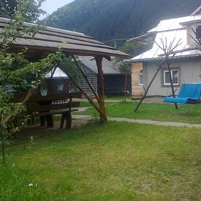 HomesteadСадиба "Біля Черемоша" КриворівняKryvorivniaunder 1 km from the riverSaunaBreakfastBBQNearby: Mykhailo Hrushevsky Museum 1.0 kmLake Bukovets 6.4 km7 trails
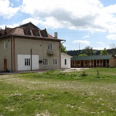 HomesteadСадиба "Затишок" ВерховинаVerkhovynaunder 1 km from the riverSaunaBBQKitchenNearby: Assumption Church 1.9 kmMt Bila Kobyla 6.1 km13 trails
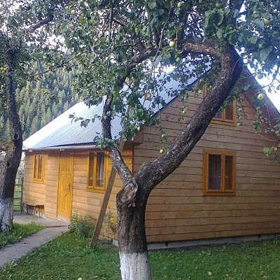 CottageСадиба "Біля Черемоша" КриворівняKryvorivniaunder 1 km from the riverSaunaBBQKitchenNearby: Mykhailo Hrushevsky Museum 1.0 kmLake Bukovets 6.4 km7 trails
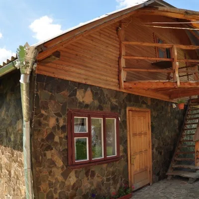 HomesteadСадиба "Над Черемошем" ВерховинаVerkhovynaunder 1 km from the riverSaunaSPAFireplaceNearby: Assumption Church 400 mMt Bila Kobyla 6.7 km7 trails
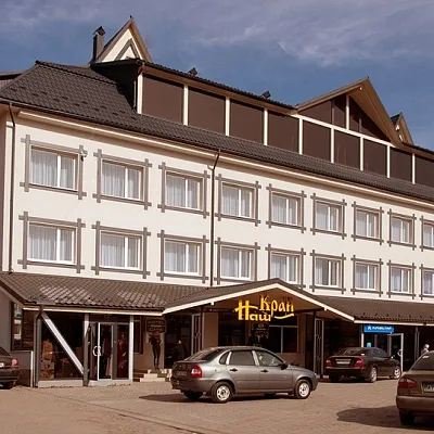 HotelМіні-готель "Верховель" ВерховинаVerkhovynaunder 1 km from the riverPoolSPAJacuzziNearby: Assumption Church 300 mMt Bila Kobyla 6.4 km11 trails
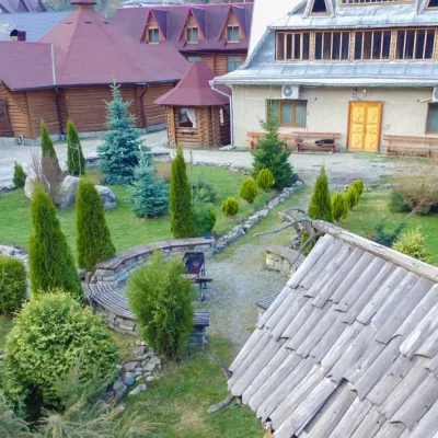 HotelГостинний двір "Зґарда" Верхній ЯсенівVerkhniy Yasenivunder 1 km from the riverPoolSaunaBBQNearby: Lake Bukovets 3.4 kmBukovelian pass 3.8 km3 trails
Trails nearby
All trails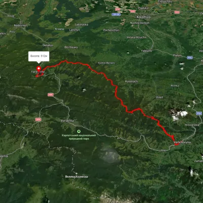 HardMulti-dayUnmarkedVerkhovyna to Yaremchevia Mount Bila Kobyla, Mount Makovytsia +1Elevation profile489–1 488 m63.8 kmascent 2 447 munder 1 km from Chornyi Cheremosh River
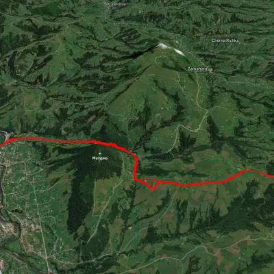 HardTwo-dayUnmarkedVerkhovyna loopvia Krynta-Skupova ridgeElevation profile575–1 320 m22.2 kmascent 979 m≈ 7.5 h walkingunder 1 km from Chornyi Cheremosh River
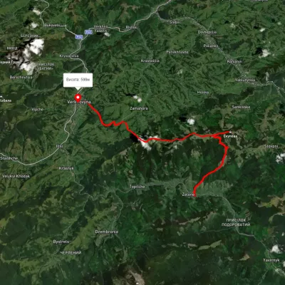 HardMulti-dayUnmarkedZelene village to Verkhovynavia Mount SkupovaElevation profile613–1 578 m32.7 kmascent 1 063 m≈ 10.5 h walkingunder 1 km from Chornyi Cheremosh River
Nearby attractions
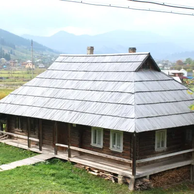 MuseumHouse-museum of the movie "Shadows of Forgotten Ancestors", VerkhovynaVerkhovynaunder 1 km from Chornyi Cheremosh RiverThe museum was founded and opened in 2000 in the Hutsul hut of Petro and Yevdokiya Soriuks, where the famous film director Sergei Parajanov lived for seven months...
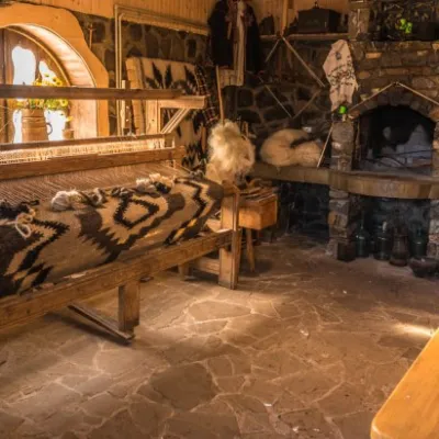 MuseumMuseum of quilt-making, Verkhovyna.Verkhovynaunder 1 km from Chornyi Cheremosh RiverTo preserve, revive, and popularize Hutsul home-woven woolen blankets (bedspreads), a museum was created in Verkhovyna, where you can learn about the history of their...
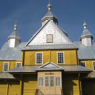 ChurchAssumption Church, VerkhovynaVerkhovynaunder 1 km from Chornyi Cheremosh RiverIt is here that the Church of the Assumption is located, which is ranked as one of the largest religious buildings in Ukraine, built of wood.