Bystrytsia village – Mount Velyka Bratkivska
Trail map
Where to stay nearby
About the trail
Route Bystrytsia village – Mount Velyka Bratkivska. Has blue marking (most notable or interesting routes). Along the route you will see: Mount Bratkivska, Mount Ruska.
At a glance
A one-day route of 15.8 km with 574 m of ascent and 1,615 m of descent from Bystrytsia village to Mount Velyka Bratkivska. Estimated walking time: about 5 h, not counting stops. Difficulty: moderate. Waymarking: blue.
Route stages
- 0–2 kmAlong the ridge at 1,660–1,760 m, past Mount Bratkivska
- 2–4 kmDescent of 470 m to Hut on Polonyna Bratkivska
- 4–9 kmGentle ups and downs at 980–1,230 m
- 9–11 kmDescent of 190 m (down to 794 m)
- 11–16 kmGentle ups and downs at 730–800 m
Steepest kilometre: km 2–3, a descent of 280 m (≈28%), near Hut on Polonyna Bratkivska.
Water and overnight stays
Springs near the trail: at km 3, 9 and 13.
Huts and shelters near the trail: Hut on Polonyna Bratkivska (km 3), Hut on Polonyna Vovkany (km 9).
When to go
Best time: June to September. In winter only for experienced hikers with proper gear: avalanche danger is possible. About 2 km of the route runs above 1,500 m, where the weather changes quickly — check the forecast.
Getting there
Start: Bystrytsia village. This is a one-way route: the finish is 12 km from the start in a straight line, so plan your way back in advance.
FAQ
- How long does the route take?
- Estimated walking time: about 5 h, not counting stops.
- Is there water on the route?
- Springs near the trail: at km 3, 9 and 13.
- Where can I stay overnight?
- Huts and shelters near the trail: Hut on Polonyna Bratkivska (km 3), Hut on Polonyna Vovkany (km 9).
Water and shelter on the route
- Spring below Mount Bratkivska (4)km 3.3 from the start · Not verified · 1 245 m
- Hut on Polonyna Bratkivskakm 3.4 from the start · 280 m off the path · Not verified · 1 217 m
- Spring below Mount Bratkivska (2)km 3.7 from the start · Not verified · 1 176 m
- Spring (Bystrytsia, 15)km 8.5 from the start · 90 m off the path · Not verified · 968 m
- Hut on Polonyna Vovkanykm 9 from the start · Not verified · 993 m
- Spring (Bystrytsia, 18)km 13.3 from the start · Not verified · 769 m
Comments
What to see on the trail
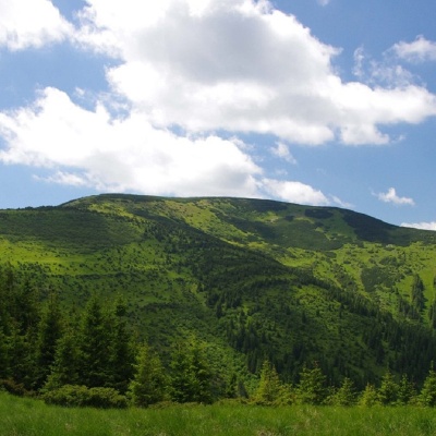 Mount Bratkivskaaltitude 1 788 mMount Bratkivska is a peak in the Ukrainian Carpathians, 1788 m high (some sources give other data - 1792 m).
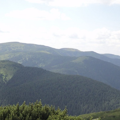 Mount Ruskaaltitude 1 678 mRuska is a 1,678-meter peak (according to other sources, the height of the mountain is 1,650 meters) located in the Gorgan mountain range of the...
Trails nearby
All trails HardMulti-dayMarkedEast Carpathian Tourist TrailElevation profile635–1 819 m278.1 kmascent 14 105 m
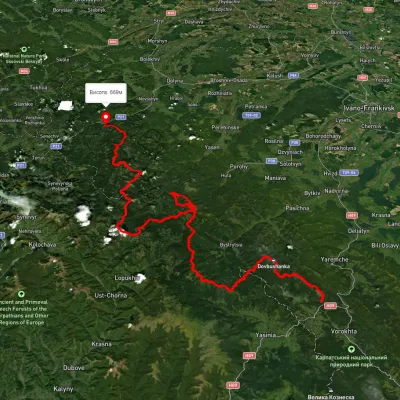 HardMulti-dayUnmarkedTatariv village to Myslivka villagevia Mount Syniak, Mount Dovbushanka +6Elevation profile671–1 792 m171.1 kmascent 9 973 m
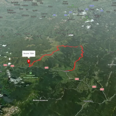 HardMulti-dayUnmarkedYasinia to Kvasy villagevia Mount Bratkivska, Mount Troiaska +1Elevation profile532–1 867 m60.3 kmascent 3 353 m