Siret River
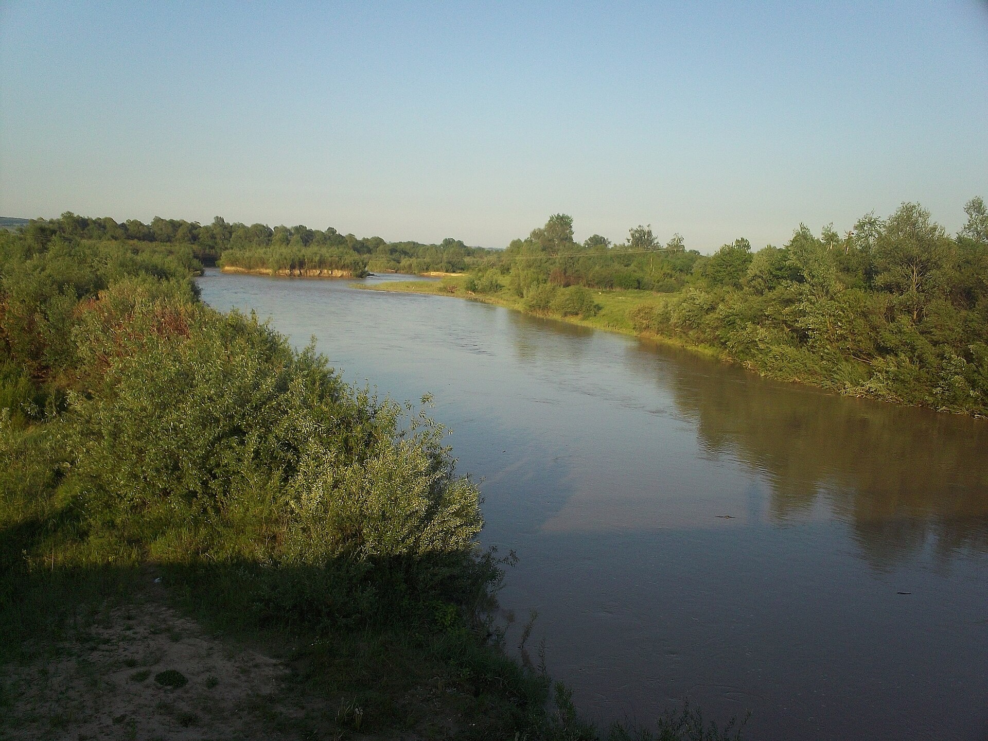
The Siret is a major Danube tributary 682 km long, but only its first 123 km lie in Ukraine. It rises on the northern slopes of Mount Oseredok near Dolishnii Shepit in the Pokuttia-Bukovyna Carpathians, flows through Berehomet, Storozhynets, Ropcha, Panka and Nova Zhadova, and beyond Karapchiv and Kamianka crosses into Romania.
Upstream it is a fast mountain river; near Berehomet the valley widens to 2.5 km. Storozhynets stands on the Siret in the foothills. Almost half of the Vyzhnytskyi National Nature Park drains into the Siret, so the upper valley combines well with walks in the park. Upstream of Panka the river is protected as the Siret ichthyological reserve, with spawning grounds of trout and Carpathian barbel.
Surveys in 2009–2010 found trout near Berehomet and, further down, chub, pike, perch and ruffe. The Red Book barbel and nase also live here. In 2025 the state released almost 12,000 brown trout fry into the river. The spawning closure runs from 1 April to 20 May, and trout are protected from 10 October to 1 March. Do not confuse the Bukovynian Siret with the Seret in the Ternopil region. Details are in the fishing section; other waters are on Fishing in the Carpathians.
- Length: 682 km (123 km in Ukraine)
- Catchment: 44,835 km² (2,070 km² in Ukraine)
- Source: Mount Oseredok near Dolishnii Shepit
- Mouth: the Danube near Galați (Romania)
- Oblast: Chernivtsi
Photos: Bukovynka, CC BY-SA 4.0 — Wikimedia Commons.
Location on the map
Fishing on the Siret
The Siret runs down from the Bukovynian Carpathians through Berehomet to Storozhynets and on to Romania. In the mountain part anglers catch trout; further downstream, chub, pike and perch.
Can I fish now?
- Brown trout — closed until 1 MarchTrout spawning: closed from 10 October to 1 March in the Zakarpattia, Ivano-Frankivsk, Lviv and Chernivtsi regions.Each illegally caught fish costs UAH 7,225 in damages on top of the fine.
- Other species — allowed within the daily limitKeep to the minimum sizes and the daily limit; release protected species.
Limits and rules
Siret ichthyological reserve
Upstream of Panka the Siret is part of a local ichthyological reserve (5,019 ha, since 2001) created to protect spawning grounds of rainbow and brown trout, Carpathian barbel, streber and loach. Its regulations are not published — check the fishing regime with the Chernivtsi fisheries patrol. The upper Stebnyk and Sukhyi tributaries lie in the Vyzhnytskyi National Park, where fishing is only possible on stretches of the regulated recreation zone.
What to catch
 Brown troutBerehomet and upstream · closed from 10 October to 1 Marchclosed until 1 March
 ChubBerehomet, Storozhynets, Karapchivallowed
 PikeStorozhynets, Karapchiv · closed from 15 February to 31 Marchallowed
 PerchStorozhynets, Karapchivallowed
Surveys in 2007–2010 also found the Red Book Danube gudgeon, Kessler’s gudgeon and Walecki’s barbel in the Siret, and the alien Amur sleeper near Storozhynets. Grayling, Danube salmon and burbot are not confirmed on the Siret. Do not confuse this river with the Seret, a Dniester tributary in the Ternopil region.
 Barbel
 Nase
NaseRed Book of Ukraine species: if one bites, unhook it carefully and release it. Taking one means a fine and compensation for damages.
Stocking 2025
11,850 young fish released into the river under the state stocking programme
Water quality
Monitoring post in Storozhynets, last sampled on 12 August 2026.
- Dissolved oxygen9.3 mg O₂/lnorm at least 4
- Acidity, pH7.9norm 6.5–8.5
- BOD₅ (organic matter)2.9 mg O₂/lnorm up to 3
- Nitrates1.97 mg/lnorm up to 45
- Water temperature21.5 °C
All indicators are within the norms.
Bite forecast near Berehomet
- TodaygoodSteady pressure, light wind1024 hPa · wind up to 13 km/h · 7…10 °C
- TomorrowfairPressure falling fast (−4.2 hPa in 6 h), light wind, partly cloudy1026 hPa · wind up to 10 km/h · 3…11 °C
- Thursday, 15 OctobergoodSteady pressure, moderate wind, partly cloudy1025 hPa · wind up to 22 km/h · 5…9 °C
For species open now: chub, pike, perch. Brown trout closed. Based on pressure, wind, temperature and cloud — an estimate, not a guarantee.
Fishing spots 103
Places where you can drive up to the water: fish markers on the page map and the list below. Look at the satellite view before you go — the bank may be steep or overgrown.
Closed right now: brown trout — until 1 March.
- Dirt-road access on the SiretAbout 110 m to the water from a dirt road. Nearest village (straight line): Tesnytska, 6.2 km.
- Dirt-road access on the SiretAbout 40 m to the water from a dirt road. Nearest village (straight line): Dolishnii Shepit, 5.8 km.
- Stream mouth on the SiretAbout 100 m to the water from a dirt road. Nearest village (straight line): Dolishnii Shepit, 5.1 km.
- Dirt-road access, Dolishnii Shepit (4.3 km)About 40 m to the water from a dirt road. Nearest village (straight line): Dolishnii Shepit, 4.3 km.
- Dirt-road access, Dolishnii Shepit (3.5 km)The road comes almost to the water. Nearest village (straight line): Dolishnii Shepit, 3.5 km.
- Dirt-road access, Dolishnii Shepit (2.8 km)The road comes almost to the water. Nearest village: Dolishnii Shepit, 2.8 km.
- Dirt-road access, Dolishnii Shepit (2.4 km)The road comes almost to the water. Nearest village: Dolishnii Shepit, 2.4 km.
- By the bridge, Dolishnii Shepit (1.8 km)About 60 m to the water from a local road. Bridge 120 m away. Nearest village: Dolishnii Shepit, 1.8 km.
Show all spots (103)
- Access road to the water, Dolishnii ShepitThe road comes almost to the water. Nearest village: Dolishnii Shepit, 990 m.
- By the road, Dolishnii ShepitAbout 90 m to the water from the road. Village: Dolishnii Shepit.
- By the road, Dolishnii ShepitAbout 80 m to the water from the road. Nearest village: Dolishnii Shepit, 830 m.
- By the road, Dolishnii Shepit (1.8 km)About 40 m to the water from the road. Nearest village: Dolishnii Shepit, 1.8 km.
- Tributary mouth, Dolishnii Shepit (2.6 km)About 40 m to the water from a dirt road. Nearest village: Dolishnii Shepit, 2.6 km.
- By the road, Dolishnii Shepit (2.8 km)About 140 m to the water from the road. Nearest village: Dolishnii Shepit, 2.8 km.
- By the road, Dolishnii Shepit (3.3 km)About 40 m to the water from the road. Nearest village (straight line): Dolishnii Shepit, 3.3 km.
- Dirt-road access, Lopushna (4.1 km)About 90 m to the water from a dirt road. Nearest village (straight line): Lopushna, 4.1 km.
- Stream mouth, Lopushna (3.5 km)The road comes almost to the water. Nearest village (straight line): Lopushna, 3.5 km.
- Tributary mouth, Lopushna (2.6 km)About 110 m to the water from an access road. Nearest village: Lopushna, 2.6 km.
- Access from a village street, Lopushna (1.7 km)About 140 m to the water from the street. Nearest village: Lopushna, 1.7 km.
- Local-road access, LopushnaThe road comes almost to the water. Nearest village: Lopushna, 750 m.
- Local-road access, LopushnaThe road comes almost to the water. Village: Lopushna.
- By the bridge, LekechiAbout 50 m to the water from the road. Bridge 70 m away. Nearest village: Lekechi, 790 m.
- Access road to the water, LekechiAbout 140 m to the water from an access road. Village: Lekechi.
- By the bridge, LekechiThe road comes almost to the water. A bridge is right here. Nearest village: Lekechi, 1.3 km.
- By the road, Lekechi (2.2 km)About 90 m to the water from the road. Nearest village: Lekechi, 2.2 km.
- By the road, Berehomet (2.6 km)About 130 m to the water from the road. Nearest village: Berehomet, 2.6 km.
- Dirt-road access, BerehometAbout 120 m to the water from a dirt road. Nearest village: Berehomet, 1.5 km.
- Dirt-road access, BerehometAbout 40 m to the water from a dirt road. Village: Berehomet.
- Dirt-road access, ZarichchiaAbout 90 m to the water from a dirt road. Village: Zarichchia.
- Local-road access, ZarichchiaAbout 60 m to the water from a local road. Nearest village: Zarichchia, 920 m.
- Dirt-road access, Zarichchia (1.8 km)About 90 m to the water from a dirt road. Nearest village: Zarichchia, 1.8 km.
- Dirt-road access, Myhove (2.7 km)About 60 m to the water from a dirt road. Nearest village: Myhove, 2.7 km.
- Access from a village street, Myhove (3.0 km)About 110 m to the water from the street. Nearest village: Myhove, 3.0 km.
- Dirt-road access, Myhove (3.4 km)About 140 m to the water from a dirt road. Nearest village (straight line): Myhove, 3.4 km.
- Dirt-road access, Velyke (3.4 km)About 60 m to the water from a dirt road. Nearest village (straight line): Velyke, 3.4 km.
- Access road to the water, Velyke (3.0 km)About 140 m to the water from an access road. Nearest village: Velyke, 3.0 km.
- By the road, Lukavtsi (2.8 km)About 130 m to the water from the road. Nearest village: Lukavtsi, 2.8 km.
- Dirt-road access, Lukavtsi (1.8 km)About 130 m to the water from a dirt road. Nearest village: Lukavtsi, 1.8 km.
- Dirt-road access, LukavtsiAbout 90 m to the water from a dirt road. Nearest village: Lukavtsi, 1.2 km.
- Dirt-road access, LukavtsiAbout 60 m to the water from a dirt road. Nearest village: Lukavtsi, 1.0 km.
- Dirt-road access, LukavtsiAbout 80 m to the water from a dirt road. Nearest village: Lukavtsi, 1.4 km.
- Dirt-road access, Stara Zhadova (2.2 km)About 130 m to the water from a dirt road. Nearest village: Stara Zhadova, 2.2 km.
- By the road, Stara ZhadovaAbout 110 m to the water from the road. Nearest village: Stara Zhadova, 1.4 km.
- Dirt-road access, Stara ZhadovaAbout 60 m to the water from a dirt road. Nearest village: Stara Zhadova, 780 m.
- Access from a village street, Stara ZhadovaAbout 140 m to the water from the street. Nearest village: Stara Zhadova, 1.2 km.
- Dirt-road access, Stara Zhadova (1.8 km)About 80 m to the water from a dirt road. Nearest village: Stara Zhadova, 1.8 km.
- Access road to the water, Nova ZhadovaAbout 110 m to the water from an access road. Nearest village: Nova Zhadova, 880 m.
- Access road to the water, Nova ZhadovaAbout 130 m to the water from an access road. Nearest village: Nova Zhadova, 1.3 km.
- Dirt-road access, Nova ZhadovaAbout 30 m to the water from a dirt road. Nearest village: Nova Zhadova, 1.0 km.
- Dirt-road access, Nova Zhadova (1.8 km)About 40 m to the water from a dirt road. Nearest village: Nova Zhadova, 1.8 km.
- Dirt-road access, Komarivtsi (1.7 km)About 120 m to the water from a dirt road. Nearest village: Komarivtsi, 1.7 km.
- Dirt-road access, KomarivtsiAbout 110 m to the water from a dirt road. Nearest village: Komarivtsi, 1.1 km.
- Dirt-road access, KomarivtsiAbout 60 m to the water from a dirt road. Village: Komarivtsi.
- By the bridge, KomarivtsiThe road comes almost to the water. A bridge is right here. Nearest village: Komarivtsi, 940 m.
- Dirt-road access, Komarivtsi (1.8 km)About 40 m to the water from a dirt road. Nearest village: Komarivtsi, 1.8 km.
- Dirt-road access, Panka (2.7 km)About 80 m to the water from a dirt road. Nearest village: Panka, 2.7 km.
- Dirt-road access, Panka (1.8 km)The road comes almost to the water. Nearest village: Panka, 1.8 km.
- Dirt-road access, PankaThe road comes almost to the water. Nearest village: Panka, 1.0 km.
- Dirt-road access, PankaAbout 90 m to the water from a dirt road. Village: Panka.
- Access road to the water, PankaAbout 90 m to the water from an access road. Village: Panka.
- Dirt-road access, PankaAbout 70 m to the water from a dirt road. Nearest village: Panka, 1.1 km.
- Access from a village street, Panka (1.7 km)About 110 m to the water from the street. Nearest village: Panka, 1.7 km.
- Access road to the water, Panka (2.8 km)About 130 m to the water from an access road. Nearest village: Panka, 2.8 km.
- Access from a village street, Storozhynets (2.2 km)About 140 m to the water from the street. Nearest village: Storozhynets, 2.2 km.
- Access from a village street, StorozhynetsAbout 120 m to the water from the street. Nearest village: Storozhynets, 1.3 km.
- Dirt-road access, StorozhynetsAbout 30 m to the water from a dirt road. Village: Storozhynets.
- Access from a village street, StorozhynetsAbout 80 m to the water from the street. Nearest village: Storozhynets, 810 m.
- Access from a village street, StorozhynetsAbout 70 m to the water from the street. Nearest village: Storozhynets, 1.4 km.
- Local-road access, Storozhynets (2.0 km)About 110 m to the water from a local road. Nearest village: Storozhynets, 2.0 km.
- Stream mouth, Storozhynets (3.0 km)About 40 m to the water from a dirt road. Nearest village: Storozhynets, 3.0 km.
- Local-road access, Storozhynets (3.4 km)About 40 m to the water from a local road. Nearest village (straight line): Storozhynets, 3.4 km.
- Dirt-road access, Storozhynets (3.7 km)About 110 m to the water from a dirt road. Nearest village (straight line): Storozhynets, 3.7 km.
- Dirt-road access, Ropcha (3.3 km)About 80 m to the water from a dirt road. Nearest village (straight line): Ropcha, 3.3 km.
- Dirt-road access, Ropcha (2.4 km)About 50 m to the water from a dirt road. Nearest village: Ropcha, 2.4 km.
- Access road to the water, Ropcha (1.7 km)About 50 m to the water from an access road. Nearest village: Ropcha, 1.7 km.
- Access from a village street, RopchaAbout 130 m to the water from the street. Nearest village: Ropcha, 1.3 km.
- Dirt-road access, Ropcha (2.0 km)About 140 m to the water from a dirt road. Nearest village: Ropcha, 2.0 km.
- Local-road access, Ropcha (1.9 km)About 130 m to the water from a local road. Nearest village: Ropcha, 1.9 km.
- Access from a village street, Yordaneshty (2.2 km)About 100 m to the water from the street. Nearest village: Yordaneshty, 2.2 km.
- Access from a village street, YordaneshtyAbout 120 m to the water from the street. Nearest village: Yordaneshty, 1.3 km.
- Dirt-road access, YordaneshtyAbout 40 m to the water from a dirt road. Village: Yordaneshty.
- Local-road access, YordaneshtyThe road comes almost to the water. Nearest village: Yordaneshty, 980 m.
- Dirt-road access, KarapchivAbout 50 m to the water from a dirt road. Nearest village: Karapchiv, 1.2 km.
- By the bridge, KarapchivAbout 50 m to the water from a dirt road. Bridge 110 m away. Nearest village: Karapchiv, 790 m.
- Dirt-road access, KarapchivThe road comes almost to the water. Nearest village: Karapchiv, 820 m.
- Dirt-road access, ProsikaAbout 80 m to the water from a dirt road. Nearest village: Prosika, 1.0 km.
- Dirt-road access, ProsikaAbout 70 m to the water from a dirt road. Village: Prosika.
- By the road, ProsikaAbout 60 m to the water from the road. Nearest village: Prosika, 960 m.
- Dirt-road access, PetrychankaAbout 80 m to the water from a dirt road. Nearest village: Petrychanka, 1000 m.
- Local-road access, PetrychankaAbout 110 m to the water from a local road. Nearest village: Petrychanka, 1.0 km.
- Dirt-road access, Petrychanka (1.7 km)About 60 m to the water from a dirt road. Nearest village: Petrychanka, 1.7 km.
- Dirt-road access, KamiankaAbout 90 m to the water from a dirt road. Nearest village: Kamianka, 1.2 km.
- Dirt-road access, KamiankaAbout 110 m to the water from a dirt road. Village: Kamianka.
- Dirt-road access, KamiankaAbout 70 m to the water from a dirt road. Nearest village: Kamianka, 760 m.
- Dirt-road access, Kamianka (1.6 km)About 50 m to the water from a dirt road. Nearest village: Kamianka, 1.6 km.
- Dirt-road access, CherepkivtsiAbout 70 m to the water from a dirt road. Nearest village: Cherepkivtsi, 1.3 km.
- Dirt-road access, CherepkivtsiAbout 60 m to the water from a dirt road. Nearest village: Cherepkivtsi, 1.0 km.
- By the bridge, CherepkivtsiThe road comes almost to the water. Bridge 50 m away. Village: Cherepkivtsi.
- Dirt-road access, CherepkivtsiThe road comes almost to the water. Nearest village: Cherepkivtsi, 890 m.
- Dirt-road access, Cherepkivtsi (1.7 km)About 50 m to the water from a dirt road. Nearest village: Cherepkivtsi, 1.7 km.
- Dirt-road access, Cherepkivtsi (1.8 km)About 120 m to the water from a dirt road. Nearest village: Cherepkivtsi, 1.8 km.
- Dirt-road access, Cherepkivtsi (2.3 km)The road comes almost to the water. Nearest village: Cherepkivtsi, 2.3 km.
- Dirt-road access, Novyi Vovchynets (2.0 km)About 80 m to the water from a dirt road. Nearest village: Novyi Vovchynets, 2.0 km.
Spots are marked from open data (roads and ways to the water, OpenStreetMap); if a spot is inconvenient or inaccessible, let us know. © OpenStreetMap, ODbL.
Springs: Recreational Fishing Rules (Order No. 700 of the Ministry of Agrarian Policy); State Fisheries Agency, Ivano-Frankivsk: trout spawning; State Fisheries Agency, Ivano-Frankivsk: spawning ban; Law on the Nature Reserve Fund of Ukraine, art. 16, 18, 21; Wikipedia (uk): Siret (Danube tributary); Wikipedia (uk): Siret ichthyological reserve; Vyzhnytskyi National Park: waters; State Fisheries Agency: fish stocking, data.gov.ua (CC BY); Kutsokon Y., Roman A. Own findings of fish of Ukraine 2001–2021 (GBIF, CC BY 4.0); Kharchenko V. et al. Records of protected animal species in Ukraine (GBIF, CC BY 4.0); Red Book of Ukraine animal list (Ministry of Environment Order No. 29, 2021); State Water Agency: water monitoring (CC BY); Weather forecast: MET Norway (CC BY 4.0). Rules may change — check the current orders of the fisheries patrol.
Comments
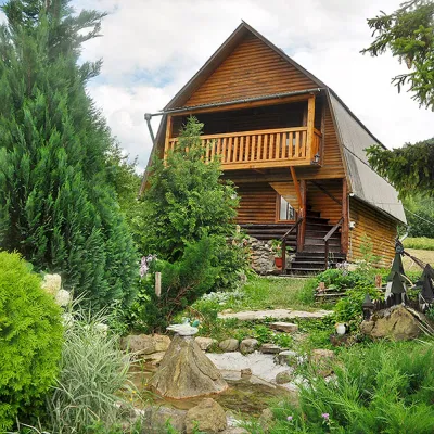
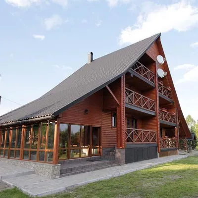
Where anglers can stay
Stays offering fishing within 2 km of the river
Trails nearby
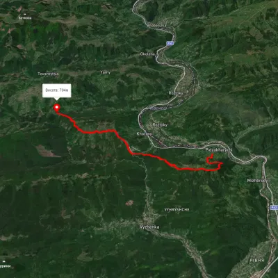 HardTwo-dayMarkedNimchych Pass Protiate KaminniaElevation profile473–820 m20.9 kmascent 1 063 m≈ 7.5 h walking19 km from Siret River
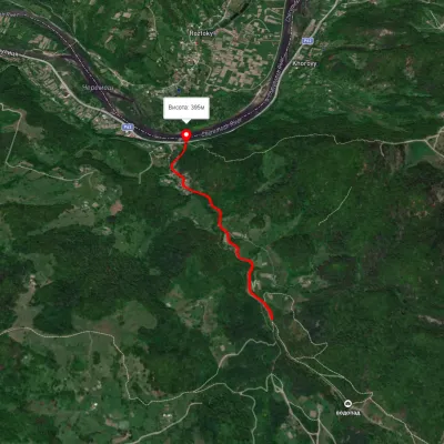 EasyOne-dayMarkedSmuharski WaterfallsElevation profile395–483 m4 kmascent 106 m≈ 1 h walking22 km from Siret River
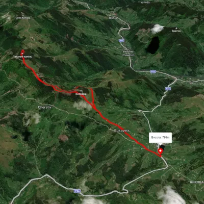 ModerateTwo-dayUnmarkedBukovets village loopvia Pysanyi KaminElevation profile845–1 261 m12.4 kmascent 823 m≈ 4.5 h walking39 km from Siret River
Nearby attractions
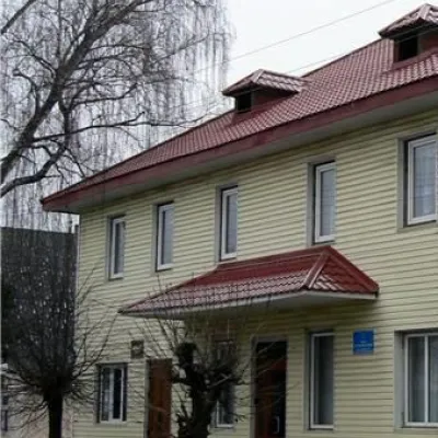 MuseumHistorical Museum, Beregometunder 1 km from Siret RiverThe historical museum in Berehomet is one of the youngest in Bukovyna. However, in its short history, it has already become the cultural center of the village.
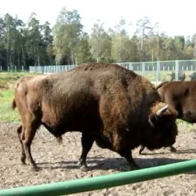 NatureBison reproduction center, Beregometunder 1 km from Siret RiverThe bison population is being restored in Bukovyna. An environmental education and research center for the restoration of the bison population operates in the village...
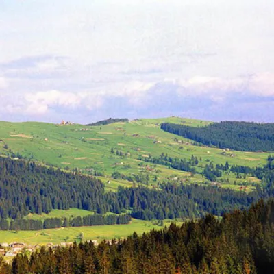 NatureNational Nature Park "Vyzhnytskyi" Berehomet1.7 km from Siret RiverNational Nature Park "Vyzhnytskyi" was established on August 30, 1995 (Park Office: Chernivtsi Oblast, Vyzhnytskyi District, town of Berehomet, Centralna St., 27a.