Lake Rosokhan (Osmoloda, Gorgany)
The Gorgany Mountains are considered inaccessible and strictly protected by law. To get here, you need to be patient with "the whole Hoverla")), as well as to withstand the steep, low slopes and stone fields that cover all the Gorgan peaks. Others are deterred by the ban on tourist visits to most of the Gorgany reserve.
There are many lakes in the Carpathians, but most of them are either reached by a bunch of tours from all over Ukraine (for example, to Lake Synevyr) or Lake Maricheika, past which tourists are taken by SUVs to Pip Ivan Chornohirsky. Therefore, it is very good that there is still an opportunity to retire near Lake Rosokhan.
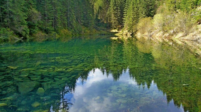
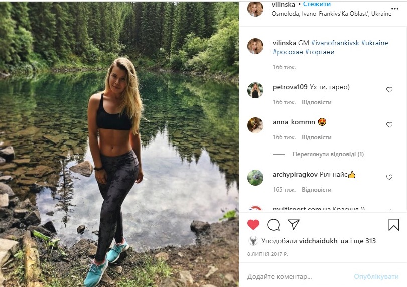
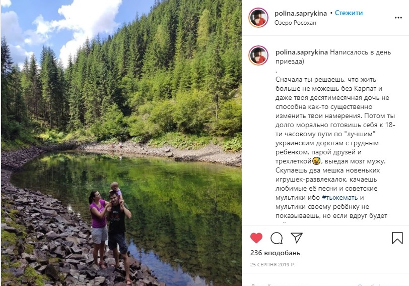
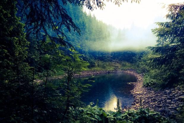
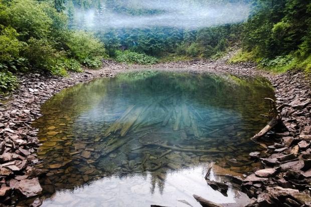
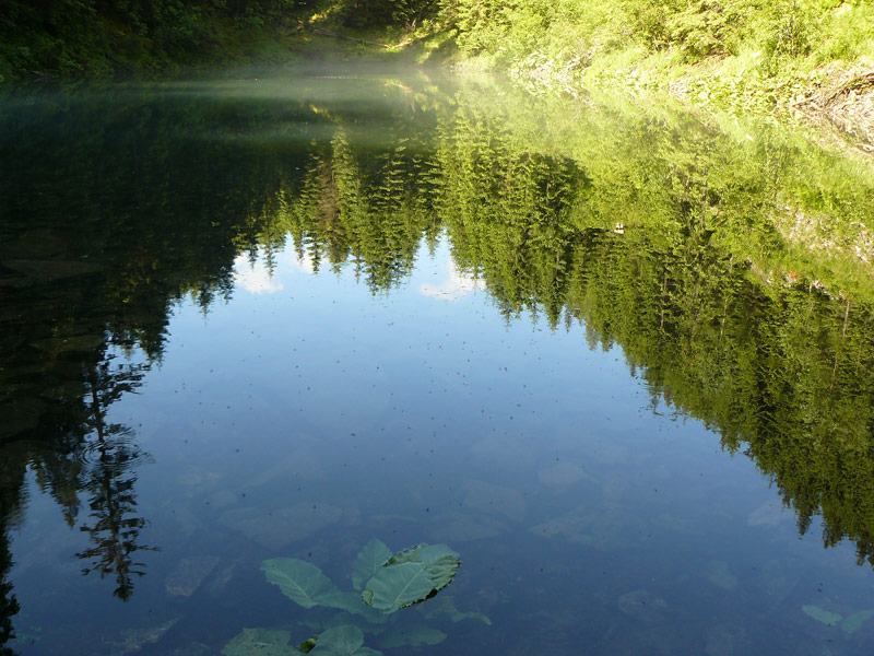
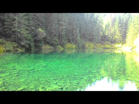
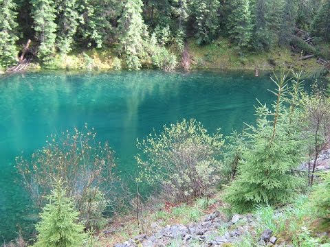
Lake Rosokhan in the Horgan Mountains is incredibly beautiful - clean and transparent to the point that you can see every pebble on the bottom, because it reflects the sky and everything around with amazing accuracy. It's not easy to take photos of the lake from different angles, the shores above the lake are steep and rocky, sometimes densely overgrown with centuries-old pine needles. But we have selected a few more photos from social media for you.
Someone once even tried to breed fish in the lake. But apparently, due to the composition of the water, the fish did not take root here. But people can drink it. Of course, swimming is very useful here, but not everyone dares to do it, because the bottom of the lake is very rocky, and the water does not warm up above 10-12 degrees in the summer. Perhaps because it is high - 1120 meters above sea level - and the sun's rays do not penetrate through the steep spruce slopes.
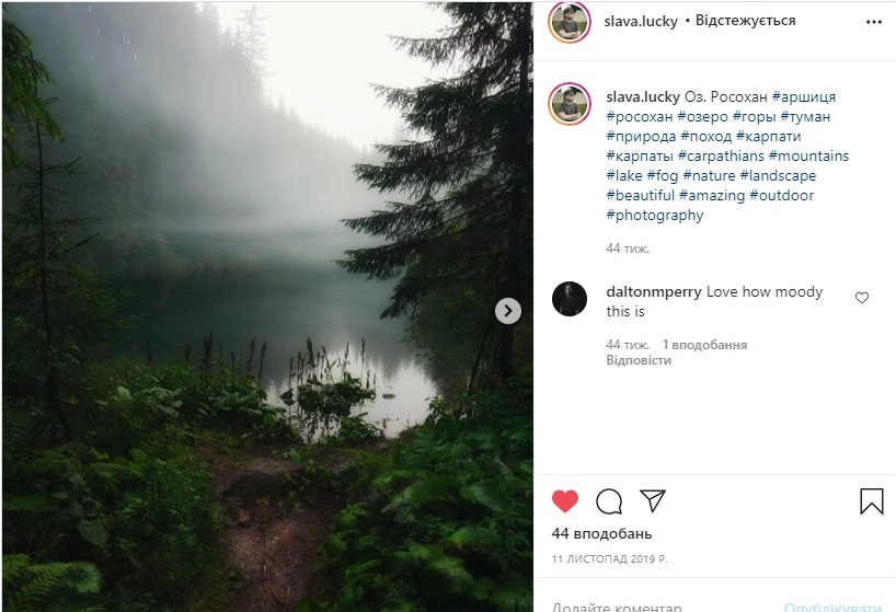
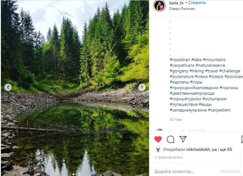
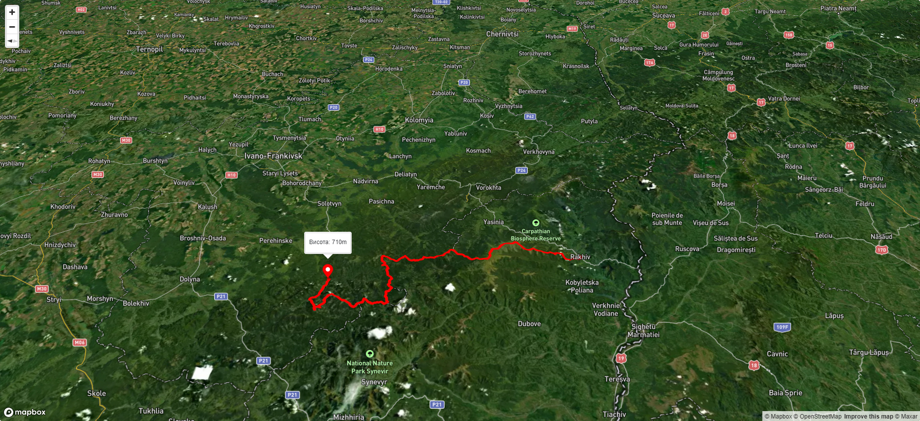
Lake Rosokhan is located near the Arshytsia ridge. It is sometimes confused with the Grofetsky Pond, which can be reached from the saddle between the Grofetsky Horse and the Grofa. The pond is much smaller, located below Rosokhan, is shallow in the summer, and the surrounding area is heavily swamped.
The way to the lake
Step 1. First, you need to get to Myslivka or Osmoloda. Myslivka can be reached from Ivano-Frankivsk by buses in the direction of Khust and Uzhhorod. From Kyiv and Lviv, buses go to Dolyna (buses to Khust are also suitable), and there it is convenient to change to the right bus to Myslivka. You can also go to Osmoloda via Kalush.
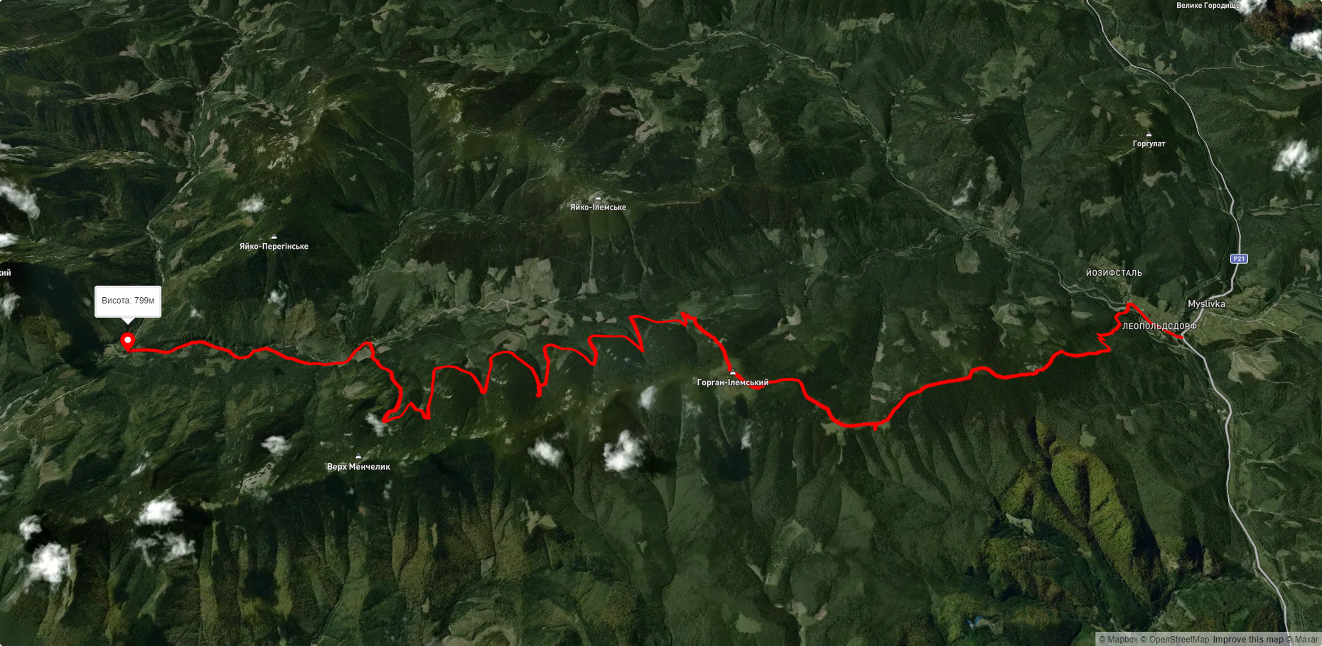
Step 2. You can't get to the lake quickly and comfortably. The best option is to walk from Myslivka to Osmoloda along Arshytsia and visit not only Rosokhan, but also other lakes - Arshytsia, Ubyte, Zabutove, Luzhky. It turns out that Arshytsia is the same lake range as the Svydovets massif.
- After the Osmoloda bridge, turn left along the road across the Moloda River to the Mshana forestry (a few neat buildings beyond Osmoloda) to Rosokhan, a little over 7 km away. The control point (CP) is a bridge at the confluence of the Mshana River and the Moloda River. The condition of the dirt road in this part allows for smooth passage by passenger vehicles. The road takes: 25 minutes to the Kotelets stream (2 km from Osmoloda), a metal bridge; + 10 minutes to the bridge over the Moloda river; + 15 minutes to the Luzhak tract, the Studite monastery is down there, on the left along the way (before the branch that goes up to the Arshytsia mountain); + 25 minutes to the forestry itself.
- Then, without crossing the bridge, walk along the Mshana River to the so-called Warehouses. The checkpoint is an unfinished bridge, a tall metal structure. The path runs along a road broken by logging trucks in some places. The 5.2 km stretch with a snack and mushroom checks takes two hours. From the forestry, there are two options: the old lower road - berries, and the new upper road - mushrooms. Both lead to a small hut.
- The final part is a one-and-a-half kilometer easy climb from the Warehouses to Lake Rosokhan. The total distance is up to 13 km.
- However, you can also start from Myslivka: this option is for several days, and the lake is 28 km from the village. You won't be able to camp near Rosokhan because there are no gentle areas, but they are a little higher from the reservoir. There's enough space for several tents (and don't forget to bring a burner - you won't be able to make a fire here).
Accommodation around Lake Rosokhan (Osmoloda, Gorgany):


Які маршрути проходять повз Lake Rosokhan (Osmoloda, Gorgany)?
Пропонуємо пройти такі туристичні (пішохідні) маршрути через/біля Lake Rosokhan (Osmoloda, Gorgany): с. Мислівка, через г. Вел. Пустушак, пол. Німецька, г. Горган Ілемcький до с. Осмолода, с. Мислівка, через хр. Аршиця, г. Молода, г. Яйко-Ілемське до с. Мислівка, с. Мислівка, через г. Молода, г. Попадя, с. Свобода, оз. Синевир, г. Озерна до смт. Міжгір'я, Траверс Аршиці, м. Рахів, через г. Близниця, г. Трояска, г. Братківська до с. Осмолода, Eкостежка довкола Яйка Перегінського

с. Мислівка, через г. Вел. Пустушак, пол. Німецька, г. Горган Ілемcький до с. Осмолода
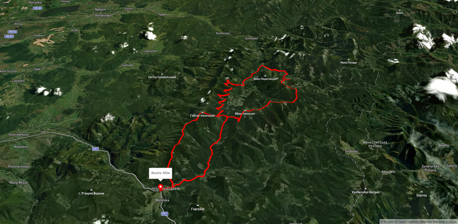
с. Мислівка, через хр. Аршиця, г. Молода, г. Яйко-Ілемське до с. Мислівка
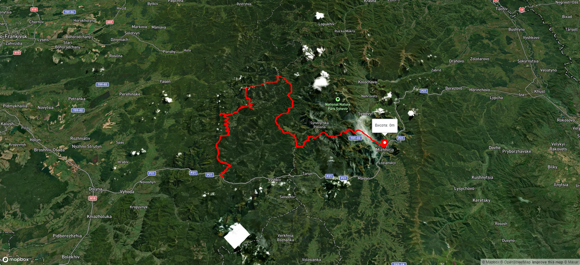
с. Мислівка, через г. Молода, г. Попадя, с. Свобода, оз. Синевир, г. Озерна до смт. Міжгір'я
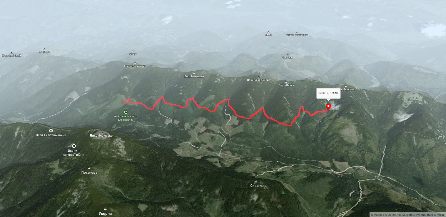
Траверс Аршиці