Prut
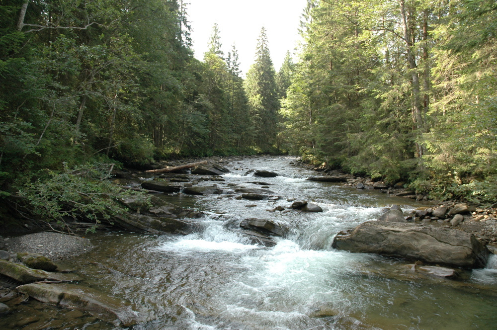
The Prut River is a river that connects several countries and is of great natural, historical and cultural importance. Not only is it an important ecological and economic resource for people, but it is also one of the natural beauties that attracts tourists, nature lovers and scientists.
Information:
- Length - 953m
- Pool area - 27 500m²
- Bridges - Eiffel Bridge
- Sources - Ukraine, Carpathians, Hoverla
- Mouths - Danube, Galati
- Basin - Danube basin
- Fauna - The river is home to many species of fish, including pike, catfish, pike perch, gudgeon, as well as various species of birds and mammals.
Use of the river:
- Trade - The river has been an important waterway for trade and communication between different cultures and peoples.
- Irrigation - The river is important for agriculture, in particular for irrigating the lands through which it flows.
- Hydroelectric power plants: There is a hydroelectric power plant on the river - Sniatynska HPP.
- Recreation: It is popular among tourists who go kayaking, rafting and fishing.
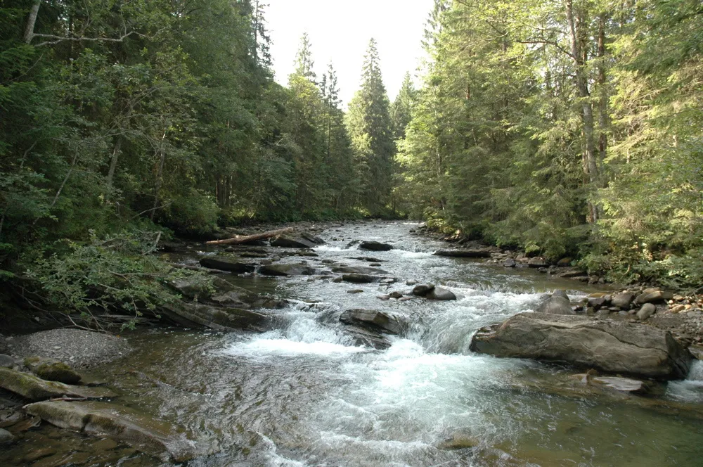
Location on the map
Fishing on the Prut
The mountain Prut is a trout river with cold clear water and riffles. Further downstream, on the lowland Prut, anglers catch chub, pike and carp.
Can I fish now?
- Brown trout — closed until 1 MarchTrout spawning: closed from 10 October to 1 March in the Zakarpattia, Ivano-Frankivsk, Lviv and Chernivtsi regions.Each illegally caught fish costs UAH 7,225 in damages on top of the fine.
- Other species — allowed within the daily limitKeep to the minimum sizes and the daily limit; release protected species.
Limits and rules
Carpathian National Nature Park
The upper Prut — from its source below Hoverla through Vorokhta to Yaremche — flows through the Carpathian National Nature Park. In the park, recreational fishing is only allowed on specially designated stretches of the regulated recreation zone. The park does not publish a list of them — check with the park administration (Yaremche) before you fish.
What to catch
 Brown troutmountain stretch: Vorokhta — Yaremche — Deliatyn and tributaries · closed from 10 October to 1 Marchclosed until 1 March
 Chubfrom Yaremche downstreamallowed
 Pikelowland Prut: Kolomyia — Sniatyn — Chernivtsi · closed from 15 February to 31 Marchallowed
 Common carplower Prut, calm pools and backwatersallowed
 Grayling
 Danube salmon (huchen)
 Barbel
 Nase
Nase Common dace
 Burbot
Red Book of Ukraine species: if one bites, unhook it carefully and release it. Taking one means a fine and compensation for damages.
Stocking 2025
44,379 young fish released into the river under the state stocking programme
- Brown trout35,279
- Grayling Red Book5,700
- Danube salmon (huchen) Red Book3,400
Water quality
Monitoring post near Yaremche, last sampled on 21 July 2026.
- Dissolved oxygen9.5 mg O₂/lnorm at least 4
- Acidity, pH8.56norm 6.5–8.5
- BOD₅ (organic matter)1.6 mg O₂/lnorm up to 3
- Nitrates4 mg/lnorm up to 45
- Water temperature12 °C
Within the norms except: acidity, ph.
Bite forecast near Yaremche
- TomorrowgoodHigh pressure, light wind1025 hPa · wind up to 14 km/h · 5…7 °C
- Saturday, 17 OctobergoodSteady pressure, light wind1019 hPa · wind up to 10 km/h · 6…9 °C
- Sunday, 18 OctobergoodSteady pressure, light wind1021 hPa · wind up to 14 km/h · 8…9 °C
For species open now: chub, pike, common carp. Brown trout closed. Based on pressure, wind, temperature and cloud — an estimate, not a guarantee.
Fishing spots 201
Places where you can drive up to the water: fish markers on the page map and the list below. Look at the satellite view before you go — the bank may be steep or overgrown.
Closed right now: brown trout — until 1 March.
- By the bridge on the PrutAbout 140 m to the water from a dirt road. Bridge 110 m away. Nearest village (straight line): Bystrets, 11 km.National park — fishing only in designated sections, check with the park
- Local-road access on the PrutAbout 70 m to the water from a local road. Nearest village (straight line): Bystrets, 9.7 km.National park — fishing only in designated sections, check with the park
- By the bridge on the PrutAbout 30 m to the water from a local road. A bridge is right here. Nearest village (straight line): Bystrets, 9.0 km.National park — fishing only in designated sections, check with the park
- Local-road access on the PrutThe road comes almost to the water. Nearest village (straight line): Bystrets, 8.8 km.National park — fishing only in designated sections, check with the park
- Local-road access on the PrutAbout 140 m to the water from a local road. Nearest village (straight line): Bystrets, 8.7 km.National park — fishing only in designated sections, check with the park
- Access road to the water on the PrutAbout 40 m to the water from an access road. Nearest village (straight line): Bystrets, 9.1 km.National park — fishing only in designated sections, check with the park
- By the bridge on the PrutAbout 80 m to the water from an access road. Bridge 80 m away. Nearest village (straight line): Bystrets, 9.3 km.National park — fishing only in designated sections, check with the park
- By the bridge on the PrutAbout 40 m to the water from an access road. Bridge 100 m away. Nearest village (straight line): Kryvopillia, 9.8 km.National park — fishing only in designated sections, check with the park
Show all spots (201)
- Local-road access on the PrutThe road comes almost to the water. Nearest village (straight line): Kryvopillia, 9.2 km.National park — fishing only in designated sections, check with the park
- Local-road access on the PrutAbout 130 m to the water from a local road. Nearest village (straight line): Kryvopillia, 8.7 km.National park — fishing only in designated sections, check with the park
- Access road to the water on the PrutAbout 150 m to the water from an access road. Nearest village (straight line): Kryvopillia, 7.7 km.
- Local-road access on the PrutAbout 150 m to the water from a local road. Nearest village (straight line): Volova, 7.2 km.National park — fishing only in designated sections, check with the park
- Local-road access on the PrutAbout 150 m to the water from a local road. Nearest village (straight line): Volova, 6.3 km.National park — fishing only in designated sections, check with the park
- Local-road access on the PrutAbout 90 m to the water from a local road. Nearest village (straight line): Volova, 5.9 km.National park — fishing only in designated sections, check with the park
- By the main road on the PrutAbout 60 m to the water from the main road. Nearest village (straight line): Volova, 5.8 km.National park — fishing only in designated sections, check with the park
- Stream mouth on the PrutAbout 110 m to the water from a dirt road. Bridge 110 m away. Nearest village (straight line): Volova, 6.2 km.National park — fishing only in designated sections, check with the park
- By the bridge on the PrutThe road comes almost to the water. A bridge is right here. Nearest village (straight line): Vorokhta, 5.7 km.National park — fishing only in designated sections, check with the park
- By the main road, Vorokhta (4.9 km)About 140 m to the water from the main road. Nearest village (straight line): Vorokhta, 4.9 km.National park — fishing only in designated sections, check with the park
- By the bridge, Vorokhta (4.2 km)About 130 m to the water from an access road. Bridge 70 m away. Nearest village (straight line): Vorokhta, 4.2 km.National park — fishing only in designated sections, check with the park
- By the main road, Vorokhta (3.8 km)About 40 m to the water from the main road. Nearest village (straight line): Vorokhta, 3.8 km.National park — fishing only in designated sections, check with the park
- Access road to the water, Vorokhta (3.0 km)About 40 m to the water from an access road. Nearest village: Vorokhta, 3.0 km.National park — fishing only in designated sections, check with the park
- By the bridge, Vorokhta (2.1 km)The road comes almost to the water. Bridge 90 m away. Nearest village: Vorokhta, 2.1 km.National park — fishing only in designated sections, check with the park
- Stream mouth, Vorokhta (1.6 km)The road comes almost to the water. A bridge is right here. Nearest village: Vorokhta, 1.6 km.National park — fishing only in designated sections, check with the park
- Access from a village street, VorokhtaAbout 80 m to the water from the street. Nearest village: Vorokhta, 1.4 km.National park — fishing only in designated sections, check with the park
- Access from a village street, VorokhtaAbout 110 m to the water from the street. Nearest village: Vorokhta, 780 m.National park — fishing only in designated sections, check with the park
- Access from a village street, VorokhtaAbout 70 m to the water from the street. Village: Vorokhta.National park — fishing only in designated sections, check with the park
- By the bridge, VorokhtaAbout 30 m to the water from the street. A bridge is right here. Village: Vorokhta.National park — fishing only in designated sections, check with the park
- By the main road, Vorokhta (1.5 km)About 90 m to the water from the main road. Nearest village: Vorokhta, 1.5 km.National park — fishing only in designated sections, check with the park
- By the bridge, Vorokhta (2.4 km)About 30 m to the water from the main road. Bridge 80 m away. Nearest village: Vorokhta, 2.4 km.National park — fishing only in designated sections, check with the park
- By the main road, Tatariv (2.7 km)About 50 m to the water from the main road. Nearest village: Tatariv, 2.7 km.National park — fishing only in designated sections, check with the park
- By the main road, Tatariv (1.9 km)About 40 m to the water from the main road. Nearest village: Tatariv, 1.9 km.National park — fishing only in designated sections, check with the park
- By the main road, TatarivAbout 70 m to the water from the main road. Nearest village: Tatariv, 1.1 km.National park — fishing only in designated sections, check with the park
- Access from a village street, TatarivAbout 80 m to the water from the street. Village: Tatariv.National park — fishing only in designated sections, check with the park
- Access from a village street, TatarivAbout 70 m to the water from the street. Village: Tatariv.National park — fishing only in designated sections, check with the park
- By the main road, TatarivAbout 50 m to the water from the main road. Nearest village: Tatariv, 1.2 km.National park — fishing only in designated sections, check with the park
- Access from a village street, Tatariv (2.1 km)About 70 m to the water from the street. Nearest village: Tatariv, 2.1 km.National park — fishing only in designated sections, check with the park
- By the main road, Tatariv (2.8 km)About 110 m to the water from the main road. Nearest village: Tatariv, 2.8 km.National park — fishing only in designated sections, check with the park
- By the bridge, Tatariv (3.7 km)About 40 m to the water from the street. A bridge is right here. Nearest village (straight line): Tatariv, 3.7 km.National park — fishing only in designated sections, check with the park
- Access road to the water, Tatariv (3.4 km)About 100 m to the water from an access road. Nearest village (straight line): Tatariv, 3.4 km.National park — fishing only in designated sections, check with the park
- Access from a village street, Tatariv (2.9 km)The road comes almost to the water. Nearest village: Tatariv, 2.9 km.National park — fishing only in designated sections, check with the park
- By the main road, Mykulychyn (3.0 km)About 100 m to the water from the main road. Nearest village: Mykulychyn, 3.0 km.National park — fishing only in designated sections, check with the park
- By the main road, Mykulychyn (2.1 km)About 40 m to the water from the main road. Nearest village: Mykulychyn, 2.1 km.National park — fishing only in designated sections, check with the park
- Dirt-road access, MykulychynAbout 40 m to the water from a dirt road. Nearest village: Mykulychyn, 1.2 km.National park — fishing only in designated sections, check with the park
- Dirt-road access, MykulychynAbout 50 m to the water from a dirt road. Village: Mykulychyn.National park — fishing only in designated sections, check with the park
- Dirt-road access, MykulychynAbout 80 m to the water from a dirt road. Village: Mykulychyn.National park — fishing only in designated sections, check with the park
- By the bridge, MykulychynAbout 110 m to the water from an access road. Bridge 60 m away. Nearest village: Mykulychyn, 1.4 km.National park — fishing only in designated sections, check with the park
- By the main road, Mykulychyn (2.2 km)About 50 m to the water from the main road. Nearest village: Mykulychyn, 2.2 km.National park — fishing only in designated sections, check with the park
- Mouth of the Pyshnyi tributary, Yamna (1.6 km)About 60 m to the water from the main road. Nearest village: Yamna, 1.6 km.National park — fishing only in designated sections, check with the park
- Access from a village street, YamnaAbout 100 m to the water from the street. Nearest village: Yamna, 1.1 km.National park — fishing only in designated sections, check with the park
- Tributary mouth, YamnaAbout 40 m to the water from an access road. Village: Yamna.National park — fishing only in designated sections, check with the park
- Access from a village street, YamnaAbout 90 m to the water from the street. Village: Yamna.National park — fishing only in designated sections, check with the park
- Access from a village street, YamnaAbout 70 m to the water from the street. Nearest village: Yamna, 1.3 km.National park — fishing only in designated sections, check with the park
- Access road to the water, Yaremche (1.9 km)About 60 m to the water from an access road. Nearest village: Yaremche, 1.9 km.National park — fishing only in designated sections, check with the park
- Access from a village street, Yaremche (1.9 km)About 110 m to the water from the street. Nearest village: Yaremche, 1.9 km.National park — fishing only in designated sections, check with the park
- By the bridge, Yaremche (1.8 km)About 70 m to the water from the street. Bridge 80 m away. Nearest village: Yaremche, 1.8 km.National park — fishing only in designated sections, check with the park
- By the bridge, Yaremche (1.8 km)About 40 m to the water from the street. A bridge is right here. Nearest village: Yaremche, 1.8 km.National park — fishing only in designated sections, check with the park
- By the bridge, YaremcheAbout 30 m to the water from the main road. A bridge is right here. Nearest village: Yaremche, 1.1 km.National park — fishing only in designated sections, check with the park
- Access from a village street, YaremcheAbout 70 m to the water from the street. Village: Yaremche.National park — fishing only in designated sections, check with the park
- Mouth of the Chornohorchyk tributary, YaremcheAbout 70 m to the water from an access road. Nearest village: Yaremche, 870 m.National park — fishing only in designated sections, check with the park
- Stream mouth, Yaremche (1.6 km)About 120 m to the water from the main road. Nearest village: Yaremche, 1.6 km.National park — fishing only in designated sections, check with the park
- By the bridge, DoraAbout 50 m to the water from an access road. Bridge 100 m away. Nearest village: Dora, 1.1 km.National park — fishing only in designated sections, check with the park
- Access from a village street, DoraAbout 60 m to the water from the street. Village: Dora.National park — fishing only in designated sections, check with the park
- Access from a village street, DoraThe road comes almost to the water. Nearest village: Dora, 870 m.National park — fishing only in designated sections, check with the park
- Access road to the water, Dora (1.6 km)About 50 m to the water from an access road. Nearest village: Dora, 1.6 km.
- Stream mouth, Dora (2.5 km)About 80 m to the water from an access road. Nearest village: Dora, 2.5 km.
- Access road to the water, Deliatyn (3.4 km)About 110 m to the water from an access road. Nearest village (straight line): Deliatyn, 3.4 km.
- Access from a village street, Zarichchia (2.6 km)About 90 m to the water from the street. Nearest village: Zarichchia, 2.6 km.
- Dirt-road access, Deliatyn (1.7 km)The road comes almost to the water. Nearest village: Deliatyn, 1.7 km.
- Dirt-road access, DeliatynAbout 60 m to the water from a dirt road. Nearest village: Deliatyn, 910 m.
- Dirt-road access, DeliatynAbout 140 m to the water from a dirt road. Village: Deliatyn.
- Dirt-road access, DeliatynAbout 100 m to the water from a dirt road. Nearest village: Deliatyn, 1.3 km.
- Dirt-road access, ZarichchiaAbout 40 m to the water from a dirt road. Nearest village: Zarichchia, 1.5 km.
- Dirt-road access, Zarichchia (2.2 km)About 120 m to the water from a dirt road. Nearest village: Zarichchia, 2.2 km.
- Dirt-road access, Dobrotiv (1.9 km)About 80 m to the water from a dirt road. Nearest village: Dobrotiv, 1.9 km.
- Access from a village street, DobrotivAbout 40 m to the water from the street. Nearest village: Dobrotiv, 1.1 km.
- Dirt-road access, DobrotivAbout 40 m to the water from a dirt road. Nearest village: Dobrotiv, 990 m.
- Dirt-road access, Dobrotiv (1.6 km)About 50 m to the water from a dirt road. Nearest village: Dobrotiv, 1.6 km.
- Dirt-road access, Dobrotiv (2.4 km)About 110 m to the water from a dirt road. Nearest village: Dobrotiv, 2.4 km.
- Access from a village street, LanchynAbout 120 m to the water from the street. Nearest village: Lanchyn, 1.5 km.
- Dirt-road access, LanchynAbout 100 m to the water from a dirt road. Nearest village: Lanchyn, 810 m.
- Dirt-road access, LanchynAbout 70 m to the water from a dirt road. Nearest village: Lanchyn, 740 m.
- Dirt-road access, Sadzhavka (1.7 km)About 70 m to the water from a dirt road. Nearest village: Sadzhavka, 1.7 km.
- Dirt-road access, SadzhavkaAbout 50 m to the water from a dirt road. Nearest village: Sadzhavka, 1.0 km.
- Dirt-road access, SadzhavkaAbout 50 m to the water from a dirt road. Nearest village: Sadzhavka, 850 m.
- Dirt-road access, Sadzhavka (1.7 km)About 90 m to the water from a dirt road. Nearest village: Sadzhavka, 1.7 km.
- Dirt-road access, Sadzhavka (2.3 km)About 60 m to the water from a dirt road. Nearest village: Sadzhavka, 2.3 km.
- Access from a village street, Ivanivtsi (1.9 km)About 150 m to the water from the street. Nearest village: Ivanivtsi, 1.9 km.
- Dirt-road access, IvanivtsiAbout 30 m to the water from a dirt road. Nearest village: Ivanivtsi, 1.4 km.
- Dirt-road access, IvanivtsiAbout 60 m to the water from a dirt road. Nearest village: Ivanivtsi, 840 m.
- Dirt-road access, Ivanivtsi (1.6 km)The road comes almost to the water. Nearest village: Ivanivtsi, 1.6 km.
- Access road to the water, TovmachykAbout 150 m to the water from an access road. Nearest village: Tovmachyk, 990 m.
- Access from a village street, TovmachykAbout 70 m to the water from the street. Village: Tovmachyk.
- Dirt-road access, KniazhdvirAbout 150 m to the water from a dirt road. Nearest village: Kniazhdvir, 1.3 km.
- Dirt-road access, KniazhdvirAbout 90 m to the water from a dirt road. Nearest village: Kniazhdvir, 1.3 km.
- Dirt-road access, Kniazhdvir (1.6 km)The road comes almost to the water. Nearest village: Kniazhdvir, 1.6 km.
- Dirt-road access, Sheparivtsi (1.7 km)About 80 m to the water from a dirt road. Nearest village: Sheparivtsi, 1.7 km.
- Dirt-road access, SheparivtsiAbout 50 m to the water from a dirt road. Nearest village: Sheparivtsi, 1.4 km.
- Access road to the water, SheparivtsiAbout 50 m to the water from an access road. Nearest village: Sheparivtsi, 1.3 km.
- Dirt-road access, SheparivtsiAbout 30 m to the water from a dirt road. Nearest village: Sheparivtsi, 1.4 km.
- Dirt-road access, Kidanch (1.8 km)About 80 m to the water from a dirt road. Nearest village: Kidanch, 1.8 km.
- Dirt-road access, Kidanch (1.7 km)About 50 m to the water from a dirt road. Nearest village: Kidanch, 1.7 km.
- Access road to the water, Kidanch (2.4 km)About 70 m to the water from an access road. Nearest village: Kidanch, 2.4 km.
- Dirt-road access, Kolomyia (2.0 km)About 60 m to the water from a dirt road. Nearest village: Kolomyia, 2.0 km.
- Stream mouth, KolomyiaAbout 140 m to the water from the street. Nearest village: Kolomyia, 1.5 km.
- Access from a village street, Kolomyia (1.7 km)About 90 m to the water from the street. Nearest village: Kolomyia, 1.7 km.
- Dirt-road access, Nyzhnii Verbizh (2.1 km)About 40 m to the water from a dirt road. Nearest village: Nyzhnii Verbizh, 2.1 km.
- By a side channel, Voskresintsi (1.7 km)About 70 m to the water from a dirt road. Nearest village: Voskresintsi, 1.7 km.
- Dirt-road access, VoskresintsiAbout 60 m to the water from a dirt road. Nearest village: Voskresintsi, 1.0 km.
- Dirt-road access, VoskresintsiAbout 70 m to the water from a dirt road. Nearest village: Voskresintsi, 1.2 km.
- Dirt-road access, VoskresintsiAbout 130 m to the water from a dirt road. Nearest village: Voskresintsi, 1.4 km.
- Dirt-road access, HrushivAbout 50 m to the water from a dirt road. Nearest village: Hrushiv, 1.2 km.
- Dirt-road access, KornychAbout 130 m to the water from a dirt road. Nearest village: Kornych, 1.3 km.
- Dirt-road access, KornychAbout 130 m to the water from a dirt road. Nearest village: Kornych, 1.3 km.
- Access from a village street, PereryvAbout 70 m to the water from the street. Nearest village: Pereryv, 960 m.
- Dirt-road access, TrostiankaAbout 130 m to the water from a dirt road. Nearest village: Trostianka, 840 m.
- Dirt-road access, TrostiankaAbout 150 m to the water from a dirt road. Nearest village: Trostianka, 1.1 km.
- Dirt-road access, MateivtsiAbout 130 m to the water from a dirt road. Nearest village: Mateivtsi, 1.2 km.
- Dirt-road access, MateivtsiAbout 60 m to the water from a dirt road. Nearest village: Mateivtsi, 1.2 km.
- Dirt-road access, MateivtsiAbout 120 m to the water from a dirt road. Nearest village: Mateivtsi, 1.4 km.
- Dirt-road access, ZamulyntsiAbout 70 m to the water from a dirt road. Nearest village: Zamulyntsi, 880 m.
- Dirt-road access, ZamulyntsiAbout 30 m to the water from a dirt road. Nearest village: Zamulyntsi, 1.1 km.
- Dirt-road access, SemakivtsiAbout 80 m to the water from a dirt road. Nearest village: Semakivtsi, 730 m.
- Dirt-road access, SemakivtsiAbout 120 m to the water from a dirt road. Nearest village: Semakivtsi, 1.1 km.
- Dirt-road access, BorshchivAbout 90 m to the water from a dirt road. Nearest village: Borshchiv, 1.3 km.
- Dirt-road access, TriitsiaAbout 50 m to the water from a dirt road. Nearest village: Triitsia, 1.2 km.
- Dirt-road access, BorshchivAbout 140 m to the water from a dirt road. Nearest village: Borshchiv, 750 m.
- Access from a village street, BorshchivAbout 120 m to the water from the street. Nearest village: Borshchiv, 810 m.
- Access from a village street, KhlibychynAbout 70 m to the water from the street. Nearest village: Khlibychyn, 1.1 km.
- Stream mouth, KhlibychynAbout 60 m to the water from the street. Nearest village: Khlibychyn, 1.1 km.
- Dirt-road access, ZabolotivAbout 90 m to the water from a dirt road. Nearest village: Zabolotiv, 1.1 km.
- By the road, ZabolotivAbout 120 m to the water from the road. Nearest village: Zabolotiv, 980 m.
- Dirt-road access, ZabolotivAbout 50 m to the water from a dirt road. Nearest village: Zabolotiv, 1.5 km.
- Dirt-road access, Tulukiv (1.6 km)About 130 m to the water from a dirt road. Nearest village: Tulukiv, 1.6 km.
- Dirt-road access, TulukivAbout 100 m to the water from a dirt road. Nearest village: Tulukiv, 1.2 km.
- Dirt-road access, TulukivAbout 50 m to the water from a dirt road. Nearest village: Tulukiv, 1.3 km.
- Dirt-road access, Oleshkiv (1.5 km)About 80 m to the water from a dirt road. Nearest village: Oleshkiv, 1.5 km.
- Dirt-road access, OleshkivAbout 150 m to the water from a dirt road. Nearest village: Oleshkiv, 1.4 km.
- Dirt-road access, Oleshkiv (1.8 km)About 90 m to the water from a dirt road. Nearest village: Oleshkiv, 1.8 km.
- Dirt-road access, Oleshkiv (2.0 km)About 100 m to the water from a dirt road. Nearest village: Oleshkiv, 2.0 km.
- Dirt-road access, Vovchkivtsi (1.9 km)About 150 m to the water from a dirt road. Nearest village: Vovchkivtsi, 1.9 km.
- Dirt-road access, VovchkivtsiAbout 50 m to the water from a dirt road. Nearest village: Vovchkivtsi, 1.1 km.
- Dirt-road access, VovchkivtsiAbout 50 m to the water from a dirt road. Nearest village: Vovchkivtsi, 720 m.
- Dirt-road access, OreletsAbout 90 m to the water from a dirt road. Nearest village: Orelets, 1.1 km.
- Dirt-road access, OreletsAbout 90 m to the water from a dirt road. Nearest village: Orelets, 1.0 km.
- Dirt-road access, VydynivAbout 40 m to the water from a dirt road. Nearest village: Vydyniv, 1.4 km.
- Dirt-road access, TulovaAbout 40 m to the water from a dirt road. Nearest village: Tulova, 890 m.
- Dirt-road access, TulovaAbout 100 m to the water from a dirt road. Nearest village: Tulova, 950 m.
- Tributary mouth, UstiaAbout 110 m to the water from a dirt road. Nearest village: Ustia, 1.4 km.
- Dirt-road access, PrutivkaAbout 70 m to the water from a dirt road. Nearest village: Prutivka, 1.3 km.
- Dirt-road access, UstiaAbout 80 m to the water from a dirt road. Nearest village: Ustia, 1.2 km.
- Dirt-road access, BudylivAbout 40 m to the water from a dirt road. Nearest village: Budyliv, 1.3 km.
- Dirt-road access, BudylivAbout 30 m to the water from a dirt road. Nearest village: Budyliv, 900 m.
- Access from a village street, BudylivAbout 130 m to the water from the street. Nearest village: Budyliv, 1.4 km.
- Dirt-road access, SniatynAbout 120 m to the water from a dirt road. Nearest village: Sniatyn, 1.2 km.
- Access from a village street, SniatynAbout 50 m to the water from the street. Nearest village: Sniatyn, 890 m.
- Dirt-road access, ZapruttiaAbout 130 m to the water from a dirt road. Nearest village: Zapruttia, 1.3 km.
- Access road to the water, ZapruttiaAbout 130 m to the water from an access road. Nearest village: Zapruttia, 760 m.
- Dirt-road access, ZapruttiaAbout 50 m to the water from a dirt road. Nearest village: Zapruttia, 890 m.
- Dirt-road access, Zapruttia (1.5 km)About 110 m to the water from a dirt road. Nearest village: Zapruttia, 1.5 km.
- Dirt-road access, OrshivtsiAbout 100 m to the water from a dirt road. Nearest village: Orshivtsi, 1.3 km.
- Dirt-road access, Orshivtsi (1.7 km)About 70 m to the water from a dirt road. Nearest village: Orshivtsi, 1.7 km.
- Dirt-road access, Orshivtsi (2.0 km)About 60 m to the water from a dirt road. Nearest village: Orshivtsi, 2.0 km.
- Dirt-road access, OrshivtsiAbout 70 m to the water from a dirt road. Nearest village: Orshivtsi, 1.2 km.
- Dirt-road access, Orshivtsi (1.8 km)About 100 m to the water from a dirt road. Nearest village: Orshivtsi, 1.8 km.
- Dirt-road access, Zavallia (2.1 km)About 50 m to the water from a dirt road. Nearest village: Zavallia, 2.1 km.
- Dirt-road access, Zavallia (1.8 km)About 100 m to the water from a dirt road. Nearest village: Zavallia, 1.8 km.
- Dirt-road access, Zavallia (2.4 km)About 90 m to the water from a dirt road. Nearest village: Zavallia, 2.4 km.
- Dirt-road access, Klokichka (2.2 km)About 80 m to the water from a dirt road. Nearest village: Klokichka, 2.2 km.
- Dirt-road access, KlokichkaAbout 140 m to the water from a dirt road. Nearest village: Klokichka, 1.3 km.
- Dirt-road access, Klokichka (1.6 km)About 140 m to the water from a dirt road. Nearest village: Klokichka, 1.6 km.
- Dirt-road access, Berehomet (1.7 km)About 120 m to the water from a dirt road. Nearest village: Berehomet, 1.7 km.
- Dirt-road access, BerehometAbout 40 m to the water from a dirt road. Nearest village: Berehomet, 1.4 km.
- Dirt-road access, HlynytsiaAbout 140 m to the water from a dirt road. Nearest village: Hlynytsia, 1.3 km.
- Access from a village street, HlynytsiaAbout 90 m to the water from the street. Village: Hlynytsia.
- Dirt-road access, HlynytsiaAbout 130 m to the water from a dirt road. Nearest village: Hlynytsia, 1.2 km.
- Dirt-road access, KorostuvataAbout 50 m to the water from a dirt road. Village: Korostuvata.
- Dirt-road access, BurdeiAbout 140 m to the water from a dirt road. Village: Burdei.
- Dirt-road access, BurdeiAbout 90 m to the water from a dirt road. Village: Burdei.
- Dirt-road access, LuzhanyAbout 140 m to the water from a dirt road. Nearest village: Luzhany, 1.1 km.
- Dirt-road access, RevneAbout 40 m to the water from a dirt road. Nearest village: Revne, 860 m.
- By the road, RevneAbout 120 m to the water from the road. Village: Revne.
- Dirt-road access, Mamaivtsi (1.5 km)About 140 m to the water from a dirt road. Nearest village: Mamaivtsi, 1.5 km.
- Access road to the water, MamaivtsiAbout 130 m to the water from an access road. Nearest village: Mamaivtsi, 1.5 km.
- Access road to the water, Striletskyi KutAbout 70 m to the water from an access road. Nearest village: Striletskyi Kut, 1.2 km.
- Access road to the water, Striletskyi KutAbout 110 m to the water from an access road. Village: Striletskyi Kut.
- By the road, Striletskyi KutAbout 50 m to the water from the road. Nearest village: Striletskyi Kut, 1.1 km.
- Dirt-road access, BilaAbout 140 m to the water from a dirt road. Nearest village: Bila, 1.3 km.
- Dirt-road access, BilaAbout 60 m to the water from a dirt road. Village: Bila.
- Dirt-road access, BilaAbout 80 m to the water from a dirt road. Nearest village: Bila, 840 m.
- Dirt-road access, LenkivtsiAbout 70 m to the water from a dirt road. Nearest village: Lenkivtsi, 1.1 km.
- By the road, KlokuchkaAbout 140 m to the water from the road. Nearest village: Klokuchka, 870 m.
- Access road to the water, KlokuchkaAbout 100 m to the water from an access road. Nearest village: Klokuchka, 1.3 km.
- Dirt-road access, Chernivtsi (2.6 km)About 130 m to the water from a dirt road. Nearest village: Chernivtsi, 2.6 km.
- By the bridge, Stara Zhuchka (1.5 km)About 110 m to the water from an access road. Bridge 110 m away. Nearest village: Stara Zhuchka, 1.5 km.
- Access road to the water, KalichankaAbout 120 m to the water from an access road. Nearest village: Kalichanka, 1.1 km.
- By the road, KalichankaAbout 140 m to the water from the road. Nearest village: Kalichanka, 1.3 km.
- Dirt-road access, Kalichanka (1.7 km)About 40 m to the water from a dirt road. Nearest village: Kalichanka, 1.7 km.
- Stream mouth, Horecha (1.6 km)About 120 m to the water from a dirt road. Nearest village: Horecha, 1.6 km.
- Dirt-road access, HorechaAbout 130 m to the water from a dirt road. Nearest village: Horecha, 930 m.
- Stream mouth, Yaremche (1.9 km)About 100 m to the water from an access road. Nearest village: Yaremche, 1.9 km.National park — fishing only in designated sections, check with the park
- Dirt-road access, BorshchivAbout 110 m to the water from a dirt road. Nearest village: Borshchiv, 710 m.
Spots are marked from open data (roads and ways to the water, OpenStreetMap); if a spot is inconvenient or inaccessible, let us know. © OpenStreetMap, ODbL.
Springs: Recreational Fishing Rules (Order No. 700 of the Ministry of Agrarian Policy); State Fisheries Agency, Ivano-Frankivsk: trout spawning; State Fisheries Agency, Ivano-Frankivsk: spawning ban; Law on the Nature Reserve Fund of Ukraine, art. 21; State Fisheries Agency: fish stocking, data.gov.ua (CC BY); State Water Agency: water monitoring (CC BY); Weather forecast: MET Norway (CC BY 4.0). Rules may change — check the current orders of the fisheries patrol.
Comments
Where anglers can stay
Stays offering fishing within 2 km of the river
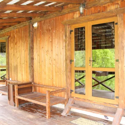 HomesteadHomestead "Hutsulska Pisnya"Mykulychynunder 1 km from the riverBBQPetsTransferNearby: Dovbush trail in Yaremche 3.5 kmDovbush's stone 3.6 km30 trails
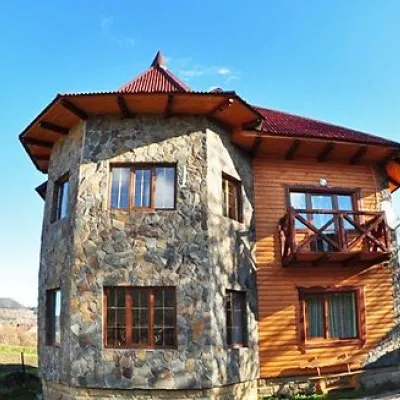 CottageКотеджі "Аркан" Микуличин (літній басейн, риболовля)Mykulychynunder 1 km from the riverPoolBBQKitchenNearby: Trinity Church 500 mDovbush trail in Yaremche 5.1 km29 trails
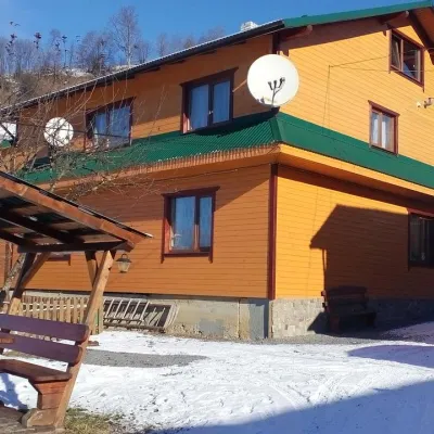 HomesteadHomestead "Heredyuka" VorokhtaVorokhtaunder 1 km from the riverSaunaFireplaceKitchenNearby: Austrian viaduct bridge 2.4 kmPolonyna Borsuchyna 4.9 km8 trails
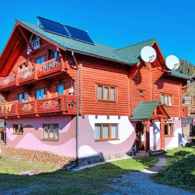 CottageКомплекс "Скита" ВорохтаVorokhtaunder 1 km from the riverHot tubPoolSaunaNearby: Austrian viaduct bridge 2.5 kmPolonyna Borsuchyna 4.7 km8 trails
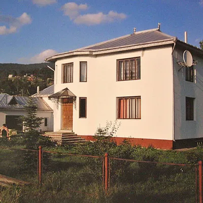 Homestead"Біла садиба" в ВорохтіVorokhtaunder 1 km from the riverSaunaBBQKitchenNearby: Austrian viaduct bridge 900 mMt Magura 4.2 km14 trails
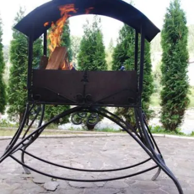 HotelMini-Hotel "Bilogir'ya" in YaremcheYaremcheunder 1 km from the riverPoolKitchenKidsNearby: Dovbush's stone 1.2 kmDovbush trail in Yaremche 1.6 km36 trails
Trails nearby
All trails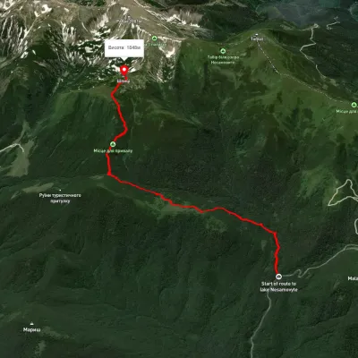 ModerateOne-dayUnmarkedZaroslyak base Mount ShpytsiElevation profile1 105–1 851 m6.9 kmascent 814 m≈ 3.5 h walkingunder 1 km from Prut
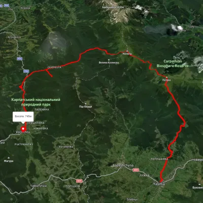 HardMulti-dayUnmarkedYasinia to Vorokhtavia Mount Petros, Mount HoverlaElevation profile650–2 049 m51.7 kmascent 2 112 munder 1 km from Prut
 ModerateTwo-dayUnmarkedZaroslyak base loopvia Lake Nesamovyte, Mount ShpytsiElevation profile1 162–1 964 m18.2 kmascent 937 m≈ 6.5 h walkingunder 1 km from Prut
Nearby attractions
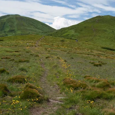 Mountain meadowPolonyna Pozhizhevska (Pozhizhevskaya)Nadvirna districtChornohora range1.7 km from PrutPolonyna lies at an altitude of 1382-1822 meters. The Pozhyzhevska meadow lies at the foot of the mountain of the same name in the Montenegrin ridge.
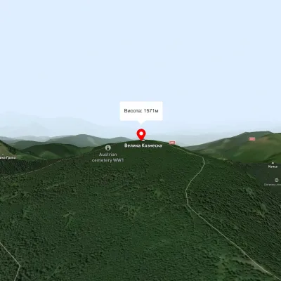 PeakMount Velyka KozmeskaVoronenkoaltitude 1 571 m2.9 km from PrutMount Wielkie Kozmeska is a peak with an altitude of 1571.7 meters above sea level. The mountain has the shape of a pyramid with three gentle spurs.
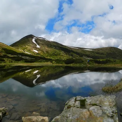 LakeHigh-mountainous Lake Nesamovite (1750 m.a.s.l., Chornohora ridge)Vorokhta4.6 km from PrutNesamovyte is one of the highest lakes in the Ukrainian Carpathians (1750 m above sea level). It is located within the Nadvirna district of Ivano-Frankivsk region.