Polyanitsa
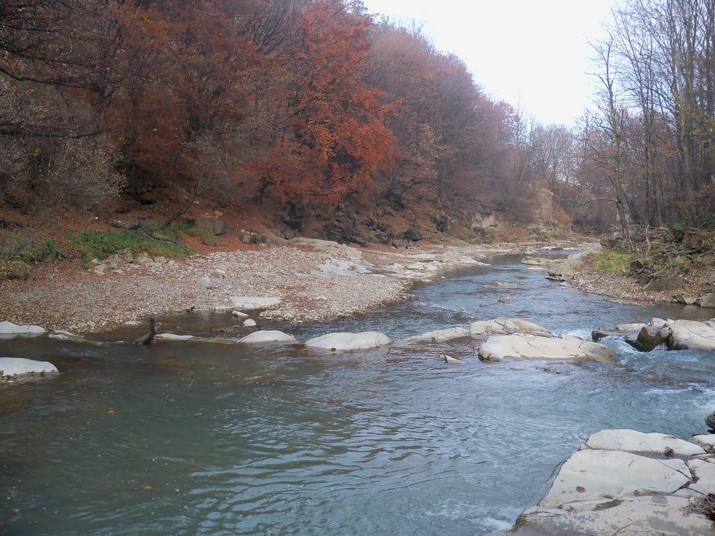
Polianytsia is a village of the Bolekhiv City Council in Ivano-Frankivsk Oblast. It is located in the east of Ivano-Frankivsk region within the Carpathian region and the Sukil River valley. Within the boundaries of the Polianytsia village council there is a monument of national importance - Dovbush Rocks. The village of Polianytsia is located in the hollow of the mountain river Sukil (which flows in the middle of the village). The village is located not far from the town of Bolekhiv (13 kilometers northeast of its center), and borders on the villages of: Trukhaniv (in the Lviv region) and Bukovets (in the south), and Bubnyshche and Tysiv (in the north). Living in a mountainous area, most of the villagers work in the forestry and farms, and also have the opportunity to work at the enterprises of Bolekhiv.
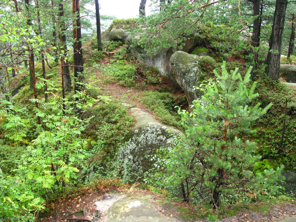
The first written mention of the village dates back to 1578. Most likely, the first settlers appeared here during the reign of Prince Danylo Halytskyi, in the first half of the twelfth century. The surrounding area is rich in forests and game, and nearby, in Bolekhiv, crafts began to develop: salt making, woodworking, and leather tanning. Timber could be delivered both by horseback and by rafting down the river. And here, on the border of the principality, like the natural rock fortress of Tustan, an outpost could stand. Here, through Bolekhiv, Tysiv, and Trukhaniv, the ancient Synevydske is the most direct and convenient road from Halych to the great road to the Carpathian Pass, which often bypasses high-flowing rivers. It is here that the fortified rock massif known to the public as "Dovbush's Rocks" is located. It is believed that this is a rock fortress, undoubtedly equipped for long-term defense.
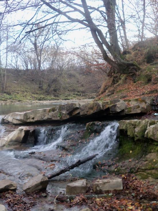
This assumption can be confirmed by the names of the tracts along the way, such as Vorottsi (Gate), Hranytsia (Border), Bashta (Tower), Ruban (place of massacre). At the bottom of the cliffs, near the river, in a meadow (hence the name of the village - Polianytsia), warriors, their families, and servants could live, and in case of danger, quickly hide or take up defense on the impregnable rocks. This period is characterized by frequent Horde raids on southwestern Rus. Batu with fire and sword marched through Volyn and Galicia, destroying most of the cities, and then went through the Carpathian passes to Hungary. One of these paths was necessarily along the specified route (place names confirm this). And they were named for the first time, were important, and have survived to this day. It is no coincidence that the surnames Budzherin, Fedzherin, Hajun, and Murza are common in neighboring villages. After the defeat of the Tatar cavalry in 1672 in a battle with the soldiers of Polish King Jan Sobieski near Zhuravno, many of the Crimean Khan's subjects were resettled in Galicia, particularly in Tysiv. But some could have settled earlier. Even the name of the Sukil River is of Turkic origin: su-water, kel-running. It has its own legend, quite plausible and similar to something described by Ivan Franko in his novel The Rising Hawk. Above the village of Polianytsi, there is a place where two mountains converge closely, called Bashta. A fast-flowing mountain river flows between them, leaving a narrow passage for the road on one side. Having made a dam on the river and blocked the rest of the passage with tree trunks, the brave fighters were waiting for the uninvited guests. Approaching the rubble, the leading Horde soldiers began to shout "Tower! We can't pass here!" warning the attackers, looking for some way through. A dam was opened on the river and the whole thing rushed toward the crowded army. With cries of "su-kel!" a panicked flight began.
The village, like the surrounding ones, probably had a time of decline and new development. The reason could be the same conquerors, as well as some kind of pestilence - cholera, which mowed down almost the entire population. To this day, traces of the cemetery, which is called the cholera cemetery, have been preserved. This is a consequence of the fact that not everything has been preserved in the people's memory, not passed down through generations. For example, no one knows about this rock massif, the role of its fortifications, the dungeon that begins near the riverbed and leads somewhere deep into the mountain... This is the case in neighboring Sukil. One can only guess what the fate of the church-laboratory, the bits of information about which have been preserved, what kind of underground passages under Mount Lavrivka were accidentally discovered as a result of a landslide. Roman coins, a silver bowl with some kind of pattern, and an ancient saber were also found here.
Not far from Polianytsia, in the Zarinky tract, there were forges and furnaces for smelting iron. Ditches 125-150 meters long have been preserved to this day, which were used to supply water and the remains of burnt ore. In the Ozeriv tract, baking soda potash was produced by burning wood. Since then, the area has been called Potashnia.
The river was actively used for economic purposes. Most often, firewood was floated by the moth method. Thus, in the 90s of the XIX century, about 15 thousand m3 of beech firewood and 3-5 thousand m3 of spruce wood were transported to the city of Bolekhiv annually along the Sukil River. According to the estimates of Polish engineer S. Kokhanovskyi, during 1882-1909, the boyka delivered almost 620 thousand m3 of wood through this waterway.
In 1908, the village created the Polianytsia supra-forestry, which included forests from the village of Tysova to Bryaza (now the village of Kozakivka). In 1912, a 32 km long narrow-gauge railway was laid through the village from Bolekhiv to the Heryava tract and the villages of Luzhky - Sloboda Bolekhivska. In 1956, the railroad was dismantled, and timber was brought down from the mountains by logging trucks.
The territory of the village council covers 4531 hectares, the area of the settlement is 659 hectares. A wooden church of St. Demetrius was built in the center of the village in 1850. From 1913 to 1917 the village administration was headed by Mykhailo Prokopovych Yatsynyn (the old starosta). 3 From 1918 to 1920, the village administration was headed by Fedir Dubiv (Hanchukiv). According to the 1935 census, 895 Ukrainians, 53 Poles, and 4 Jews lived in the village.
Before the outbreak of the First World War, two brothers-entrepreneurs, the Raises, arrived in the village from Austria. The younger Ludwig founded a tartak (sawmill) in the village, which employed 12-17 people. A water mill was built, which provided electricity for the production. Later, after the pond in front of the mill was silted up by floods on the Sukil River, a steam boiler was launched to drive an electric generator. Part of the electricity began to be supplied for village needs. The village was fully electrified in the early 60s, when a power line was laid from the town of Bolekhiv. With the outbreak of World War I, 32 people from Polianytsia were drafted into the Austrian army. Half of them survived, and some soldiers joined the ranks of the UGA after their return.
In 1938, in the Zaluchshyha tract, entrepreneurs from Boryslav laid a mine for the extraction of mountain wax, ozokerite. The mine employed up to 30 people. The wax was of good quality. Before the outbreak of World War II, the Polish government ordered the mine to be closed for unknown reasons. In the interwar period, the village was home to the Ukrainian societies Prosvita, Ruralist, Native School, and Plast. Primary schools were opened, and education was conducted in Polish. The village community opened two cooperative shops for share contributions, and bought a mechanical thresher and a fan. The head of the cooperative was Fedir Shmeha.
On the morning of June 22, 1941, Nazi planes appeared in the sky above the village. After a while, the advanced units of the German army arrived in the village. The arrests of OUN activists began. Young girls and boys were taken to work in Germany. From the end of 1943, the youth of the village began to join the UPA units.
In July-August 1944, the partisans attacked the Nazis who were retreating into the mountains to the so-called Arpad Line, a powerful fortification that ran along the main Carpathian ridge. A lot of ammunition and food was captured. Under the pressure of the Soviet army, the front moved higher into the Carpathians. On August 12, 1944, Bolshevik rule was restored in the village. The new occupier began with a contingent food tax, which consisted of: 150 kg of grain from the yard, 250 liters of milk from a cow, 60 kg of meat, 150 eggs. Almost half of the salary was collected from every worker who worked for a "voluntary" state loan. The search began for everyone who was to some extent involved or maintained ties with the nationalist underground. Entire families, even those with small children, were repressed. Many of them were left to rest in the land of Karaganda, Vorkuta, Magadan...
In 1955, by the decision of the bureau of the district Communist Party committee, all the fertile land around the village of Polianytsia was taken away from the villagers and transferred to the newly formed Druzhba collective farm in the neighboring village of Tysiv, which never took root due to its unprofitability in mountainous conditions. The forests and pastures were transferred to the Bolekhiv Forestry and Forestry Enterprise. The villagers resisted the authorities, but anyone who expressed dissatisfaction in any way was tried. The second was the campaign to join the collective farm, which also caused repressions on the part of the authorities against the owners, who lost everything in a short time. And finally, they lost their freedom. This is how collective farm serfdom began. It is no accident that the armed resistance continued until 1955, despite terror, provocations, mass deportations, and arrests. In the struggle for independence, 49 people died, 30 were convicted, 61 were repressed (deported), 13 were killed at the fronts, and three went missing.
A two-story building of the village hospital was built and opened in the village, which was later closed as unprofitable. Currently, there is a rural health center, a dental office, and a pharmacy. The issue of building a new community center is being resolved. There are several grocery stores run by private entrepreneurs in the village, four café-pavilions outside the village on the way to the Dovbush Rocks, one tourist and recreation complex, and a trout farm. Children study and receive education at the secondary school. There are difficulties with employment of the adult population. A small number of people work at a private local timber factory, some in forestry. The majority are engaged in private farming, which is very difficult to maintain given the low soil fertility. That is why it is common for people to go abroad for seasonal work, looking for better earnings.
The village has a Greek Catholic Church of the Great Martyr Demetrius. There are two church feast days in the year: Demetrius on November 8 and the Presentation of the Lord on February 15. The ancient traditions of Easter and Christmas celebrations (caroling, nativity scene, watching and waiting by the fire near the Church of the Resurrection), as well as the even more ancient, probably pagan Ivan Kupala, and the lighting and descent of wheels from Chornohora Mountain on the night of St. George the Victorious - May 6 - are honored and supported.
In order to preserve the geobotanically original mountain range, valuable natural, historical and cultural complexes and objects, and to create conditions for effective tourism and recreation, the Polyanets Regional Landscape Park was established in 1996. It includes the Dovbush Rocks rock reserve, a mountain lake, and part of the forests and mountain meadows of the forestry.
The cultural and political revival of the village began in 1989, when a branch of the Ukrainian Language Society, and later the Rukh, was established in the village. The choir and amateur theater, led by Zenovii Dubiv and Fedir Dubiv, respectively, gave concerts in 65 villages of the region during the 1990 election campaign and traveled to the eastern regions of Ukraine. All conscious Ukrainians joined the process of establishing the state's independence peacefully. Young people from Bubnyshche and Polianytsia took an active part in the celebration of the 620th anniversary of Bolekhiv. The village has an extremely high potential for tourism development.
The village has the Polianytsia forestry of the Bolekhiv forestry plant. There are nature protection areas on the territory subordinated to the forestry:
- Polianytsia Regional Landscape Park;
- Dovbush Rocks (a natural monument);
- Olirky (natural monument).
77221, Ivano-Frankivsk region, Bolekhiv City Council, Polianytsia village, tel. +380 03437 3-94-09


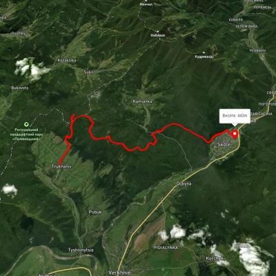
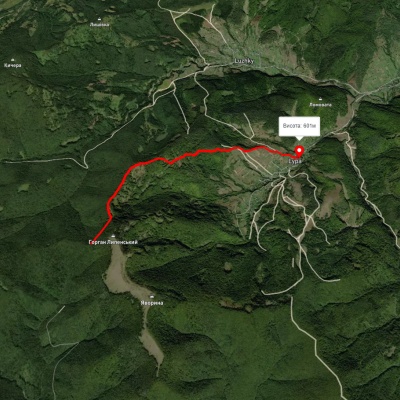
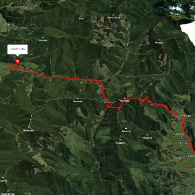
Які туристичні (пішохідні) маршрути проходять через/біля Polyanitsa?
Пропонуємо пройти такі туристичні (пішохідні) маршрути через/біля Polyanitsa: с. Труханів, через г. Ключ, оз. Журавлине, вдсп. Кам'янка до м. Сколе, c. Липа - Яворина - Бункер Роберта, с. Либохора, через г. Матагів до с. Козаківка, м. Сколе, через г. Лопата, г. Хом, с. Кам'янка, вдсп. Кам'янка, с. Дубина до м. Сколе, м. Сколе, через г. Лопата, вдсп. Кам'янка до с. Дубина, с. Дубина, чере вдсп. Кам'янка, г. Лопата, г. Матагів до с. Тухля