Volovets district
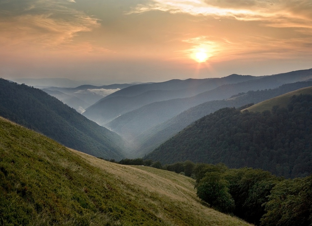
There is something to do in Volovets district at any time of the year: in summer, you can walk in the woods in search of mushrooms, climb to the meadow to pick up japans, and conquer the ski slopes in winter. This is where the Borzhava Polonyna, one of the longest Carpathian ranges, begins. Thousands of tourists are attracted by the Veretsky Pass, the peaks of Pikuy and Plyay (Vyacheslav Chornovil once worked at the weather station here, and now there is a memorial sign in his honor), Vysoky Kamen, interesting objects of the Arpad Line, ski slopes, mineral springs, authentic wooden churches of the eighth century, and more. Enthusiasts in the district have developed tourist routes for bus and walking tours, weekend walks, and multi-day hikes of various levels of difficulty.
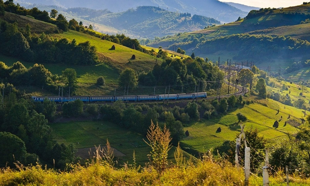
The district center has a very convenient location, as there is a railway line that connects Zakarpattia with many Ukrainian and foreign cities. Trains coming from Lviv, Kyiv, Kharkiv, Simferopol, Odesa, etc. stop in Volovets. Transport connections between the cities allow you to plan your leisure time in Volovets district for the weekend (for example, a guest books accommodation during the week, leaves Kyiv on Friday, and on Saturday and Sunday relaxes and soaks up the nature of the Carpathians, and on Monday returns to work).
This is the area of northern Zakarpattia, within the Vododilnyi and Polonyna ranges, bordering Velykyi Bereznyi (west), Svaliava (south) and Mizhhirya (east) districts of Zakarpattia region, as well as Lviv region of Ukraine. The highest peaks are Mount Stiy (1681 m) and Mount Velykyi Verkh (1598 m), on the border with Mizhhiria district. The mountain ranges from Pashkivtsi to Vysokyi Kamen near Pidpolozzia are the Pikuy Floristic Reserve, where many valuable rare plants, including medicinal ones, are protected.
Mountain ranges rise high to the sky here: Velyka Hranka and Bukyuska Polonyna. And through the Vodorozdilnyi Ridge, important transportation passes that have served people for centuries lead to us: Serednyi Veretskyi (Vorytskyi - 839 m), Volovetskyi (Skotarskyi - 1.014 m).
All the rivers of Volovets region are tributaries of the Latorytsia (Danube basin), which originates on the slopes of the Verkhovyna ridge, under the Veretskyi pass. It gave its name to the village of Latirka, which is located on both banks of its channel, which becomes fuller with time. The Latorytsia is joined by the Bashta and Slavka rivers that flow through Verkhni Vorota, as well as the Kachurka (Verbyazh, Zavadka), Vicha (Huklyvy, Volovets), Zhdenivka (Zhdenievo), and others that originate in the upper reaches of the mountains. All of them have a rapid flow, steep banks, and narrow valleys. There is an amazing Devil's Mill waterfall in the district.
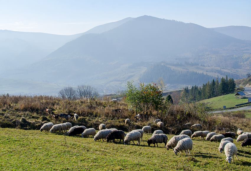
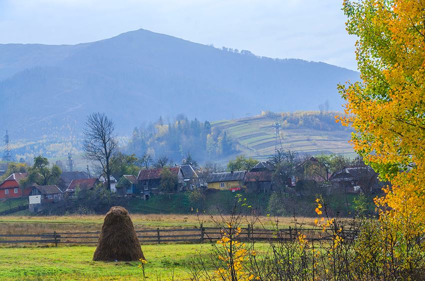
Volovets district (the district center is the village of Volovets) is part of the ethnographic region of Boikivshchyna, one of the three well-known historical and ethnographic groups of the Ukrainian Carpathians - Hutsuls, Boikos, Lemkos - that have significant differences in their way of life, customs, rituals, and material culture (the district's festivals are the Verkhovyna Yafyna festival in the village of Huklyvy and the Zvonki Perlynyky Verkhovyna festival in Volovets). However, the eastern part of the district is inhabited by the Lemko subethnos. Thus, the border between two ethnographic groups of Ukrainians, Lemkos and Boikos, runs through Volovets. The district has unique wooden churches in the villages: Huklyvyi, Yalove, V. Hrabivnytsia, Tyshiv, Zadilske, and a male Orthodox monastery in the village of Tyshiv. The area is rich in mixed forests, where spruce, fir, beech, ash, and sycamore trees grow predominantly. Many mushrooms and berries can be found among the trees in summer and fall.
The beauty of the mountain tops and the healing power of the mountain air still contribute to the development of the tourist infrastructure. The Zhdeniyevo resort is being filled with new hotels and a ski lift. For more than a decade, the majority of people coming to the resort for recreation have been residents of the region affected by the Chernobyl disaster. Those staying in Volovets will have access to ski lifts in the villages of the neighboring Mizhhiria district - Podobovtsi (about 10 km away) and Pylyptsi (about 15 km away). The district hosts paragliding, orienteering, and other competitions.
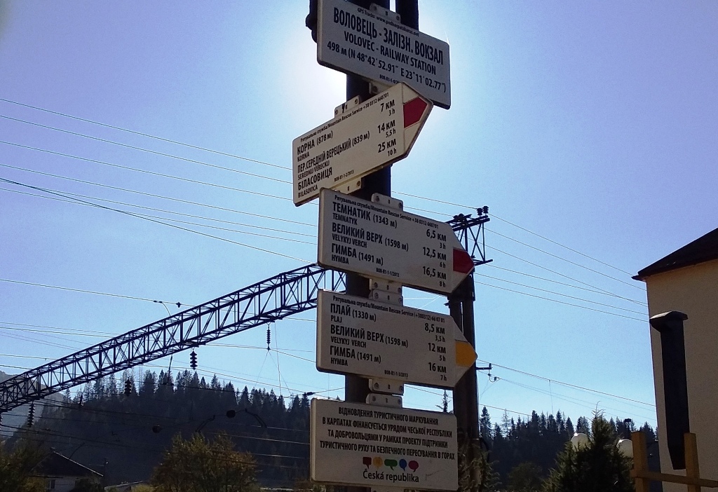
There are many routes for hiking, the most popular of which are the following:
- From Volovets to Polonyna Borzhava and from Pashkivtsi and Zhdenievo to the Watershed Ridge;
- To the Temnatyk. It is most convenient to start from the village of Volovets
- To the Play. Tourists can climb to this peak both from Volovets and from the village of Huklyve.
- To the Velykyi Verkh. Climbing to the top can be started from Volovets, Huklyve, Pylypets, Veretsky pass.
- On Buzhora. the ascent to this peak in this area is carried out from the village of Yabluniv
- Pikuy. The most popular routes are the ascent to the top from the villages of Bilasovytsia and Shcherbovets.
- Mount Ostra. Tourists can also climb from the villages of Perekrestnyi, Rotoka and Kichernyi.
There are 7 mineral springs in Volovets district. The most famous of them is in the Zanka tract. For a long time, there were baths there, maintained by a timber mill.
- The burial of Austrian and Russian soldiers from the First World War in the village of Yalove.
- Cross to the Sich Riflemen. On the Veretsky Pass.
- Cross to V. Chornovil. G. Plai.
- A monument in honor of the Hungarian tribes' crossing of the Carpathians. Veretsky Pass.
- Arpad's line (defense system, World War II): bunker Pidpolozzia village Yabluniv village
Observing the defeats of its German allies on the eastern front, in the summer of 1943 Hungary began to create a defense system in the mountainous regions of the Carpathians, the so-called Arpad Line. It stretched for 350 kilometers along the tops of mountain ranges, and its width in some places reached 120 kilometers. The line was additionally reinforced by 99 strongholds, 750 pillboxes, 343 pillboxes, 439 open firing positions, and 400 km of anti-personnel and anti-tank trenches. And on the outskirts of the village of Yasinia and the Yablunytsia Pass, 12 kilometers of barbed wire were installed, through which a current of 3000 V was passed. Nevertheless, units of the Soviet army managed to overcome this defense system at the cost of the lives of more than 10 thousand soldiers. The most famous remnants of the Arpad Line include a bunker in the village of Verkhnia Hrabivnytsia and a pillbox in the village of Pidpolozzia.
Wooden churches
- The wooden Church of the Assumption of the Blessed Virgin Mary and the bell tower of 1804 in the village of Abranka;
- Church of the Transfiguration of the Lord (1878) with a bell tower (early twentieth century), Verbyazh village;
- Church of the Holy Spirit with a bell tower (early eighteenth century), Huklyvyi;
- St. Nicholas wooden two-storey church with a bell tower (early twentieth century), Zadilske village;
- Wooden two-storey church of St. Basil the Great with a bell tower of the early twentieth century, Zadilske;
- The wooden three-storeyed Church of St. George (late eighteenth-nineteenth centuries) with a nineteenth-century bell tower in the village of Kotelnytsia;
Monastery of the Mother of God of Kazayan in Kotelnytsia village; - Church of the Assumption of the Blessed Virgin Mary with a bell tower (1898), Tyshiv village;
- The wooden three-storey Church of the Ascension (XVIII-XIX centuries) and the bell tower of the 19th century in Yalove village;
- The chapel built in honor of the abolition of serfdom (1848, 1928); Verkhni Vorota village;
- The Church of the Ascension of the Lord (1947) in Perekrestnyi village;
- Holy Dormition Monastery in Kichernyi village.
Attractive territories, landscapes, reserves, nature reserves, natural objects:
- Floristic reserve "Pikuy". It is located on the border of Zakarpattia and Lviv region. Many valuable rare plants, beech sparse forest with remnants of beech crooked forest on the slopes of Pikuy mountain (1408.3 m) are protected.
- Rosishny Forest Reserve (western slopes of Mount Stiy). Elite fir plantations, as well as a number of rare plants, such as scolopendra leaflet, common ostrich feather, and forest lily, have been preserved in their original form. There is also a beech virgin forest.
- Lilac Botanical Reserve (Zhdeniivka Forestry). The reserve protects a rare endemic species of Hungarian lilac listed in the Red Book of Ukraine. It can be seen in the thickets of gray ash trees with an admixture of common ash, mountain ash and sycamore, and together with European cowberry, fluffy honeysuckle, brittle buckthorn, and goat willow, it forms an undergrowth here. The grass cover includes: marsh puddleweed, elongated viper's mallow, shaking sedge, white oregano, sweet-bitter nightshade and some others.
- The general zoological reserve "Osa Stream". The following species are under protection: brook trout, spotted salamander, Carpathian newt, alpine shrew.
- Golitsa reserve, near the village of Nyzhni Vorota. Plants listed in the Red Book of Ukraine are protected: winged broom, Heifel's saffron and other rare species.
- Botanical natural monument "High Stone Mountain". It is famous for having the highest habitat of rock oak and black pine in the Carpathians, as well as relict communities dominated by broadleaf and heart-leaf linden, which have been preserved on steep slopes and a rocky ridge at an altitude of 840 m. One of the two relict centers of scots pine in Transcarpathia is protected on the mountain top. On the rocky placers there are bushes of shiny currants and gooseberries.
- Botanical natural monument "Berry Yew" (Pidpolozyany forestry). The habitat of the berry yew, which is listed in the Red Book of Ukraine. The trees are about 300 years old.
- The reserve and Mount Temnatyk (1343.6 m). It is located near the village of Volovets.
- The Maidan tract.
- The Holy Spring in the village of Huklyve.
- Mount Ostra (1405.2 m). It is located on the border with Velykyi Bereznyi district.
- Mount Play (1330.5 m).
- Mount Velykyi Verkh (1598 m).
- Volovets Pass or Beskydy Pass (974 m).
- Veretsky pass (838 m).
The region is actively developing its tourist infrastructure. Hiking, green and military tourism are popularized. Zhdeniyevo and Huklyvyi have long had their own clientele who do not demand too much comfort from hotels. The main thing for such a traveler is a cozy and comfortable place to stay. And here they have all this, and they will also be fed deliciously!


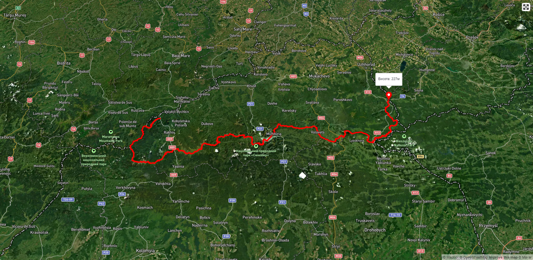
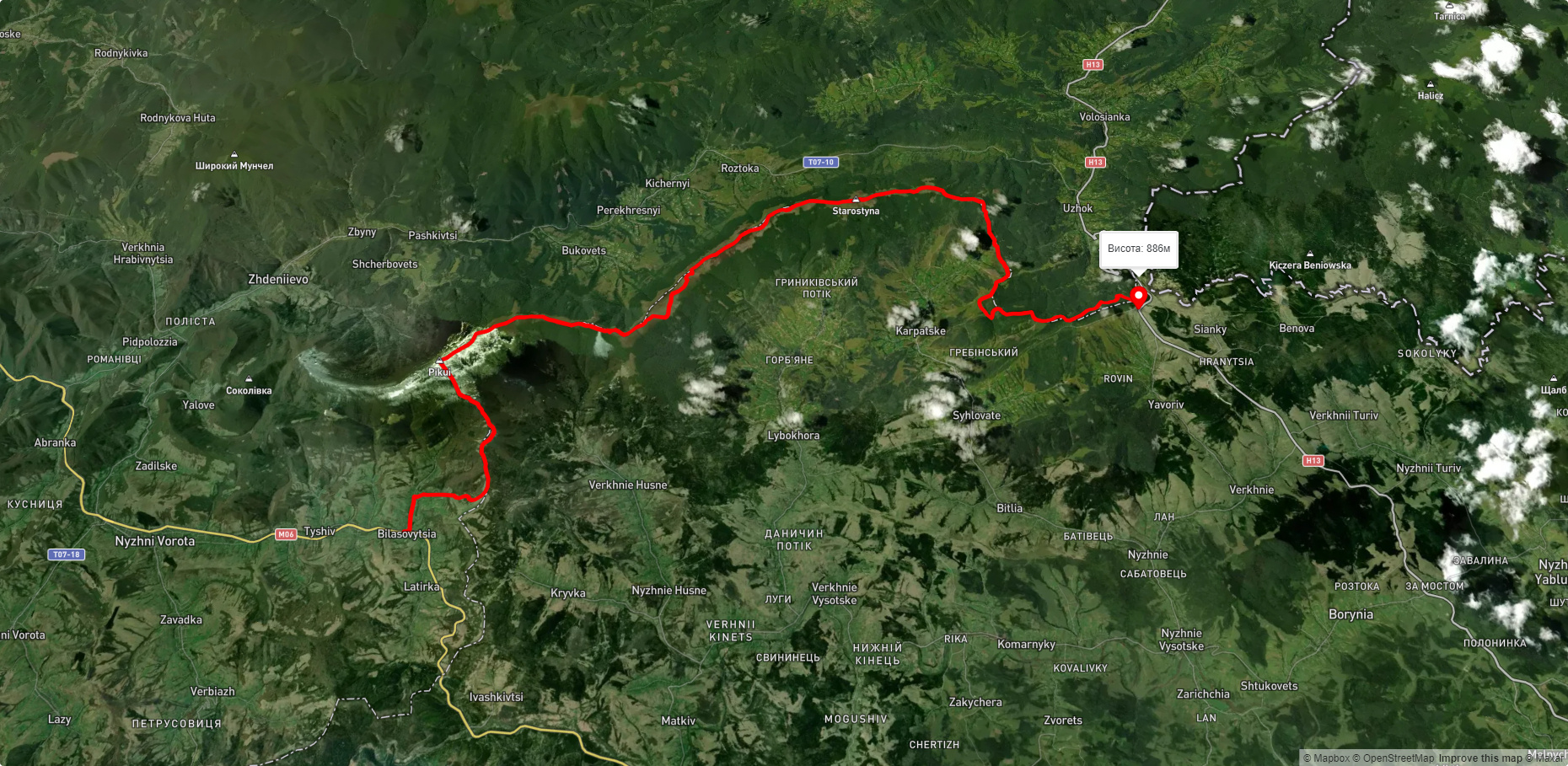
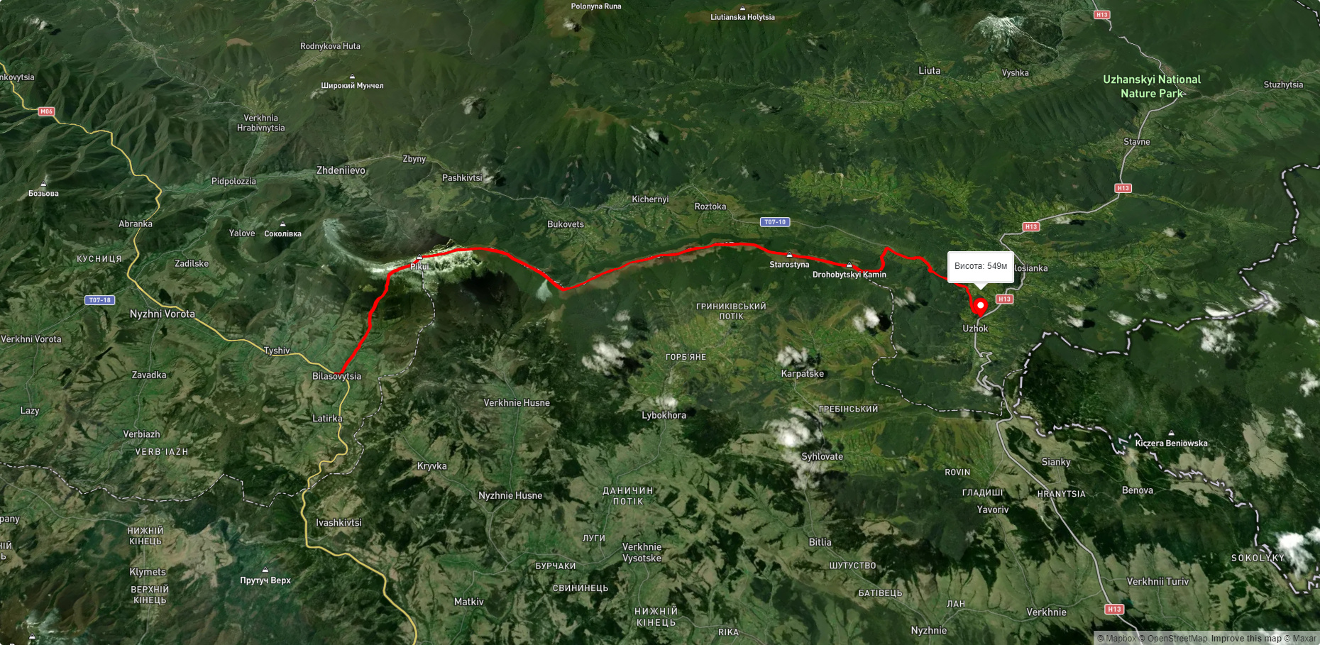
Які туристичні (пішохідні) маршрути проходять через/біля Volovets district?
Пропонуємо пройти такі туристичні (пішохідні) маршрути через/біля Volovets district: Закарпатський туристичний шлях, с. Біласовиця, через г. Пікуй, перевал Руська Путь, г. Дрогобицький Камінь до с. Сянки, с. Ужок, через с. Гусний, г. Дрогобицький Камінь, перевал Руська Путь, г. Пікуй до с. Біласовиця, с. Сянки, через г. Дрогобицький Камінь, перевал Руська Путь, г. Пікуй до с. Біласовиця, с. Либохора, через г. Пікуй до с. Біласовиця, с. Сянки, через Верховинський Вододільний хребет, г. Пікуй до с. Біласовиця