Tatariv village — to Mykulychyn village, via Mount Lisniv
Unmarked trailmore
It may be partly marked. Unmarked trails have no information boards, signposts or auxiliary signs (water, campsite, etc.). The decision to walk the trail is entirely your own responsibility.
Trail map
Where to stay nearby
About the trail
Route Tatariv village, via Mount Lisniv to Mykulychyn village. Along the route you will see: Church of St. Demetrius of Thessaloniki, Tatariv, Mount Lisniv, Trinity Church, Mykulychyn, Museum of customary symbols of the Hutsul region (Mykulychyn).
At a glance
A one-day route of 15 km with 732 m of ascent from Tatariv village to Mykulychyn village. Estimated walking time: about 5 h, not counting stops. Difficulty: moderate. Waymarking is missing or partial.
Route stages
- 0–5 kmClimb of 530 m to Mount Lisniv (1,257 m)
- 5–7 kmGentle ups and downs at 1,180–1,230 m
- 7–12 kmDescent of 570 m (down to 620 m)
- 12–15 kmGentle ups and downs at 580–620 m
Steepest kilometre: km 3–4, a climb of 240 m (≈22%).
Water and overnight stays
Springs near the trail: at km 3, 5, 7, 10 and 15.
Huts and shelters near the trail: Hut below Mount Lisniv (km 5), Hut (Mykulychyn, 7) (km 11), Mountain shelter (Mykulychyn, 2) (km 14). Places to stay near the start: Tatariv; near the finish: Mykulychyn.
When to go
Best time: May to October. In winter deep snow is possible, so experience and winter gear are needed.
Getting there
Start: Tatariv village. Most places to stay near the start are in Tatariv. This is a one-way route: the finish is 6 km from the start in a straight line, so plan your way back in advance.
FAQ
- How long does the route take?
- Estimated walking time: about 5 h, not counting stops.
- Is there water on the route?
- Springs near the trail: at km 3, 5, 7, 10 and 15.
- Where can I stay overnight?
- Huts and shelters near the trail: Hut below Mount Lisniv (km 5), Hut (Mykulychyn, 7) (km 11), Mountain shelter (Mykulychyn, 2) (km 14). Places to stay near the start: Tatariv; near the finish: Mykulychyn.
Water and shelter on the route
- Spring below Mount Lisniv (4)km 3.1 from the start · Not verified · 930 m
- Hut below Mount Lisnivkm 4.8 from the start · 190 m off the path · Standing · 1 172 m
- Spring below Mount Lisniv (6)km 4.9 from the start · 150 m off the path · Not verified · 1 167 m
- Spring below Mount Lisniv (5)km 6 from the start · 150 m off the path · Not verified · 1 149 m
- Spring below Mount Lisniv (3)km 6.6 from the start · Not verified · 1 090 m
- Spring (Mykulychyn, 23)km 9.4 from the start · Not verified · 813 m
- Hut (Mykulychyn, 7)km 10.1 from the start · Not verified · 731 m
- Mountain shelter (Mykulychyn, 2)km 12.6 from the start · 70 m off the path · Not verified · 588 m
- Spring (Mykulychyn, 22)km 13.7 from the start · 260 m off the path · Not verified · 716 m
Comments
What to see on the trail
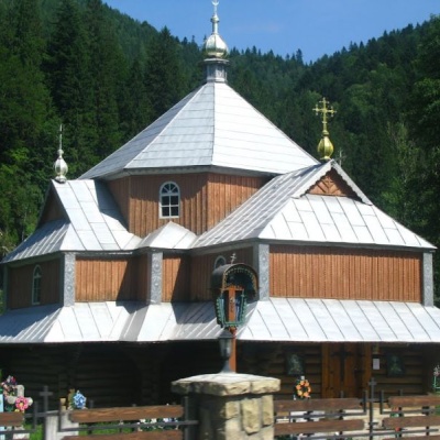 Church of St. Demetrius of Thessaloniki, Tatarivaltitude 691 mDemetrius of Thessalonica in the small village of Tatariv was built in 1870. The church was erected in honor of the righteous great martyr Dmytro...
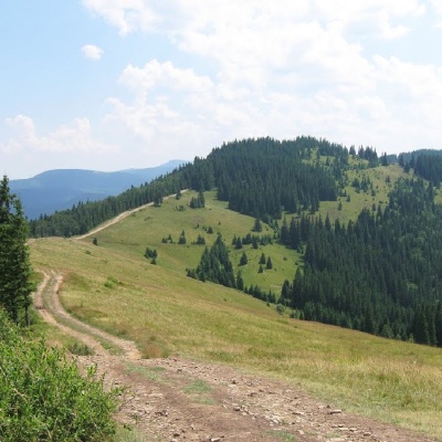 Mount Lisnivaltitude 1 257 mMount Lisniv is a 1257-meter peak of the Ukrainian Carpathians, which is located on the territory of the Pokutsko-Bukovyna mountain range.
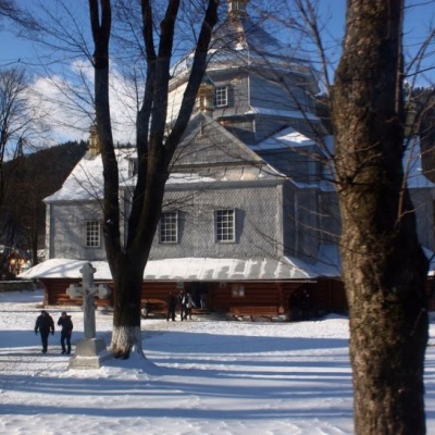 Trinity Church, Mykulychynaltitude 622 mThe church is made entirely of wood in the Hutsul style. The temple is remarkable for its power.
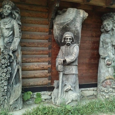 Museum of customary symbols of the Hutsul region (Mykulychyn)altitude 622 mDid you know that the Museum of Customary Symbols of the Hutsul Region (Mykulychyn) and its exhibition are housed in three rooms of an old hut?
Trails nearby
All trails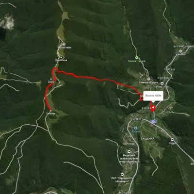 EasyOne-dayMarkedTatariv Mount YahidnaElevation profile678–1 231 m5.9 kmascent 250 m≈ 2 h walking
 HardMulti-dayMarkedEast Carpathian Tourist TrailElevation profile635–1 819 m278.1 kmascent 14 105 m
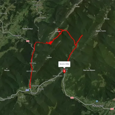 HardTwo-dayUnmarkedTatariv village to Zhenets tract (Mykulychyn village)via Mount Khomiak, Zhenetskyi Huk WaterfallElevation profile645–1 523 m21.9 kmascent 1 124 m≈ 7.5 h walking