Borzhava River
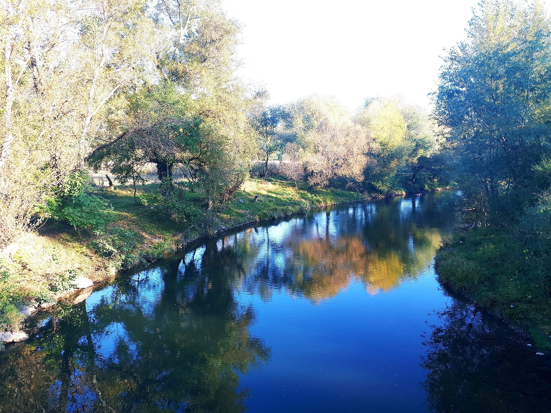
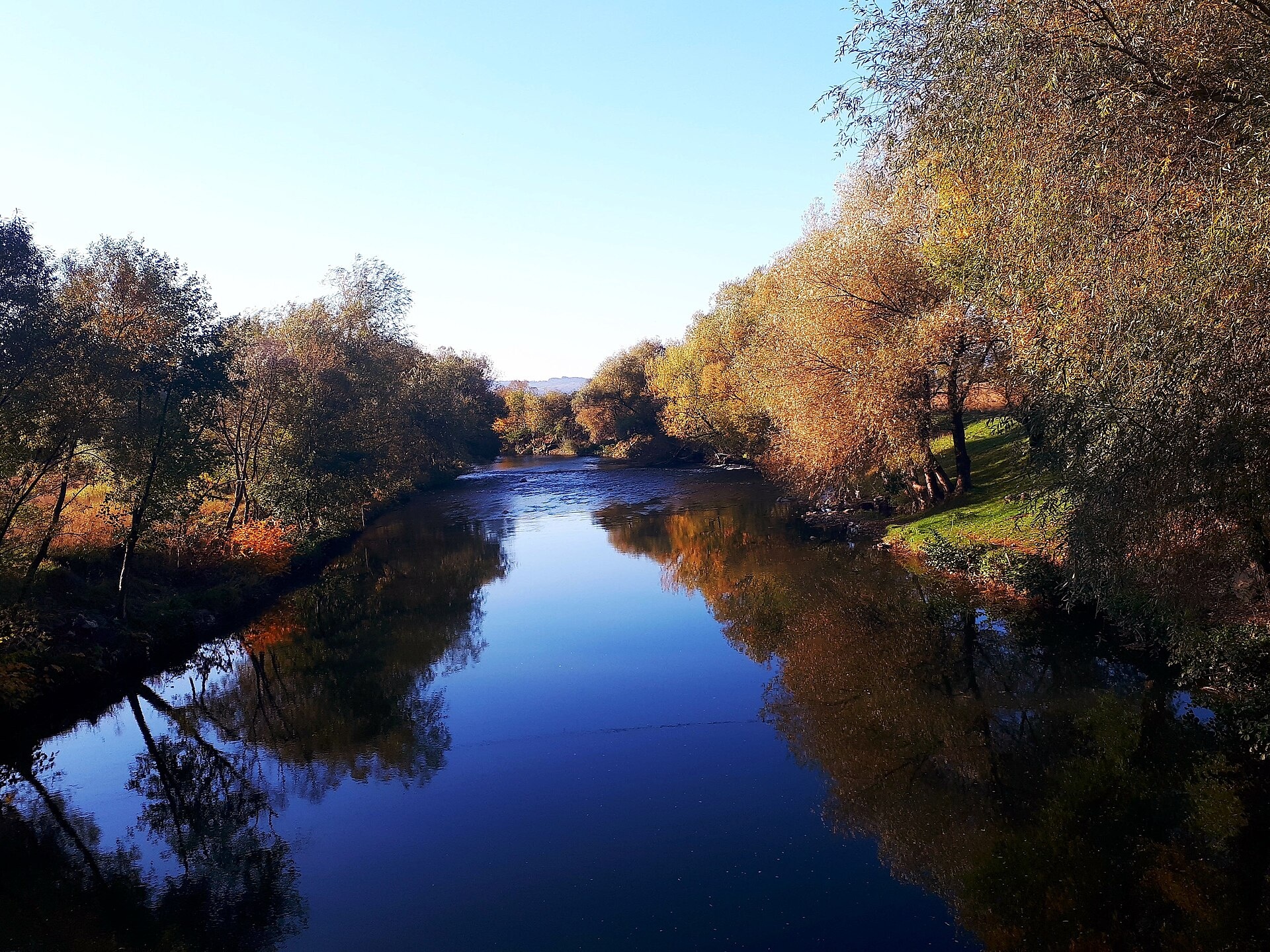
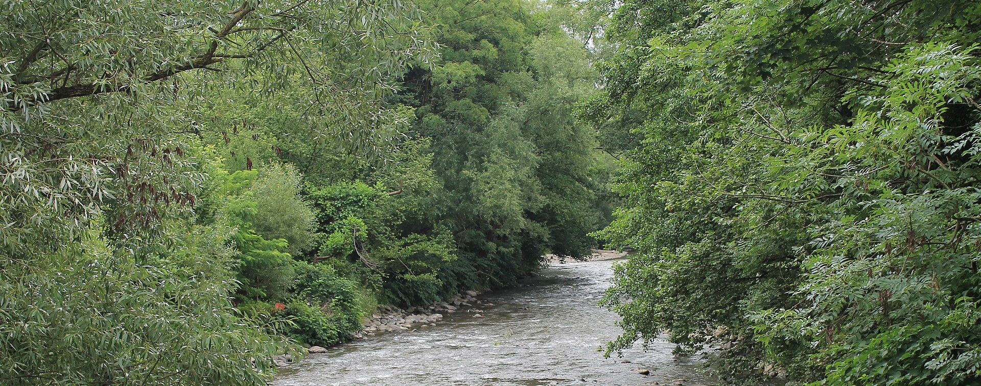
The Borzhava rises on the ridge of the same name, on the eastern slopes of Mount Stii (1,681 m), and flows through Bereznyky, Kushnytsia, Bronka, Dovhe, Pryborzhavske, Lukovo and Velyki Komiaty to Bene and Vary, where it joins the Tysa. The upper course is mountainous, the middle course runs through foothills, and below Velyki Komiaty the river reaches the plain. The town of Irshava stands not on the Borzhava but on its tributary, the Irshava.
- Length: 106 km
- Basin area: 1,365 km²
- Source: the Borzhava ridge, slopes of Mount Stii
- Mouth: the Tysa south of Vary
The Borzhava polonyna is the longest mountain meadow ridge in Zakarpattia and a popular hike. Since 1908 the Borzhava narrow-gauge railway Berehove — Dovhe — Kushnytsia has run along the river; today it operates only in part.
The upper Borzhava holds brown trout; further down, in 2008–2011, ichthyologists found chub, pike, wels catfish, zander, asp and bream. Barbel, nase, ide and burbot are in the Red Book. Gravel and sand have been extracted from the riverbed for years, and the water in the lower course can be polluted. The spawning ban runs from 25 March to 15 May, and trout are closed from 10 October to 1 March. Details are in the fishing section. All the region’s waters are on the Fishing in the Carpathians page.
Photos: Іванна Черленяк-Керечанин, CC BY-SA 4.0; Іванна Черленяк-Керечанин, CC BY-SA 4.0; Білявина, CC BY-SA 4.0 — Wikimedia Commons.
Location on the map
Fishing on the Borzhava
The upper Borzhava is trout water, while on the foothill and lowland course anglers catch chub, pike, wels catfish, zander and asp.
Can I fish now?
- Brown trout — closed until 1 MarchTrout spawning: closed from 10 October to 1 March in the Zakarpattia, Ivano-Frankivsk, Lviv and Chernivtsi regions.Each illegally caught fish costs UAH 7,225 in damages on top of the fine.
- Other species — allowed within the daily limitKeep to the minimum sizes and the daily limit; release protected species.
Limits and rules
The Borzhava had no stretches on the 2026 list of places open during spawning, so it is not fished from 25 March to 15 May. The mouth near Vary is on the Tysa, which forms the border with Hungary there, so the border strip may apply.
What to catch
 Brown troutupper reaches · closed from 10 October to 1 Marchclosed until 1 March
 Chuballowed
 Pikeclosed from 15 February to 31 Marchallowed
 Wels catfishlowland courseallowed
 Zanderallowed
 Aspallowed
In 2008–2011 surveys bream, perch and Prussian carp also turned up, and the middle course held the rare zingel and streber, Carpathian lamprey, gudgeons and schraetser (Red Book). Reference sources also list grayling and Danube salmon for the Borzhava, but there are no recent confirmations. The Borzhava itself was not stocked by the state in 2019–2026; in 2026 trout were released for the first time into its tributary, the Irshava.
 Barbel
 Nase
Nase Ide
Ide Burbot
Red Book of Ukraine species: if one bites, unhook it carefully and release it. Taking one means a fine and compensation for damages.
Bite forecast near Dovhe
- TodaygoodSteady pressure, light wind, clear1024 hPa · wind up to 13 km/h · 8…11 °C
- TomorrowgoodHigh pressure, light wind, partly cloudy1028 hPa · wind up to 9 km/h · -1…11 °C
- Thursday, 15 OctobergoodHigh pressure, light wind, partly cloudy1025 hPa · wind up to 14 km/h · 5…11 °C
For species open now: chub, pike, wels catfish, zander, asp. Brown trout closed. Based on pressure, wind, temperature and cloud — an estimate, not a guarantee.
Fishing spots 91
Places where you can drive up to the water: fish markers on the page map and the list below. Look at the satellite view before you go — the bank may be steep or overgrown.
Closed right now: brown trout — until 1 March.
- Dirt-road access on the BorzhavaAbout 150 m to the water from a dirt road. Nearest village (straight line): Potik, 5.8 km.
- Dirt-road access on the BorzhavaAbout 110 m to the water from a dirt road. Nearest village (straight line): Podobovets, 7.6 km.
- Dirt-road access on the BorzhavaThe road comes almost to the water. Nearest village (straight line): Potik, 7.9 km.
- Dirt-road access on the BorzhavaThe road comes almost to the water. Nearest village (straight line): Potik, 7.5 km.
- Dirt-road access on the BorzhavaAbout 50 m to the water from a dirt road. Nearest village (straight line): Potik, 7.8 km.
- Stream mouth on the BorzhavaThe road comes almost to the water. Nearest village (straight line): Potik, 8.1 km.
- Stream mouth on the BorzhavaThe road comes almost to the water. Nearest village (straight line): Bereznyky, 7.8 km.
- Dirt-road access on the BorzhavaAbout 60 m to the water from a dirt road. Nearest village (straight line): Bereznyky, 6.9 km.
Show all spots (91)
- Dirt-road access on the BorzhavaAbout 40 m to the water from a dirt road. Nearest village (straight line): Bereznyky, 6.0 km.
- Dirt-road access on the BorzhavaAbout 70 m to the water from a dirt road. Nearest village (straight line): Bereznyky, 5.1 km.
- Stream mouth, Bereznyky (4.3 km)The road comes almost to the water. Nearest village (straight line): Bereznyky, 4.3 km.
- Dirt-road access, Bereznyky (3.5 km)About 100 m to the water from a dirt road. Nearest village (straight line): Bereznyky, 3.5 km.
- Dirt-road access, Bereznyky (2.6 km)The road comes almost to the water. Nearest village: Bereznyky, 2.6 km.
- Access from a village street, Bereznyky (1.8 km)About 70 m to the water from the street. Nearest village: Bereznyky, 1.8 km.
- Access road to the water, BereznykyAbout 40 m to the water from an access road. Nearest village: Bereznyky, 960 m.
- By the bridge, BereznykyThe road comes almost to the water. Bridge 70 m away. Village: Bereznyky.
- Access road to the water, BereznykyAbout 90 m to the water from an access road. Nearest village: Bereznyky, 1.0 km.
- Dirt-road access, KeretskyAbout 70 m to the water from a dirt road. Nearest village: Keretsky, 920 m.
- Access from a village street, KeretskyAbout 80 m to the water from the street. Village: Keretsky.
- Access from a village street, KeretskyAbout 50 m to the water from the street. Nearest village: Keretsky, 810 m.
- Local-road access, Kushnytsia (2.6 km)About 80 m to the water from a local road. Nearest village: Kushnytsia, 2.6 km.
- By the main road, Kushnytsia (1.8 km)The road comes almost to the water. Nearest village: Kushnytsia, 1.8 km.
- By the main road, KushnytsiaAbout 60 m to the water from the main road. Nearest village: Kushnytsia, 970 m.
- By the bridge, KushnytsiaThe road comes almost to the water. Bridge 70 m away. Nearest village: Kushnytsia, 710 m.
- Local-road access, KushnytsiaAbout 60 m to the water from a local road. Nearest village: Kushnytsia, 840 m.
- Local-road access, Kushnytsia (1.6 km)About 70 m to the water from a local road. Nearest village: Kushnytsia, 1.6 km.
- Dirt-road access, BronkaAbout 140 m to the water from a dirt road. Nearest village: Bronka, 1.2 km.
- Mouth of the Bronka tributary, BronkaAbout 120 m to the water from an access road. Village: Bronka.
- Dirt-road access, Bronka (1.5 km)About 90 m to the water from a dirt road. Nearest village: Bronka, 1.5 km.
- Dirt-road access, Bronka (2.3 km)About 150 m to the water from a dirt road. Nearest village: Bronka, 2.3 km.
- Dirt-road access, Dovhe (2.1 km)About 110 m to the water from a dirt road. Nearest village: Dovhe, 2.1 km.
- Dirt-road access, DovheAbout 50 m to the water from a dirt road. Nearest village: Dovhe, 1.2 km.
- Access from a village street, DovheAbout 40 m to the water from the street. Village: Dovhe.
- Mouth of the Trosna tributary, DovheAbout 100 m to the water from an access road. Village: Dovhe.
- Dirt-road access, DovheThe road comes almost to the water. Nearest village: Dovhe, 1.4 km.
- Dirt-road access, Dovhe (2.3 km)About 80 m to the water from a dirt road. Nearest village: Dovhe, 2.3 km.
- Dirt-road access, PryborzhavskeAbout 120 m to the water from a dirt road. Nearest village: Pryborzhavske, 1.5 km.
- Access road to the water, PryborzhavskeAbout 60 m to the water from an access road. Village: Pryborzhavske.
- Dirt-road access, PryborzhavskeAbout 70 m to the water from a dirt road. Village: Pryborzhavske.
- By the bridge, Pryborzhavske (1.6 km)About 70 m to the water from a dirt road. Bridge 70 m away. Nearest village: Pryborzhavske, 1.6 km.
- Local-road access, LukovoAbout 90 m to the water from a local road. Nearest village: Lukovo, 840 m.
- By the bridge, LukovoAbout 50 m to the water from the road. Bridge 60 m away. Village: Lukovo.
- Dirt-road access, LukovoAbout 40 m to the water from a dirt road. Nearest village: Lukovo, 1.2 km.
- Dirt-road access, Lukovo (2.0 km)About 50 m to the water from a dirt road. Nearest village: Lukovo, 2.0 km.
- By the bridge, Imstychovo (1.9 km)The road comes almost to the water. A bridge is right here. Nearest village: Imstychovo, 1.9 km.
- Dirt-road access, Imstychovo (1.7 km)The road comes almost to the water. Nearest village: Imstychovo, 1.7 km.
- Dirt-road access, Bilky (2.4 km)The road comes almost to the water. Nearest village: Bilky, 2.4 km.
- Dirt-road access, Bilky (2.1 km)About 130 m to the water from a dirt road. Nearest village: Bilky, 2.1 km.
- Stream mouth, Velykyi Rakovets (2.3 km)About 80 m to the water from a dirt road. Nearest village: Velykyi Rakovets, 2.3 km.
- Dirt-road access, Velykyi Rakovets (2.5 km)About 40 m to the water from a dirt road. Nearest village: Velykyi Rakovets, 2.5 km.
- Dirt-road access, Bilky (2.6 km)About 100 m to the water from a dirt road. Nearest village: Bilky, 2.6 km.
- Dirt-road access, DubrivkaAbout 120 m to the water from a dirt road. Nearest village: Dubrivka, 1.2 km.
- Access road to the water, DubrivkaAbout 30 m to the water from an access road. Nearest village: Dubrivka, 800 m.
- By the bridge, Mala RoztokaAbout 50 m to the water from the road. Bridge 70 m away. Village: Mala Roztoka.
- Dirt-road access, Velyka RoztokaAbout 120 m to the water from a dirt road. Nearest village: Velyka Roztoka, 1.1 km.
- Dirt-road access, HrebliaAbout 150 m to the water from a dirt road. Village: Hreblia.
- Dirt-road access, Hreblia (1.5 km)About 120 m to the water from a dirt road. Nearest village: Hreblia, 1.5 km.
- Dirt-road access, Borzhavske (1.5 km)About 60 m to the water from a dirt road. Nearest village: Borzhavske, 1.5 km.
- By the bridge, BorzhavskeThe road comes almost to the water. Bridge 110 m away. Nearest village: Borzhavske, 1.4 km.
- Dirt-road access, BorzhavskeThe road comes almost to the water. Nearest village: Borzhavske, 1.3 km.
- Dirt-road access, ZavadkaAbout 40 m to the water from a dirt road. Village: Zavadka.
- By the road, ZavadkaAbout 100 m to the water from the road. Nearest village: Zavadka, 710 m.
- By a side channel, Velyki KomiatyThe road comes almost to the water. Nearest village: Velyki Komiaty, 810 m.
- Dirt-road access, Velyki KomiatyAbout 60 m to the water from a dirt road. Nearest village: Velyki Komiaty, 1.2 km.
- Dirt-road access, Velyki Komiaty (1.8 km)About 50 m to the water from a dirt road. Nearest village: Velyki Komiaty, 1.8 km.
- Dirt-road access, Velyki Komiaty (2.7 km)About 70 m to the water from a dirt road. Nearest village: Velyki Komiaty, 2.7 km.
- Dirt-road access, Velyki Komiaty (3.5 km)About 140 m to the water from a dirt road. Nearest village (straight line): Velyki Komiaty, 3.5 km.
- Dirt-road access, Shalanky (3.4 km)About 60 m to the water from a dirt road. Nearest village (straight line): Shalanky, 3.4 km.
- By the road, Shalanky (3.0 km)About 50 m to the water from the road. Nearest village (straight line): Shalanky, 3.0 km.
- Dirt-road access, Shalanky (3.2 km)About 140 m to the water from a dirt road. Nearest village (straight line): Shalanky, 3.2 km.
- Dirt-road access, Shalanky (3.0 km)About 60 m to the water from a dirt road. Nearest village: Shalanky, 3.0 km.
- Dirt-road access, Verkhni Remety (2.6 km)About 90 m to the water from a dirt road. Nearest village: Verkhni Remety, 2.6 km.
- Dirt-road access, Verkhni Remety (1.6 km)About 100 m to the water from a dirt road. Nearest village: Verkhni Remety, 1.6 km.
- Dirt-road access, Verkhni RemetyAbout 140 m to the water from a dirt road. Nearest village: Verkhni Remety, 700 m.
- Dirt-road access, Verkhni RemetyAbout 120 m to the water from a dirt road. Nearest village: Verkhni Remety, 810 m.
- Dirt-road access, Nyzhni RemetyAbout 130 m to the water from a dirt road. Nearest village: Nyzhni Remety, 810 m.
- Dirt-road access, Nyzhni Remety (1.6 km)About 110 m to the water from a dirt road. Nearest village: Nyzhni Remety, 1.6 km.
- Dirt-road access, KvasovoAbout 140 m to the water from a dirt road. Village: Kvasovo.
- By the road, KvasovoAbout 110 m to the water from the road. Village: Kvasovo.
- Dirt-road access, Bene (2.3 km)About 110 m to the water from a dirt road. Nearest village: Bene, 2.3 km.
- By the road, BeneAbout 80 m to the water from the road. Nearest village: Bene, 1.4 km.
- By the bridge, BeneAbout 40 m to the water from the road. Bridge 90 m away. Nearest village: Bene, 890 m.
- Dirt-road access, BeneAbout 140 m to the water from a dirt road. Nearest village: Bene, 1.3 km.
- Dirt-road access, BeneAbout 130 m to the water from a dirt road. Nearest village: Bene, 1.0 km.
- Access road to the water, BorzhavaAbout 140 m to the water from an access road. Nearest village: Borzhava, 1.3 km.
- Dirt-road access, Borzhava (1.8 km)About 80 m to the water from a dirt road. Nearest village: Borzhava, 1.8 km.
- Dirt-road access, Vary (1.5 km)About 130 m to the water from a dirt road. Nearest village: Vary, 1.5 km.
- Access from a village street, VaryAbout 120 m to the water from the street. Nearest village: Vary, 780 m.
- By the road, VaryAbout 120 m to the water from the road. Village: Vary.
- Dirt-road access, VaryAbout 90 m to the water from a dirt road. Nearest village: Vary, 1.3 km.
- Dirt-road access, Lukovo (2.0 km)About 40 m to the water from a dirt road. Nearest village: Lukovo, 2.0 km.
Spots are marked from open data (roads and ways to the water, OpenStreetMap); if a spot is inconvenient or inaccessible, let us know. © OpenStreetMap, ODbL.
Springs: Recreational Fishing Rules (Order No. 700 of the Ministry of Agrarian Policy); Zakarpattia fisheries patrol: 2026 spawning ban and permitted stretches; Zakarpattia fisheries patrol: trout ban from 10 October 2026; Regulation on the border regime (Cabinet of Ministers Resolution No. 1147); Trapeznikova L. et al. Comprehensive assessment of the Borzhava water quality (2010); Didenko O. et al. Records of fish in Ukraine, field studies 2008–2023 (GBIF, CC BY 4.0); Didenko O. et al. Fish occurrences in the Dnipro, Dnister and Tysa basins, 2024–2026 (GBIF, CC BY 4.0); Kharchenko V. et al. Records of protected animal species in Ukraine (GBIF, CC BY 4.0); Kutsokon Y., Roman A. Own findings of fish of Ukraine 2001–2021 (GBIF, CC BY 4.0); Kurtyak F., Bondar P. Rare fish of Zakarpattia and principles of their protection (2014); Zakarpattia fisheries patrol: trout stocking in the Tysa basin, August 2026; Red Book of Ukraine animal list (Ministry of Environment Order No. 29, 2021); Wikipedia (uk): Borzhava; Wikipedia (uk): Borzhava narrow-gauge railway; Weather forecast: MET Norway (CC BY 4.0). Rules may change — check the current orders of the fisheries patrol.
Comments
Where anglers can stay
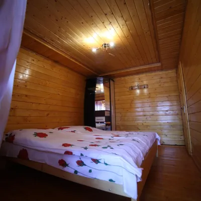
Stays offering fishing within 2 km of the river
Trails nearby
All trails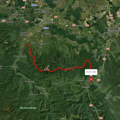 HardMulti-dayUnmarkedLukovo village to Svaliavavia Mount BuzhoraElevation profile165–1 085 m46.8 kmascent 1 967 m7.4 km from Borzhava River
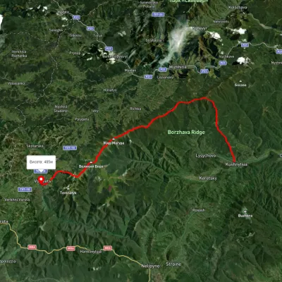 HardMulti-dayUnmarkedKushnytsia village to Volovetsvia Kuk polonyna, Mount Shyrokyi Verkh +3Elevation profile226–1 540 m47.1 kmascent 2 774 m8.9 km from Borzhava River
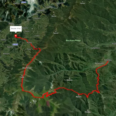 HardMulti-dayUnmarkedKerechky village to Rychka villagevia Mount Stiy, Mount Velykyi Verkh +2Elevation profile254–1 651 m48.3 kmascent 2 525 m14 km from Borzhava River
Nearby attractions
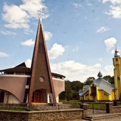 ArchitectureChurch of the Descent of the Holy Spirit, DovheDovheunder 1 km from Borzhava RiverThis applies not only to ancient wooden churches, but also to modern ones, such as the Church of the Descent of the Holy Spirit in Dovhe.
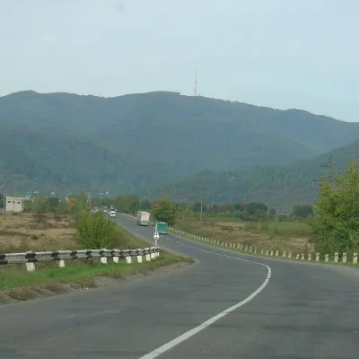 PeakMount TupyiImstychovoaltitude 878 m · Volcanic Carpathians range11 km from Borzhava RiverTupyi is the highest summit of the massif of the same name, part of the volcanic ridge of the Ukrainian Carpathians.
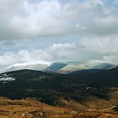 Mountain meadowPolonyna-KukMizhhiriaaltitude 1 189 m · Borzhava range18 km from Borzhava RiverVery beautiful scenery, there is a spring and places to spend the night with a tent down the road to Mount Cook.