Mountain Polyanytske Lake (Dead Lake)
Mountain Lake (another name - Dead Lake) is a picturesque mountain lake of natural origin in the Ukrainian Carpathians (the Skole Beskids massif). It is located within the Bolehiv City Council of Ivano-Frankivsk region, to the west of the village of Polyanytsia, to the northwest of the village of Bukovets, and to the southwest of the Dovbush Rocks in Bubnyshche - at a distance of 4.0 km.
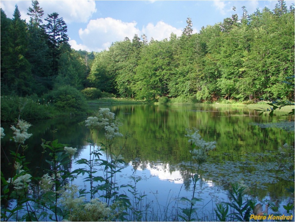
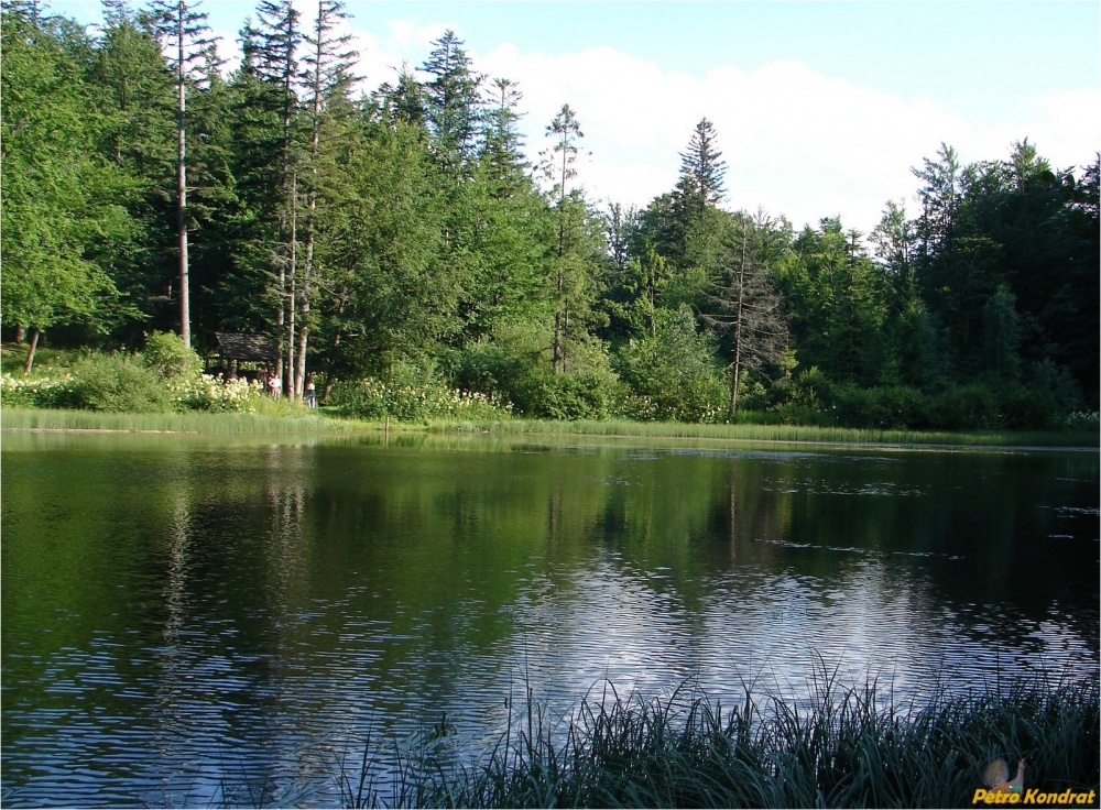
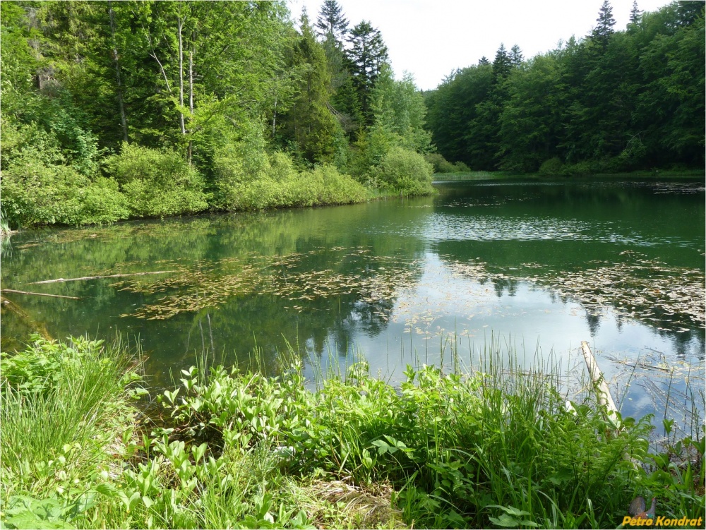
The lake is elongated, about 70 meters long. It was formed on one of the left tributaries of the Ozgra stream, at an altitude of 785 m above sea level, amidst mature spruce-beech forest, and is rare and unique for the nature of the Skole Beskids. The water in the lake is clear, but due to high hydrogen sulfide saturation, higher living organisms are absent, which is why the lake has another name - Dead Lake; along the shore, there are many marshy areas. This makes the lake very similar to Zhuravlyne Lake, which is located lower than the village of Kam'yanka in the Skole district. Not far away, 5 km to the west of it, along one mountain ridge.
The lake is located within the forest massif, in the territory of the Polyanytsia Regional Landscape Park. Since 1996, it has been protected as a natural monument of local significance. Mountain Lake is a little-known tourist attraction.

It occupies an area of up to 0.30 ha and is fed by its own spring as well as two streams. One outlet flows into the Sukil River near the village of Bukovets. The bottom is muddy, with a layer that reaches 3 meters even near the shores. The water is clear. It is rich in natural gas-methane. There are quite a few submerged trees at the bottom. Until recently, it was completely "dead" for any aquatic life. The only master was the Carpathian newt. It has been stocked by nature enthusiasts. Currently, trout, which spawns in one of the streams, carp, and a rare species for the Carpathians - the rotan, are found here.
To the east of the lake, within a kilometer, there are many boulders in the forest, some of which are up to 20 meters high. There are places where the rocks form impassable walls up to 200 meters long. Starting gently in the lowland, they end with steep cliffs. Wolves actively used this feature for their hunts on deer. An animal driven to a narrow sharp peak was doomed.
There are several legends regarding such a name. One of them says that when the lord seized the fields of the local farmer, the ground collapsed, and a deep lake was formed in that place. You can have a good rest here, but if you decide to swim, you must be very careful - the depth of the lake reaches 18 meters. From the lake, along the stream that flows from it, a road (4 km - 1.5 hours walk) leads down to the village of Bukovets.
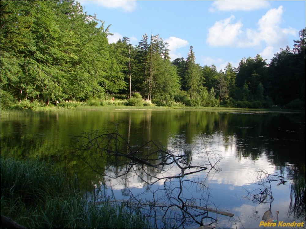
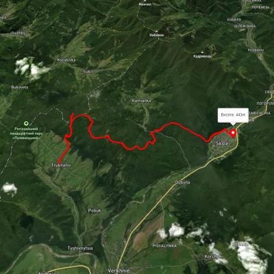
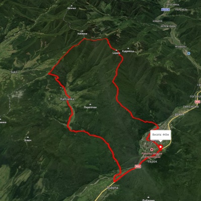
You can get here from the villages of Polyanytsia, Bukovets, Sukil of Bolehiv City Council, or Trukhaniv in the Skole district. Our route goes from Bukovets. The route is not the best, not closer or easier than any other. The goal was to walk along the paths that were once walked long ago and reach the Dovbush Rocks. At the end of the village, near the sawmill, we turn right from the road, cross the bridge over the Sukil River, and immediately find ourselves in the forest. Further, there is a forest road, parallel to which a stream gurgles with many playful cascades-waterfalls. I will let you in on a secret, I was guided by them when choosing the route. Long ago, even with "Smena", I ran here trying to photograph a strange bird, the dipper, and the waterfalls themselves. When that was... And where are those dippers! Two kilometers of tolerable road, no birds in sight, cloudy, and dark in the woods. What photography here? On both sides of the slopes - forest wilderness, post-logging state. This is something, you have to see. And the stream gurgles... Further, the road as such completely disappears, there is not even a path in places. We jump from stone to stone across the stream bed. (Here I chose a route for my companion!). Twenty years ago, after heavy rains and floods, everything was washed away, both the road and the bridges. In my soul, I rejoice, from here the forest will definitely not be cut down. Nature itself has tried. There is no technique capable of passing this debris of stones, rapids, tree fragments, stumps, landslides in nature. Not even a tank... And here further such firs, two wraps... And no traces of a tractor.Finally, between the tree trunks, the surface of the lake began to appear. There is always an exciting feeling when you approach it like this. In the Carpathians, there are not so many natural mountain lakes, and if for someone this is just a "puddle", for a local resident, it is already something. I remembered what impression it made when I first saw it. On a warm summer day, wandering among the mountains in the mature spruce forest, I felt some freshness, coolness of the water. Descending down the slope, I stumbled upon a stream and already followed it to the lake. The lake was surrounded by broad spruce trees, which were reflected on the surface of the water. Where these spruces are, below or above, where is the sky, it is immediately hard to tell. In my head, there is a swirl, some loss of orientation in space. The water is crystal clear, through the many meters of depth, the bottom with the smallest details is visible. And the silence around was almost frightening. So I froze...And again, once... Somewhere in the seventies, they began to cut down these spruces above the lake. The foreman of the logging brigade, a hero of social labor, who was also a tractor driver, soaked each pack of felled trees in the lake for the entire length. The skidding was carried out right at the edge of the water, with a turn at a right angle. Thus, the tractor moves along the road, and the tops of the trees at the turn go over the lake, with all the mud, debris... And as a mockery of this, next to it was a sign: - "Mountain Lake. Rare in the Carpathians. Protected by law". It was long defended, many years. And something here is already not right. It started to overgrow, algae appeared. And the unfortunate tourists contribute, cutting down everything closer for fuel.We climb to the top of the ridge, heading towards the Dovbush Rocks. We pass this old logging area where once (again!) spruces grew. I think that on the taxational forestry maps, young plantings of spruce, larch "flourish" here... And of course! We are planting! The Carpathians will be green forever! In fact - aspen-birch "groves"... And nothing more.Here is the top. Below are villages, towns, and there are the Rocks, seemingly scattered among the forest. The weather has cleared, birds are chirping, meadows covered with tall grass, various colors of flowers warm the soul. Everything is good.About the fact that we "stumbled" again on a thicket of rowan-elderberry logging, and that it is complete and still in the nature reserve zone, and in another place "damaged by bark beetles" the felled trunks of these long-suffering spruces, I will remain silent. And somehow everything turned out not right. I just wanted to take beautiful photographs... (Source https://foto-kadr.io.ua/)
Experienced guides from the “Boykivshchyna” Museum (Dolyna) will help organize excursion tours through Dolynshchyna, if you want to see the Museum of the Insurgent Victory in Dolyna, the old saltworks, the bunker where Ukrainian nationalists hid, the Carpathian tram in Vygoda, the Dovbush Rocks in Bubnyshche, Shirkovec Swamp and the Mizun Waterfalls near Novyi Mizun or Hoshiv Monastery, the Ivan Franko Museum in the village of Lolin.
Accommodation around Mountain Polyanytske Lake (Dead Lake):


Which trails pass by Mountain Polyanytske Lake (Dead Lake)?
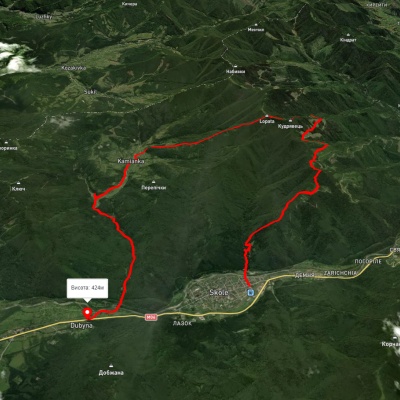
We suggest these hiking trails through or near Mountain Polyanytske Lake (Dead Lake): Trukhaniv village, via Mount Kliuch, Lake Zhuravlyne and Kamianka Waterfall to Skole, Skole, via Mount Lopata, Mount Khom, Kamianka village, Kamianka Waterfall and Dubyna village to Skole, Lybokhora village, via Mount Matahiv to Kozakivka village, Skole, via Mount Lopata and Kamianka Waterfall to Dubyna village, Dubyna village, via Kamianka Waterfall, Mount Lopata and Mount Matahiv to Tukhlia village, Kamianka village, via Mount Lopata, Skole and Mount Parashka to Krushelnytsia village

Trukhaniv village, via Mount Kliuch, Lake Zhuravlyne and Kamianka Waterfall to Skole
Skole, via Mount Lopata, Mount Khom, Kamianka village, Kamianka Waterfall and Dubyna village to Skole
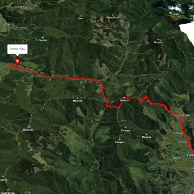
Lybokhora village, via Mount Matahiv to Kozakivka village
Skole, via Mount Lopata and Kamianka Waterfall to Dubyna village