Sukil is a village subordinated to the Kozakivka village council within the Bolekhiv city council of Ivano-Frankivsk oblast. The village has a population of 516 people and 182 households. The area of the settlement is 115 hectares. It is located in the east of Ivano-Frankivsk region, within the Prykarpattia region. Located in a mountainous area and a valley of the Sukil River, there are several mountain lakes and small water cascades near the village. The village of Sukil is located in the hollow of the Sukil River. The village is located in a mountainous area within the Bolekhiv City Council (25 kilometers northeast of its center) and borders the village of Kamianka (Lviv region) to the west and the village of Kozakivka (Ivano-Frankivsk region) to the east. Living in a mountainous area, most of the villagers work in the forestry and farms, and also have the opportunity to work at the enterprises of Bolekhiv.
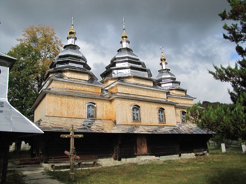
The first written mention of the village dates back to 1587. There are several versions of the origin of the name Sukil. It probably comes from the Tatar words: "su" - water, "keel" - running. Old-timers say that in ancient times there were about 900 houses in the village. People lived in the Kryvuliny, Boznyky, Plai, and Lavrivka tracts. There was a monastery in Lavrivka, and the foundation of the monastery is still standing today. Under the Lavrivka mountain there is an artificial cave-room with carved niches for the guards and a large supply of fresh water. Until 1983, the Church of St. Michael kept 350- and 500-year-old icons that were barbarically destroyed by atheists. In 1861 the church of St. Michael was built.
The village of Sukil lies in a picturesque mountainous area among the mountains of the Skole Beskydy, in the valley of the Sukil River.
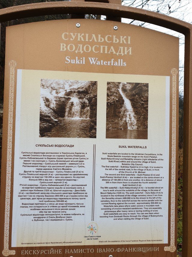
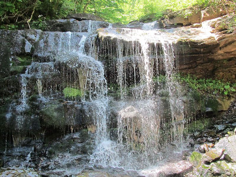
Near the village of Sukil there are the Sukil waterfalls on the streams Sukil-Playsky, Sukil-Nabivkivsky and Berezhky (right tributaries of the Sukil River). The territory of the village is divided into mountainous and foothill areas.
The largest mountain in the vicinity is Nabyvky (1225 m), which offers wide views in sunny weather.
The first written mention of the village dates back to 1587. There are several versions of the origin of the name Sukil. According to one of them, the name "Sukil" comes from Tatar words: "su" - water, "keel" - running. According to legend, in ancient times there were about 900 houses in the village. The village is home to the Sukil forestry of the Bolekhiv Forestry Plant. There are protected areas on the territory subordinated to the forestry:
- Basarabka (protected tract)
- Zelemen (protected tract)
- Nabyvky (a natural monument).
The village has a wooden church of St. Michael, built in 1861, an architectural monument of local significance No. 746.
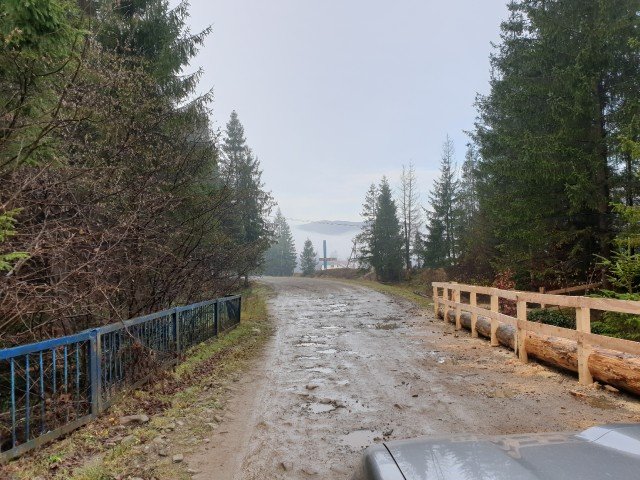
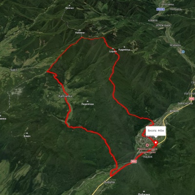
The distance from Bolekhiv to Sukil is 25 km and the drive takes 50 minutes. The village of Sukil lies exactly in the middle between the two tourist centers: Dovbush Rocks and Kamianka Waterfall. If not for the terrible road, it could be a Carpathian version of the Golden Horseshoe. As it is, it's only possible by jeep. In general, it takes 2.5 hours to get from Lviv to Sukil.
At the entrance to the village, there is the first waterfall, "Sukilskyi Nyzhnii". There is a small sign near it describing the entire cascade of waterfalls.