One of the most picturesque places in the Ukrainian Carpathians is undoubtedly the Chornohora range, with the highest peak in our country - Hoverla. Climbing Hoverla is considered quite prestigious for most Ukrainian citizens. Moreover, you don't need to be a climber to climb Hoverla. Most often, the conquest of Hoverla starts from the Zaroslyak sports center, located near Vorokhta, in Ivano-Frankivsk region.
I should say right away that there are many routes to Hoverla. Two of them start from the Zaroslyak sports center. The base is located on the territory of the Carpathian National Nature Park. Therefore, when entering the park, you need to leave your data at the local checkpoint and pay a special fee (50 UAH per adult, 20 UAH per child).
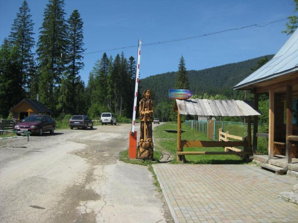
The road from the checkpoint to Zaroslyak is not paved and quite difficult. At the moment, the sign prohibiting the speed limit of 30 km/h looks rather anecdotal. No one in their right mind would drive faster on such a road.
The base itself has a small souvenir market. In addition, you can always have a snack and coffee here. There is a convenient paid (20 UAH) guarded parking lot for motorists.
As mentioned above, there are two routes to the highest peak in Ukraine from Zaroslyak: a longer one with green markings and a shorter one with blue markings. However, shorter does not mean easier. This route is only 3.7 km in one direction. However, you have to climb about 730 meters, so you need to be prepared for a constant rather steep climb.
The route starts in the forest, and it is well marked with tourist markers on the trees. A fairly large number of people always take this route. You have to climb in the forest along the roots of trees. At the same time, it is necessary to cross a rather picturesque mountain stream.
After a while, the trail leaves the forest and leads to an open area where you can take a break. There is a table and benches for this purpose. Further along the route, you don't have to dream about such amenities.
The trail leads up along the shrubs and leads to the so-called Zaroslyak meadow, from where you can already see the surrounding mountain peaks. However, Hoverla itself is not yet visible from here.

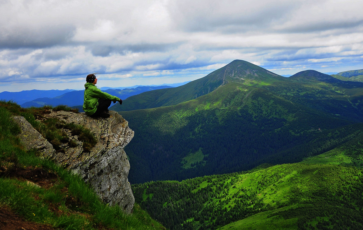
From here, a gradual ascent to the so-called Hoverla shoulders begins. Despite the fact that the distance does not seem to be long, most people often stop to rest. Meanwhile, an unforgettable panorama of the surrounding mountains begins to unfold around you, which becomes more and more impressive with every meter to the top.
At the same time, it is quite interesting to look at the people who are overcoming the path you have already traveled far below. It is by comparing these people to the majesty of the mountains that you can realize how grandiose the area is.
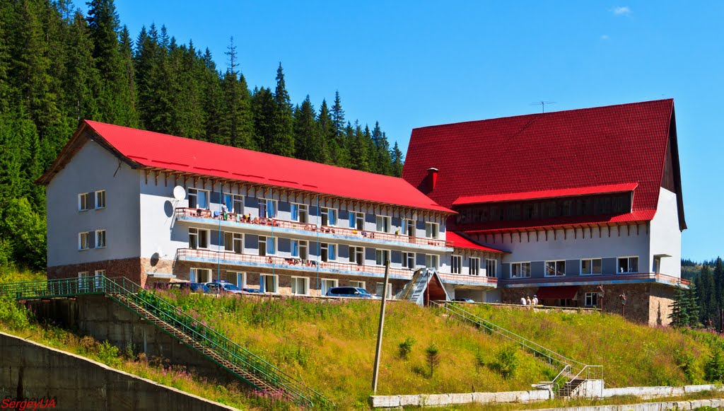
Far below, you can see the red roofs of the Zaroslyak sports complex, where this route to Hoverla began.
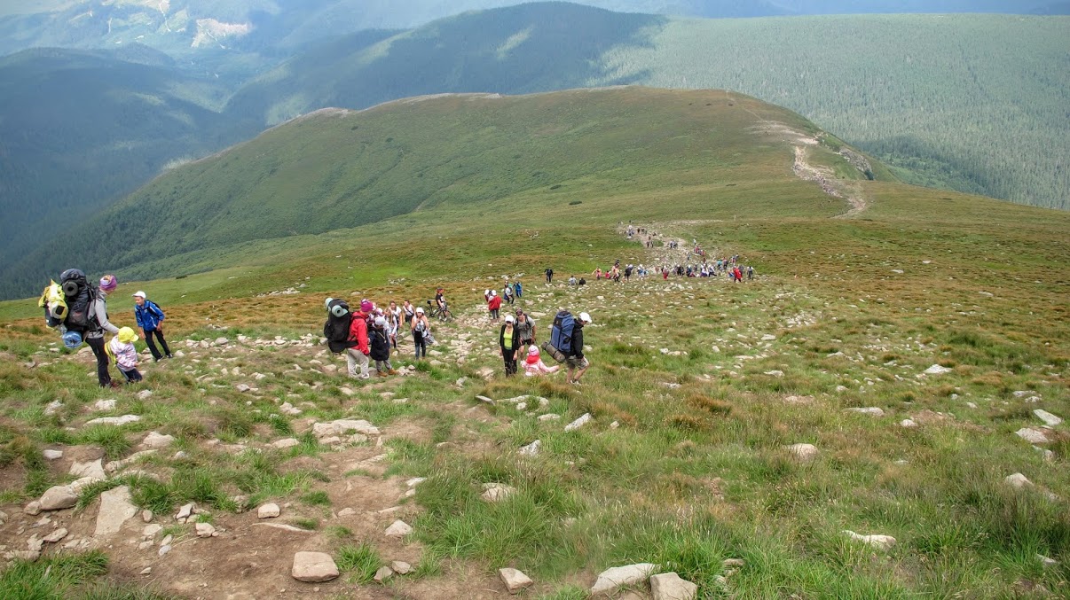
Having overcome several "shoulders" of the mountain, the summit is finally visible. But, as they say, the last meters are the most difficult. The greater the joy of finally having the summit at your feet. After all, what could be the best memory of a vacation in Yaremche if not the fact of climbing the highest mountain peak in Ukraine!
However, there are a few surprises waiting for you at the top of Hoverla. First of all, it is quite crowded here. Several dozen people are running around the top, taking pictures, planting flags and singing the national anthem. As for the flags, you can see flags of Ukrainian cities and regions in addition to the Ukrainian one.
At the same time, the views here are truly spectacular. In clear weather, you can see Ivano-Frankivsk, Sniatyn, and Kolomyia from the top of Hoverla. And if you look south, you can see the Romanian city of Sighetu Marmatiei.
To the southeast, you can see several peaks of the Chornohora ridge. The closest one is Hoverla's neighbor, Mount Breskul. Behind it is Mount Pozhyzhevska and other peaks of Chornohora. However, the most breathtaking panorama opens in the western direction. The majestic panorama of the Carpathian Mountains with the incredible Petros (2020 m) will be remembered for a lifetime. It is here that one of the best backdrops for photography is found.

As for the time you need to spend on this tour. On the stands in Zaroslyak, it says that you can climb to the top in 2 hours. Specialized literature provides less optimistic data. It takes up to 6 hours to climb and descend. However, local athletes run to the top of Hoverla in 45 minutes. In any case, everyone chooses their own pace, taking into account their health.