Hiking routes

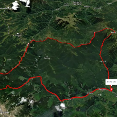
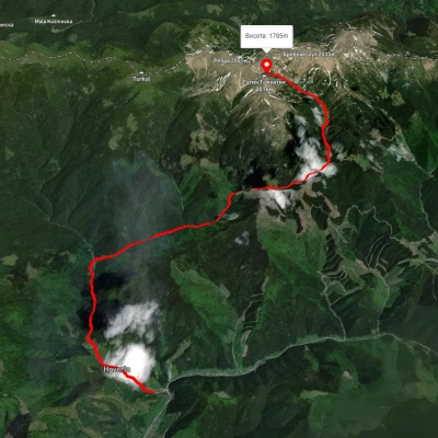
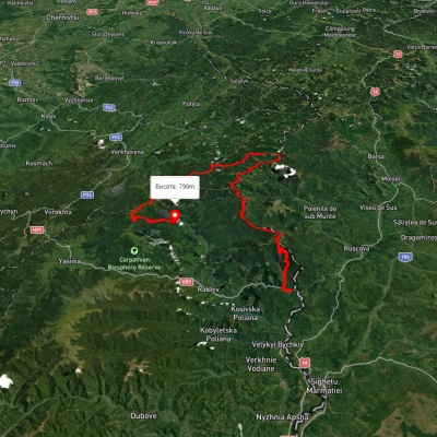
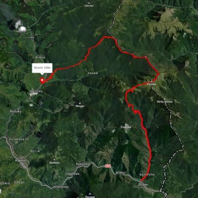
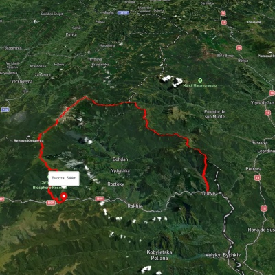
Bohdan village, via Mount Pip Ivan Marmaroskyi, Mount Mika-Mare, Mount Pip Ivan Chornohirskyi and Luhy village to Bohdan village
3D map
90 views
Length: 79.4km
Total ascent: 3621m
Total descent: 3621m
Minimum altitude: 525m
Maximum altitude: 1983m
More
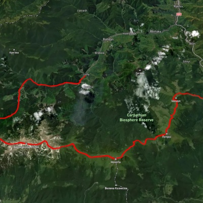
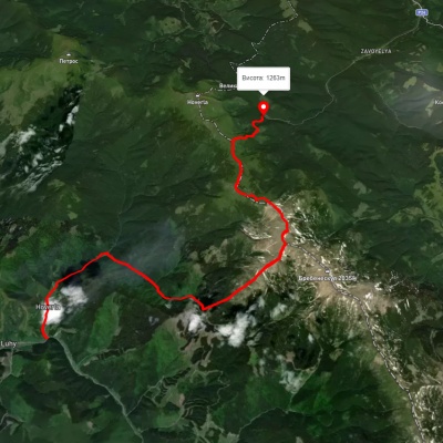
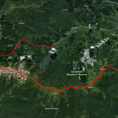
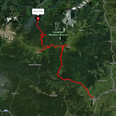
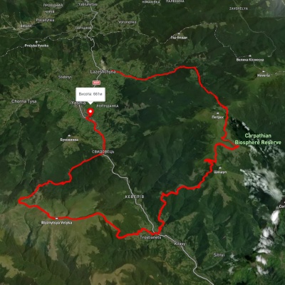
Kvasy village, via Mount Petros, Mount Hoverla and Hoverla village to Luhy village

Kvasy village, via Mount Petros, Mount Hoverla and Hoverla village to Luhy village

Three days or more
Unmarked
Passes through peaks: Mount Sheshul, Mount Petrosul, Mount Petros, Mount Hoverla
3D map
95 views
Length: 55.8km
Total ascent: 2207m
Total descent: 2131m
Minimum altitude: 539m
Maximum altitude: 2057m
More
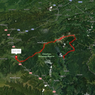
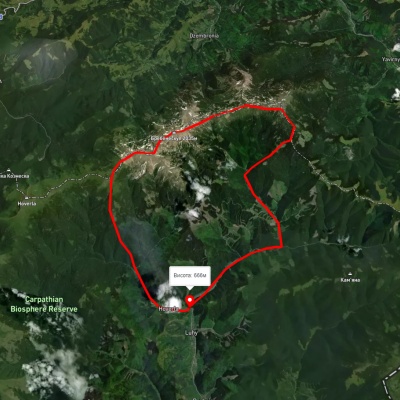
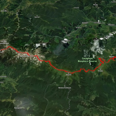
Yasinia, via Mount Petros, Mount Hoverla and Mount Pip Ivan Chornohirskyi to Luhy village

Yasinia, via Mount Petros, Mount Hoverla and Mount Pip Ivan Chornohirskyi to Luhy village

Three days or more
Unmarked
Passes through peaks: Mount Pip Ivan of Chornohora (Pip Ivan, Black Mountain), Mount Dzembronya, Mount Menchul, Mount Brebeneskul, Mount Gutin Tomnatik, Mount Rebra, Mount Turkul, Mount Danzig, Mount Pozhyzhevska, Mount Breskul, Mount Hoverla, Mount Petros, Mount Petrosul
3D map
88 views
Length: 61.4km
Total ascent: 3171m
Total descent: 3143m
Minimum altitude: 625m
Maximum altitude: 2033m
More
Luhy village, via Mount Pip Ivan Chornohirskyi, Mount Hoverla, Mount Petros and Mount Sheshul to Kvasy village
3D map
82 views
Length: 59.8km
Total ascent: 3454m
Total descent: 3550m
Minimum altitude: 532m
Maximum altitude: 2036m
More
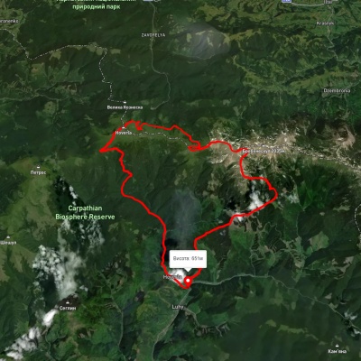
Luhy village, via Mount Hutyn Tomnatyk, Lake Brebeneskul, Lake Nesamovyte and Mount Hoverla to Luhy village
3D map
89 views
Length: 45.4km
Total ascent: 3607m
Total descent: 3607m
Minimum altitude: 650m
Maximum altitude: 2039m
More
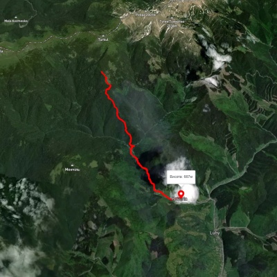
Luhy village – Lake Brebeneskul

Luhy village – Lake Brebeneskul

Two-day routes
Unmarked
Passes through peaks: Mount Gutin Tomnatik
3D map
89 views
Length: 16.4km
Total ascent: 1580m
Total descent: 430m
Minimum altitude: 647m
Maximum altitude: 1800m
More
Luhy village, via Mount Hutyn Tomnatyk, Mount Rebra, Lake Nesamovyte and Mount Pozhyzhevska to Zaroslyak base
3D map
108 views
Length: 22.4km
Total ascent: 1813m
Total descent: 1204m
Minimum altitude: 652m
Maximum altitude: 1999m
More
Luhy village, via Lake Nesamovyte, Mount Hoverla and Mount Petros to Kvasy village

Luhy village, via Lake Nesamovyte, Mount Hoverla and Mount Petros to Kvasy village

Three days or more
Unmarked
Passes through peaks: Mount Turkul, Mount Danzig, Mount Pozhyzhevska, Mount Breskul, Mount Hoverla, Mount Petros, Mount Petrosul, Mount Sheshul
3D map
80 views
Length: 37.8km
Total ascent: 2881m
Total descent: 2971m
Minimum altitude: 533m
Maximum altitude: 2032m
More
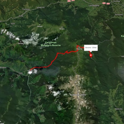
Luhy village, via Mount Pip Ivan Chornohirskyi, Mount Dzembronia, Mount Brebeneskul and Lake Nesamovyte to Hoverla village
3D map
81 view
Length: 38.9km
Total ascent: 1503m
Total descent: 1503m
Minimum altitude: 651m
Maximum altitude: 2019m
More
Luhy village, via Mount Pip Ivan Chornohirskyi, Mount Rebra, Mount Hoverla, Mount Petros and Mount Sheshul to Kvasy village
3D map
89 views
Length: 58.8km
Total ascent: 3435m
Total descent: 3530m
Minimum altitude: 532m
Maximum altitude: 2023m
More
Luhy village, via Mount Pip Ivan Chornohirskyi, Mount Hoverla and Mount Petros to Kvasy village

Luhy village, via Mount Pip Ivan Chornohirskyi, Mount Hoverla and Mount Petros to Kvasy village

Three days or more
Unmarked
Passes through peaks: Mount Pip Ivan of Chornohora (Pip Ivan, Black Mountain), Mount Dzembronya, Mount Menchul, Mount Brebeneskul, Mount Gutin Tomnatik, Mount Rebra, Mount Turkul, Mount Danzig, Mount Pozhyzhevska, Mount Breskul, Mount Hoverla, Mount Petros, Mount Petrosul, Mount Sheshul
3D map
94 views
Length: 57.1km
Total ascent: 3447m
Total descent: 3562m
Minimum altitude: 535m
Maximum altitude: 2033m
More
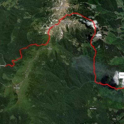
Turkulska polonyna – Hoverla village
3D map
70 views
Length: 8.5km
Total ascent: 341m
Total descent: 1197m
Minimum altitude: 687m
Maximum altitude: 1574m
More
Luhy village, via Mount Hoverla to Zaroslyak base

Luhy village, via Mount Hoverla to Zaroslyak base

Two-day routes
Unmarked
Passes through peaks: Mount Breskul, Mount Hoverla
3D map
80 views
Length: 23.7km
Total ascent: 1431m
Total descent: 816m
Minimum altitude: 665m
Maximum altitude: 2053m
More
Zaroslyak base, via Lake Nesamovyte, Mount Rebra and Lake Brebeneskul to Luhy village

Zaroslyak base, via Lake Nesamovyte, Mount Rebra and Lake Brebeneskul to Luhy village

Three days or more
Unmarked
Passes through peaks: Mount Danzig, Mount Turkul, Mount Rebra, Mount Gutin Tomnatik, Mount Brebeneskul
3D map
104 views
Length: 27.7km
Total ascent: 755m
Total descent: 1394m
Minimum altitude: 683m
Maximum altitude: 1966m
More
Hoverla village, via Mount Turkul, Mount Hoverla and Mount Petros to Yasinia

Hoverla village, via Mount Turkul, Mount Hoverla and Mount Petros to Yasinia

Three days or more
Unmarked
Passes through peaks: Mount Turkul, Mount Danzig, Mount Pozhyzhevska, Mount Breskul, Mount Hoverla, Mount Petros, Mount Petrosul
3D map
92 views
Length: 33.4km
Total ascent: 2358m
Total descent: 2380m
Minimum altitude: 646m
Maximum altitude: 2039m
More
Dilove village, via Mount Pip Ivan Marmaroskyi, Mount Chyvchyn, Shybene village, Mount Pip Ivan Chornohirskyi and Mount Hoverla to Hoverla village
3D map
96 views
Length: 162.3km
Total ascent: 5379m
Total descent: 4957m
Minimum altitude: 317m
Maximum altitude: 2020m
More
Lazeshchyna village, via Mount Petros and Mount Hoverla to Hoverla village

Lazeshchyna village, via Mount Petros and Mount Hoverla to Hoverla village

Three days or more
Unmarked
Passes through peaks: Mount Petros, Mount Petrosul, Mount Hoverla
3D map
88 views
Length: 44.6km
Total ascent: 2019m
Total descent: 1988m
Minimum altitude: 719m
Maximum altitude: 2033m
More
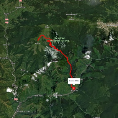
Bohdan village – Rohnieska polonyna

Bohdan village – Rohnieska polonyna

Two-day routes
Has yellow marking.
Passes through peaks: Mount Sheshul
3D map
91 view
Length: 23.4km
Total ascent: 1318m
Total descent: 2351m
Minimum altitude: 548m
Maximum altitude: 1658m
More
Hoverla village – Mount Brebeneskul

Hoverla village – Mount Brebeneskul

One-day routes
Has yellow marking.
3D map
83 views
Length: 10.5km
Total ascent: 35m
Total descent: 115m
Minimum altitude: 771m
Maximum altitude: 851m
More
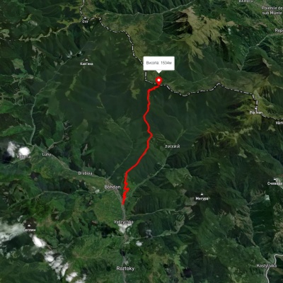
Bohdan village – Dovha polonyna

Bohdan village – Dovha polonyna

One-day routes
Has green marking.
Passes through peaks: Гора Довга
3D map
80 views
Length: 13.6km
Total ascent: 1382m
Total descent: 382m
Minimum altitude: 525m
Maximum altitude: 1554m
More
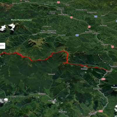
Dilove village, via Mount Pip Ivan Marmaroskyi to Bohdan village

Dilove village, via Mount Pip Ivan Marmaroskyi to Bohdan village

Three days or more
Unmarked
Passes through peaks: Berlebashka Mountain, Mount Pip Ivan of Marmarosh
3D map
92 views
Length: 42.4km
Total ascent: 2158m
Total descent: 1994m
Minimum altitude: 354m
Maximum altitude: 1903m
More
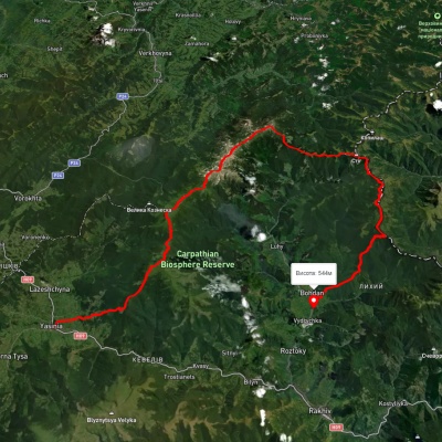
Yasinia, via Mount Petros, Mount Hoverla, Mount Pip Ivan Chornohirskyi and Mount Mika-Mare to Bohdan village
3D map
87 views
Length: 79.3km
Total ascent: 3765m
Total descent: 3887m
Minimum altitude: 528m
Maximum altitude: 2042m
More
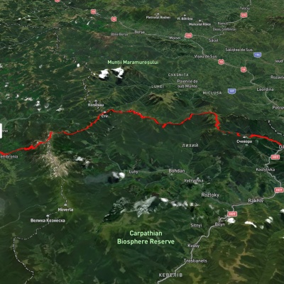
Dilove village, via Mount Pip Ivan Marmaroskyi and Mount Pip Ivan Chornohirskyi to Dzembronia village
3D map
97 views
Length: 71.7km
Total ascent: 3720m
Total descent: 3372m
Minimum altitude: 356m
Maximum altitude: 2015m
More
Holovcheska polonyna – Kvasy village

Holovcheska polonyna – Kvasy village

Two-day routes
Unmarked
Passes through peaks: Mount Petros, Mount Petrosul, Mount Sheshul
3D map
85 views
Length: 19.1km
Total ascent: 439m
Total descent: 1372m
Minimum altitude: 579m
Maximum altitude: 1613m
More
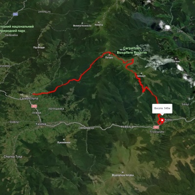
Lazeshchyna village, via Kozmeshchyk, Mount Petros and Mount Sheshul to Kvasy village

Lazeshchyna village, via Kozmeshchyk, Mount Petros and Mount Sheshul to Kvasy village

Three days or more
Unmarked
Passes through peaks: Mount Petros, Mount Petrosul, Mount Sheshul
3D map
100 views
Length: 34.8km
Total ascent: 2169m
Total descent: 2333m
Minimum altitude: 538m
Maximum altitude: 1999m
More
Lazeshchyna village, via Mount Petros, Mount Sheshul, Kvasy village, Mount Blyznytsia and Mount Stih to Yasinia
3D map
98 views
Length: 69.1km
Total ascent: 2758m
Total descent: 2821m
Minimum altitude: 537m
Maximum altitude: 1861m
More
Kvasy village, via Mount Petros, Mount Hoverla, Lake Nesamovyte, Mount Brebeneskul and Mount Smotrych to Dzembronia village
3D map
113 views
Length: 56.4km
Total ascent: 2349m
Total descent: 2185m
Minimum altitude: 499m
Maximum altitude: 1936m
More
Dilove village, Mount Pip Ivan Marmaroskyi, Mount Pip Ivan Chornohirskyi, Mount Hoverla and Mount Petros to Kvasy village
3D map
83 views
Length: 91.1km
Total ascent: 5532m
Total descent: 5340m
Minimum altitude: 359m
Maximum altitude: 2014m
More
Dilove village, via Mount Pip Ivan Marmaroskyi, Mount Pip Ivan Chornohirskyi, Mount Hoverla and Mount Petros to Yasinia
3D map
88 views
Length: 90.7km
Total ascent: 4982m
Total descent: 4703m
Minimum altitude: 363m
Maximum altitude: 2012m
More
Dilove village, via Mount Pip Ivan Marmaroskyi, Mount Mika-Mare and Mount Steavul to Mount Stih

Dilove village, via Mount Pip Ivan Marmaroskyi, Mount Mika-Mare and Mount Steavul to Mount Stih

Three days or more
Unmarked
Passes through peaks: Berlebashka Mountain, Mount Pip Ivan of Marmarosh, Mount Mala Nenieska, Mount Mica Mare, Mount Birsenscu, Mount Steavul, Mount Stig
3D map
97 views
Length: 45.1km
Total ascent: 3537m
Total descent: 2390m
Minimum altitude: 358m
Maximum altitude: 1923m
More

The Carpathian Mountains are one of the most beautiful places in Ukraine, attracting people from all over the world. These mountains stretch in the southwest of the country and consist of several mountain ranges, including Montenegro, Svydovets, Gorgany, Marmarosy, Beskydy, and others. Hiking routes in the Carpathians are a great way to experience the beauty of the mountain scenery and enjoy the fresh air. We'll take a look at the most popular routes for beginners and experienced hikers.


The most popular hiking routes in the Carpathians

The route to Mount Hoverla

The route to Mount Hoverla is the most popular route among tourists who come to the Carpathians. It is the highest mountain in Ukraine with a height of 2061 meters. Although the route is not too difficult, tourists should be prepared for long walks. Travel time depends on the route chosen, but on average it takes 5 to 8 hours. The best time to climb Hoverla is in summer or early autumn, when the weather is not as harsh as in winter, when the mountain is covered with snow.

Route to the Pip Ivan Chornohirsky mountain

Mount Pip Ivan Chornohirsky is the third highest mountain in the Carpathians after Hoverla and Brebeneskul. The height of its peak is 2028 meters. Another name for the peak is Chorna Hora, which gave the name to the Chornohora mountain range of the same name. The route to Pip Ivan Chornohirsky is more difficult than to Hoverla. It can take from 8 to 10 hours, depending on the route chosen. Tourists should be prepared to cross steep rocky areas. At the top of the mountain there is a stone tower, an old observatory, which offers a beautiful view of the Carpathians and the Chornohora range.

How to choose a hiking route

First of all, you should determine the level of physical fitness and experience of hiking in the mountains. For beginners, it is recommended to choose easy routes that do not require the use of special equipment. Experienced hikers can choose more difficult routes that include rocky areas and require the use of safety equipment.

It is also worth considering the time of year, as hiking routes in the Carpathians can be dangerous in winter or spring during snowmelt. The safest time for hiking is summer and fall.

You should also consider the length of the route and its complexity. It is not recommended to choose routes that take more than 10 hours if you do not have sufficient experience and physical fitness. For beginners, it is better to choose routes that take from 3 to 6 hours.

When choosing a route, you should also take into account the availability of springs, places for tents, where you can rest and have a snack.

Frequently asked questions about hiking routes in the Carpathians

Do I need special equipment for hiking in the Carpathians?

Some routes in the Carpathians may require special equipment, such as carabiners, a safety belt, ropes, etc. If you do not have enough experience or do not know how to use such equipment, it is better to contact an experienced guide or instructor.

Can I go hiking in the Carpathians on my own?

Yes, you can go hiking in the Carpathians on your own, but you should have sufficient experience and knowledge of the weather conditions and landscape of the region. You also need to be prepared for possible dangers and know how to act in case of emergency.

Is it safe to hike in the Carpathians?

Hiking in the Carpathians can be dangerous, especially in spring and winter. The safest time for hiking is summer and fall, but you should always consider the weather conditions and check the forecast before setting out on the route.

Hiking in the Carpathians is a great way to spend time outdoors, enjoy the panoramas and see the incredible beauty of this region. However, you should be well prepared before setting out on the route, taking into account the complexity of the route, weather conditions, and your own physical abilities. It is better to choose routes according to your abilities and experience, and if necessary, contact an experienced guide or instructor. Remember to be safe and enjoy your outdoor adventures!