Ask the AI guide:

Hiking routes

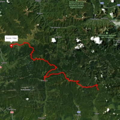
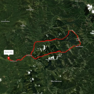
Osmoloda village, via Plistse polonyna, Mount Koretvyna, Mount Mala Popadia and Mount Velyka Popadia to Osmoloda village
3D map
38 views
Length: 42.6km
Total ascent: 1933m
Total descent: 2012m
Minimum altitude: 649m
Maximum altitude: 1731m
More
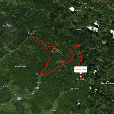
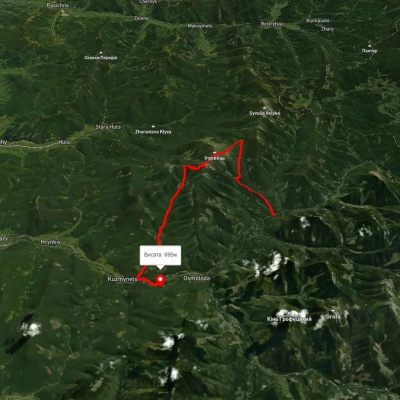
Osmoloda village, via Mount Ihrovets and Mount Vysoka to Osmoloda village
Osmoloda village, via Mount Ihrovets and Mount Vysoka to Osmoloda village

Ring routes
Unmarked
Passes through peaks: Mount Igrovets, Gora Vysoka, Srednya Mountain
3D map
42 views
Length: 24.8km
Total ascent: 1185m
Total descent: 1291m
Minimum altitude: 680m
Maximum altitude: 1795m
More
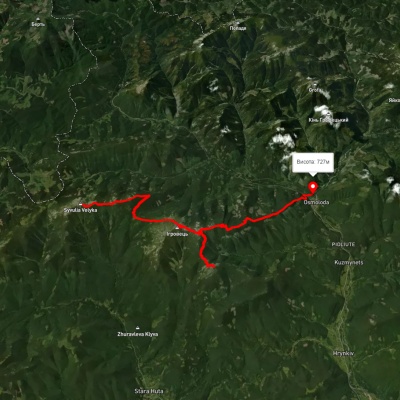
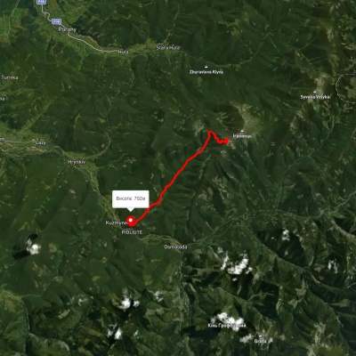
Kuzmynets village – Mount Vysoka

Kuzmynets village – Mount Vysoka

One-day routes
Has yellow marking.
Passes through peaks: Gora Vysoka, Srednya Mountain
3D map
48 views
Length: 11.1km
Total ascent: 372m
Total descent: 1446m
Minimum altitude: 693m
Maximum altitude: 1767m
More
Osmoloda village, via Mount Ihrovets, Mount Syvulia, Bystrytsia village, Mount Bratkivska, Mount Ruska and Mount Dohiaska to Dragobrat
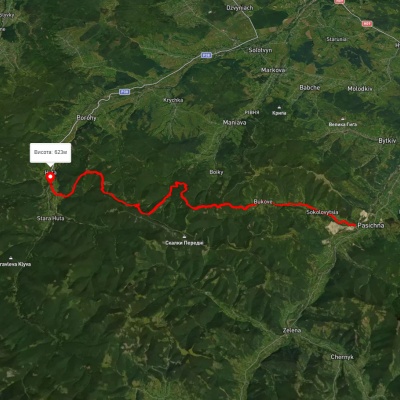
3D map
38 views
Length: 116.7km
Total ascent: 4557m
Total descent: 4026m
Minimum altitude: 687m
Maximum altitude: 1824m
More
Huta village – Pasichna village

Huta village – Pasichna village

Three days or more
Has red marking.
3D map
47 views
Length: 26.4km
Total ascent: 2293m
Total descent: 2190m
Minimum altitude: 524m
Maximum altitude: 1217m
More
Bystrytsia village, via Mount Boiaryn, Mount Syvulia, Stara Huta village, Mount Vysoka, Mount Ihrovets and Osmoloda village to Kuzmynets village
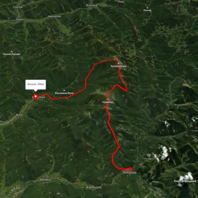
3D map
40 views
Length: 67.6km
Total ascent: 6302m
Total descent: 6325m
Minimum altitude: 661m
Maximum altitude: 1788m
More
Osmoloda, via Mount Vysoka, Mount Ihrovets and Mount Syvulia to Stara Huta village
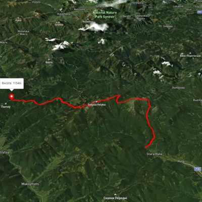
Osmoloda, via Mount Vysoka, Mount Ihrovets and Mount Syvulia to Stara Huta village

Three days or more
Unmarked
Passes through peaks: Gora Vysoka, Mount Igrovets, Mount Borevka, Mount Lopushnaya, Mount Velyka Sivulya, Mount Mala Sivulya
3D map
43 views
Length: 33.4km
Total ascent: 2125m
Total descent: 2185m
Minimum altitude: 651m
Maximum altitude: 1797m
More
Stara Huta village, via Mount Vysoka, Mount Ihrovets and Mount Syvulia to the Mali Rohodzy Pass
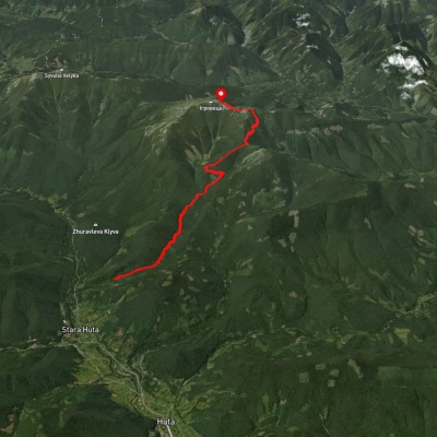
Stara Huta village, via Mount Vysoka, Mount Ihrovets and Mount Syvulia to the Mali Rohodzy Pass

Three days or more
Unmarked
Passes through peaks: Srednya Mountain, Gora Vysoka, Mount Igrovets, Mount Borevka, Mount Lopushnaya, Mount Velyka Sivulya, Mount Mala Sivulya
3D map
61 view
Length: 35.1km
Total ascent: 2581m
Total descent: 2137m
Minimum altitude: 705m
Maximum altitude: 1796m
More
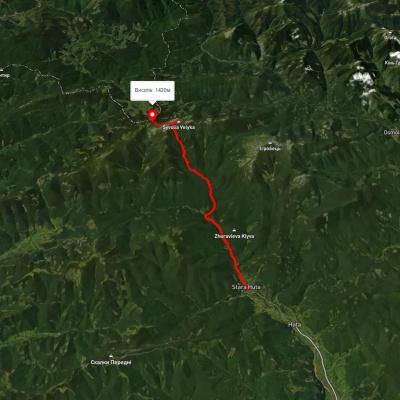
Stara Huta village, via Mount Vysoka to Mount Ihrovets
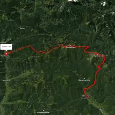
Stara Huta village, via Mount Vysoka to Mount Ihrovets

One-day routes
Unmarked
Passes through peaks: Srednya Mountain, Gora Vysoka, Mount Igrovets
3D map
42 views
Length: 12.5km
Total ascent: 1271m
Total descent: 239m
Minimum altitude: 754m
Maximum altitude: 1787m
More
Stara Huta village, via Mount Vysoka, Mount Ihrovets and Mount Syvulia to Bystrytsia village
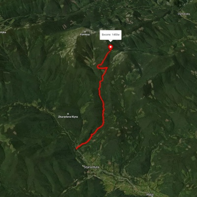
Stara Huta village, via Mount Vysoka, Mount Ihrovets and Mount Syvulia to Bystrytsia village

Three days or more
Unmarked
Passes through peaks: Srednya Mountain, Gora Vysoka, Mount Igrovets, Mount Borevka, Mount Lopushnaya, Mount Velyka Sivulya, Mount Mala Sivulya, Mount Negrova, Mount Boyarin (Korotkan)
3D map
39 views
Length: 41.7km
Total ascent: 2074m
Total descent: 2002m
Minimum altitude: 649m
Maximum altitude: 1797m
More
Stara Huta village – Serednia polonyna
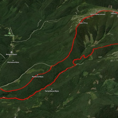
Stara Huta village – Serednia polonyna

One-day routes
Has blue marking.
Passes through peaks: Srednya Mountain
3D map
32 views
Length: 8.5km
Total ascent: 1059m
Total descent: 310m
Minimum altitude: 702m
Maximum altitude: 1451m
More
Stara Huta village, via Mount Vysoka and Mount Ihrovets to Stara Huta village
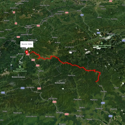
Stara Huta village, via Mount Vysoka and Mount Ihrovets to Stara Huta village

Ring routes
Unmarked
Passes through peaks: Mount Igrovets, Gora Vysoka, Srednya Mountain
3D map
48 views
Length: 21.2km
Total ascent: 1925m
Total descent: 1336m
Minimum altitude: 0m
Maximum altitude: 1789m
More
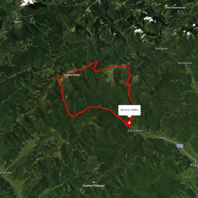
Stara Huta village, via Mount Vysoka, Mount Syvulia, Mount Durnia, Mount Bratkivska, Mount Tataruka and Mount Blyznytsia to Bilyn village
3D map
42 views
Length: 95.9km
Total ascent: 5130m
Total descent: 5353m
Minimum altitude: 481m
Maximum altitude: 1850m
More
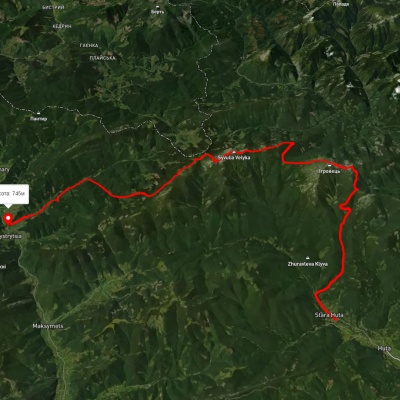
Stara Huta village, via Mount Vysoka, Mount Borevka, Mount Syvulia and Rushchyna polonyna to Stara Huta village
3D map
32 views
Length: 36.8km
Total ascent: 1710m
Total descent: 1709m
Minimum altitude: 685m
Maximum altitude: 1815m
More
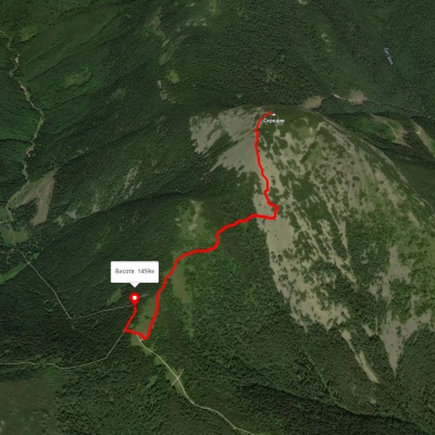
Stara Huta village, via Mount Vysoka, Mount Ihrovets and Mount Syvulia to Bystrytsia village

Stara Huta village, via Mount Vysoka, Mount Ihrovets and Mount Syvulia to Bystrytsia village
Three days or more
Unmarked
Passes through peaks: Srednya Mountain, Gora Vysoka, Mount Igrovets, Mount Borevka, Mount Lopushnaya, Mount Velyka Sivulya, Mount Mala Sivulya, Mount Negrova, Mount Boyarin (Korotkan)
3D map
34 views
Length: 39.9km
Total ascent: 2102m
Total descent: 2013m
Minimum altitude: 656m
Maximum altitude: 1795m
More
Hrynkiv village – Mount Serednia

Hrynkiv village – Mount Serednia

One-day routes
Has green marking.
Passes through peaks: Srednya Mountain
3D map
39 views
Length: 1.3km
Total ascent: 99m
Total descent: 280m
Minimum altitude: 1436m
Maximum altitude: 1617m
More
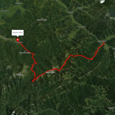
Mount Velyka Syvulia, via Mount Borevka, Mount Ihrovets, Mount Vysoka and Mount Serednia to Osmoloda village
3D map
40 views
Length: 27.8km
Total ascent: 1193m
Total descent: 2289m
Minimum altitude: 715m
Maximum altitude: 1818m
More
Bystrytsia village, via Mount Syvulia, Mount Lopushna and Mount Borevka to Stara Huta village

Bystrytsia village, via Mount Syvulia, Mount Lopushna and Mount Borevka to Stara Huta village
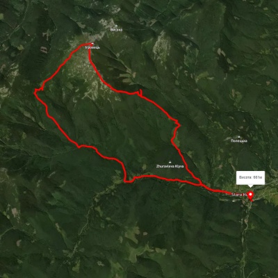
Three days or more
Unmarked
Passes through peaks: Mount Boyarin (Korotkan), Mount Negrova, Mount Mala Sivulya, Mount Velyka Sivulya, Mount Lopushnaya, Mount Borevka
3D map
34 views
Length: 43.8km
Total ascent: 1353m
Total descent: 1424m
Minimum altitude: 655m
Maximum altitude: 1825m
More
Stara Huta village – Mount Ihrovets – Stara Huta village
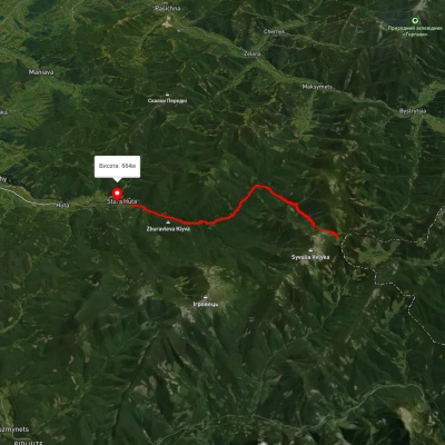
Stara Huta village – Mount Ihrovets – Stara Huta village
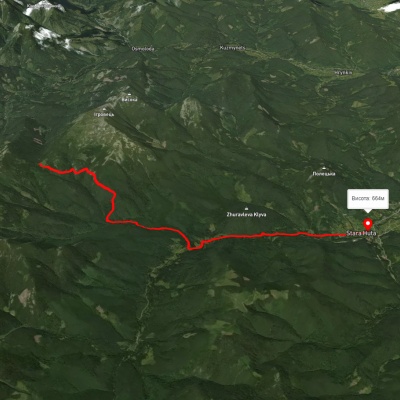
Ring routes
Unmarked
Passes through peaks: Mount Igrovets
3D map
33 views
Length: 29.9km
Total ascent: 1475m
Total descent: 1656m
Minimum altitude: 650m
Maximum altitude: 1797m
More
Stara Huta village – Borevka Pass

Stara Huta village – Borevka Pass

One-day routes
Has green marking.
3D map
33 views
Length: 12.2km
Total ascent: 431m
Total descent: 1091m
Minimum altitude: 662m
Maximum altitude: 1351m
More
Stara Huta village – Rushchyna polonyna

Stara Huta village – Rushchyna polonyna

Two-day routes
Has yellow marking.
3D map
36 views
Length: 15.6km
Total ascent: 486m
Total descent: 1236m
Minimum altitude: 662m
Maximum altitude: 1425m
More
Stara Huta village, via the Vodospadnyi Pass and Mount Velyka Syvulia to Rushchyna polonyna
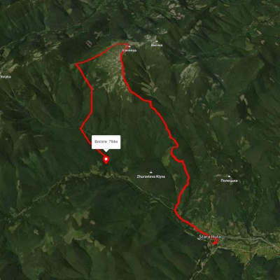
Stara Huta village, via the Vodospadnyi Pass and Mount Velyka Syvulia to Rushchyna polonyna

Two-day routes
Unmarked
Passes through peaks: Mount Velyka Sivulya, Mount Mala Sivulya, Mount Lopushnaya
3D map
31 view
Length: 20km
Total ascent: 1854m
Total descent: 1098m
Minimum altitude: 670m
Maximum altitude: 1834m
More
Stara Huta village, via Mount Ihrovets and Borevka Pass to Stara Huta village
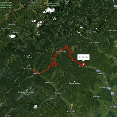
Stara Huta village, via Mount Ihrovets and Borevka Pass to Stara Huta village

Ring routes
Unmarked
Passes through peaks: Mount Igrovets
3D map
23 views
Length: 20.4km
Total ascent: 1494m
Total descent: 1394m
Minimum altitude: 698m
Maximum altitude: 1841m
More
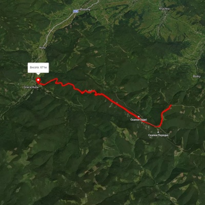
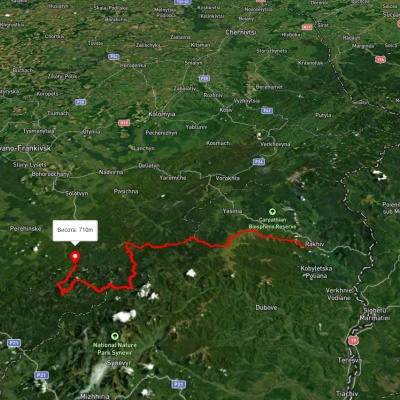
Bystrytsia village, via Mount Syvulia, Mount Lopushna and Mount Borevka to Stara Huta village

Bystrytsia village, via Mount Syvulia, Mount Lopushna and Mount Borevka to Stara Huta village
Three days or more
Unmarked
Passes through peaks: Mount Boyarin (Korotkan), Mount Negrova, Mount Mala Sivulya, Mount Velyka Sivulya, Mount Lopushnaya, Mount Borevka
3D map
30 views
Length: 43.5km
Total ascent: 1845m
Total descent: 2320m
Minimum altitude: 278m
Maximum altitude: 1820m
More
Huta – Poharchyna

Huta – Poharchyna

One-day routes
Has yellow marking.
3D map
40 views
Length: 11km
Total ascent: 1077m
Total descent: 1460m
Minimum altitude: 669m
Maximum altitude: 1269m
More
Rakhiv, via Mount Blyznytsia, Mount Troiaska and Mount Bratkivska to Osmoloda village
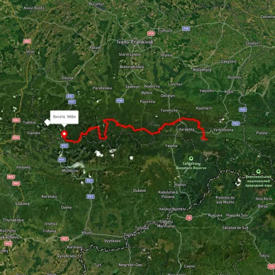
Rakhiv, via Mount Blyznytsia, Mount Troiaska and Mount Bratkivska to Osmoloda village

Three days or more
Unmarked
Passes through peaks: Mount Bliznytsia, Mount Stig (Dragobrat), Mount Bolshoi Kotel, Mount Dogyaska, Mount Trojaska, Mount Tataruka, Mount Bratkivska, Mount Grope, Mount Durnia, Mount End of Gorgan, Mount Velyka Popadia, Mount Mala Popadia, Mount Koretvina, Parenki Mountain, Mount Grofa, Mount Kin Grofetsky, Mount Moloda, Mount Yayko-Pereginske
3D map
46 views
Length: 134.1km
Total ascent: 7086m
Total descent: 6816m
Minimum altitude: 437m
Maximum altitude: 1858m
More
East Carpathian Tourist Trail

East Carpathian Tourist Trail

Three days or more
Has red marking.
Passes through peaks: Mount Horde, Mount Lisniv, Mount Khomiak, Mount Sinyak, Mount Maly Gorgan, Mount Boyarin (Korotkan), Mount Negrova, Mount Mala Sivulya, Mount Velyka Sivulya, Mount Lopushnaya, Mount Borevka, Mount Igrovets, Gora Vysoka, Mount Petros Gorgansky, Mount Velyka Popadia, Mount Mala Popadia, Mount Koretvina, Parenki Mountain, Mount Grofa, Mount Kin Grofetsky, Mount Moloda, Mount Yayko-Pereginske
3D map
44 views
Length: 278.1km
Total ascent: 14105m
Total descent: 14673m
Minimum altitude: 635m
Maximum altitude: 1819m
More
Bystrytsia village, via Mount Boiaryn, Mount Syvulia, Mount Ihrovets and Mount Vysoka to Osmoloda village
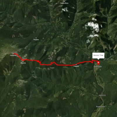
3D map
50 views
Length: 41.5km
Total ascent: 1060m
Total descent: 1063m
Minimum altitude: 387m
Maximum altitude: 929m
More
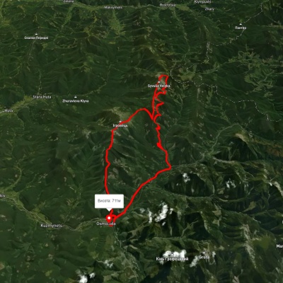
Osmoloda village, via Mount Ihrovets and Mount Vysoka to Osmoloda village

Osmoloda village, via Mount Ihrovets and Mount Vysoka to Osmoloda village
Ring routes
Unmarked
Passes through peaks: Gora Vysoka, Mount Igrovets
3D map
33 views
Length: 25km
Total ascent: 1409m
Total descent: 1370m
Minimum altitude: 679m
Maximum altitude: 1801m
More
Osmoloda village, via Mount Vysoka, Mount Borevka, Mount Lopushna and Mount Syvulia to Osmoloda village
3D map
42 views
Length: 44.1km
Total ascent: 2360m
Total descent: 2371m
Minimum altitude: 710m
Maximum altitude: 1790m
More

The Carpathian Mountains are one of the most beautiful places in Ukraine, attracting people from all over the world. These mountains stretch in the southwest of the country and consist of several mountain ranges, including Montenegro, Svydovets, Gorgany, Marmarosy, Beskydy, and others. Hiking routes in the Carpathians are a great way to experience the beauty of the mountain scenery and enjoy the fresh air. We'll take a look at the most popular routes for beginners and experienced hikers.


The most popular hiking routes in the Carpathians

The route to Mount Hoverla

The route to Mount Hoverla is the most popular route among tourists who come to the Carpathians. It is the highest mountain in Ukraine with a height of 2061 meters. Although the route is not too difficult, tourists should be prepared for long walks. Travel time depends on the route chosen, but on average it takes 5 to 8 hours. The best time to climb Hoverla is in summer or early autumn, when the weather is not as harsh as in winter, when the mountain is covered with snow.

Route to the Pip Ivan Chornohirsky mountain

Mount Pip Ivan Chornohirsky is the third highest mountain in the Carpathians after Hoverla and Brebeneskul. The height of its peak is 2028 meters. Another name for the peak is Chorna Hora, which gave the name to the Chornohora mountain range of the same name. The route to Pip Ivan Chornohirsky is more difficult than to Hoverla. It can take from 8 to 10 hours, depending on the route chosen. Tourists should be prepared to cross steep rocky areas. At the top of the mountain there is a stone tower, an old observatory, which offers a beautiful view of the Carpathians and the Chornohora range.

How to choose a hiking route

First of all, you should determine the level of physical fitness and experience of hiking in the mountains. For beginners, it is recommended to choose easy routes that do not require the use of special equipment. Experienced hikers can choose more difficult routes that include rocky areas and require the use of safety equipment.

It is also worth considering the time of year, as hiking routes in the Carpathians can be dangerous in winter or spring during snowmelt. The safest time for hiking is summer and fall.

You should also consider the length of the route and its complexity. It is not recommended to choose routes that take more than 10 hours if you do not have sufficient experience and physical fitness. For beginners, it is better to choose routes that take from 3 to 6 hours.

When choosing a route, you should also take into account the availability of springs, places for tents, where you can rest and have a snack.

Frequently asked questions about hiking routes in the Carpathians

Do I need special equipment for hiking in the Carpathians?

Some routes in the Carpathians may require special equipment, such as carabiners, a safety belt, ropes, etc. If you do not have enough experience or do not know how to use such equipment, it is better to contact an experienced guide or instructor.

Can I go hiking in the Carpathians on my own?

Yes, you can go hiking in the Carpathians on your own, but you should have sufficient experience and knowledge of the weather conditions and landscape of the region. You also need to be prepared for possible dangers and know how to act in case of emergency.

Is it safe to hike in the Carpathians?

Hiking in the Carpathians can be dangerous, especially in spring and winter. The safest time for hiking is summer and fall, but you should always consider the weather conditions and check the forecast before setting out on the route.

Hiking in the Carpathians is a great way to spend time outdoors, enjoy the panoramas and see the incredible beauty of this region. However, you should be well prepared before setting out on the route, taking into account the complexity of the route, weather conditions, and your own physical abilities. It is better to choose routes according to your abilities and experience, and if necessary, contact an experienced guide or instructor. Remember to be safe and enjoy your outdoor adventures!

Carpathian GuideOnline

Ask a question about travelling in the Carpathians to start a conversation.