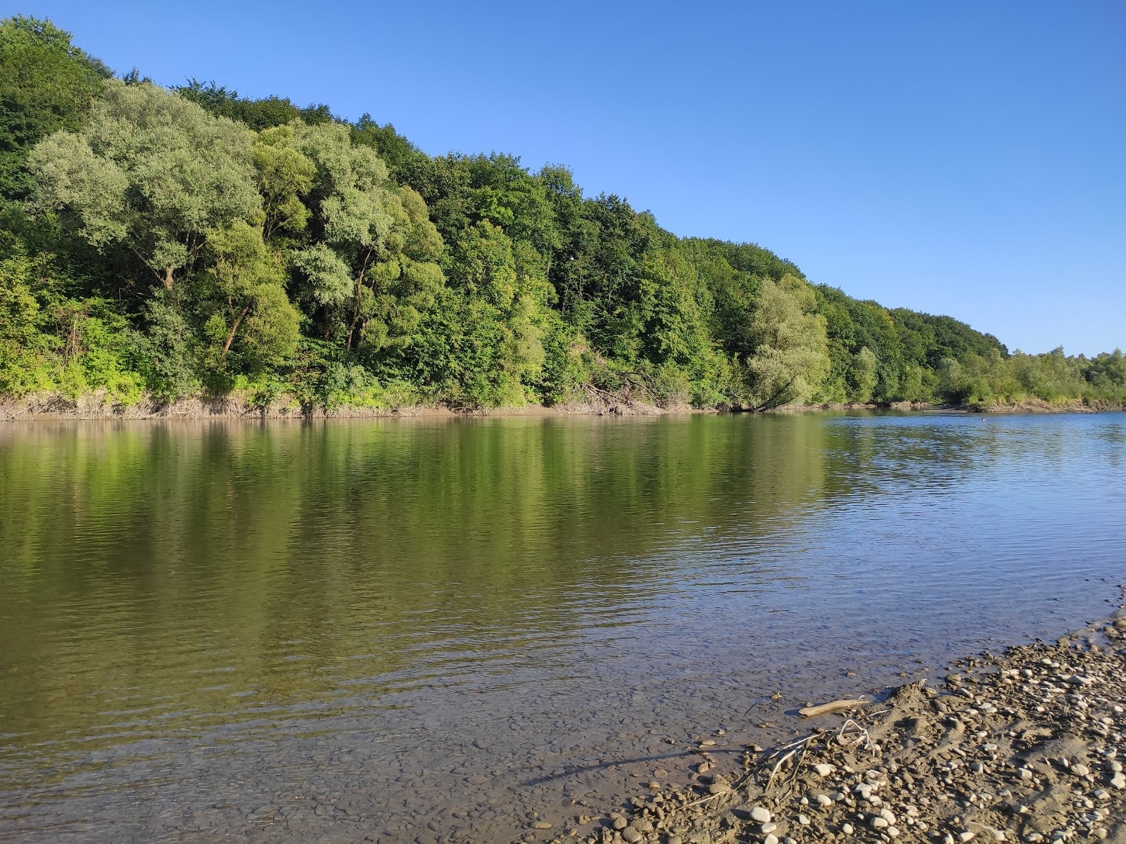
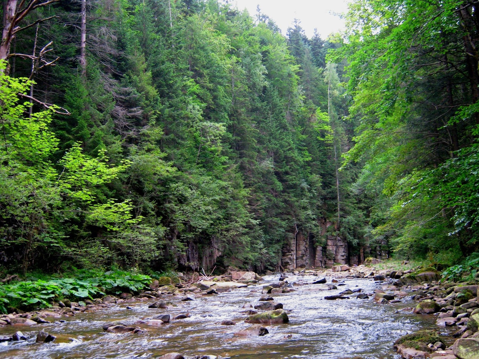
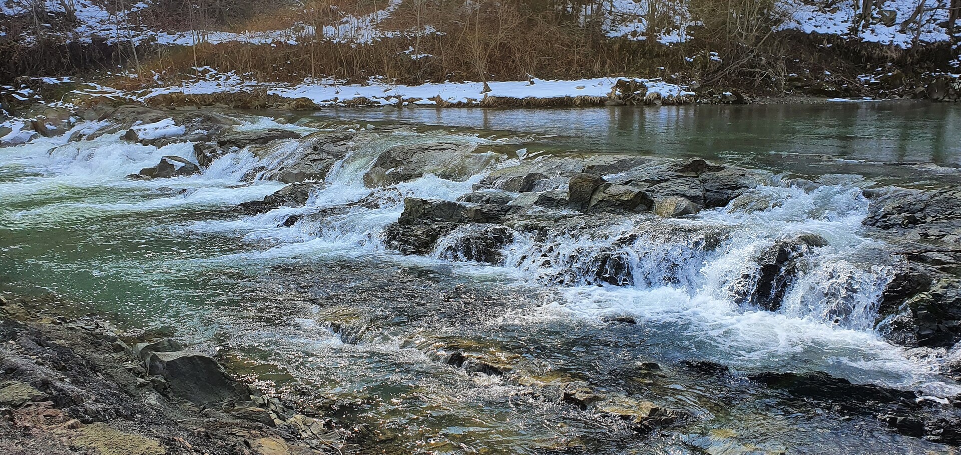
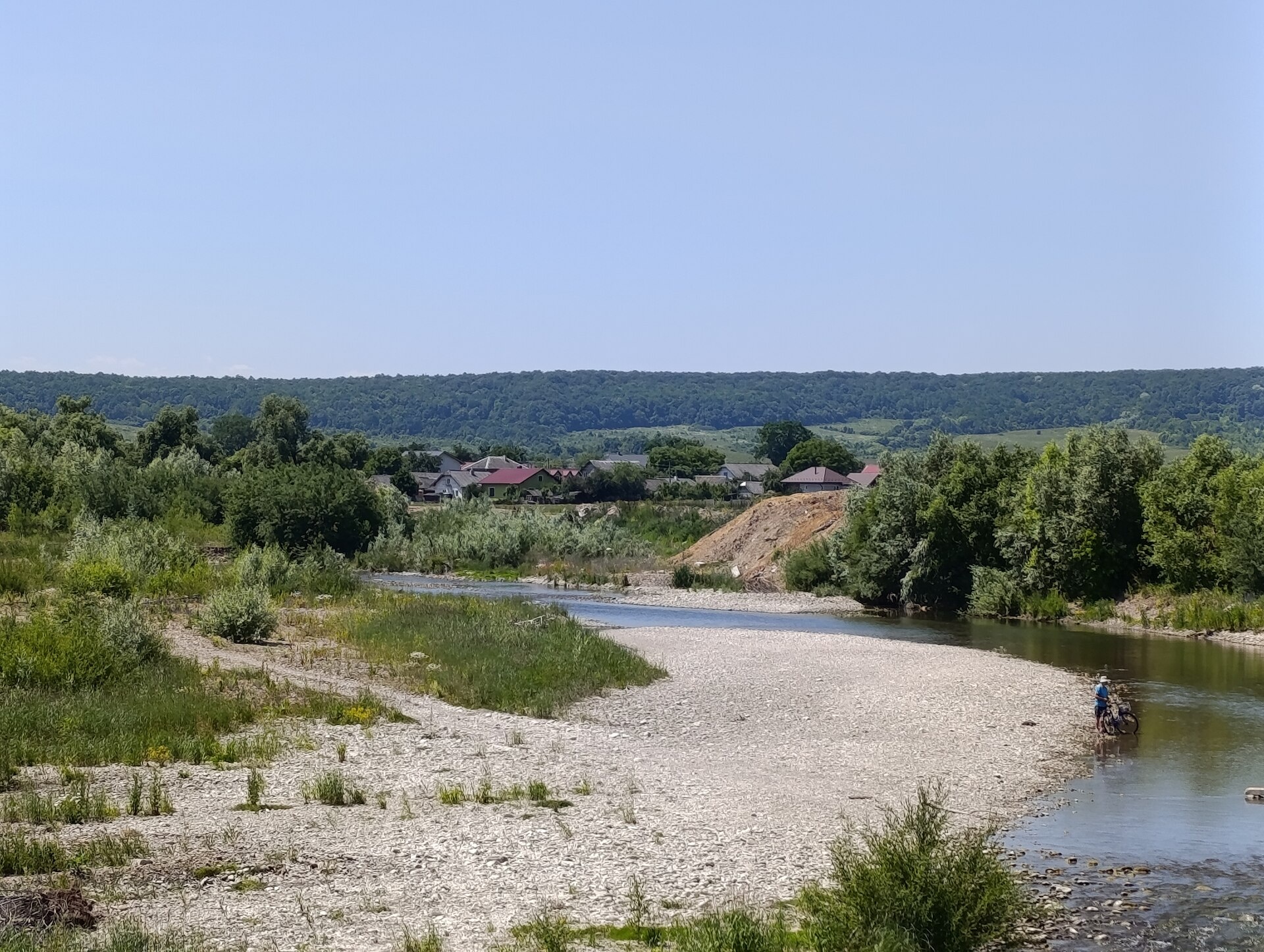
The Bystrytsia Solotvynska rises at about 1,390 m at the foot of Mala Syvulia and Bystryk, near the Peklo cliffs in the highest part of the Gorgany. Over 84 km it passes Porohy, Huta, Solotvyn, Stebnyk, Zhuraky and Drahomyrchany, and near Vovchynets in Ivano-Frankivsk it joins the Bystrytsia Nadvirnianska to form the Bystrytsia, a tributary of the Dniester.
On the river and its tributaries are the Maniava, Rakovets, Malyi Kuzmynets and Pid Komynom waterfalls. The area around Huta in the upper valley belongs to the Synohora National Nature Park. The upper water is clear and clean: at Stebnyk it is taken for the Ivano-Frankivsk water supply. The ponds that became Ivano-Frankivsk’s City Lake were once linked to the Bystrytsia Solotvynska by sluices.
The mountain course is trout water: 25,000 brown trout fry were released here in 2024. Surveys have found the Red Book Black Sea roach in the river, and the European bullhead and bitterling near Zhuraky. The river belongs to the Dniester basin, so the spawning closure runs from 1 April to 10 June, and trout may not be taken from 10 October to 1 March. Details are in the fishing section; for all waters see Fishing in the Carpathians.
- Length: 84 km
- Catchment: 795 km²
- Source: foot of Mala Syvulia and Bystryk (≈1,390 m)
- Mouth: confluence with the Bystrytsia Nadvirnianska near Vovchynets
- Oblast: Ivano-Frankivsk
Photos: S. Mochar, CC BY 4.0; S. Mochar, CC BY 4.0; Gudyma s, CC BY-SA 3.0; S. Mochar, CC BY-SA 4.0 — Wikimedia Commons.
Location on the map
Fishing on the Bystrytsia Solotvynska
The Bystrytsia Solotvynska is a clear-water Gorgany river flowing through Huta and Solotvyn to Ivano-Frankivsk. Its upper course is trout water; 25,000 fry were released here in 2024.
Can I fish now?
- Brown trout — closed until 1 MarchTrout spawning: closed from 10 October to 1 March in the Zakarpattia, Ivano-Frankivsk, Lviv and Chernivtsi regions.Each illegally caught fish costs UAH 7,225 in damages on top of the fine.
- Other species — allowed within the daily limitKeep to the minimum sizes and the daily limit; release protected species.
Limits and rules
During the spawning closure the patrol (2018 list) allowed fishing on the Bystrytsias only within Ivano-Frankivsk. The list is updated every year — check with the fisheries patrol.
Synohora National Nature Park
The upper course near Huta runs through the Synohora National Nature Park (10,866 ha, since 2009). In a national park fishing is only possible on stretches of the regulated recreation zone, and the park has no published fishing rules — contact the park administration before fishing.
What to catch
 Brown troutupper and middle course: Huta — Solotvyn · closed from 10 October to 1 Marchclosed until 1 March
In 2017 surveyors found the Red Book Black Sea roach (vyrezub) in the river, and the European bullhead and bitterling near Zhuraky and Drahomyrchany. There is no complete list of the river’s fish in the scientific literature.
Stocking 2024
25,000 young fish released into the river under the state stocking programme
- Brown trout25,000
Water quality
Monitoring post in Skobychivka (Ivano-Frankivsk water intake), last sampled on 25 August 2026.
- Dissolved oxygen10 mg O₂/lnorm at least 4
- Acidity, pH8.22norm 6.5–8.5
- BOD₅ (organic matter)1.1 mg O₂/lnorm up to 3
- Nitrates2.2 mg/lnorm up to 45
- Water temperature14 °C
All indicators are within the norms.
Bite forecast near Solotvyn
- TodayfairHigh pressure, moderate wind1025 hPa · wind up to 19 km/h · 7…9 °C
- TomorrowgoodHigh pressure, light wind1025 hPa · wind up to 14 km/h · 5…8 °C
- Saturday, 17 OctobergoodSteady pressure, light wind1019 hPa · wind up to 12 km/h · 6…9 °C
Brown trout closed. Based on pressure, wind, temperature and cloud — an estimate, not a guarantee.
Fishing spots 84
Places where you can drive up to the water: fish markers on the page map and the list below. Look at the satellite view before you go — the bank may be steep or overgrown.
Closed right now: brown trout — until 1 March.
- Dirt-road access on the Bystrytsia SolotvynskaAbout 90 m to the water from a dirt road. Nearest village (straight line): Stara Huta, 8.9 km.National park — fishing only in designated sections, check with the park
- Stream mouth on the Bystrytsia SolotvynskaAbout 50 m to the water from a dirt road. Nearest village (straight line): Stara Huta, 8.1 km.National park — fishing only in designated sections, check with the park
- Dirt-road access on the Bystrytsia SolotvynskaAbout 90 m to the water from a dirt road. Nearest village (straight line): Stara Huta, 7.8 km.National park — fishing only in designated sections, check with the park
- Stream mouth on the Bystrytsia SolotvynskaAbout 40 m to the water from a dirt road. Nearest village (straight line): Stara Huta, 7.0 km.National park — fishing only in designated sections, check with the park
- Dirt-road access on the Bystrytsia SolotvynskaAbout 90 m to the water from a dirt road. Nearest village (straight line): Stara Huta, 6.5 km.National park — fishing only in designated sections, check with the park
- Stream mouth on the Bystrytsia SolotvynskaAbout 70 m to the water from a dirt road. Nearest village (straight line): Stara Huta, 6.2 km.National park — fishing only in designated sections, check with the park
- Dirt-road access on the Bystrytsia SolotvynskaThe road comes almost to the water. Nearest village (straight line): Stara Huta, 5.9 km.National park — fishing only in designated sections, check with the park
- Dirt-road access on the Bystrytsia SolotvynskaAbout 150 m to the water from a dirt road. Nearest village (straight line): Stara Huta, 5.3 km.National park — fishing only in designated sections, check with the park
Show all spots (84)
- By the bridge, Stara Huta (4.8 km)About 70 m to the water from a local road. Bridge 90 m away. Nearest village (straight line): Stara Huta, 4.8 km.National park — fishing only in designated sections, check with the park
- Local-road access, Stara Huta (4.1 km)The road comes almost to the water. Nearest village (straight line): Stara Huta, 4.1 km.National park — fishing only in designated sections, check with the park
- Local-road access, Stara Huta (3.3 km)About 130 m to the water from a local road. Nearest village (straight line): Stara Huta, 3.3 km.National park — fishing only in designated sections, check with the park
- Local-road access, Stara Huta (2.6 km)About 80 m to the water from a local road. Nearest village: Stara Huta, 2.6 km.National park — fishing only in designated sections, check with the park
- Dirt-road access, Stara Huta (1.7 km)About 60 m to the water from a dirt road. Nearest village: Stara Huta, 1.7 km.National park — fishing only in designated sections, check with the park
- Dirt-road access, Stara HutaAbout 80 m to the water from a dirt road. Nearest village: Stara Huta, 960 m.
- Access road to the water, Stara HutaAbout 60 m to the water from an access road. Village: Stara Huta.
- Stream mouth, Stara HutaAbout 110 m to the water from the road. Village: Stara Huta.
- Stream mouth, Stara HutaThe road comes almost to the water. Nearest village: Stara Huta, 1.5 km.
- Stream mouth, HutaAbout 80 m to the water from a dirt road. Nearest village: Huta, 1.5 km.
- By the road, HutaThe road comes almost to the water. Nearest village: Huta, 1.2 km.
- By the main road, HutaAbout 120 m to the water from the main road. Village: Huta.
- Stream mouth, HutaAbout 140 m to the water from a dirt road. Village: Huta.
- Stream mouth, Huta (1.6 km)The road comes almost to the water. Nearest village: Huta, 1.6 km.
- Dirt-road access, Porohy (2.0 km)About 90 m to the water from a dirt road. Nearest village: Porohy, 2.0 km.
- Stream mouth, PorohyAbout 80 m to the water from a dirt road. Nearest village: Porohy, 1.1 km.
- By the bridge, PorohyAbout 40 m to the water from a dirt road. Bridge 110 m away. Village: Porohy.
- Stream mouth, PorohyAbout 60 m to the water from a dirt road. Nearest village: Porohy, 820 m.
- By the main road, Porohy (1.7 km)The road comes almost to the water. Nearest village: Porohy, 1.7 km.
- Stream mouth, Yablunka (2.0 km)About 130 m to the water from a dirt road. Nearest village: Yablunka, 2.0 km.
- Dirt-road access, YablunkaThe road comes almost to the water. Nearest village: Yablunka, 1.1 km.
- Stream mouth, YablunkaAbout 120 m to the water from the street. Village: Yablunka.
- Stream mouth, YablunkaAbout 120 m to the water from a dirt road. Nearest village: Yablunka, 1.1 km.
- Stream mouth, KrychkaThe road comes almost to the water. Nearest village: Krychka, 1.2 km.
- Dirt-road access, Kryvets (2.2 km)About 120 m to the water from a dirt road. Nearest village: Kryvets, 2.2 km.
- Stream mouth, Kryvets (2.0 km)About 40 m to the water from a dirt road. Nearest village: Kryvets, 2.0 km.
- Dirt-road access, RakovetsThe road comes almost to the water. Nearest village: Rakovets, 1.3 km.
- Stream mouth, RakovetsThe road comes almost to the water. Nearest village: Rakovets, 740 m.
- Stream mouth, RakovetsAbout 90 m to the water from a dirt road. Nearest village: Rakovets, 810 m.
- Dirt-road access, Solotvyn (1.5 km)About 110 m to the water from a dirt road. Nearest village: Solotvyn, 1.5 km.
- Dirt-road access, SolotvynThe road comes almost to the water. Village: Solotvyn.
- Stream mouth, SolotvynAbout 130 m to the water from the street. Nearest village: Solotvyn, 830 m.
- Stream mouth, MonastyrchanyAbout 60 m to the water from a dirt road. Nearest village: Monastyrchany, 1.3 km.
- Dirt-road access, MonastyrchanyAbout 90 m to the water from a dirt road. Nearest village: Monastyrchany, 730 m.
- Mouth of the Maniavka tributary, MonastyrchanyThe road comes almost to the water. Nearest village: Monastyrchany, 1.1 km.
- Stream mouth, Zhuraky (1.5 km)The road comes almost to the water. Nearest village: Zhuraky, 1.5 km.
- By the road, ZhurakyAbout 140 m to the water from the road. Village: Zhuraky.
- Stream mouth, ZhurakyAbout 70 m to the water from an access road. Village: Zhuraky.
- Access road to the water, ZhurakyAbout 140 m to the water from an access road. Nearest village: Zhuraky, 1.3 km.
- By the bridge, ZhurakyAbout 90 m to the water from a dirt road. Bridge 120 m away. Nearest village: Zhuraky, 1.5 km.
- Dirt-road access, DibrovaThe road comes almost to the water. Village: Dibrova.
- Dirt-road access, DibrovaAbout 90 m to the water from a dirt road. Nearest village: Dibrova, 750 m.
- Dirt-road access, Dibrova (1.6 km)The road comes almost to the water. Nearest village: Dibrova, 1.6 km.
- By the bridge, PidhiriaAbout 70 m to the water from the main road. Bridge 70 m away. Nearest village: Pidhiria, 1.1 km.
- Stream mouth, PidhiriaAbout 90 m to the water from an access road. Nearest village: Pidhiria, 1.1 km.
- Local-road access, PidhiriaAbout 120 m to the water from a local road. Nearest village: Pidhiria, 1.4 km.
- Access from a village street, Pidhiria (2.2 km)About 140 m to the water from the street. Nearest village: Pidhiria, 2.2 km.
- Dirt-road access, Bohorodchany (1.9 km)About 120 m to the water from a dirt road. Nearest village: Bohorodchany, 1.9 km.
- Dirt-road access, Stari BohorodchanyAbout 110 m to the water from a dirt road. Nearest village: Stari Bohorodchany, 1.4 km.
- Dirt-road access, Stari BohorodchanyThe road comes almost to the water. Nearest village: Stari Bohorodchany, 760 m.
- Dirt-road access, SkobychivkaAbout 120 m to the water from a dirt road. Village: Skobychivka.
- Dirt-road access, SkobychivkaThe road comes almost to the water. Nearest village: Skobychivka, 1.2 km.
- Dirt-road access, Skobychivka (1.9 km)The road comes almost to the water. Nearest village: Skobychivka, 1.9 km.
- Dirt-road access, Stebnyk (1.9 km)About 130 m to the water from a dirt road. Nearest village: Stebnyk, 1.9 km.
- Dirt-road access, StebnykAbout 140 m to the water from a dirt road. Nearest village: Stebnyk, 1.4 km.
- Access from a village street, StebnykAbout 120 m to the water from the street. Village: Stebnyk.
- Dirt-road access, StebnykAbout 120 m to the water from a dirt road. Village: Stebnyk.
- Dirt-road access, Staryi LysetsAbout 30 m to the water from a dirt road. Nearest village: Staryi Lysets, 1.1 km.
- Access road to the water, Staryi LysetsThe road comes almost to the water. Village: Staryi Lysets.
- Dirt-road access, LysetsAbout 50 m to the water from a dirt road. Nearest village: Lysets, 810 m.
- Dirt-road access, LysetsAbout 90 m to the water from a dirt road. Nearest village: Lysets, 1.4 km.
- Dirt-road access, DrahomyrchanyAbout 70 m to the water from a dirt road. Village: Drahomyrchany.
- Dirt-road access, DrahomyrchanyThe road comes almost to the water. Nearest village: Drahomyrchany, 710 m.
- Dirt-road access, PidlissiaAbout 80 m to the water from a dirt road. Nearest village: Pidlissia, 760 m.
- Local-road access, PidlissiaAbout 150 m to the water from a local road. Nearest village: Pidlissia, 1.2 km.
- Dirt-road access, KrykhivtsiAbout 110 m to the water from a dirt road. Nearest village: Krykhivtsi, 1.4 km.
- Dirt-road access, ZahvizdiaAbout 60 m to the water from a dirt road. Nearest village: Zahvizdia, 1.1 km.
- Access road to the water, ZahvizdiaAbout 130 m to the water from an access road. Village: Zahvizdia.
- Dirt-road access, ZahvizdiaAbout 150 m to the water from a dirt road. Nearest village: Zahvizdia, 720 m.
- Dirt-road access, KantAbout 40 m to the water from a dirt road. Village: Kant.
- By the main road, KantAbout 120 m to the water from the main road. Nearest village: Kant, 830 m.
- Access road to the water, KniahynynAbout 110 m to the water from an access road. Village: Kniahynyn.
- By the main road, KniahynynAbout 140 m to the water from the main road. Nearest village: Kniahynyn, 890 m.
- Access road to the water, KluzivAbout 70 m to the water from an access road. Nearest village: Kluziv, 1.4 km.
- Access from a village street, VovchynetsAbout 60 m to the water from the street. Nearest village: Vovchynets, 830 m.
- Dirt-road access, KluzivAbout 70 m to the water from a dirt road. Nearest village: Kluziv, 940 m.
Spots are marked from open data (roads and ways to the water, OpenStreetMap); if a spot is inconvenient or inaccessible, let us know. © OpenStreetMap, ODbL.
Springs: Recreational Fishing Rules (Order No. 700 of the Ministry of Agrarian Policy); State Fisheries Agency, Ivano-Frankivsk: trout spawning; State Fisheries Agency, Ivano-Frankivsk: spawning ban; Fisheries patrol: places open during the spawning ban; Law on the Nature Reserve Fund of Ukraine, art. 16, 18, 21; Wikipedia (uk): Bystrytsia Solotvynska; Wikipedia (uk): Synohora National Park; Wikipedia (uk): City Lake, Ivano-Frankivsk; State Fisheries Agency: fish stocking, data.gov.ua (CC BY); Kharchenko V. et al. Records of protected animal species in Ukraine (GBIF, CC BY 4.0); Records of protected animal, plant and fungi species in Ukraine, 2020 (GBIF, CC BY 4.0); Red Book of Ukraine animal list (Ministry of Environment Order No. 29, 2021); State Water Agency: water monitoring (CC BY); Weather forecast: MET Norway (CC BY 4.0). Rules may change — check the current orders of the fisheries patrol.
Comments
Where anglers can stay
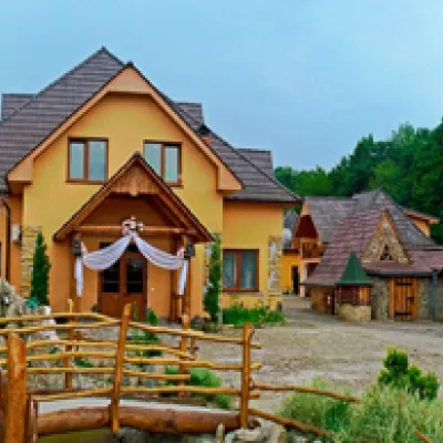
Stays offering fishing within 2 km of the river
Trails nearby
All trails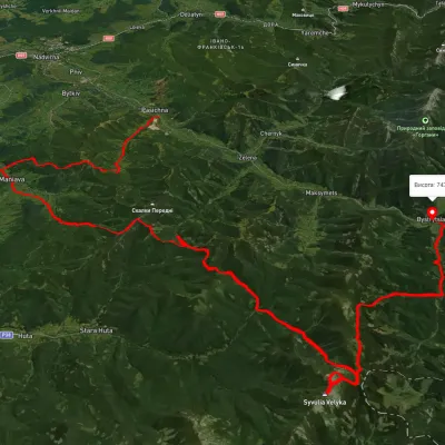 HardMulti-dayUnmarkedPasichna village to Bystrytsia villagevia Maniava village, Maniava Waterfall +1Elevation profile497–1 835 m69.7 kmascent 3 340 m5.8 km from Bystrytsia Solotvynska River
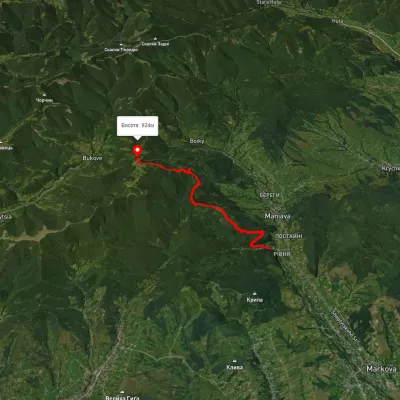 ModerateOne-dayMarkedManiava village Monastyretska polonynaElevation profile514–940 m7.3 kmascent 776 m≈ 3.5 h walking6.2 km from Bystrytsia Solotvynska River
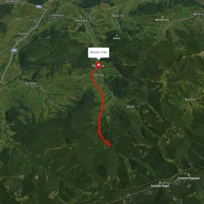 EasyOne-dayMarkedManiava village Maniava WaterfallElevation profile515–740 m7 kmascent 170 m≈ 2 h walking7.1 km from Bystrytsia Solotvynska River
Nearby attractions
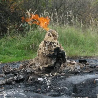 NatureMud volcano, StarunyaStarunia5.4 km from Bystrytsia Solotvynska RiverThe Starunya mud volcano is a geological natural monument that is unique not only in Ukraine but also in the world.
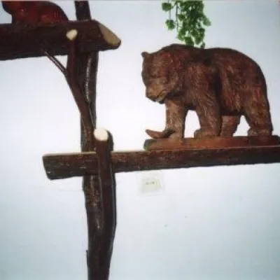 MuseumMuseum of the brown bearManiava6.9 km from Bystrytsia Solotvynska RiverThe initiator of this unusual museum in the village of Manyava was an ecologist Mykola Skidaniuk, who is concerned about the threat of the brown bear's complete...
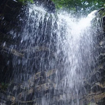 WaterfallKrapelkovyi waterfall (Monastyrsko-Bukhtivetskyi waterfall)Bukove12 km from Bystrytsia Solotvynska RiverKrapelkovyi waterfall is a waterfall in the Ukrainian Carpathians (Gorgany massif), within the Nadvirna district of Ivano-Frankivsk region.