Banilov-Pidhirny
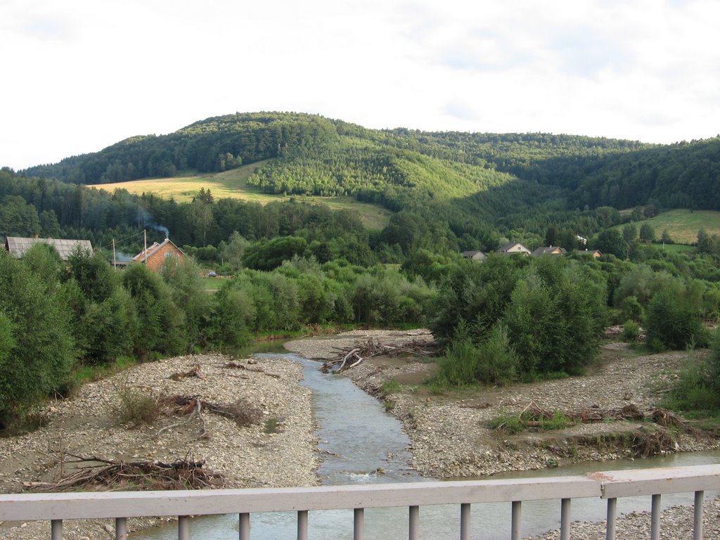
Banyliv-Pidhirnyi is a village in Ukraine, in the Chernivtsi region, Storozhynets district. The village is a real paradise for lovers of mountain nature. It is surrounded on almost all sides by the peaks of the Bukovyna Carpathians: to the west - Velyka Kichera (857 m) and Lyshechyny (878 m), to the southwest - Perekhrest (1013 m), Velyka and Mala Macherky (1027 m and 875 m respectively), Halechky Velyki (1012 m) and Bukova (1080 m), to the south - Rahidna (1028 m) and Paltyn (1097 m), and to the southeast - Volkhovny (817 m). It is not difficult to climb any of these mountains, and from their tops you will see an unforgettable panorama of other mountains of the Bukovynian Carpathians in the south and picturesque Carpathian villages in the north. Almost a Carpathian village, known since 1428. Until 1946, the village was called Banyla nad Seretom, and until 1963 it was simply called Banyliv. Banyliv-Pidhirnyi stretches for many kilometers along the Little Seret and its mountain tributaries.
Banyliv-Pidhirnyi is the easternmost village where Hutsuls live. No wonder they sing in kolomyikas:
Oh, shepherd, goldsmith,
Play the trembita,
Let the world hear about Banyl
All over the world.
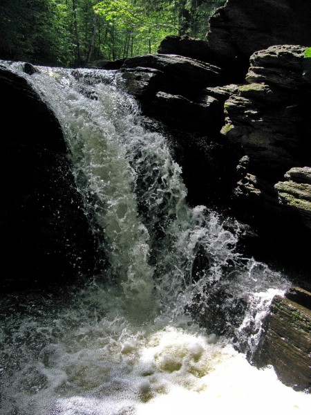
The village has a waterfall and healing mineral springs. In recent years, Banyliv-Pidhirnyi has become a significant center of rural "green" tourism. Every year the number of private tourist estates and, accordingly, the number of tourists increases. The huge village consists of several corners, each of which is usually stretched along small streams that carry their water through mountain gorges to the Small Seret. We will get acquainted with only a few of these corners that are of interest to the traveler.
Let's start with the village center. To reach it, you need to take the road with the signs, do not turn anywhere, regardless of the signs. The road leading from Cheresh along Malyi Seret runs almost through the entire village and is its main street. At the beginning of the village, the road is a real nightmare. But closer to the center, everything changes: the road is perfect there. The best road in Bukovyna, I would say. There are speed bumps every 50 meters.
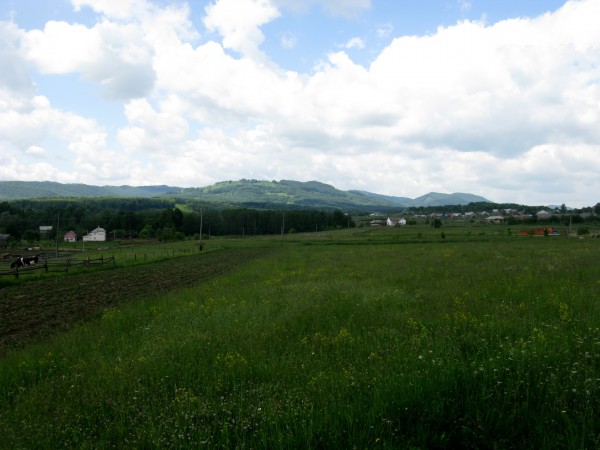
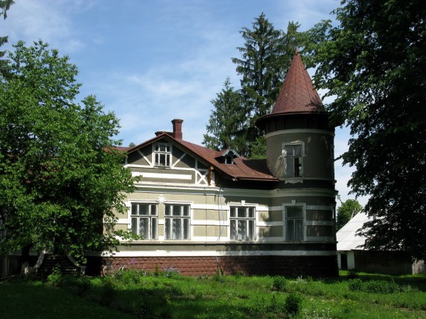
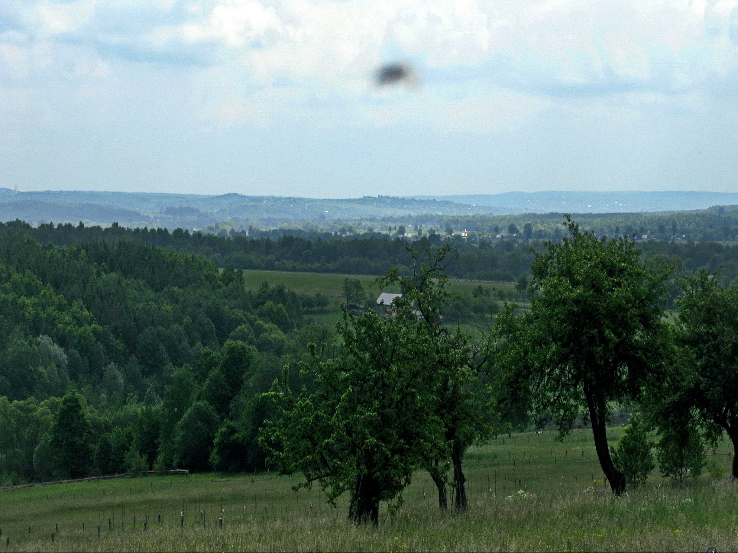
Banyliv is widely spread out on the Carpathian foothills, at the foot of mountains rich in mushrooms and berries. Spruce and beech forests have been preserved in this part of the Carpathians. Since the end of the eighteenth century, Polish settlers have lived here, joined by German colonists in 1830. Several solid brick buildings and villas in the center of Banyliv, as well as the modest palace of the Gross family, are a reminder of those times.
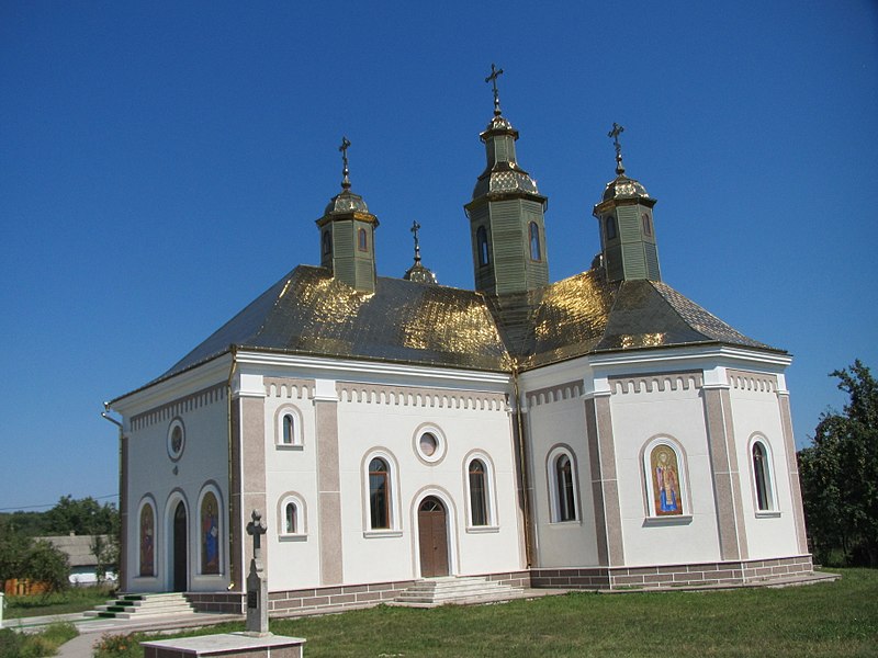
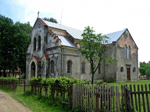
On the outskirts of Banyliv, the cemetery of the German settlement Augustendorf has been preserved to this day. In 1907, a Trinitarian monastery with a brick church of St. Martin was built in Augustendorf on the site of a wooden church (1881). Today, the cells house a children's boarding school and the "Pearl of the Mountains" camp. The church was used for some time as a classroom and gym. In 1993, part of the church was returned to the Catholics of the village.
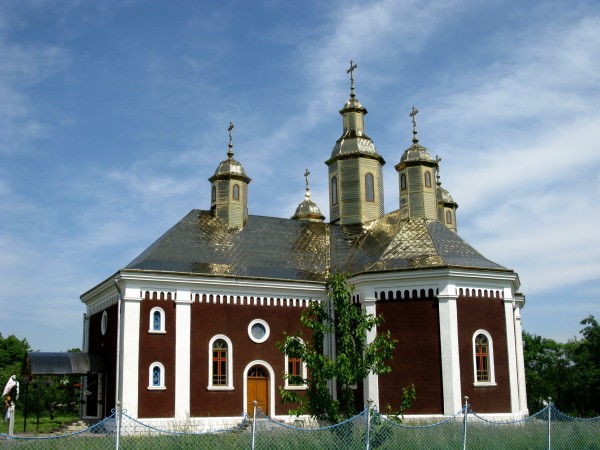
A 22.5 km branch of the narrow-gauge railway of the Bukovyna Local Railway, opened on October 15, 1908, passed through the village, the village of Hilche. On June 7, 2016, Archbishop Onufriy consecrated the chapel of the Forerunner and Baptist John in the village of Koshuia.
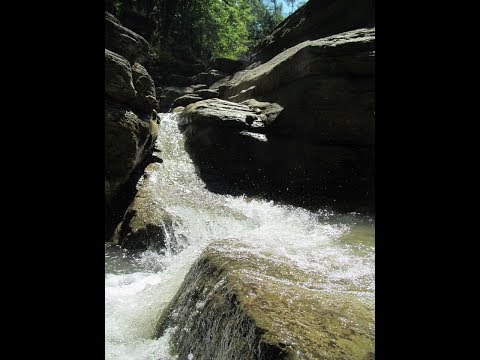
Banylivskyi Park is located in the village, and the Zubrovytsia general zoological reserve is located on the southern outskirts of the village, in the village of Hilche. Approximately 3 kilometers from Hilche, on the slope of Mount Volkhovnya, there is a little-known Korolivskyi waterfall with trout (3 m waterfall, segmented type, in the Hilche tract on the Dumytrytsia River, Malyi Siret River basin). In the village, the Solonets Velykyi river flows into the Malyi Seret.
Every May, just like in Putyla, the shepherds' departure to the meadows is celebrated here. The settlement has sources of chloride mineral waters. The Zubrovytsia tract is home to bison, a rare visitor to the Bukovyna Carpathians. In the Kechera tract, there is a spring whose water is good for psoriasis. The Malyi Solonets river, whose salty water was once used to extract salt, also originates from here. In the meadows above Banylove, wild orchids, European undergrowth, pear tree, and Kalgan grow.
Several radial streets diverge from the main street towards the mountains, leading to the so-called "kuty" - remote parts of the village. The most interesting of these corners is Koshelivka, where you turn right before reaching the center with the church. The village of Koshelivka, located along the Solonets stream, which flows into the Malyi Seret, was once an independent village. The village got its name because people used to weave baskets here, as vines grew on the banks of the Solonets.
Koshelivka is decorated with the wooden church of St. Dmytro, built in 1875 by craftsmen from Galicia. It was closed by the Bolsheviks in 1978. The school history of the village tells of the miraculous salvation of the church bells by the locals. By order of the then head of the village council, the authorities destroyed the iconostasis and icons. The bells were to be the next to go. Upon learning about this, the brave residents of Koshelivka buried three bells in three different corners of the village, thus saving them from the god-haters. After 8 years, in 1986, the church bells were heard again in Koshelivka.


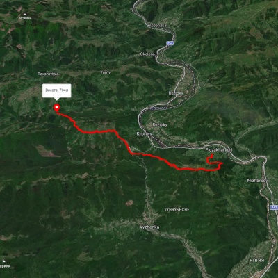
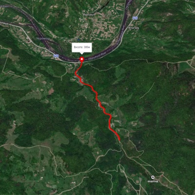
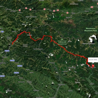
Which hiking trails pass through or near Banilov-Pidhirny?
We suggest these hiking trails through or near Banilov-Pidhirny: Nimchych Pass – Protiate Kaminnia, Smuharski Waterfalls, Shepit village, via Mount Yarovytsia, Mount Pnivie and Mount Masnyi Pryslip to Shybene village, Shepit village – Mount Yarovytsia, Nyzhnii Yalovets village, via Mount Yarovytsia to Shypit village, Verkhnii Yalovets village – Mount Yarovytsia