Rika River
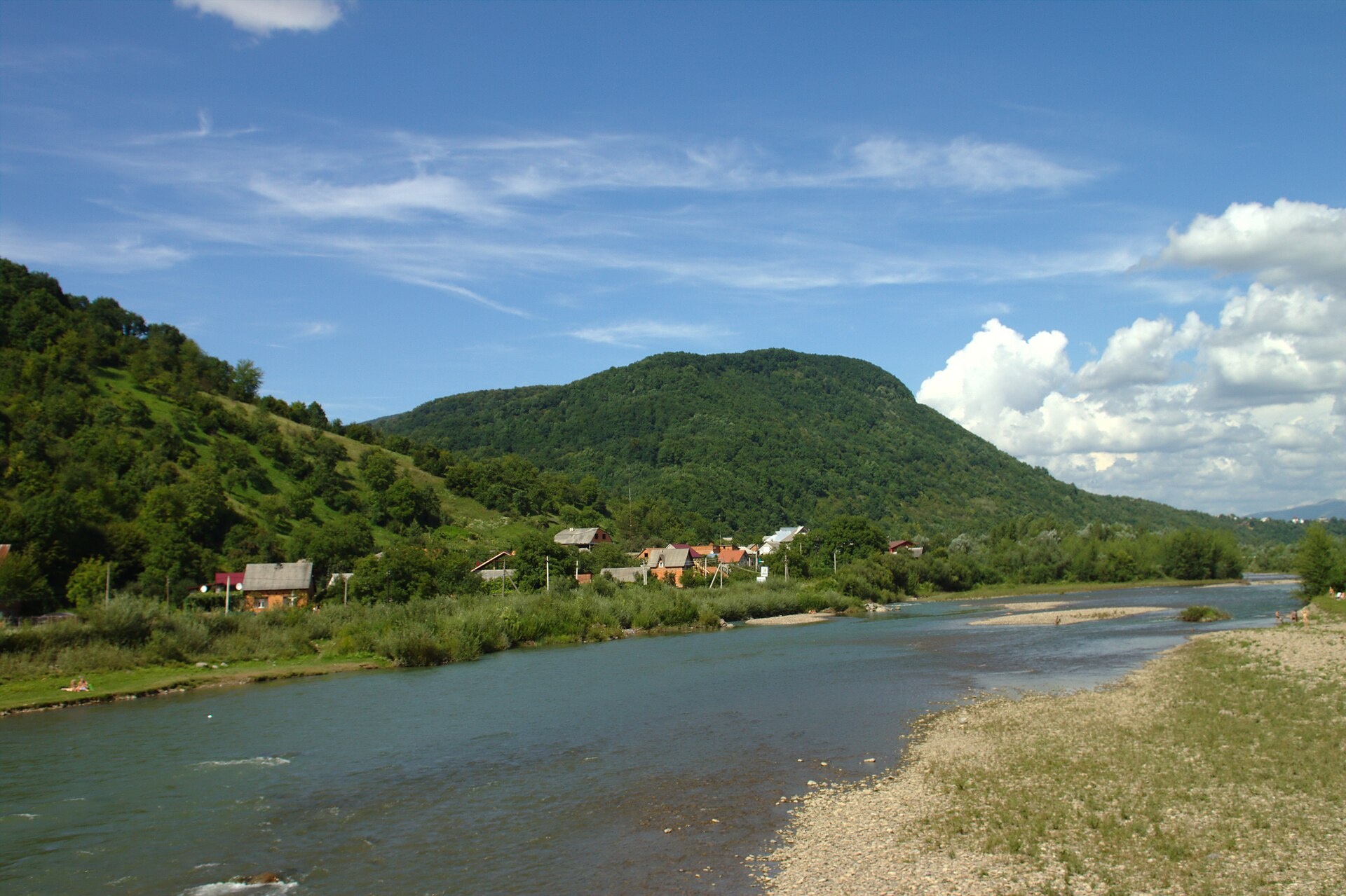
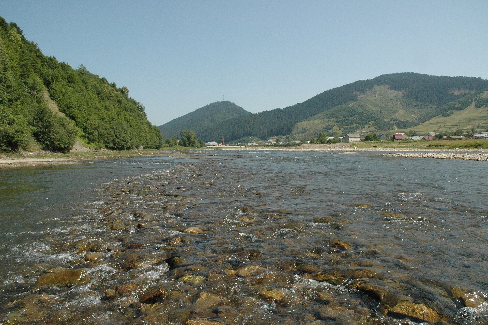
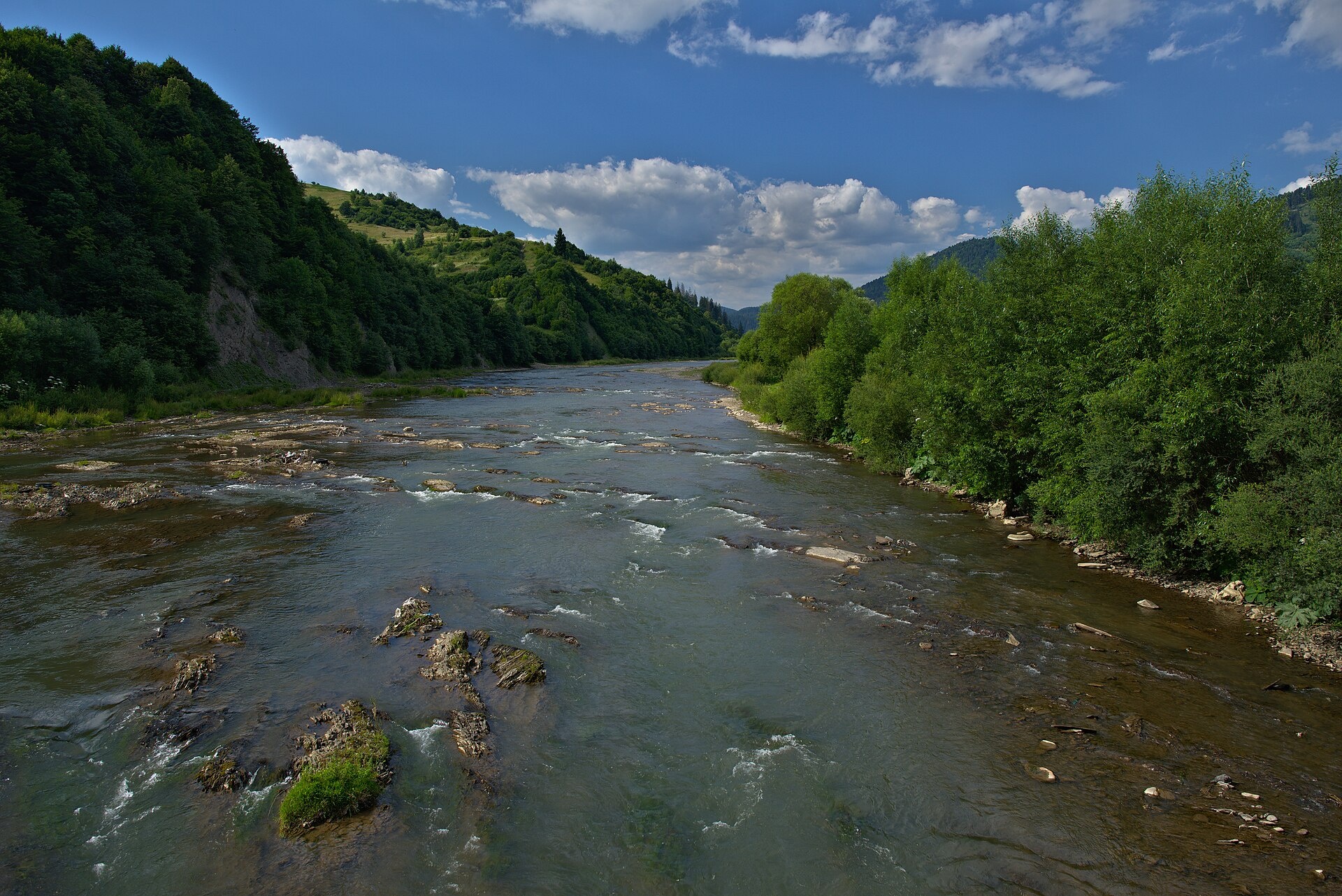
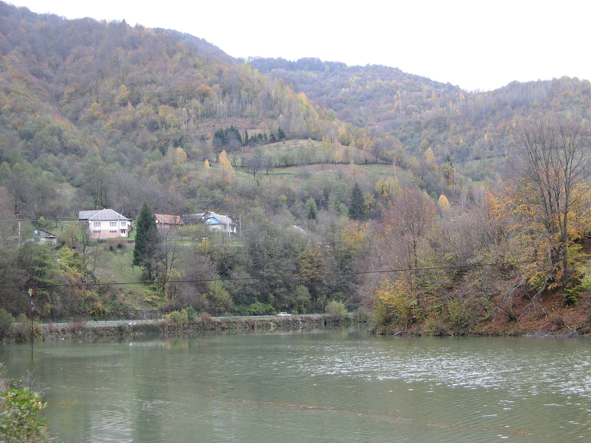
The Rika rises near the village of Torun on the south-western slopes of the Verkhovyna Range, where the Pryslip and Torunka streams meet, and flows through Mizhhiria, Verkhnii and Nyzhnii Bystryi and Lypcha to Khust, where it joins the Tysa. Below Torun there are rapids, the valley is popular for rafting, and there are many holiday lodges along the banks.
- Length: 92 km
- Basin area: 1,240 km²
- Source: near Torun, confluence of the Pryslip and Torunka streams
- Mouth: the Tysa near Khust
The Rika basin includes the 14 m Shypit waterfall on the Pylypets stream, which reaches the Rika via the Repynka. Near the mouth, above Khust, stand the ruins of the 14th-century Khust Castle. The Tereblia-Rika hydroelectric plant works in the valley: water reaches it through a 3.7 km tunnel from the Vilshany Reservoir on the Tereblia.
The Rika is stocked with brown trout every year — above Nyzhnii Bystryi and around Mizhhiria — and in 2025 grayling and Danube salmon, both in the Red Book, were released as well. In survey catches ichthyologists have found chub, barbel, souffia and Danube gudgeon here. The spawning ban runs from 25 March to 15 May, and trout are closed from 10 October to 1 March. Details are in the fishing section. All the region’s waters are on the Fishing in the Carpathians page.
Photos: Aktron, CC BY 3.0; VargaA, CC BY-SA 3.0; Jiří Komárek, CC BY-SA 4.0; MSha, CC BY-SA 4.0 — Wikimedia Commons.
Location on the map
Fishing on the Rika
The Rika from Mizhhiria to Khust is a mountain river that the state stocks with trout every year, and since 2025 with grayling and Danube salmon too. Anglers fish here for trout and chub.
Can I fish now?
- Brown trout — closed until 1 MarchTrout spawning: closed from 10 October to 1 March in the Zakarpattia, Ivano-Frankivsk, Lviv and Chernivtsi regions.Each illegally caught fish costs UAH 7,225 in damages on top of the fine.
- Other species — allowed within the daily limitKeep to the minimum sizes and the daily limit; release protected species.
Limits and rules
The Rika had no stretches on the 2026 list of places open during spawning, so it is not fished from 25 March to 15 May. In autumn the upper Rika is a priority trout protection zone.
What to catch
 Brown troutabove Nyzhnii Bystryi, Mizhhiria area · closed from 10 October to 1 Marchclosed until 1 March
 Chuballowed
There is no scientific fish list for the Rika. In 2009–2026 surveys ichthyologists found chub, common and Carpathian barbel, spirlin and bullhead here, as well as the rare souffia, Danube gudgeon, zingel and Walecki’s barbel — all in the Red Book.
 Danube salmon (huchen)
 Grayling
 Barbel
 Nase
Nase Common dace
Red Book of Ukraine species: if one bites, unhook it carefully and release it. Taking one means a fine and compensation for damages.
Stocking 2025
18,100 young fish released into the river: state stocking and other sources
Bite forecast near Mizhhiria
- TodaygoodSteady pressure, light wind, partly cloudy1024 hPa · wind up to 14 km/h · 3…11 °C
- TomorrowgoodHigh pressure, light wind, partly cloudy1027 hPa · wind up to 10 km/h · 2…11 °C
- Thursday, 15 OctobergoodHigh pressure, moderate wind, partly cloudy1026 hPa · wind up to 16 km/h · 6…10 °C
For species open now: chub. Brown trout closed. Based on pressure, wind, temperature and cloud — an estimate, not a guarantee.
Fishing spots 75
Places where you can drive up to the water: fish markers on the page map and the list below. Look at the satellite view before you go — the bank may be steep or overgrown.
Closed right now: brown trout — until 1 March.
- Mouth of the Pryslip tributary, TorunThe road comes almost to the water. A bridge is right here. Nearest village: Torun, 1.0 km.
- By the bridge, LopushneThe road comes almost to the water. A bridge is right here. Nearest village: Lopushne, 930 m.
- By the main road, Lopushne (1.7 km)About 80 m to the water from the main road. Nearest village: Lopushne, 1.7 km.
- Dirt-road access, Verkhnii Bystryi (2.3 km)About 130 m to the water from a dirt road. Nearest village: Verkhnii Bystryi, 2.3 km.
- Access from a village street, Verkhnii BystryiThe road comes almost to the water. Nearest village: Verkhnii Bystryi, 1.3 km.
- By the main road, Verkhnii BystryiThe road comes almost to the water. Village: Verkhnii Bystryi.
- By the main road, Verkhnii BystryiAbout 110 m to the water from the main road. Village: Verkhnii Bystryi.
- By the main road, Verkhnii BystryiAbout 60 m to the water from the main road. Nearest village: Verkhnii Bystryi, 1.2 km.
Show all spots (75)
- Access from a village street, MaidanAbout 120 m to the water from the street. Nearest village: Maidan, 1.5 km.
- By the bridge, MaidanAbout 100 m to the water from the street. Bridge 100 m away. Village: Maidan.
- Mouth of the Holiatynka tributary, MaidanAbout 80 m to the water from the main road. Nearest village: Maidan, 1.1 km.
- By the main road, Repynne (1.9 km)About 90 m to the water from the main road. Nearest village: Repynne, 1.9 km.
- Dirt-road access, Soimy (1.9 km)About 100 m to the water from a dirt road. Nearest village: Soimy, 1.9 km.
- Dirt-road access, SoimyAbout 80 m to the water from a dirt road. Nearest village: Soimy, 1.0 km.
- Access from a village street, SoimyAbout 30 m to the water from the street. Village: Soimy.
- By the main road, SoimyAbout 150 m to the water from the main road. Nearest village: Soimy, 850 m.
- By the main road, Soimy (1.6 km)About 150 m to the water from the main road. Nearest village: Soimy, 1.6 km.
- By the bridge, Lozianskyi (1.6 km)About 70 m to the water from the road. Bridge 70 m away. Nearest village: Lozianskyi, 1.6 km.
- Access from a village street, MizhhiriaAbout 50 m to the water from the street. Nearest village: Mizhhiria, 1.1 km.
- Dirt-road access, MizhhiriaAbout 120 m to the water from a dirt road. Village: Mizhhiria.
- Tributary mouth, MizhhiriaAbout 60 m to the water from a dirt road. Nearest village: Mizhhiria, 890 m.
- Access road to the water, Mizhhiria (1.7 km)The road comes almost to the water. Nearest village: Mizhhiria, 1.7 km.
- Local-road access, Mizhhiria (2.7 km)About 60 m to the water from a local road. Nearest village: Mizhhiria, 2.7 km.
- By the main road, Zaperedillia (2.8 km)About 80 m to the water from the main road. Nearest village: Zaperedillia, 2.8 km.
- By the main road, Zaperedillia (2.7 km)About 110 m to the water from the main road. Nearest village: Zaperedillia, 2.7 km.
- Dirt-road access, Zaperedillia (2.1 km)About 30 m to the water from a dirt road. Nearest village: Zaperedillia, 2.1 km.
- By the main road, ZaperedilliaAbout 90 m to the water from the main road. Nearest village: Zaperedillia, 1.2 km.
- Access from a village street, ZaperedilliaAbout 60 m to the water from the street. Village: Zaperedillia.
- Tributary mouth, ZaperedilliaAbout 90 m to the water from the main road. Village: Zaperedillia.
- Dirt-road access, ZaperedilliaAbout 50 m to the water from a dirt road. Nearest village: Zaperedillia, 1.3 km.
- Dirt-road access, Zaperedillia (1.8 km)About 50 m to the water from a dirt road. Nearest village: Zaperedillia, 1.8 km.
- Dirt-road access, Vuchkove (1.6 km)About 100 m to the water from a dirt road. Nearest village: Vuchkove, 1.6 km.
- By the main road, VuchkoveAbout 50 m to the water from the main road. Village: Vuchkove.
- Access from a village street, VuchkoveAbout 50 m to the water from the street. Village: Vuchkove.
- Dirt-road access, VuchkoveAbout 50 m to the water from a dirt road. Nearest village: Vuchkove, 1.2 km.
- By the main road, Vuchkove (2.1 km)About 60 m to the water from the main road. Nearest village: Vuchkove, 2.1 km.
- Dirt-road access, Vuchkove (2.9 km)About 50 m to the water from a dirt road. Nearest village: Vuchkove, 2.9 km.
- By the main road, Pidchumal (3.7 km)About 110 m to the water from the main road. Nearest village (straight line): Pidchumal, 3.7 km.
- By the main road, Pidchumal (2.9 km)About 120 m to the water from the main road. Nearest village: Pidchumal, 2.9 km.
- By the main road, Pidchumal (2.1 km)About 90 m to the water from the main road. Nearest village: Pidchumal, 2.1 km.
- By the main road, PidchumalAbout 80 m to the water from the main road. Nearest village: Pidchumal, 1.4 km.
- By the main road, PidchumalAbout 40 m to the water from the main road. Village: Pidchumal.
- By the main road, PidchumalAbout 30 m to the water from the main road. Village: Pidchumal.
- By the main road, ProtyvenAbout 140 m to the water from the main road. Nearest village: Protyven, 1.1 km.
- By the bridge, ProtyvenAbout 60 m to the water from the main road. Bridge 80 m away. Village: Protyven.
- By the main road, ProtyvenAbout 110 m to the water from the main road. Nearest village: Protyven, 980 m.
- Dirt-road access, Protyven (2.0 km)About 40 m to the water from a dirt road. Nearest village: Protyven, 2.0 km.
- By the main road, Nyzhnii Bystryi (2.4 km)The road comes almost to the water. Nearest village: Nyzhnii Bystryi, 2.4 km.
- By the main road, Nyzhnii BystryiThe road comes almost to the water. Nearest village: Nyzhnii Bystryi, 1.5 km.
- By the main road, Nyzhnii BystryiAbout 120 m to the water from the main road. Nearest village: Nyzhnii Bystryi, 1.2 km.
- By the main road, Nyzhnii BystryiAbout 50 m to the water from the main road. Village: Nyzhnii Bystryi.
- By the main road, HontsoshAbout 130 m to the water from the main road. Village: Hontsosh.
- By the main road, HontsoshAbout 50 m to the water from the main road. Village: Hontsosh.
- Access road to the water, HontsoshAbout 70 m to the water from an access road. Nearest village: Hontsosh, 1.5 km.
- Tributary mouth, Riapid (2.2 km)About 130 m to the water from the main road. Nearest village: Riapid, 2.2 km.
- By the main road, Riapid (1.7 km)About 70 m to the water from the main road. Nearest village: Riapid, 1.7 km.
- Access from a village street, RiapidAbout 90 m to the water from the street. Nearest village: Riapid, 840 m.
- By the main road, RiapidAbout 140 m to the water from the main road. Nearest village: Riapid, 790 m.
- Local-road access, BerezovoAbout 140 m to the water from a local road. Village: Berezovo.
- By the main road, BerezovoAbout 50 m to the water from the main road. Nearest village: Berezovo, 1.2 km.
- By the main road, KutlashAbout 110 m to the water from the main road. Village: Kutlash.
- By the bridge, Horinchovo (1.7 km)About 80 m to the water from the road. Bridge 90 m away. Nearest village: Horinchovo, 1.7 km.
- Tributary mouth, HorinchovoAbout 110 m to the water from a local road. Nearest village: Horinchovo, 1.3 km.
- Access from a village street, Horinchovo (1.6 km)About 140 m to the water from the street. Nearest village: Horinchovo, 1.6 km.
- By the bridge, LypchaAbout 70 m to the water from the main road. Bridge 70 m away. Nearest village: Lypcha, 1.0 km.
- Local-road access, Koshelovo (2.2 km)About 140 m to the water from a local road. Nearest village: Koshelovo, 2.2 km.
- Local-road access, Koshelovo (1.7 km)About 80 m to the water from a local road. Nearest village: Koshelovo, 1.7 km.
- Access from a village street, IzaAbout 140 m to the water from the street. Nearest village: Iza, 1.1 km.
- Access road to the water, IzaAbout 150 m to the water from an access road. Nearest village: Iza, 710 m.
- Dirt-road access, IzaAbout 80 m to the water from a dirt road. Nearest village: Iza, 1.3 km.
- Dirt-road access, ZarichneAbout 100 m to the water from a dirt road. Nearest village: Zarichne, 750 m.
- By the main road, ZarichneAbout 50 m to the water from the main road. Village: Zarichne.
- By the main road, ZarichneAbout 120 m to the water from the main road. Nearest village: Zarichne, 1.1 km.
- Dirt-road access, KhustAbout 130 m to the water from a dirt road. Nearest village: Khust, 1.4 km.
- By the bridge, ChertizhAbout 70 m to the water from an access road. Bridge 40 m away. Nearest village: Chertizh, 1.5 km.
Spots are marked from open data (roads and ways to the water, OpenStreetMap); if a spot is inconvenient or inaccessible, let us know. © OpenStreetMap, ODbL.
Springs: Recreational Fishing Rules (Order No. 700 of the Ministry of Agrarian Policy); Zakarpattia fisheries patrol: 2026 spawning ban and permitted stretches; Zakarpattia fisheries patrol: trout ban from 10 October 2026; Zakarpattia fisheries patrol: autumn trout spawning; State Fisheries Agency: fish stocking, data.gov.ua (CC BY); Zakarpattia fisheries patrol: fish stocking report 2025; Zakarpattia fisheries patrol: grayling stocking, September 2026; Didenko O. et al. Fish occurrences in the Dnipro, Dnister and Tysa basins, 2024–2026 (GBIF, CC BY 4.0); Didenko O. et al. Records of fish in Ukraine, field studies 2008–2023 (GBIF, CC BY 4.0); Kharchenko V. et al. Records of protected animal species in Ukraine (GBIF, CC BY 4.0); Kutsokon Y., Roman A. Own findings of fish of Ukraine 2001–2021 (GBIF, CC BY 4.0); Red Book of Ukraine animal list (Ministry of Environment Order No. 29, 2021); Wikipedia (uk): Rika; Wikipedia (uk): Shypit waterfall; Wikipedia (uk): Tereblia-Rika hydroelectric plant; Weather forecast: MET Norway (CC BY 4.0). Rules may change — check the current orders of the fisheries patrol.
Comments
Where anglers can stay
Stays offering fishing within 2 km of the river
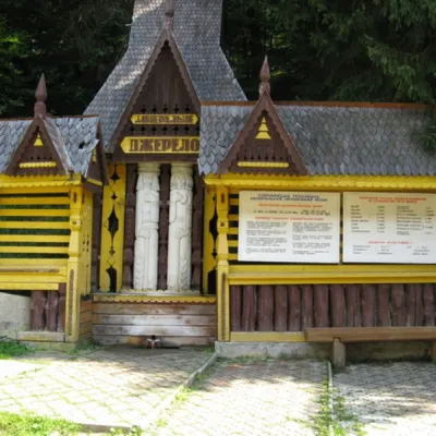 SanatoriumСанаторій «Верховина»under 1 km from the riverPoolSaunaSPANearby: Church of Peter and Paul 4.8 kmSynevyr Pass 9.4 km3 trails
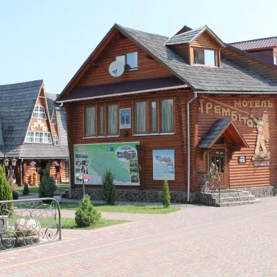 HotelHotel Complex "Trembita" Mykhyhiryaunder 1 km from the riverPoolSaunaSPANearby: Church of Peter and Paul 3.1 kmSynevyr Pass 8.3 km4 trails
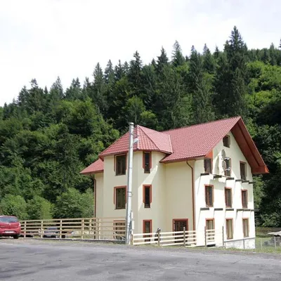 HotelRecreation Complex "Lisny" Mykulychyn1.3 km from the riverSaunaBBQParkingNearby: Church of Peter and Paul 1.0 kmSynevyr Pass 6.2 km4 trails
Trails nearby
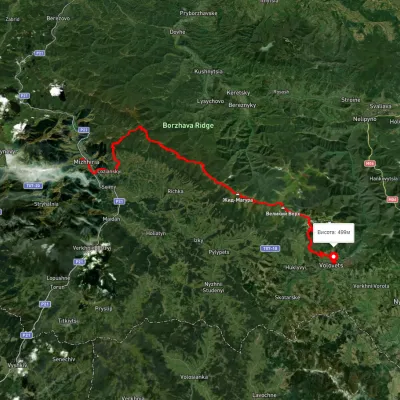 HardMulti-dayUnmarkedMizhhiria to Volovets villagevia Sopky village, Mount Zhyd-Mahura +2Elevation profile435–1 588 m51.4 kmascent 1 972 munder 1 km from Rika River
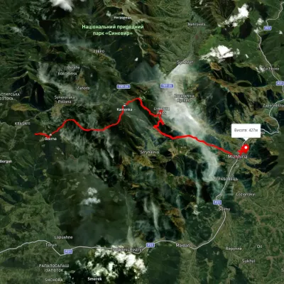 HardMulti-dayUnmarkedLake Synevyr to Mizhhiriavia Mount Ozerna, Mount Kamianka +2Elevation profile421–1 580 m31.1 kmascent 1 354 m≈ 10.5 h walkingunder 1 km from Rika River
 HardMulti-dayMarkedTranscarpathian Tourist TrailElevation profile198–2 031 m393.2 kmascent 30 283 munder 1 km from Rika River
Nearby attractions
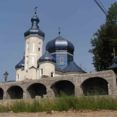 ChurchChurch of Peter and Paul, Mizhhiriaunder 1 km from Rika RiverBuilt in the mid-thirties of the last century, the Church of Peter and Paul has been radically renovated in recent years thanks to the efforts of its rector, Fr.
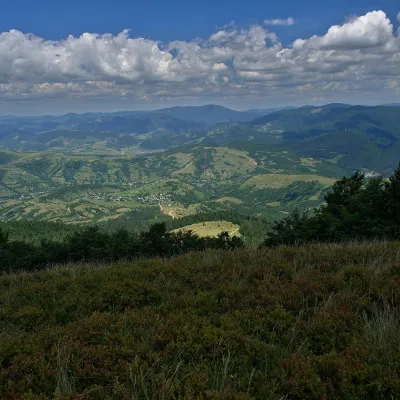 PeakMount Menchul (Mizhhiria)altitude 1 247 m · Borzhava range4.8 km from Rika RiverMenchul is a 1,247 m summit in the south-eastern part of the Polonyna Borzhava massif in Zakarpattia Oblast.
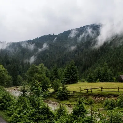 NatureSynevyr (Mizhhirya) Pass7.1 km from Rika RiverThe Synevyr Pass (also called the Mizhhiria Pass) is a pass in the Ukrainian Carpathians, in the southwestern outskirts of the Inner Gorgany massif.