Tysa River (Tisza)
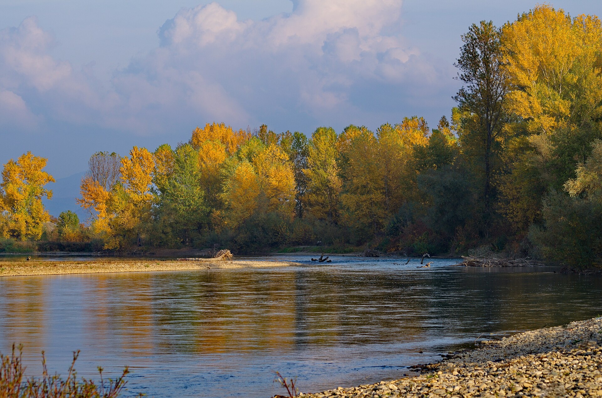
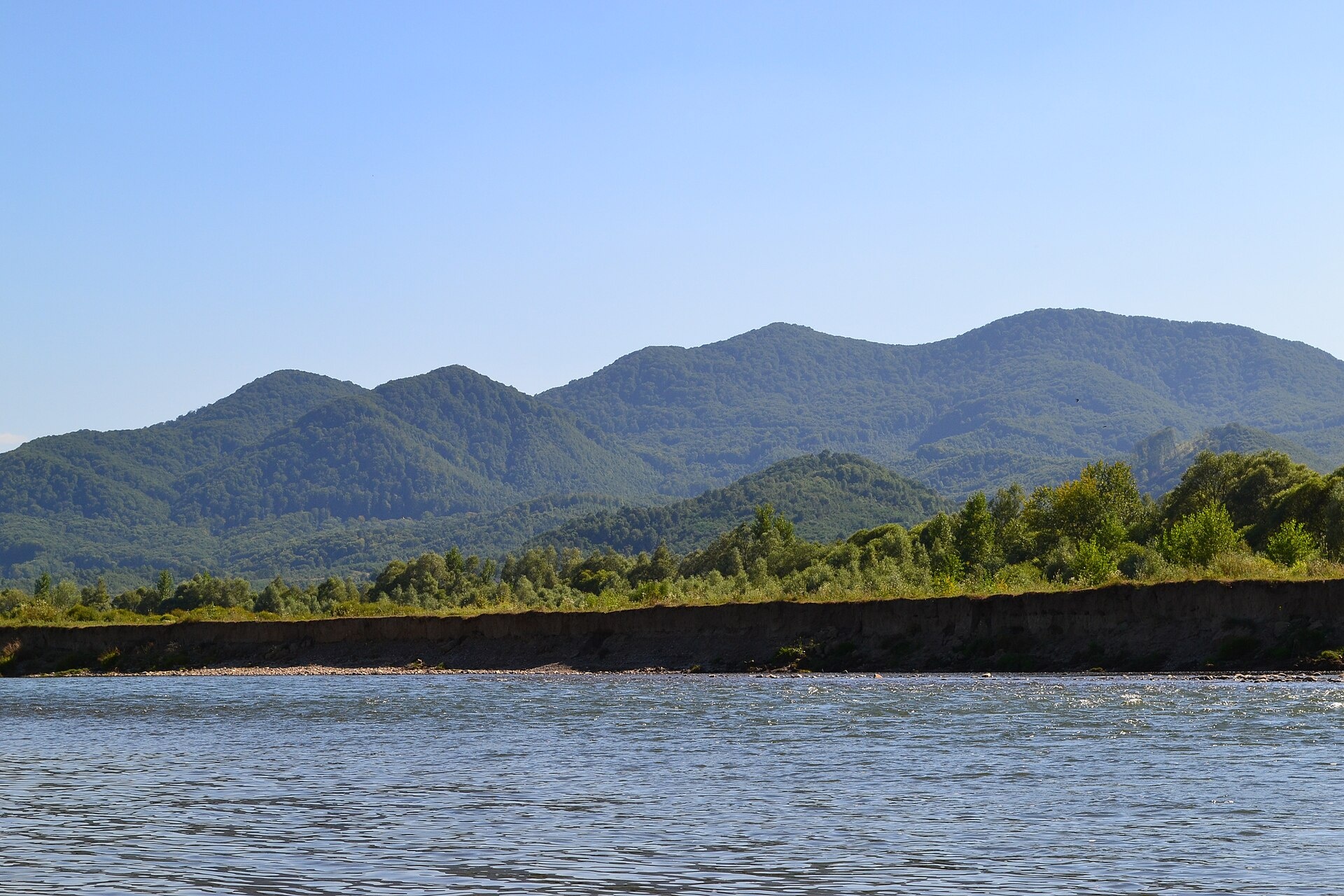
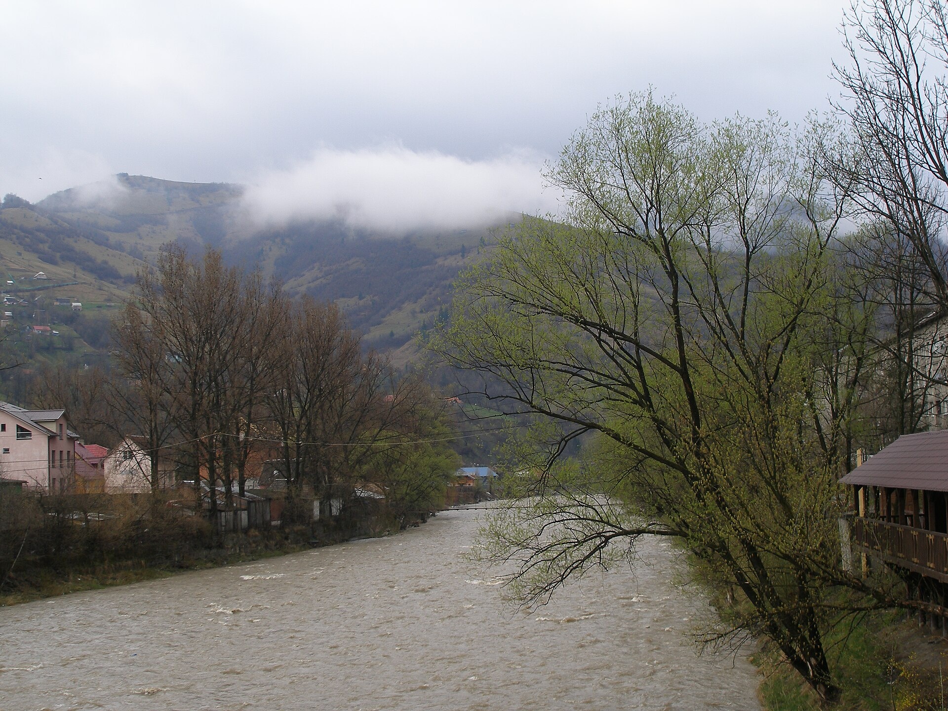
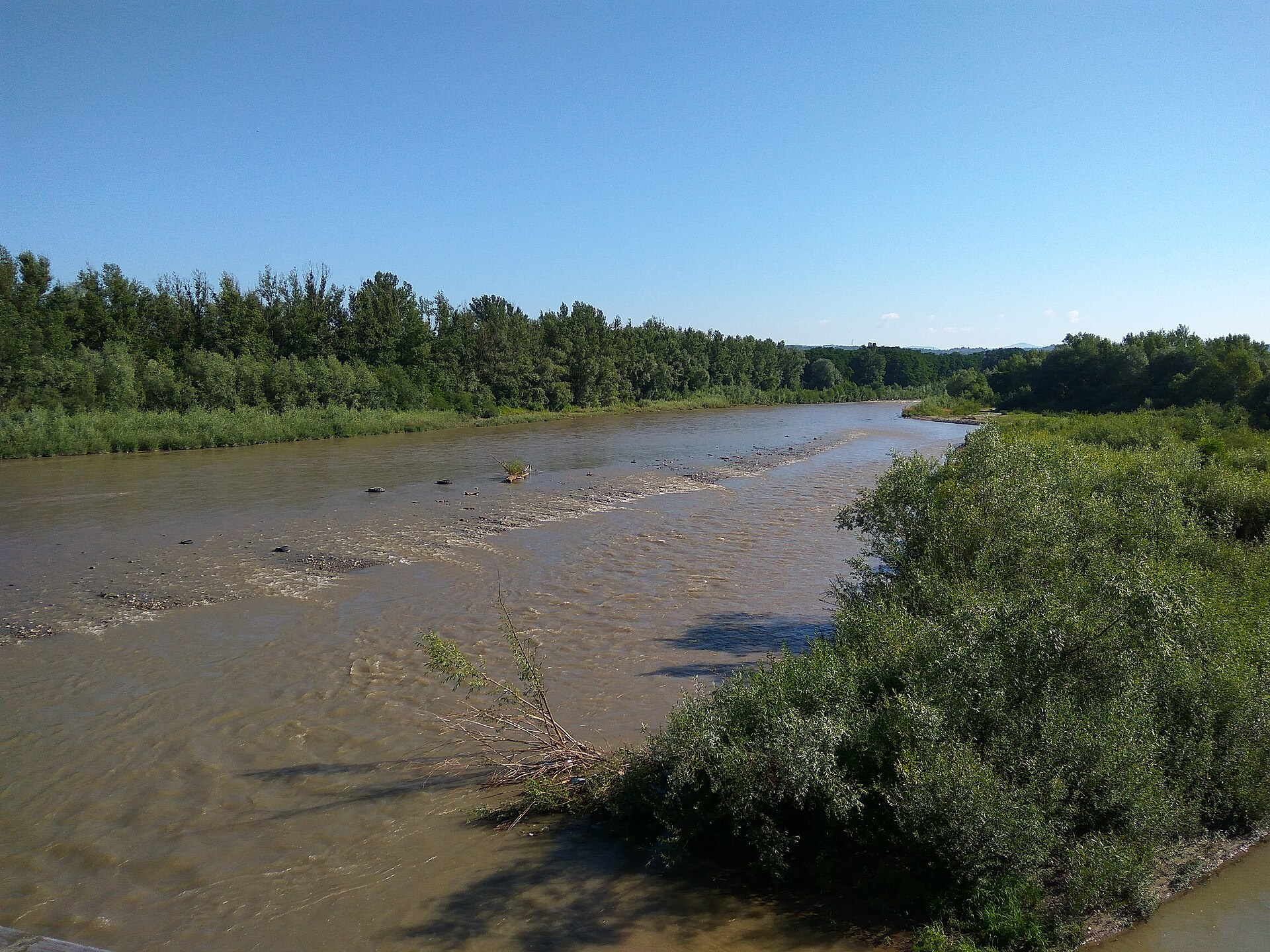
The Tysa (Tisza) is the main river of Zakarpattia. It begins on the north-eastern edge of Rakhiv, where the Chorna Tysa and the Bila Tysa meet, and flows past Dilove, Velykyi Bychkiv, Solotvyno, Tiachiv, Teresva, Bushtyno, Khust, Vynohradiv and Vylok to Chop, then on through Hungary and Serbia to the Danube. In its upper reaches it is a fast mountain river; below Khust the valley widens and the river becomes a lowland one. For part of its course the Tysa is the state border with Romania and Hungary.
- Length: 966 km, 201 km of it in Ukraine
- Basin area: 157,186 km² (12,732 km² in Ukraine)
- Source: confluence of the Chorna and Bila Tysa in Rakhiv
- Mouth: the Danube near Novi Sad (Serbia)
Near Dilove a marker of 1887 stands above the river as the “Geographical Centre of Europe”. Above Khust, near the mouth of the Rika, are the ruins of the 14th-century Khust Castle, and close by lies the Valley of Narcissi, a branch of the Carpathian Biosphere Reserve.
The mountain Tysa holds brown trout and chub, while in the oxbows near Trosnyk ichthyologists have found pike, wels catfish, zander, carp and bream. Danube salmon, grayling, barbel and nase are in the Red Book and must be released. The spawning ban on Zakarpattia rivers runs from 25 March to 15 May, and trout are closed from 10 October to 1 March. In the border zone you may fish only where the border guards allow it. Details are in the fishing section. All the region’s waters are on the Fishing in the Carpathians page.
Photos: Vitaliy Trombola, CC BY-SA 4.0; Eugene grunge, Public domain; Bukovynka, CC BY-SA 4.0; Visem, CC BY-SA 4.0 — Wikimedia Commons.
Location on the map
Fishing on the Tysa
From Rakhiv the mountain Tysa is trout and chub water, while the lowland course and oxbows below Khust hold pike, wels catfish, zander and carp. The border regime applies on frontier stretches.
Can I fish now?
- Brown trout — closed until 1 MarchTrout spawning: closed from 10 October to 1 March in the Zakarpattia, Ivano-Frankivsk, Lviv and Chernivtsi regions.Each illegally caught fish costs UAH 7,225 in damages on top of the fine.
- Other species — allowed within the daily limitKeep to the minimum sizes and the daily limit; release protected species.
Limits and rules
The Tysa is partly the border with Romania and Hungary. You may enter the border strip only with permission from the State Border Guard Service and with ID, and fishing places there are set by the state — fish only where the border guards have agreed, and expect checks. In spring 2026, during the spawning ban, the patrol allowed fishing from the bank within Rakhiv, Tiachiv and Khust and near Vynohradiv.
Carpathian Biosphere Reserve
The Kuziy massif of the Carpathian Biosphere Reserve (4,925 ha) is bounded by the Tysa on the east and south, and another branch, the Valley of Narcissi, lies near Khust. In the reserve, recreational fishing is offered only at its trout farm as a paid service; the wild waters inside the reserve are not fished. The Tysa channel itself is not part of the reserve.
What to catch
 Brown troutmountain stretch from Rakhiv · closed from 10 October to 1 Marchclosed until 1 March
 Chubthe whole courseallowed
 Pikeoxbows near Trosnyk (Vynohradiv area) · closed from 15 February to 31 Marchallowed
 Zanderfoothill and lowland course, oxbowsallowed
 Wels catfishoxbows near Trosnykallowed
 Common carpoxbows near Trosnykallowed
The oxbows near Trosnyk also hold asp, bream and roach, and the mountain course has introduced rainbow trout. The Upper Tysa basin is home to the rare zingel and streber, Carpathian lamprey, Danube gudgeon, souffia, schraetser and Walecki’s barbel — all in the Red Book. In 2000 the Tysa suffered cyanide pollution from Baia Mare in Romania.
 Danube salmon (huchen)
 Grayling
 Barbel
 Nase
Nase Common dace
 Burbot
Red Book of Ukraine species: if one bites, unhook it carefully and release it. Taking one means a fine and compensation for damages.
Stocking 2025
5,684 young fish released into the river: state stocking and other sources
Water quality
Monitoring post in Vilkhovatyi near Rakhiv, last sampled on 5 August 2026.
- Dissolved oxygen9.2 mg O₂/lnorm at least 4
- Acidity, pH8.1norm 6.5–8.5
- BOD₅ (organic matter)2.5 mg O₂/lnorm up to 3
- Water temperature23.1 °C
All indicators are within the norms.
Bite forecast in Rakhiv
- TodaygoodSteady pressure, moderate wind, partly cloudy1024 hPa · wind up to 16 km/h · 2…7 °C
- TomorrowfairHigh pressure, light wind, cold1027 hPa · wind up to 10 km/h · -1…7 °C
- Thursday, 15 OctobergoodSteady pressure, light wind1025 hPa · wind up to 13 km/h · 2…8 °C
For species open now: chub, pike, zander, wels catfish, common carp. Brown trout closed. Based on pressure, wind, temperature and cloud — an estimate, not a guarantee.
Fishing spots 182
Places where you can drive up to the water: fish markers on the page map and the list below. Look at the satellite view before you go — the bank may be steep or overgrown.
Closed right now: brown trout — until 1 March.
- By the bridge, NovoselytsiaAbout 40 m to the water from the street. A bridge is right here. Nearest village: Novoselytsia, 960 m.
- By the main road, NovoselytsiaAbout 50 m to the water from the main road. Village: Novoselytsia.
- By the main road, TsiptseraiAbout 30 m to the water from the main road. Village: Tsiptserai.
- By the main road, PodereiAbout 70 m to the water from the main road. Village: Poderei.
- By the bridge, RakhivAbout 50 m to the water from the street. Bridge 70 m away. Village: Rakhiv.
- By the bridge, RakhivThe road comes almost to the water. Bridge 50 m away. Nearest village: Rakhiv, 1.1 km.
- Local-road access, Rakhiv (1.9 km)About 50 m to the water from a local road. Nearest village: Rakhiv, 1.9 km.
- Access from a village street, Krasne PlesoAbout 50 m to the water from the street. Nearest village: Krasne Pleso, 880 m.
Show all spots (182)
- By the main road, Krasne PlesoAbout 60 m to the water from the main road. Village: Krasne Pleso.
- By the main road, VilkhovatyiThe road comes almost to the water. Nearest village: Vilkhovatyi, 1.2 km.Strict nature reserve — fishing is most likely forbidden, check with the reserve
- By the main road, VilkhovatyiAbout 50 m to the water from the main road. Village: Vilkhovatyi.Strict nature reserve — fishing is most likely forbidden, check with the reserve
- By the bridge, VilkhovatyiAbout 50 m to the water from the main road. Bridge 110 m away. Village: Vilkhovatyi.Strict nature reserve — fishing is most likely forbidden, check with the reserve
- By the main road, Vilkhovatyi (1.5 km)The road comes almost to the water. Nearest village: Vilkhovatyi, 1.5 km.Strict nature reserve — fishing is most likely forbidden, check with the reserve
- By the main road, KostylivkaAbout 40 m to the water from the main road. Nearest village: Kostylivka, 1.3 km.Strict nature reserve — fishing is most likely forbidden, check with the reserve
- Access from a village street, KostylivkaAbout 60 m to the water from the street. Village: Kostylivka.
- Access from a village street, KostylivkaAbout 50 m to the water from the street. Village: Kostylivka.
- Access road to the water, KostylivkaAbout 40 m to the water from an access road. Nearest village: Kostylivka, 1.2 km.
- By the main road, Kostylivka (2.0 km)About 60 m to the water from the main road. Nearest village: Kostylivka, 2.0 km.
- Mouth of the Loshchynskyi tributary, KruhlyiAbout 30 m to the water from a dirt road. A bridge is right here. Nearest village: Kruhlyi, 1.4 km.
- By the bridge, KruhlyiAbout 60 m to the water from the main road. Bridge 100 m away. Nearest village: Kruhlyi, 740 m.
- Access from a village street, KruhlyiAbout 90 m to the water from the street. Village: Kruhlyi.
- By the bridge, KruhlyiAbout 40 m to the water from the main road. Bridge 100 m away. Nearest village: Kruhlyi, 870 m.
- By the main road, DiloveAbout 50 m to the water from the main road. Nearest village: Dilove, 830 m.
- Mouth of the Sauliak tributary, DiloveAbout 60 m to the water from the street. Bridge 90 m away. Village: Dilove.
- By the main road, DiloveAbout 40 m to the water from the main road. Nearest village: Dilove, 1.0 km.
- By the main road, Khmeliv (1.7 km)About 50 m to the water from the main road. Nearest village: Khmeliv, 1.7 km.
- By the main road, KhmelivAbout 40 m to the water from the main road. Nearest village: Khmeliv, 1.1 km.
- Access from a village street, KhmelivAbout 50 m to the water from the street. Village: Khmeliv.
- Access from a village street, KhmelivAbout 50 m to the water from the street. Village: Khmeliv.
- By the main road, Khmeliv (1.5 km)About 30 m to the water from the main road. Nearest village: Khmeliv, 1.5 km.
- By the main road, Khmeliv (2.4 km)About 80 m to the water from the main road. Nearest village: Khmeliv, 2.4 km.
- By the main road, Khmeliv (3.1 km)About 60 m to the water from the main road. Nearest village (straight line): Khmeliv, 3.1 km.
- By the main road, Khmeliv (3.8 km)About 70 m to the water from the main road. Nearest village (straight line): Khmeliv, 3.8 km.
- By the main road, Luh (3.4 km)About 50 m to the water from the main road. Nearest village (straight line): Luh, 3.4 km.
- By the main road, Luh (2.5 km)About 90 m to the water from the main road. Nearest village: Luh, 2.5 km.
- Dirt-road access, Luh (1.6 km)About 100 m to the water from a dirt road. Nearest village: Luh, 1.6 km.
- By the main road, LuhAbout 50 m to the water from the main road. Nearest village: Luh, 750 m.
- By the main road, LuhAbout 60 m to the water from the main road. Nearest village: Luh, 1.2 km.
- By the road, Luh (2.1 km)About 60 m to the water from the road. Nearest village: Luh, 2.1 km.
- By the road, Velykyi Bychkiv (2.3 km)About 110 m to the water from the road. Nearest village: Velykyi Bychkiv, 2.3 km.
- By the main road, Velykyi BychkivAbout 70 m to the water from the main road. Nearest village: Velykyi Bychkiv, 1.3 km.
- By the main road, Velykyi BychkivAbout 140 m to the water from the main road. Nearest village: Velykyi Bychkiv, 840 m.
- Dirt-road access, Velykyi Bychkiv (2.1 km)About 140 m to the water from a dirt road. Nearest village: Velykyi Bychkiv, 2.1 km.
- Access from a village street, Velykyi Bychkiv (3.0 km)About 80 m to the water from the street. Nearest village: Velykyi Bychkiv, 3.0 km.
- Local-road access, Velykyi Bychkiv (2.8 km)About 40 m to the water from a local road. Nearest village: Velykyi Bychkiv, 2.8 km.
- Local-road access, Bila Tserkva (3.1 km)About 110 m to the water from a local road. Nearest village (straight line): Bila Tserkva, 3.1 km.
- By the main road, Bila Tserkva (2.3 km)About 130 m to the water from the main road. Nearest village: Bila Tserkva, 2.3 km.
- Dirt-road access, Bila Tserkva (1.6 km)About 50 m to the water from a dirt road. Nearest village: Bila Tserkva, 1.6 km.
- Dirt-road access, Bila TserkvaAbout 80 m to the water from a dirt road. Nearest village: Bila Tserkva, 1.0 km.
- Dirt-road access, Bila TserkvaAbout 80 m to the water from a dirt road. Village: Bila Tserkva.
- Access road to the water, Bila TserkvaAbout 90 m to the water from an access road. Nearest village: Bila Tserkva, 990 m.
- Dirt-road access, Bila Tserkva (1.9 km)About 90 m to the water from a dirt road. Nearest village: Bila Tserkva, 1.9 km.
- Dirt-road access, SolotvynoAbout 40 m to the water from a dirt road. Nearest village: Solotvyno, 1.3 km.
- Dirt-road access, SolotvynoAbout 120 m to the water from a dirt road. Village: Solotvyno.
- Dirt-road access, SolotvynoAbout 80 m to the water from a dirt road. Nearest village: Solotvyno, 1.4 km.
- Dirt-road access, Solotvyno (1.9 km)About 70 m to the water from a dirt road. Nearest village: Solotvyno, 1.9 km.
- Local-road access, Solotvyno (1.9 km)About 50 m to the water from a local road. Nearest village: Solotvyno, 1.9 km.
- Dirt-road access, Solotvyno (2.4 km)About 50 m to the water from a dirt road. Nearest village: Solotvyno, 2.4 km.
- Dirt-road access, Solotvyno (2.6 km)About 70 m to the water from a dirt road. Nearest village: Solotvyno, 2.6 km.
- Dirt-road access, Solotvyno (3.3 km)About 100 m to the water from a dirt road. Nearest village (straight line): Solotvyno, 3.3 km.
- Dirt-road access, Nyzhnia Apsha (3.4 km)About 80 m to the water from a dirt road. Nearest village (straight line): Nyzhnia Apsha, 3.4 km.
- Dirt-road access, Nyzhnia Apsha (3.0 km)About 90 m to the water from a dirt road. Nearest village (straight line): Nyzhnia Apsha, 3.0 km.
- Dirt-road access, Nyzhnia Apsha (2.2 km)About 130 m to the water from a dirt road. Nearest village: Nyzhnia Apsha, 2.2 km.
- Dirt-road access, Nyzhnia Apsha (2.2 km)About 100 m to the water from a dirt road. Nearest village: Nyzhnia Apsha, 2.2 km.
- Dirt-road access, Nyzhnia Apsha (2.6 km)About 130 m to the water from a dirt road. Nearest village: Nyzhnia Apsha, 2.6 km.
- Dirt-road access, Hrushovo (2.9 km)About 130 m to the water from a dirt road. Nearest village: Hrushovo, 2.9 km.
- Dirt-road access, Hrushovo (2.0 km)About 110 m to the water from a dirt road. Nearest village: Hrushovo, 2.0 km.
- Dirt-road access, HrushovoAbout 90 m to the water from a dirt road. Nearest village: Hrushovo, 1.2 km.
- Dirt-road access, HrushovoAbout 100 m to the water from a dirt road. Nearest village: Hrushovo, 1.4 km.
- Access road to the water, Hrushovo (2.4 km)About 150 m to the water from an access road. Nearest village: Hrushovo, 2.4 km.
- Access road to the water, Teresva (1.8 km)About 130 m to the water from an access road. Nearest village: Teresva, 1.8 km.
- Dirt-road access, TeresvaAbout 140 m to the water from a dirt road. Nearest village: Teresva, 840 m.
- Dirt-road access, TeresvaAbout 130 m to the water from a dirt road. Nearest village: Teresva, 1.4 km.
- Access from a village street, Bedevlia (1.8 km)About 90 m to the water from the street. Nearest village: Bedevlia, 1.8 km.
- Dirt-road access, Bedevlia (1.8 km)About 130 m to the water from a dirt road. Nearest village: Bedevlia, 1.8 km.
- By the main road, HovdyAbout 120 m to the water from the main road. Nearest village: Hovdy, 720 m.
- Dirt-road access, Tiachiv (1.9 km)About 100 m to the water from a dirt road. Nearest village: Tiachiv, 1.9 km.
- Dirt-road access, TiachivAbout 80 m to the water from a dirt road. Nearest village: Tiachiv, 1.0 km.
- Dirt-road access, TiachivAbout 140 m to the water from a dirt road. Nearest village: Tiachiv, 780 m.
- By the main road, TiachivAbout 50 m to the water from the main road. Nearest village: Tiachiv, 1.3 km.
- Dirt-road access, Yablunivka (2.4 km)About 140 m to the water from a dirt road. Nearest village: Yablunivka, 2.4 km.
- Tributary mouth, Yablunivka (2.0 km)About 90 m to the water from a dirt road. Nearest village: Yablunivka, 2.0 km.
- Dirt-road access, Bushtyno (2.1 km)About 140 m to the water from a dirt road. Nearest village: Bushtyno, 2.1 km.
- Dirt-road access, Bushtyno (2.1 km)About 140 m to the water from a dirt road. Nearest village: Bushtyno, 2.1 km.
- Dirt-road access, VyshkovoAbout 120 m to the water from a dirt road. Nearest village: Vyshkovo, 1.4 km.
- Dirt-road access, VyshkovoAbout 130 m to the water from a dirt road. Nearest village: Vyshkovo, 1.4 km.
- Dirt-road access, Vyshkovo (2.0 km)About 140 m to the water from a dirt road. Nearest village: Vyshkovo, 2.0 km.
- Dirt-road access, Vyshkovo (2.1 km)About 130 m to the water from a dirt road. Nearest village: Vyshkovo, 2.1 km.
- Dirt-road access, Steblivka (1.6 km)About 110 m to the water from a dirt road. Nearest village: Steblivka, 1.6 km.
- Dirt-road access, SokyrnytsiaAbout 130 m to the water from a dirt road. Nearest village: Sokyrnytsia, 860 m.
- Dirt-road access, SokyrnytsiaAbout 40 m to the water from a dirt road. Nearest village: Sokyrnytsia, 1.5 km.
- Dirt-road access, Sokyrnytsia (2.8 km)About 70 m to the water from a dirt road. Nearest village: Sokyrnytsia, 2.8 km.
- By the road, Veliatyno (3.8 km)About 110 m to the water from the road. Nearest village (straight line): Veliatyno, 3.8 km.
- Dirt-road access, Khust (3.4 km)About 90 m to the water from a dirt road. Nearest village (straight line): Khust, 3.4 km.
- Dirt-road access, Khust (2.1 km)About 100 m to the water from a dirt road. Nearest village: Khust, 2.1 km.
- Dirt-road access, KhustAbout 120 m to the water from a dirt road. Nearest village: Khust, 1.4 km.
- Dirt-road access, Khust (1.8 km)About 120 m to the water from a dirt road. Nearest village: Khust, 1.8 km.
- By the bridge, Chertizh (1.5 km)About 50 m to the water from the road. Bridge 50 m away. Nearest village: Chertizh, 1.5 km.
- Dirt-road access, ChertizhAbout 60 m to the water from a dirt road. Nearest village: Chertizh, 1.1 km.
- Dirt-road access, KryvaAbout 110 m to the water from a dirt road. Village: Kryva.
- Access road to the water, Rokosovo (2.4 km)About 140 m to the water from an access road. Nearest village: Rokosovo, 2.4 km.
- Dirt-road access, Veriatsia (2.2 km)About 120 m to the water from a dirt road. Nearest village: Veriatsia, 2.2 km.Regional landscape park — follow the park rules
- Dirt-road access, VeriatsiaAbout 130 m to the water from a dirt road. Nearest village: Veriatsia, 1.4 km.Regional landscape park — follow the park rules
- Dirt-road access, VeriatsiaAbout 80 m to the water from a dirt road. Nearest village: Veriatsia, 990 m.Regional landscape park — follow the park rules
- Dirt-road access, Veriatsia (1.9 km)About 130 m to the water from a dirt road. Nearest village: Veriatsia, 1.9 km.Regional landscape park — follow the park rules
- Dirt-road access, Veriatsia (1.9 km)About 120 m to the water from a dirt road. Nearest village: Veriatsia, 1.9 km.Regional landscape park — follow the park rules
- Stream mouth, Korolevo (1.6 km)About 130 m to the water from a dirt road. Nearest village: Korolevo, 1.6 km.Regional landscape park — follow the park rules
- Dirt-road access, Mala KopaniaAbout 70 m to the water from a dirt road. Nearest village: Mala Kopania, 1.2 km.Regional landscape park — follow the park rules
- Dirt-road access, VynnychkyAbout 130 m to the water from a dirt road. Nearest village: Vynnychky, 1.3 km.Regional landscape park — follow the park rules
- Dirt-road access, VynnychkyAbout 100 m to the water from a dirt road. Village: Vynnychky.Regional landscape park — follow the park rules
- By the bridge, VynnychkyAbout 110 m to the water from the road. Bridge 110 m away. Nearest village: Vynnychky, 1.0 km.Regional landscape park — follow the park rules
- Dirt-road access, TekovoAbout 150 m to the water from a dirt road. Village: Tekovo.Regional landscape park — follow the park rules
- Dirt-road access, TekovoAbout 130 m to the water from a dirt road. Nearest village: Tekovo, 930 m.Regional landscape park — follow the park rules
- Dirt-road access, Tekovo (1.9 km)About 100 m to the water from a dirt road. Nearest village: Tekovo, 1.9 km.Regional landscape park — follow the park rules
- Dirt-road access, Tekovo (2.5 km)About 70 m to the water from a dirt road. Nearest village: Tekovo, 2.5 km.Regional landscape park — follow the park rules
- Dirt-road access, Sasovo (2.3 km)About 140 m to the water from a dirt road. Nearest village: Sasovo, 2.3 km.Regional landscape park — follow the park rules
- Dirt-road access, Hetynia (2.1 km)About 140 m to the water from a dirt road. Nearest village: Hetynia, 2.1 km.Regional landscape park — follow the park rules
- Dirt-road access, HetyniaAbout 130 m to the water from a dirt road. Nearest village: Hetynia, 1.0 km.Regional landscape park — follow the park rules
- Dirt-road access, HetyniaAbout 110 m to the water from a dirt road. Nearest village: Hetynia, 1.1 km.Regional landscape park — follow the park rules
- Access road to the water, HetyniaAbout 30 m to the water from an access road. Nearest village: Hetynia, 1.4 km.Regional landscape park — follow the park rules
- Dirt-road access, Trosnyk (1.9 km)About 90 m to the water from a dirt road. Nearest village: Trosnyk, 1.9 km.Regional landscape park — follow the park rules
- Dirt-road access, TrosnykAbout 150 m to the water from a dirt road. Nearest village: Trosnyk, 890 m.Regional landscape park — follow the park rules
- Dirt-road access, Trosnyk (1.6 km)About 80 m to the water from a dirt road. Nearest village: Trosnyk, 1.6 km.Regional landscape park — follow the park rules
- Dirt-road access, VovchanskeAbout 70 m to the water from a dirt road. Nearest village: Vovchanske, 1.0 km.Regional landscape park — follow the park rules
- Dirt-road access, VovchanskeAbout 80 m to the water from a dirt road. Nearest village: Vovchanske, 790 m.Regional landscape park — follow the park rules
- Access from a village street, TysobykenAbout 140 m to the water from the street. Village: Tysobyken.Regional landscape park — follow the park rules
- Dirt-road access, Tysobyken (1.5 km)About 80 m to the water from a dirt road. Nearest village: Tysobyken, 1.5 km.Regional landscape park — follow the park rules
- Local-road access, Tysobyken (2.4 km)About 130 m to the water from a local road. Nearest village: Tysobyken, 2.4 km.Regional landscape park — follow the park rules
- Dirt-road access, Tysobyken (2.7 km)About 110 m to the water from a dirt road. Nearest village: Tysobyken, 2.7 km.Regional landscape park — follow the park rules
- Dirt-road access, Nove Selo (2.7 km)About 120 m to the water from a dirt road. Nearest village: Nove Selo, 2.7 km.Regional landscape park — follow the park rules
- Dirt-road access, Vylok (1.9 km)About 120 m to the water from a dirt road. Nearest village: Vylok, 1.9 km.Regional landscape park — follow the park rules
- Dirt-road access, Vylok (2.1 km)About 90 m to the water from a dirt road. Nearest village: Vylok, 2.1 km.Regional landscape park — follow the park rules
- Dirt-road access, VylokAbout 140 m to the water from a dirt road. Nearest village: Vylok, 1.5 km.Regional landscape park — follow the park rules
- Dirt-road access, VylokAbout 150 m to the water from a dirt road. Nearest village: Vylok, 1.3 km.
- Dirt-road access, VylokAbout 120 m to the water from a dirt road. Nearest village: Vylok, 880 m.
- Dirt-road access, Vylok (1.8 km)About 130 m to the water from a dirt road. Nearest village: Vylok, 1.8 km.
- Access road to the water, Vylok (2.2 km)About 130 m to the water from an access road. Nearest village: Vylok, 2.2 km.
- Dirt-road access, ChetfalvaAbout 140 m to the water from a dirt road. Nearest village: Chetfalva, 1.1 km.
- Dirt-road access, ChetfalvaAbout 130 m to the water from a dirt road. Village: Chetfalva.
- Dirt-road access, ChetfalvaAbout 110 m to the water from a dirt road. Nearest village: Chetfalva, 880 m.
- Dirt-road access, Chetfalva (1.7 km)About 90 m to the water from a dirt road. Nearest village: Chetfalva, 1.7 km.
- Dirt-road access, Chetfalva (1.7 km)About 120 m to the water from a dirt road. Nearest village: Chetfalva, 1.7 km.
- Dirt-road access, Chetfalva (2.6 km)About 140 m to the water from a dirt road. Nearest village: Chetfalva, 2.6 km.
- Dirt-road access, Vary (2.5 km)About 120 m to the water from a dirt road. Nearest village: Vary, 2.5 km.
- Dirt-road access, Vary (1.9 km)About 110 m to the water from a dirt road. Nearest village: Vary, 1.9 km.
- Dirt-road access, VaryAbout 120 m to the water from a dirt road. Nearest village: Vary, 1.4 km.
- Dirt-road access, Vary (1.5 km)About 90 m to the water from a dirt road. Nearest village: Vary, 1.5 km.
- Dirt-road access, HalaborAbout 110 m to the water from a dirt road. Nearest village: Halabor, 1.5 km.
- Dirt-road access, HalaborAbout 120 m to the water from a dirt road. Nearest village: Halabor, 850 m.
- Dirt-road access, HalaborAbout 100 m to the water from a dirt road. Nearest village: Halabor, 1.3 km.
- Dirt-road access, Halabor (1.6 km)About 140 m to the water from a dirt road. Nearest village: Halabor, 1.6 km.
- Dirt-road access, Badalovo (1.6 km)About 100 m to the water from a dirt road. Nearest village: Badalovo, 1.6 km.
- Dirt-road access, Badalovo (1.6 km)About 130 m to the water from a dirt road. Nearest village: Badalovo, 1.6 km.
- Dirt-road access, BadalovoAbout 140 m to the water from a dirt road. Nearest village: Badalovo, 1.5 km.
- Dirt-road access on the TysaAbout 120 m to the water from a dirt road. Nearest village (straight line): Badalovo, 6.0 km.
- Dirt-road access, Solovka (4.4 km)About 150 m to the water from a dirt road. Nearest village (straight line): Solovka, 4.4 km.
- Dirt-road access, Solovka (3.5 km)About 130 m to the water from a dirt road. Nearest village (straight line): Solovka, 3.5 km.
- Dirt-road access, Solovka (1.6 km)About 150 m to the water from a dirt road. Nearest village: Solovka, 1.6 km.
- Dirt-road access, SolovkaAbout 130 m to the water from a dirt road. Nearest village: Solovka, 1.2 km.
- Dirt-road access, Solovka (1.8 km)About 130 m to the water from a dirt road. Nearest village: Solovka, 1.8 km.
- Dirt-road access, Esen (2.4 km)About 140 m to the water from a dirt road. Nearest village: Esen, 2.4 km.
- Dirt-road access, EsenAbout 140 m to the water from a dirt road. Nearest village: Esen, 1.4 km.
- Dirt-road access, TysauifaluAbout 140 m to the water from a dirt road. Nearest village: Tysauifalu, 1.2 km.
- Dirt-road access, TysaashvanAbout 110 m to the water from a dirt road. Nearest village: Tysaashvan, 1.3 km.
- Dirt-road access, Tysaashvan (1.8 km)About 140 m to the water from a dirt road. Nearest village: Tysaashvan, 1.8 km.
- Dirt-road access, ChopAbout 120 m to the water from a dirt road. Nearest village: Chop, 810 m.
- Dirt-road access, ChopAbout 90 m to the water from a dirt road. Nearest village: Chop, 980 m.
- Dirt-road access, Chop (2.0 km)About 100 m to the water from a dirt road. Nearest village: Chop, 2.0 km.
- Dirt-road access, Solomonovo (2.5 km)About 110 m to the water from a dirt road. Nearest village: Solomonovo, 2.5 km.
- Dirt-road access, Solomonovo (2.3 km)About 110 m to the water from a dirt road. Nearest village: Solomonovo, 2.3 km.
- Dirt-road access, Solomonovo (3.0 km)About 70 m to the water from a dirt road. Nearest village (straight line): Solomonovo, 3.0 km.
- Dirt-road access, VovchanskeAbout 70 m to the water from a dirt road. Nearest village: Vovchanske, 810 m.Regional landscape park — follow the park rules
- Dirt-road access, Mala Kopania (2.1 km)About 50 m to the water from a dirt road. Nearest village: Mala Kopania, 2.1 km.Regional landscape park — follow the park rules
- Dirt-road access, Sokyrnytsia (1.9 km)About 120 m to the water from a dirt road. Nearest village: Sokyrnytsia, 1.9 km.
- Dirt-road access, Veliatyno (2.7 km)About 80 m to the water from a dirt road. Nearest village: Veliatyno, 2.7 km.
- By the road, Veliatyno (3.2 km)About 140 m to the water from the road. Nearest village (straight line): Veliatyno, 3.2 km.
- Dirt-road access, Sokyrnytsia (1.7 km)About 70 m to the water from a dirt road. Nearest village: Sokyrnytsia, 1.7 km.
- Dirt-road access, Sokyrnytsia (2.0 km)About 130 m to the water from a dirt road. Nearest village: Sokyrnytsia, 2.0 km.
- Dirt-road access, Sokyrnytsia (2.3 km)About 50 m to the water from a dirt road. Nearest village: Sokyrnytsia, 2.3 km.
- Dirt-road access, Vyshkovo (2.1 km)About 100 m to the water from a dirt road. Nearest village: Vyshkovo, 2.1 km.
- Local-road access, Vyshkovo (1.9 km)About 100 m to the water from a local road. Nearest village: Vyshkovo, 1.9 km.
- Dirt-road access, Nyzhnia Apsha (2.9 km)About 60 m to the water from a dirt road. Nearest village: Nyzhnia Apsha, 2.9 km.
Spots are marked from open data (roads and ways to the water, OpenStreetMap); if a spot is inconvenient or inaccessible, let us know. © OpenStreetMap, ODbL.
Springs: Recreational Fishing Rules (Order No. 700 of the Ministry of Agrarian Policy); Zakarpattia fisheries patrol: 2026 spawning ban and permitted stretches; Zakarpattia fisheries patrol: trout ban from 10 October 2026; Zakarpattia fisheries patrol: autumn trout spawning; Regulation on the border regime (Cabinet of Ministers Resolution No. 1147); Carpathian Biosphere Reserve: paid services order (2025); Wikipedia (uk): Kuziy reserve massif; State Fisheries Agency: fish stocking, data.gov.ua (CC BY); Zakarpattia fisheries patrol: fish stocking report 2025; Rusyn V., Feketa I., Moskal M. Ecological factors and the fish fauna of the Tysa (2024); Levrints A. Fish of the Tysa oxbows near Trosnyk; Ustych V. et al. Rare fish of the Upper Tysa basin; Kharchenko V. et al. Records of protected animal species in Ukraine (GBIF, CC BY 4.0); Didenko O. et al. Fish occurrences in the Dnipro, Dnister and Tysa basins, 2024–2026 (GBIF, CC BY 4.0); Kutsokon Y., Roman A. Own findings of fish of Ukraine 2001–2021 (GBIF, CC BY 4.0); Red Book of Ukraine animal list (Ministry of Environment Order No. 29, 2021); Wikipedia (uk): Tysa; Wikipedia (uk): Geographical centre of Europe; State Water Agency: water monitoring (CC BY); Weather forecast: MET Norway (CC BY 4.0). Rules may change — check the current orders of the fisheries patrol.
Comments
Where anglers can stay
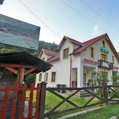
Stays offering fishing within 2 km of the river
Trails nearby
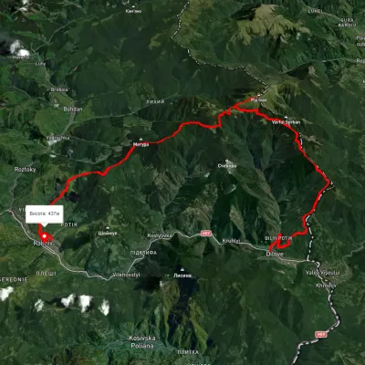 HardMulti-dayUnmarkedDilove village to Rakhivvia Mount Zherban, Mount Pip Ivan MarmaroskyiElevation profile340–1 871 m44.9 kmascent 2 247 munder 1 km from Tysa River (Tisza)
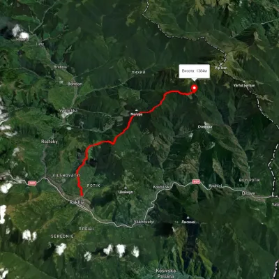 HardTwo-dayMarkedRakhiv town Berlebashka polonynaElevation profile452–1 450 m17.1 kmascent 1 854 m≈ 8 h walkingunder 1 km from Tysa River (Tisza)
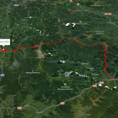 HardMulti-dayUnmarkedRakhiv to Iltsi villagevia Mount Pip Ivan Marmaroskyi, Mount Mika-Mare +1Elevation profile435–2 003 m88.2 kmascent 3 671 munder 1 km from Tysa River (Tisza)
Nearby attractions
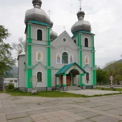 SightCathedral of the Descent of the Holy Spirit, Rakhivunder 1 km from Tysa River (Tisza)The three-domed church with a solemn main façade was built on the main square of Rakhiv from 1991 to 1993 according to the design of Rakhiv architect Mykhailo Kravchuk.
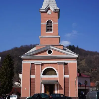 ArchitectureChurch of St. John Nepomuk, Rakhivunder 1 km from Tysa River (Tisza)John Nepomuky is one of the main architectural monuments of the small town of Rakhiv, Transcarpathian region.
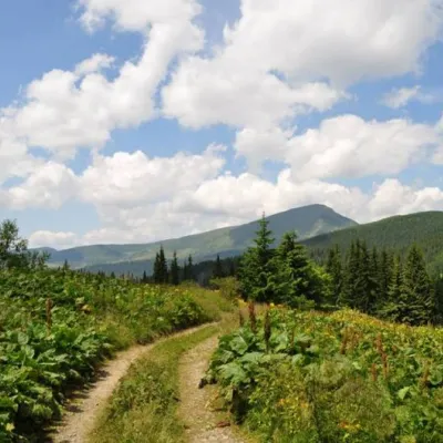 SightCarpathian Biosphere Reserve4.7 km from Tysa River (Tisza)There are many interesting places in Ukraine, but the Carpathian Biosphere Reserve, which is located in the heart of the Carpathians, is undoubtedly worthy of special...