Svicha River
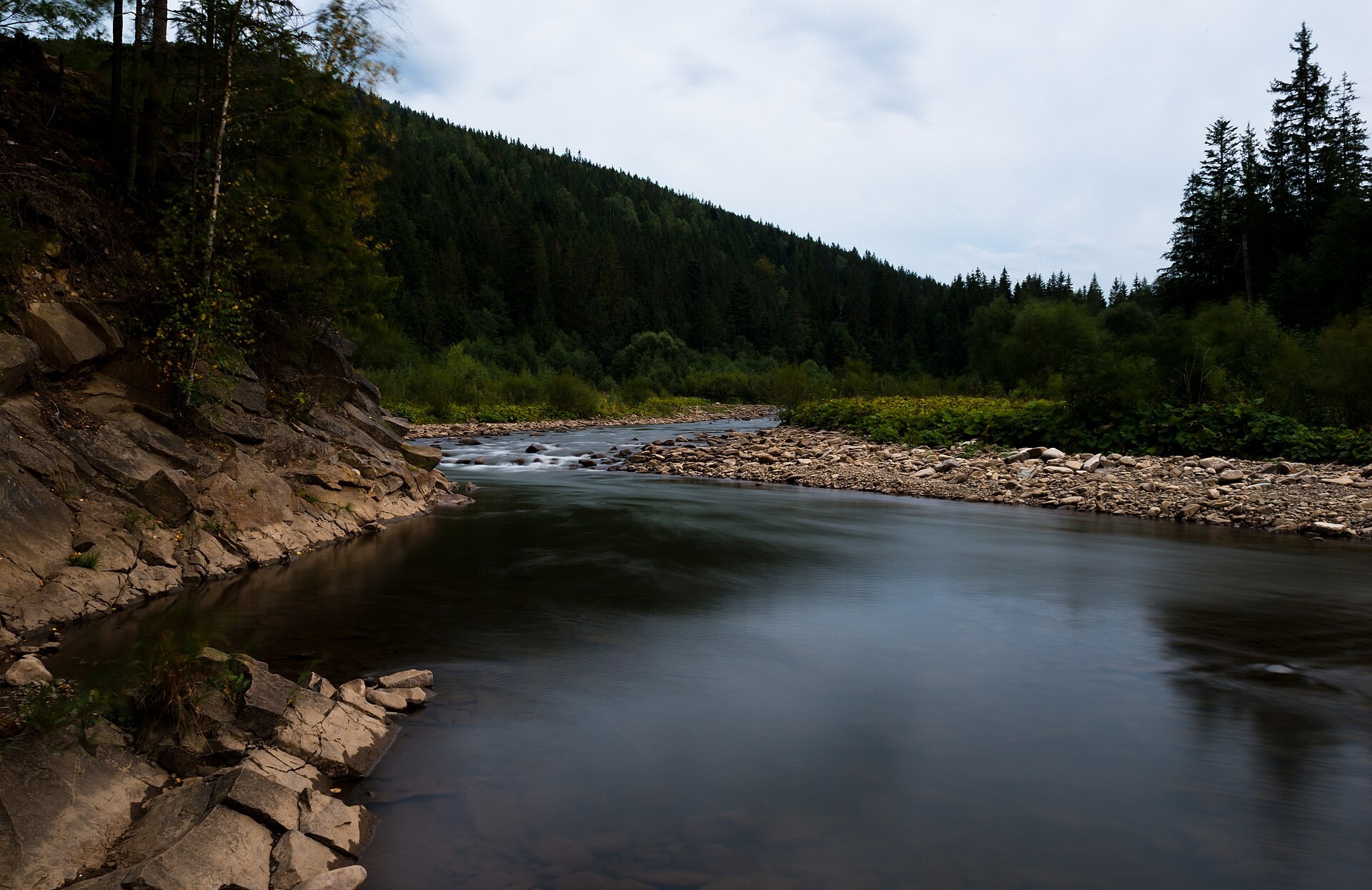
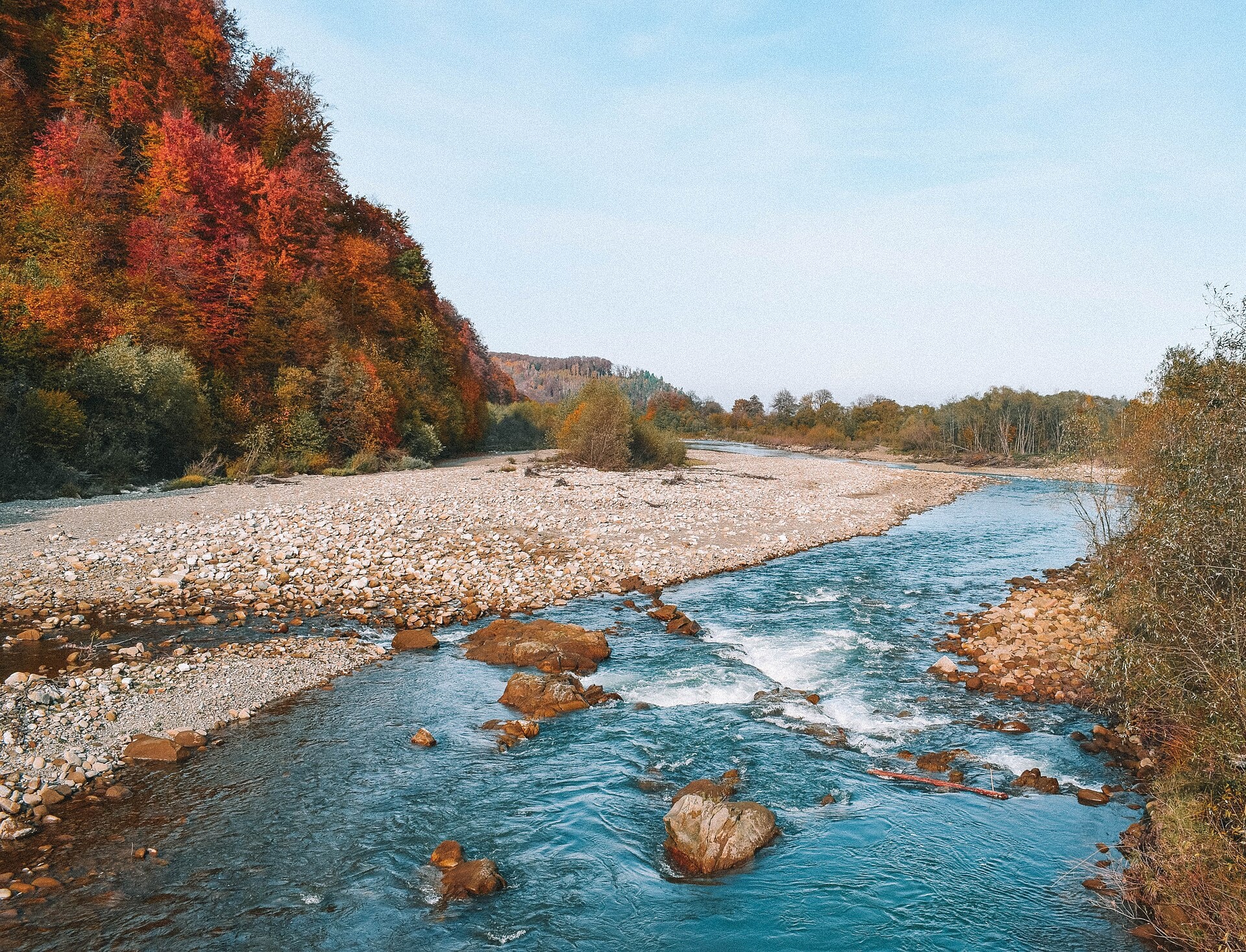
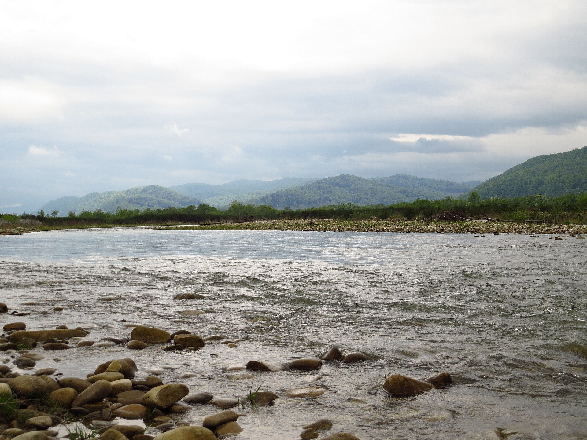
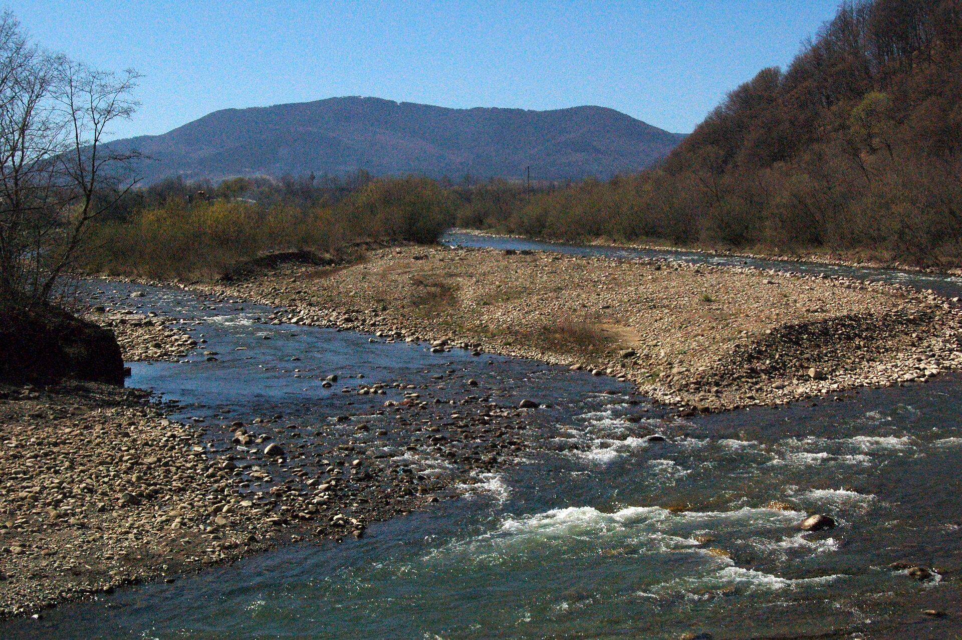
The Svicha is a 107-km right-bank tributary of the Dniester. It rises on the northern slopes of the main Gorgany divide, flows through Vyhoda, where the Mizunka joins it, passes Kniazholuky and enters the Dniester south-east of Zhuravno.
In the mountains the Svicha is a narrow river, 5–10 m wide, with rapids and rocky riffles. North of Kniazholuky it reaches the plain and flows more calmly. Together with its Mizunka tributary the river is protected as the landscape reserve «Svicha River with the Mizunka tributary» (since 1993). Vyhoda is a convenient place to start exploring the valley and the Gorgany forests.
The mountain course is trout water: surveys in 2015–2017 found brown trout here, as well as the Red Book grayling, which may not be taken. Travel sources also mention carp, pike and bream in the lowland part, but there is no scientific fish list for the Svicha, and the state did not stock it in 2018–2025. The river belongs to the Dniester basin, so the spawning closure runs from 1 April to 10 June, and trout are protected from 10 October to 1 March. Details are in the fishing section; other waters are on Fishing in the Carpathians.
- Length: 107 km
- Catchment: 1,493 km²
- Source: northern slopes of the main Gorgany divide
- Mouth: the Dniester south-east of Zhuravno
- Oblast: Ivano-Frankivsk
Photos: Pavlo Lutsan, CC BY-SA 4.0; TumkivA, CC BY-SA 4.0; YegorGeologist, CC BY-SA 4.0; Tetyana Kuchma, CC BY-SA 4.0 — Wikimedia Commons.
Location on the map
Fishing on the Svicha
The Svicha runs down from the Gorgany in a narrow rocky bed through Vyhoda and reaches the plain below Kniazholuky. The mountain course is trout water and also holds the Red Book grayling.
Can I fish now?
- Brown trout — closed until 1 MarchTrout spawning: closed from 10 October to 1 March in the Zakarpattia, Ivano-Frankivsk, Lviv and Chernivtsi regions.Each illegally caught fish costs UAH 7,225 in damages on top of the fine.
- Other species — allowed within the daily limitKeep to the minimum sizes and the daily limit; release protected species.
Limits and rules
Svicha River with the Mizunka tributary landscape reserve
The Svicha with its Mizunka tributary in the Dolyna district is a local landscape reserve (since 1993). Its public documents contain no fishing ban, but the reserve regulations are not published — check the regime with the Ivano-Frankivsk fisheries patrol.
What to catch
 Brown troutthe mountain course (records from 2015–2017) · closed from 10 October to 1 Marchclosed until 1 March
Grayling were recorded in the Svicha in 2015–2016. The Lviv Region travel portal mentions carp, pike and bream in the lowland part, but there is no scientific fish list for the river, and the state did not stock it in 2018–2025.
 Grayling
Red Book of Ukraine species: if one bites, unhook it carefully and release it. Taking one means a fine and compensation for damages.
Water quality
Monitoring post in Kniazholuka, last sampled on 14 July 2026.
- Dissolved oxygen9.5 mg O₂/lnorm at least 4
- Acidity, pH8.1norm 6.5–8.5
- BOD₅ (organic matter)1.3 mg O₂/lnorm up to 3
- Nitrates2.5 mg/lnorm up to 45
- Water temperature17 °C
All indicators are within the norms.
Bite forecast near Vyhoda
- TodayfairHigh pressure, moderate wind1026 hPa · wind up to 17 km/h · 6…9 °C
- TomorrowfairHigh pressure, light wind1026 hPa · wind up to 14 km/h · 5…8 °C
- Saturday, 17 OctobergoodSteady pressure, light wind1020 hPa · wind up to 10 km/h · 6…9 °C
Brown trout closed. Based on pressure, wind, temperature and cloud — an estimate, not a guarantee.
Fishing spots 93
Places where you can drive up to the water: fish markers on the page map and the list below. Look at the satellite view before you go — the bank may be steep or overgrown.
Closed right now: brown trout — until 1 March.
- Dirt-road access on the SvichaThe road comes almost to the water. Nearest village (straight line): Svoboda, 5.0 km.
- By the bridge on the SvichaThe road comes almost to the water. Bridge 120 m away. Nearest village (straight line): Svoboda, 5.0 km.
- Dirt-road access on the SvichaAbout 40 m to the water from a dirt road. Nearest village (straight line): Svoboda, 5.8 km.
- Dirt-road access on the SvichaThe road comes almost to the water. Nearest village (straight line): Svoboda, 6.3 km.
- Dirt-road access on the SvichaAbout 110 m to the water from a dirt road. Nearest village (straight line): Svoboda, 6.4 km.
- Local-road access on the SvichaAbout 40 m to the water from a local road. Nearest village (straight line): Svoboda, 7.0 km.
- Local-road access on the SvichaAbout 50 m to the water from a local road. Nearest village (straight line): Svoboda, 7.8 km.
- Local-road access on the SvichaAbout 40 m to the water from a local road. Nearest village (straight line): Vyshkiv, 7.7 km.
Show all spots (93)
- Local-road access on the SvichaAbout 140 m to the water from a local road. Nearest village (straight line): Vyshkiv, 7.8 km.
- Stream mouth on the SvichaAbout 150 m to the water from a dirt road. Nearest village (straight line): Myslivka, 7.1 km.
- Local-road access on the SvichaAbout 60 m to the water from a local road. Nearest village (straight line): Myslivka, 6.5 km.
- Local-road access on the SvichaAbout 80 m to the water from a local road. Nearest village (straight line): Myslivka, 5.6 km.
- Mouth of the Pustoshak tributary, Myslivka (4.5 km)About 100 m to the water from a local road. Nearest village (straight line): Myslivka, 4.5 km.
- Local-road access, Myslivka (3.7 km)The road comes almost to the water. Nearest village (straight line): Myslivka, 3.7 km.
- Local-road access, Myslivka (2.8 km)About 30 m to the water from a local road. Nearest village: Myslivka, 2.8 km.
- Local-road access, Myslivka (2.2 km)About 130 m to the water from a local road. Nearest village: Myslivka, 2.2 km.
- By the bridge, MyslivkaAbout 50 m to the water from an access road. Bridge 90 m away. Nearest village: Myslivka, 1.4 km.
- Dirt-road access, MyslivkaAbout 80 m to the water from a dirt road. Nearest village: Myslivka, 1.2 km.
- By the main road, MyslivkaAbout 30 m to the water from the main road. Nearest village: Myslivka, 1.5 km.
- Dirt-road access, Myslivka (2.3 km)The road comes almost to the water. Nearest village: Myslivka, 2.3 km.Nature reserve (zakaznyk) — check the fishing rules
- By the main road, Myslivka (3.3 km)About 70 m to the water from the main road. Nearest village (straight line): Myslivka, 3.3 km.
- Dirt-road access, Myslivka (4.2 km)About 60 m to the water from a dirt road. Nearest village (straight line): Myslivka, 4.2 km.
- By the bridge on the SvichaThe road comes almost to the water. A bridge is right here. Nearest village (straight line): Myslivka, 5.1 km.
- By the main road on the SvichaAbout 90 m to the water from the main road. Nearest village (straight line): Myslivka, 6.1 km.
- By the main road on the SvichaAbout 40 m to the water from the main road. Nearest village (straight line): Myslivka, 7.0 km.
- Stream mouth on the SvichaAbout 140 m to the water from the main road. Nearest village (straight line): Pidlisky, 6.5 km.
- By the main road on the SvichaAbout 90 m to the water from the main road. Nearest village (straight line): Pidlisky, 5.7 km.
- Mouth of the Shandrovets tributary, Pidlisky (4.8 km)About 60 m to the water from an access road. Bridge 60 m away. Nearest village (straight line): Pidlisky, 4.8 km.
- By the main road, Pidlisky (4.0 km)The road comes almost to the water. Nearest village (straight line): Pidlisky, 4.0 km.
- Dirt-road access, Pidlisky (2.6 km)About 110 m to the water from a dirt road. Nearest village: Pidlisky, 2.6 km.
- Dirt-road access, PidliskyAbout 150 m to the water from a dirt road. Nearest village: Pidlisky, 1.4 km.
- Dirt-road access, AnhelivkaAbout 60 m to the water from a dirt road. Nearest village: Anhelivka, 870 m.
- Dirt-road access, AnhelivkaAbout 80 m to the water from a dirt road. Village: Anhelivka.
- By the road, MaksymivkaAbout 70 m to the water from the road. Village: Maksymivka.
- Dirt-road access, MaksymivkaAbout 30 m to the water from a dirt road. Village: Maksymivka.
- Access from a village street, ShevchenkoveAbout 140 m to the water from the street. Village: Shevchenkove.
- Stream mouth, ShevchenkoveAbout 130 m to the water from the street. Nearest village: Shevchenkove, 1.1 km.
- Local-road access, PatsykivAbout 150 m to the water from a local road. Village: Patsykiv.
- Access from a village street, PatsykivAbout 70 m to the water from the street. Nearest village: Patsykiv, 900 m.
- Stream mouth, VyhodaAbout 120 m to the water from the road. Village: Vyhoda.
- Dirt-road access, NovoselytsiaAbout 130 m to the water from a dirt road. Nearest village: Novoselytsia, 970 m.
- Dirt-road access, NovoselytsiaThe road comes almost to the water. Village: Novoselytsia.
- Stream mouth, NovoselytsiaAbout 70 m to the water from a dirt road. Nearest village: Novoselytsia, 1.3 km.
- Stream mouth, Novoselytsia (2.3 km)About 100 m to the water from a dirt road. Nearest village: Novoselytsia, 2.3 km.
- Access road to the water, Kniazholuka (1.8 km)About 130 m to the water from an access road. Nearest village: Kniazholuka, 1.8 km.
- Dirt-road access, KniazholukaAbout 100 m to the water from a dirt road. Nearest village: Kniazholuka, 1.1 km.
- Stream mouth, VyhodivkaAbout 90 m to the water from the street. Village: Vyhodivka.
- Dirt-road access, TiapcheAbout 50 m to the water from a dirt road. Nearest village: Tiapche, 1.4 km.
- Dirt-road access, TiapcheAbout 110 m to the water from a dirt road. Nearest village: Tiapche, 950 m.
- Dirt-road access, TiapcheAbout 40 m to the water from a dirt road. Nearest village: Tiapche, 720 m.
- Dirt-road access, TiapcheAbout 80 m to the water from a dirt road. Nearest village: Tiapche, 1.1 km.
- Stream mouth, Hoshiv (1.5 km)The road comes almost to the water. Nearest village: Hoshiv, 1.5 km.
- Stream mouth, PidberezhzhiaAbout 80 m to the water from a dirt road. Nearest village: Pidberezhzhia, 1.1 km.
- Dirt-road access, PidberezhzhiaAbout 90 m to the water from a dirt road. Nearest village: Pidberezhzhia, 720 m.
- Stream mouth, HuziivAbout 130 m to the water from a dirt road. Nearest village: Huziiv, 760 m.
- Dirt-road access, Huziiv (1.6 km)About 60 m to the water from a dirt road. Nearest village: Huziiv, 1.6 km.
- Mouth of the Sadzava tributary, Huziiv (2.3 km)About 70 m to the water from a dirt road. Nearest village: Huziiv, 2.3 km.
- Dirt-road access, Zarichchia (2.6 km)About 90 m to the water from a dirt road. Nearest village: Zarichchia, 2.6 km.
- Dirt-road access, ZarichchiaAbout 60 m to the water from a dirt road. Nearest village: Zarichchia, 1.1 km.
- Stream mouth, ZarichchiaAbout 90 m to the water from a dirt road. Village: Zarichchia.
- Stream mouth, ZarichchiaAbout 80 m to the water from a dirt road. Village: Zarichchia.
- Dirt-road access, MizhrichchiaAbout 80 m to the water from a dirt road. Nearest village: Mizhrichchia, 1.0 km.
- Dirt-road access, Mizhrichchia (1.6 km)About 140 m to the water from a dirt road. Nearest village: Mizhrichchia, 1.6 km.
- Dirt-road access, MizhrichchiaAbout 50 m to the water from a dirt road. Nearest village: Mizhrichchia, 760 m.
- Local-road access, Mizhrichchia (1.6 km)About 120 m to the water from a local road. Nearest village: Mizhrichchia, 1.6 km.
- Stream mouth, Mizhrichchia (1.8 km)About 30 m to the water from a local road. Nearest village: Mizhrichchia, 1.8 km.
- Dirt-road access, Volia-Zaderevatska (2.3 km)About 120 m to the water from a dirt road. Nearest village: Volia-Zaderevatska, 2.3 km.
- Dirt-road access, Volia-Zaderevatska (2.1 km)About 80 m to the water from a dirt road. Nearest village: Volia-Zaderevatska, 2.1 km.
- Dirt-road access, Velyki Didushychi (2.3 km)About 130 m to the water from a dirt road. Nearest village: Velyki Didushychi, 2.3 km.
- Dirt-road access, Mali Didushychi (1.7 km)About 40 m to the water from a dirt road. Nearest village: Mali Didushychi, 1.7 km.
- By the road, Mali Didushychi (1.8 km)About 140 m to the water from the road. Nearest village: Mali Didushychi, 1.8 km.
- Dirt-road access, PodorozhnieAbout 90 m to the water from a dirt road. Nearest village: Podorozhnie, 1.5 km.
- Dirt-road access, ZarichneAbout 90 m to the water from a dirt road. Village: Zarichne.
- Stream mouth, Zarichne (1.6 km)About 150 m to the water from a dirt road. Nearest village: Zarichne, 1.6 km.
- Dirt-road access, DemivkaAbout 60 m to the water from a dirt road. Nearest village: Demivka, 1.1 km.
- Dirt-road access, DemivkaAbout 70 m to the water from a dirt road. Nearest village: Demivka, 910 m.
- Dirt-road access, DemivkaThe road comes almost to the water. Village: Demivka.
- Dirt-road access, DemivkaAbout 40 m to the water from a dirt road. Village: Demivka.
- Dirt-road access, SuliatychiAbout 130 m to the water from a dirt road. Nearest village: Suliatychi, 1.3 km.
- Dirt-road access, Zarichne (1.6 km)About 120 m to the water from a dirt road. Nearest village: Zarichne, 1.6 km.
- Stream mouth, ZahrabivkaAbout 70 m to the water from a dirt road. Village: Zahrabivka.
- Dirt-road access, ZarichneAbout 70 m to the water from a dirt road. Nearest village: Zarichne, 960 m.
- Dirt-road access, Zarichne (1.8 km)About 150 m to the water from a dirt road. Nearest village: Zarichne, 1.8 km.
- Dirt-road access, Dubravka (1.7 km)About 120 m to the water from a dirt road. Nearest village: Dubravka, 1.7 km.
- Dirt-road access, DubravkaAbout 50 m to the water from a dirt road. Nearest village: Dubravka, 980 m.
- Stream mouth, DubravkaAbout 60 m to the water from a dirt road. Nearest village: Dubravka, 970 m.
- Stream mouth, VolodymyrtsiAbout 120 m to the water from a dirt road. Nearest village: Volodymyrtsi, 1.3 km.
- Dirt-road access, MelnychAbout 90 m to the water from a dirt road. Nearest village: Melnych, 1.2 km.
- Dirt-road access, MelnychAbout 110 m to the water from a dirt road. Nearest village: Melnych, 900 m.
- Dirt-road access, MelnychAbout 60 m to the water from a dirt road. Nearest village: Melnych, 770 m.
- Tributary mouth, MelnychAbout 50 m to the water from a dirt road. Nearest village: Melnych, 1.2 km.
- Dirt-road access, ZhuravnoAbout 60 m to the water from a dirt road. Nearest village: Zhuravno, 1.5 km.
- Dirt-road access, ZhuravnoAbout 40 m to the water from a dirt road. Nearest village: Zhuravno, 1.3 km.
Spots are marked from open data (roads and ways to the water, OpenStreetMap); if a spot is inconvenient or inaccessible, let us know. © OpenStreetMap, ODbL.
Springs: Recreational Fishing Rules (Order No. 700 of the Ministry of Agrarian Policy); State Fisheries Agency, Ivano-Frankivsk: trout spawning; State Fisheries Agency, Ivano-Frankivsk: spawning ban; Wikipedia (uk): Svicha (Dniester tributary); Lviv Region travel portal: the Svicha river; OpenStreetMap; Kharchenko V. et al. Records of protected animal species in Ukraine (GBIF, CC BY 4.0); State Fisheries Agency: fish stocking, data.gov.ua (CC BY); Red Book of Ukraine animal list (Ministry of Environment Order No. 29, 2021); State Water Agency: water monitoring (CC BY); Weather forecast: MET Norway (CC BY 4.0). Rules may change — check the current orders of the fisheries patrol.
Comments
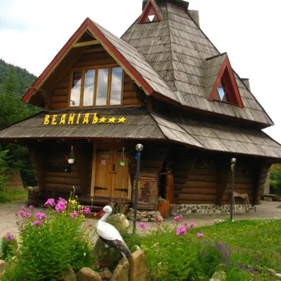
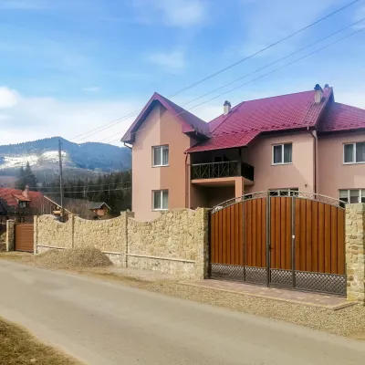
Where anglers can stay
Stays offering fishing within 2 km of the river
Trails nearby
All trails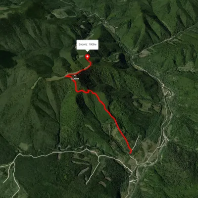 EasyOne-dayMarkedRoute to Mount ShchavnaElevation profile562–1 152 m5 kmascent 710 m≈ 2.5 h walking12 km from Svicha River
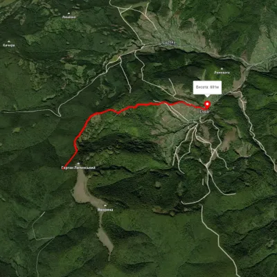 EasyOne-dayMarkedLypa village Robert's Bunkervia YavorynaElevation profile597–1 079 m11.2 kmascent 118 m≈ 3 h walking15 km from Svicha River
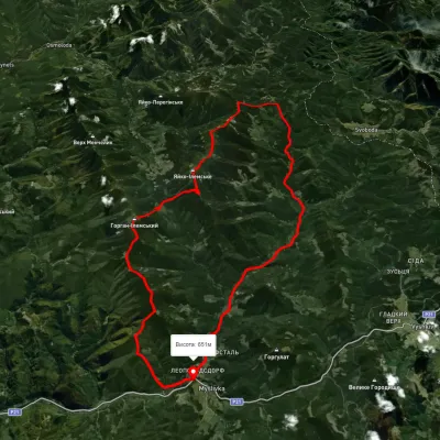 HardMulti-dayUnmarkedMyslivka village loopvia Mount Yayko-Ilemske, Mount Horhan-IlemskyiElevation profile648–1 656 m47.2 kmascent 2 092 m17 km from Svicha River
Nearby attractions
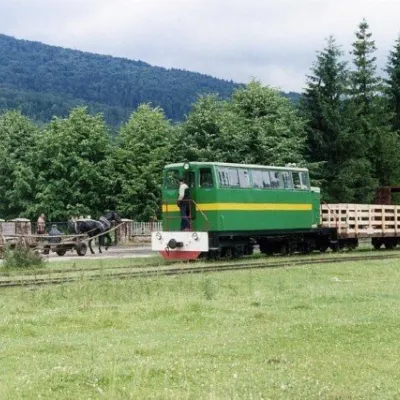 ArchitectureCarpathian TramVyhodaunder 1 km from Svicha RiverIn 1873, Austrian entrepreneur Baron Leopold Popper von Podgari moved the headquarters of his company from Hungary to Galicia.
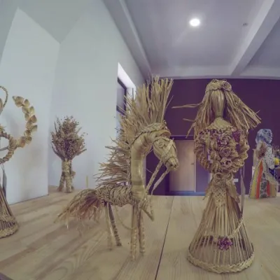 MuseumMuseum "Heritage Center of the Vygoda Narrow Gauge Railway" VygodaVyhodaunder 1 km from Svicha RiverIn Ukraine, a unique Museum "Heritage Center of the Vygoda Narrow Gauge Railway" has opened in the village of Vygoda in the Dolyna district.
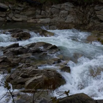 WaterfallMizun waterfallsNovyi Mizun9.7 km from Svicha RiverMizunski waterfalls are a great place for lovers of mountain recreation. Steep slopes and rapids on the Mizunka River create an incredibly spectacular cascade of...