The Carpathian Mountains are a large mountain system in Central and Eastern Europe
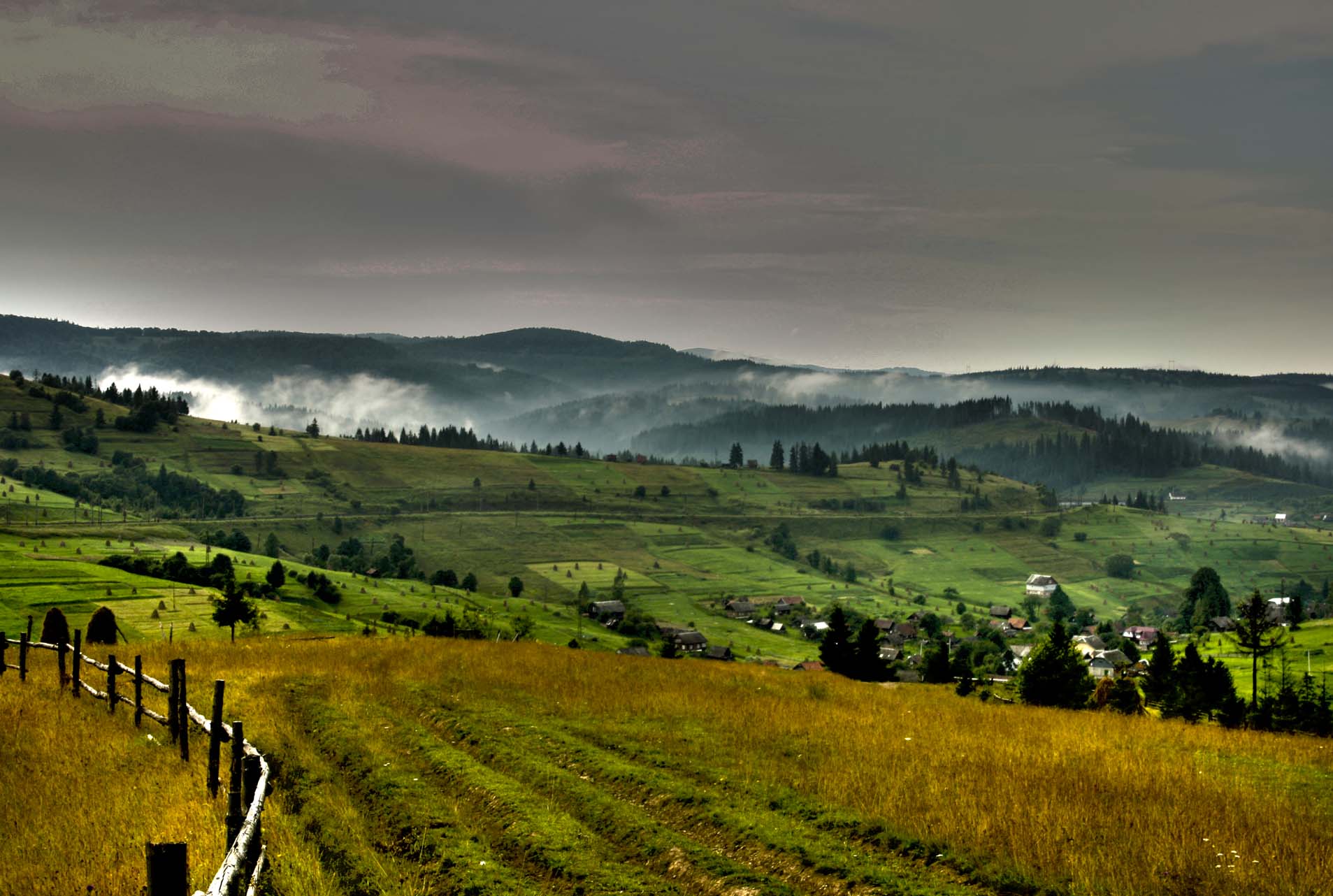
TheUkrainian Carpathians are part of the Carpathian mountain system in western Ukraine. They are 280 km long from the headwaters of the San to the headwaters of Suceava and over 100 km wide. They occupy the territory of Zakarpattia, partially Lviv, Ivano-Frankivsk and Chernivtsi regions. The area is over 24 thousand square kilometers. The mountain ranges, separated by longitudinal valleys and delimited by deep transverse valleys, stretch from NW to SE. Within Ukraine, the Carpathians are divided into: external (Beskydy, Gorgany, Pokutsko-Bukovyna Carpathians, central (Verkhovyna) and internal (Polonyna-Chernohora). The Carpathians are about 25 million years old.

The Carpathian mountain range, located in the far west of our country, is part of the so-called Alpine folded geosyncline region. It is much larger than the Crimean Mountains and forms a 1500 km long arc curving to the northeast. But only a part of this mountain system is located on the territory of Ukraine. The highest point of the Carpathians is Mount Gerlachowski-Stiet, which reaches a height of 2,655 meters above sea level and is located outside of our country.
It is in the High Tatras that the highest point of the Carpathians, Mount Gerlachowski Stt, is located:
The Ukrainian Carpathians are part of the Eastern Carpathians mountain system (which are divided into the Outer Eastern Carpathians and the Inner Eastern Carpathians) in western Ukraine.
They are 280 km long from the headwaters of the Syan to the headwaters of the Suceava, and over 110 km wide. They occupy the territory of Zakarpattia, Lviv, Ivano-Frankivsk, and Chernivtsi regions. The total area of the mountain system is over 24 thousand km². The mountain ranges, separated by longitudinal depressions and delimited by deep transverse valleys, stretch mainly from northwest to southeast.
The term "Ukrainian Carpathians" is not geographical, but rather political and ideological. The term was first actively used after September 1939 by Soviet politicians, journalists, and scholars. In terms of modern geographical zoning, the so-called "Ukrainian Carpathians" are the central part of the Eastern Carpathians, which is artificially distinguished within the modern state border of Ukraine and includes the eastern part of the Beskydy, the Gorgany, Chornohora and the eastern part of the Vyhorlat-Hutyn ridge, the Rakhiv massif and Chyvchyny.
Geography of the Carpathians
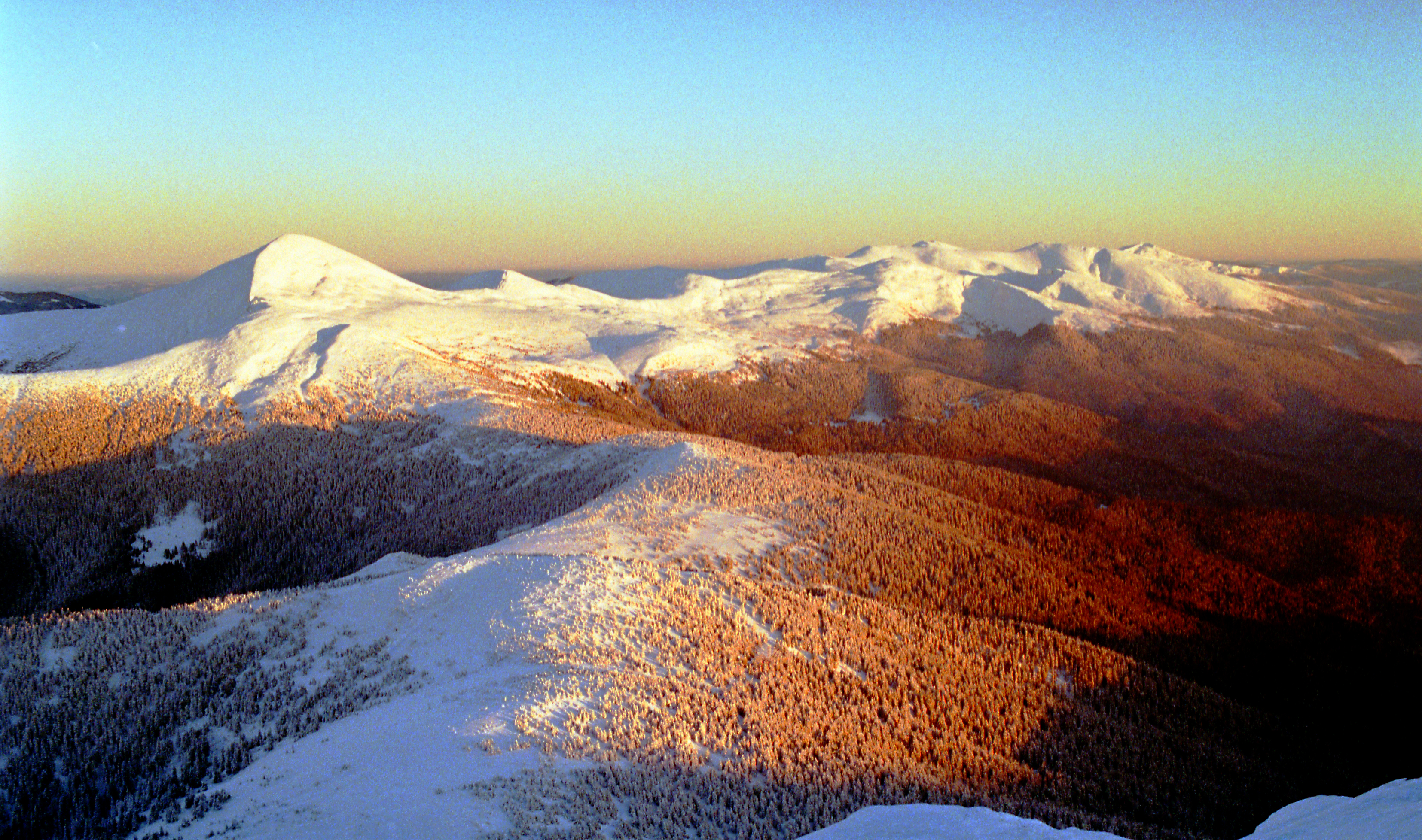
The absolute altitudes of the mountain system range from 120-400 m at the foot of the mountains to 500-800 m in the intermountain hollows and 1500-2000 m along the main ridges. All of the highest peaks - Hoverla (2061 m, the highest point in Ukraine), Brebeneskul (2036 m), Pip-Ivan Chornohirsky (2028 m), Petros (2020 m), Hutyn-Tomnatyk (2016 m), and Rebra (2001 m) - are concentrated in the Chornohora massif.
The geological structure is dominated by Cretaceous-Paleogene flysch, with outcrops of Jurassic limestone and Paleozoic crystalline schist. Neogene volcanogenic formations are represented by andesite, basalts and their tuffs.
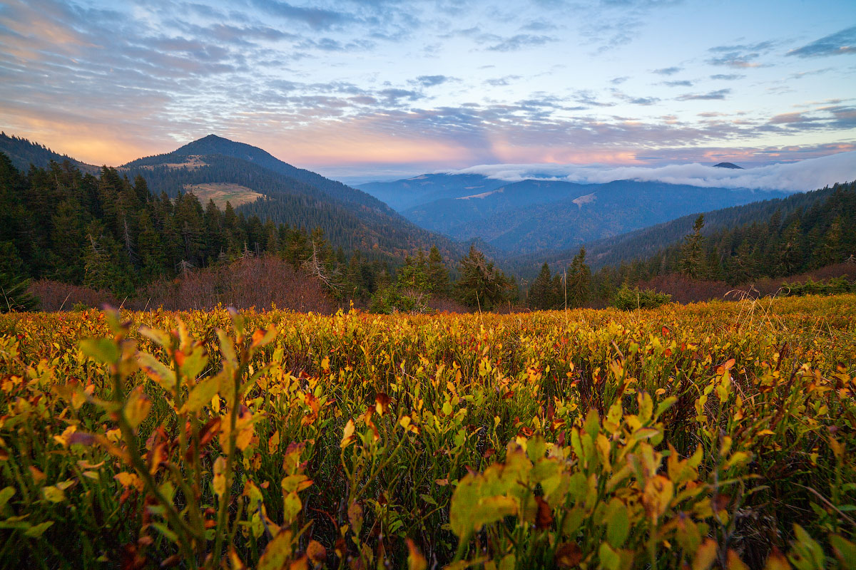
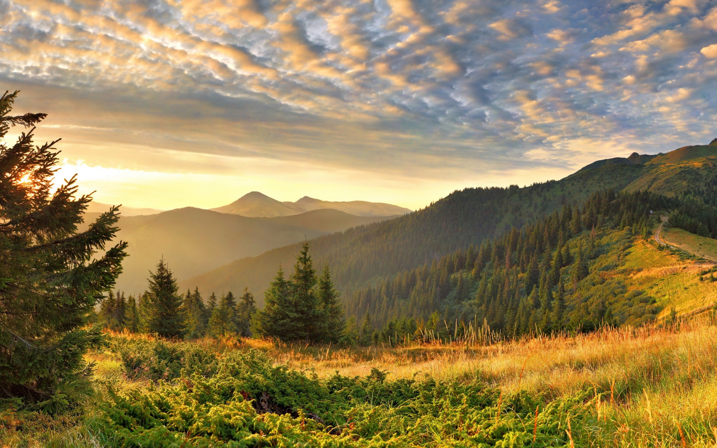
The nature of the Ukrainian Carpathians is represented by a complex system of territorial units that create high-mountain, middle-mountain, low-mountain and foothill tiers. The highland tier includes the ancient glacial-highland flysch mountain landscapes with a maximum relative elevation of up to 1500 m ( Chornohora, Svydovets, etc.) in the axial part of the mountains. The second type of mountain landscapes of this tier is the ancient glacial-high mountain crystalline(Marmarosh massif, Chivchyny). Three types of landscapes make up the next, the main one in terms of area, the mid-mountain tier. Mid-Mountainous-Polonynian landscapes (elevation up to 1300 m) are represented by the massifs of the Polonynsky ridge (Pikuy, Borzhava, Krasna, Stiy). The powerful outer ridge is made up of mid-mountainous skiba landscapes (up to 1000 m), most typically expressed in the Beskydy and Pokutsko-Bukovyna Mountains. Along the southern edge of the Ukrainian Carpathians are the mid-mountainous ancient volcanic landscapes of the Volcanic Carpathians (Makovytsia, Sinyak, Velykyi Dil, Buzhora, Tupyi).
The landscapes of the lowland tier extend in two bands inside the mountains and form their edge structures. The intermountainous Verkhovyna landscapes (up to 400 m) are associated with the Main Carpathian Watershed (Stryi-Sanska, Volovets and other uplands, as well as the Mizhhirya, Verkhnobystryska, Yasinska, Vorokhtyanska and Verkhovyna depressions). The main Carpathian passes are located here (Uzhok Pass, Veretsky Pass, Volovets Pass, and others). The regional fault, which limits the Flysch Carpathians in the south, is accompanied by low mountain and steep landscapes - Uholsky, Svalyava, and others (up to 400 meters high). The most famous karst caves of the region are concentrated here. The north-eastern edge of the Ukrainian Carpathians is made up of lowland and hill landscapes (up to 400 m) in the interfluves of the Dniester, Stryi, Svicha, Limnytsia, Bystrytsia, Prut, Cheremosh, and Siret. Hill and hollow landscapes (over 300 meters) are characteristic of the Tisza, Teresva, Tereblya, Rika, Borzhava, and Latorytsia rivers in the Transcarpathian lowlands. The most important mineral resources are oil, natural gas, ozokerite, sulfur, and mineral healing waters.
Climate.
According to the climatic zoning, the mountains belong to the Ukrainian Carpathian subregion. The climate is temperate continental, warm, with cyclonic and anticyclonic intrusions of Atlantic air. The temperature of the warmest month (July) in the foothills is +18, +20°, in the highlands +8, +10°, and the coldest month (January) is -3, -6° and -8, -9°, respectively.

Precipitation ranges from 500-800 mm in the foothills and up to 1600-2000 mm on the highest ridges. In these conditions, a dense (up to 1.5 km/sq. km) hydrographic network is formed - numerous sources of the Tisza, Dniester and Prut. They are rivers of mixed feeding with a predominance of rainfall. The regime is flooded throughout the year. In the ancient glacial-highland landscapes, there are still brown lakes (Brebeneskul, Verkhne, Nesamovyte, Vorozheska, Apshynets, and others). The largest of the rock lakes is Synevyr. There are remnants of artificial reservoirs - gates.
Flora and fauna
The altitudinal landscape differentiation of vegetation and soil cover is expressed in the dominance of subalpine meadows and wastelands with mountain-meadow-brown soil in the meadows; subalpine crooked forests of mountain pine, juniper, alder and other species in the caras and high watersheds; spruce and beech-fir-spruce forests with brown mountain-forest soils on steep ridge slopes of high mountain meadow and skiba landscapes; beech forests with mountain-forest brown soils on the slopes of mid-mountain meadow and ancient volcanic landscapes. In the lowlands and hills, there are pockets of primary oak forests. In the intermountain and upland landscapes and river valleys, meadows are common, and alder and willow communities are characteristic. The Carpathian forests are characterized by the following impurities: hornbeam, sycamore, ash, and occasionally birch and cedar. The forest cover of the mountains exceeds 50%. The fauna of the Ukrainian Carpathians is dominated by representatives of the forest complex.
Nature protection sites
In the Ukrainian Carpathians there are more than 1400 nature protection objects that occupy 2.8% of the total area of the mountains (the highest figure in Ukraine). The diversity of natural conditions of the Ukrainian Carpathians and the availability of therapeutic resources contributed to the formation of a resort area of interstate importance.
National natural parks:
- Carpathian National Nature Park - Ivano-Frankivsk region;
- Hutsulshchyna National Nature Park - Ivano-Frankivsk region;
- Uzhansky National Nature Park - Zakarpattia region;
- Synevyr National Nature Park - Zakarpattia region;
- Skole Beskydy National Nature Park - Lviv region;
- Vyzhnytsia National Nature Park - Chernivtsi region.
Nature reserves:
- Carpathian Biosphere Reserve - Transcarpathian region;
- Gorgany Nature Reserve - Ivano-Frankivsk region;
"Gorgany is a nature reserve in the Ukrainian Carpathians. It is located in the southwestern part of Ivano-Frankivsk region in the Dovbushanski Gorgany area. It was founded in 1996. It was created to preserve the relict European cedar pine(Pinus cembra). The territory of the reserve has typical geomorphological structure, vegetation and fauna structure for the Gorgan region, so the reserve is of great value for the conservation, restoration and study of biodiversity of the region and the Ukrainian Carpathians in general. In 2005, it was granted the status of a "state reserve."
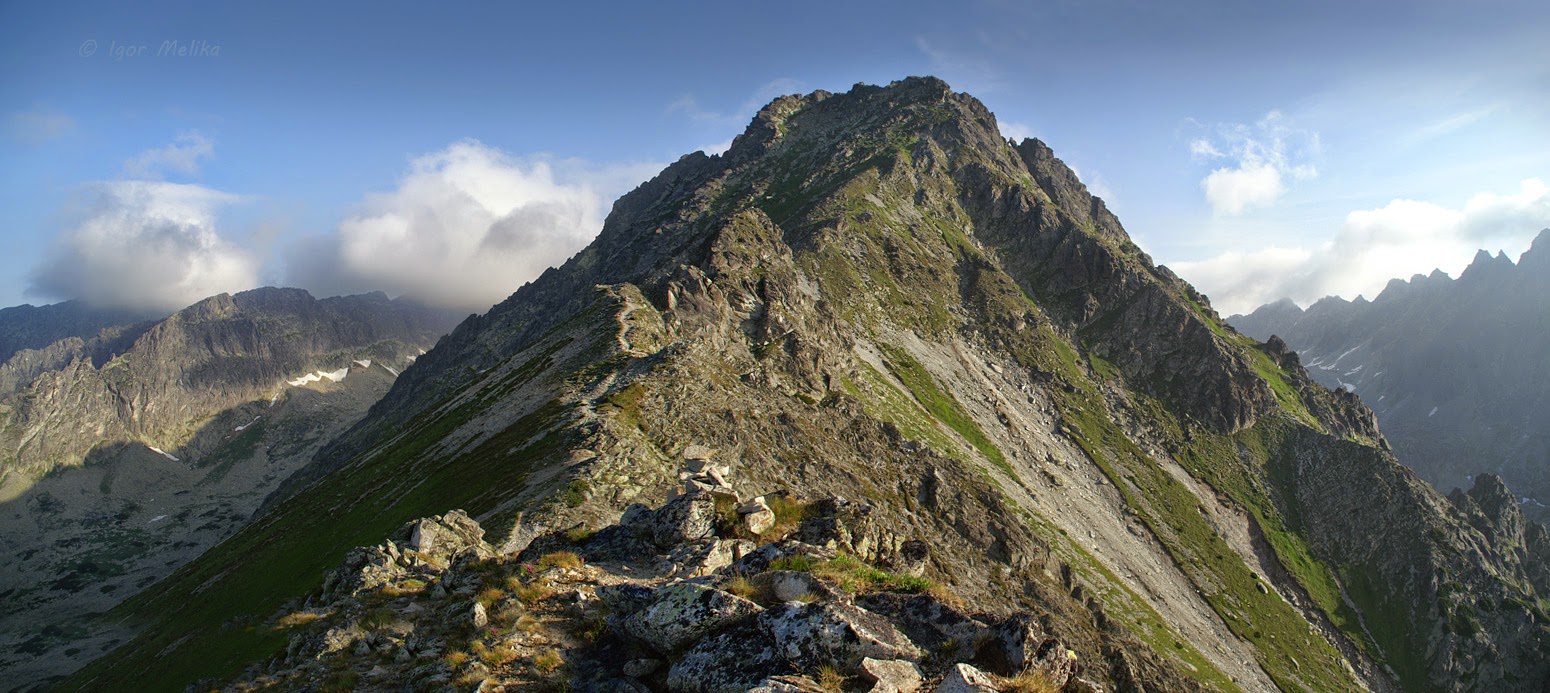
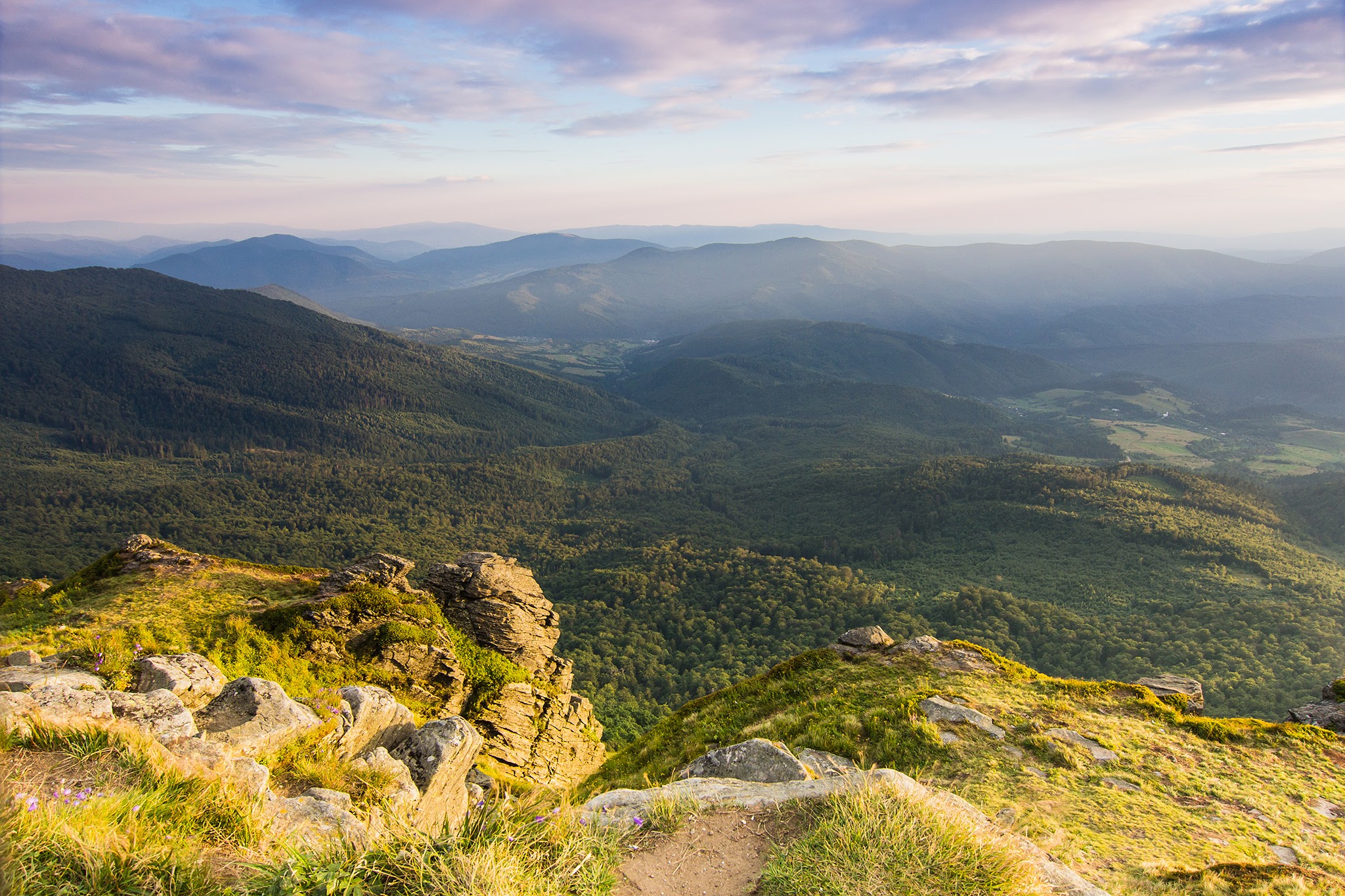
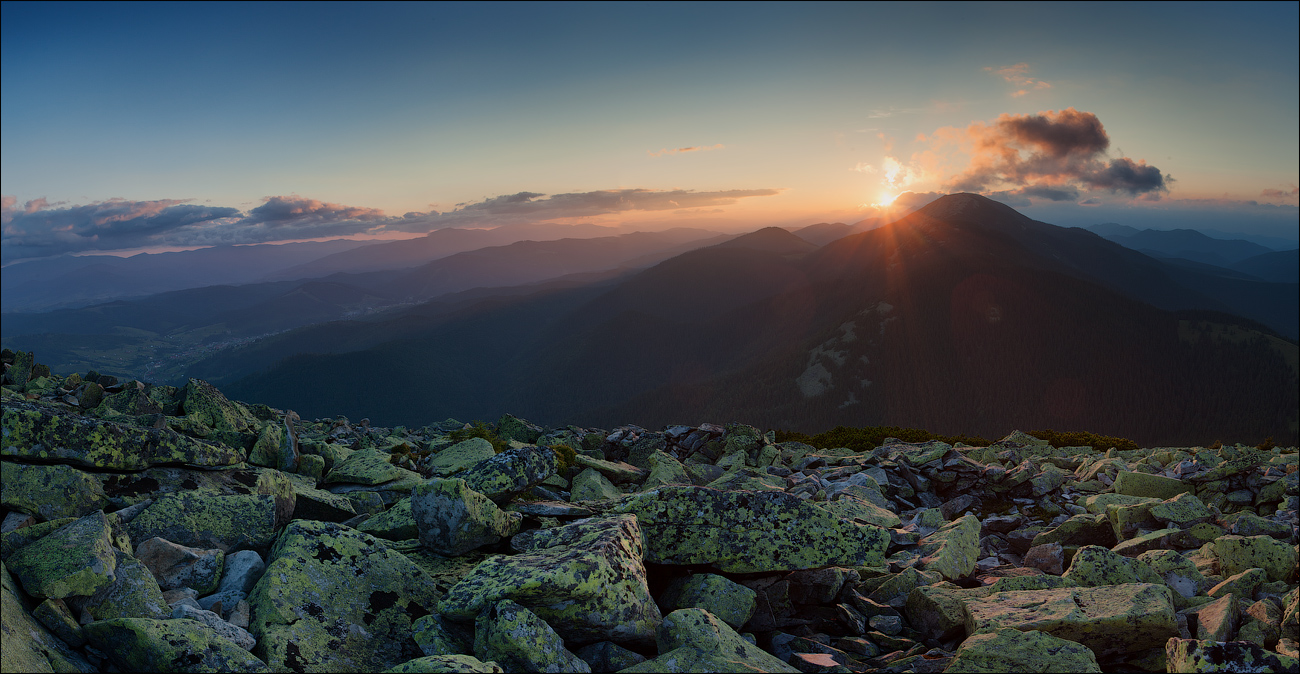 The Gorgany cannot be confused with any other mountain range in the Carpathians. Gray stone placers covered with greenish lichen can be found on every Gorgany peak. And such mushroom moss forests and paths intertwined with roots are probably not seen anywhere else.
Popular and wild at the same time
The Gorgany Mountains stretch for as much as 80 km and are 40 km wide - you can't walk across them! These mountains are difficult to access: although the highest peak reaches only 1,754 meters, the elevation differences in the Gorgany are significant, and the stone fields that cover each mountain top prevent you from overcoming them quickly and comfortably.
At the same time, only a lazy tourist has not yet visited Khomyak, Synyak, or Yavirnyk-Horgansky - even children's tourist groups go to these peaks.
References used: http://igormelika.com.ua/moi-karpati/...