Pidzakharychi


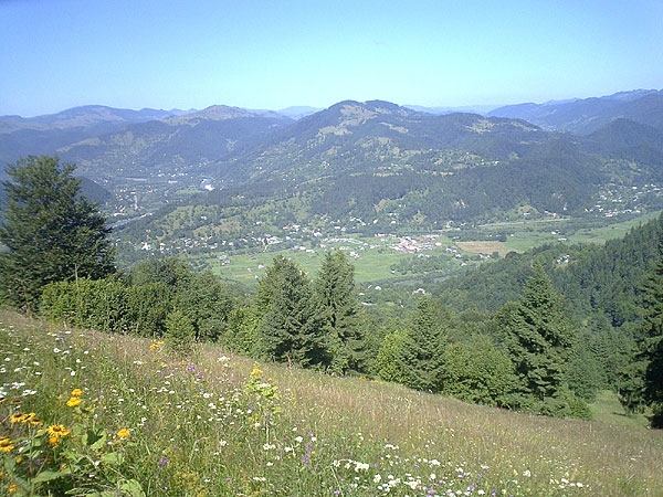
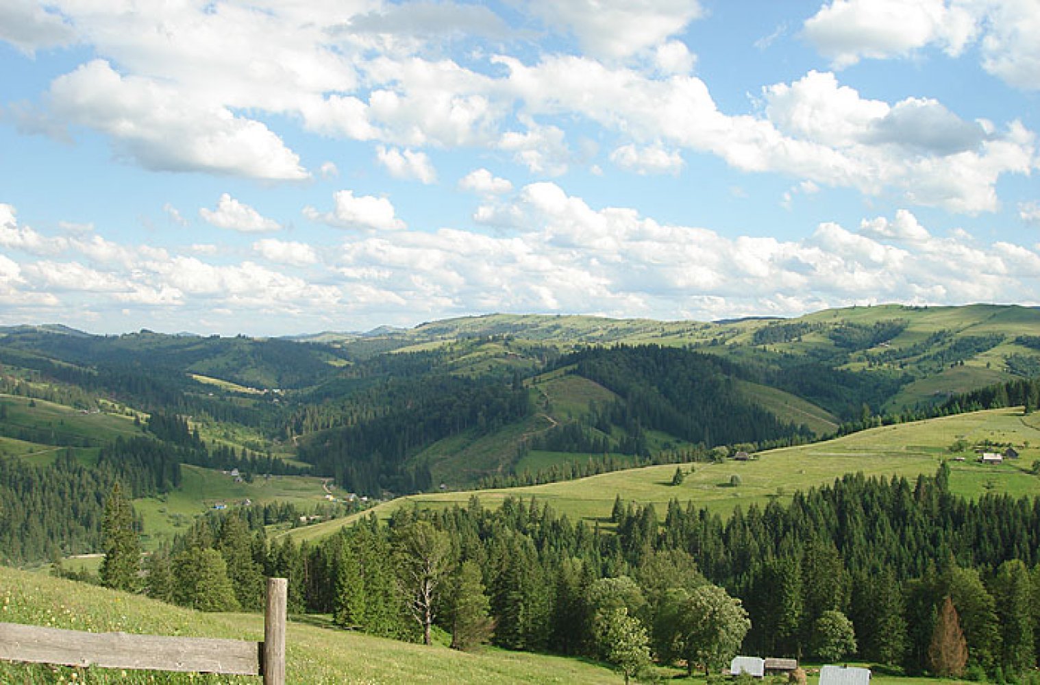
Pidzakharychi is a village in Ukraine, in the Chernivtsi region, Putyla district. The local self-government body is the Pidzakharychi village council. The population is 443 people.
It was founded in 1774. The territory on which the village was later founded was a part of Kyivan Rus, later - Galicia-Volyn state. In the Middle Ages it was part of the Moldavian principality. In 1775, the Habsburgs took Bukovyna from the weakened Ottoman Empire and until 1918 the village was part of the Austrian monarchy as part of the imperial province of Bukovyna.
On November 28, 1918, the village, like the entire Bukovyna region, was occupied by Romania. At the same time, during 1918-1939, the village was located in the border zone of Romania and Poland, the border ran along the Cheremosh River. Since 1940, it has been part of the Ukrainian SSR. Already in 1941, the Romanians, as allies of Germany, temporarily restored their occupation power in the village. Since 1944, the village has been part of Ukraine for good.
There is an interesting legend about the foundation of the village and its name. At a time when the Hutsul lands were alternately ruled by the Tatars and the Poles, who kept the locals busy, a man named Zakharii settled on top of a mountain that rises above the present-day village, not far from a mountain lake. Here he developed his own farm, kept horses, bulls, and sheep. One day, in broad daylight, the yard became dark, as if it were night, and a rainstorm with strong winds began. When Zacharias began to gather his livestock in a pile, he found that the best bull had disappeared. This happened every day. One day Zechariah came to the lake and saw that the water was red like blood. When his bull went to the lake to drink, a two-headed monster came out and grabbed the bull. Zacharias shot the beast with his rifle, but this time the monster managed to escape, flying over the mountains and hiding behind the Cheremosh.
The next time, Zacharias prepared thoroughly for the meeting with the monster by loading his guns with steel blades. On the third day of waiting, the monster appeared to attack Zachary. The rifle seemed to shoot at the beast and blinded it with fire. The wounded beast hung on a beech tree, and black blood dripped from its body. Zacharias took a sharp axe and cut off the monster's heads one by one. After that, the water in the lake became clear, the shores were covered with dense vegetation, and the human cattle never disappeared again. It is easy to guess that the Tatar hordes and the Polish gentry became the prototypes of the two-headed monster.
The inhabitants of this area saw Zacharias as a liberator and protector, and began to settle under the mountain where Zacharias lived. This is how the settlement emerged, which was first called Zakharchy, later Pidzakharych, and finally received the modern name Pidzakharychi.
Almost until the end of the twentieth century, before the construction of the road from Kuty to Roztok, the village's connection with the outside world in summer was through the Nimchych pass. In winter, Pidzakharychi remained cut off from civilization for almost six months. This contributed to the preservation of old folk traditions and local Hutsul flavor in the village. Almost all the villagers still wear embroidered shirts, colorful weddings are held here, and every house is actually a creative workshop or museum, and every family is a family art school. The residents of Pidzakharychi also have a sense of humor: they love to joke, like to cheer up with their own humorous stories and sayings, which is why the village has gained the fame of the "Hutsul Gabrov."
There are 5 museums of folk crafts in this small village, the most valuable of which is the museum of art works by the folk master, artist Ksenia Kolotylo. In the center of Pidzakharychi there is a museum of ethnography and local history of the Hutsul region, which presents antiquities, Easter eggs, embroidery, and carving.
Next to the museum, there is a peculiar wooden monument to a giant called "Garchyk" that has already become a symbol of the village. In the Hutsul region, a harchyk is a wooden vessel that resembles a huge mug used to store a fermented milk drink called guslyanka.
Since 2001, on the last weekend of September, Pidzakharychi has become a center of pilgrimage for connoisseurs of Hutsul traditions not only from the Bukovyna Hutsul region, but also from the entire Hutsul region of Ukraine and even Romania. Here, in the Museum of Ethnography and around the giant wooden garchyk, the annual ethnographic Hutsul festival-fair "Zakharetskyi Garchyk" takes place, a celebration of national culture, ethnic traditions and crafts. It is held to promote rural tourism, popularize the unique natural resources of the region and its historical and cultural heritage, revive and enhance Hutsul national customs, and search for young talent.
From morning to evening, the festival features traditional Hutsul music, numerous folklore groups demonstrate their skills, and festival guests try their hand at crafts, carving, and painting Easter eggs. The Hutsul Chichka contest ("chichka" means "flower" in the local dialect) is held among young Hutsul women, where young flowers compete for dignity, talent, wit and other qualities of a hostess.
At the festival, you can taste traditional Hutsul dishes: guslyanka, mamalyga, buy products of folk artists, try yourself as a carver or Easter egg painter. There are also master classes in traditional Hutsul art for festival guests.
Next to the museum and the giant "garky" is a crane well, and the path leading upwards will lead us to the Church of St. Basil. The wooden church and bell tower were built in 1876.
Its architecture is typically Hutsul: three towers on octagons, the nave is much wider than the chancel and the altar. Almost the entire church, except for the lower log cabins, is covered in shiny tin.
The church is located on a slope, and it offers a wonderful view of the village and the Cheremosh valley.
If you climb the mountain path to the top of the mountain that rises above Pidzakharychi, you will find a cave named after Oleksa Dovbush among the piles of huge limestone stones. Indeed, the legendary leader stayed in the surrounding settlements in 1741-1742 Dovbush: Vyzhnytsia, Putyla, Roztoky, Dovhopillia, and according to local legends, one of his places of residence was this cave. Romanian archives show that at that time the secretary of Potocki's Pokuttya estates appealed to the Moldovan lord Mavrokordat with a complaint that "the Pokuttya leader of the opryshky, Oleksa Dovbush, who is being persecuted by the Polish nobility, according to their exact data, has now gone to the Moldovan side for the winter to hide there." Starting in 1742, the neighboring village of Roztoky became the center of opryshky activity.
The entrance to the cave is located at an angle of 30-40 degrees on the northern part of the rocks, with an entrance height of up to 2.5 meters. Today the cave is 10 meters long, although according to legend it used to be 30 meters long. It is also said that in Dovbush's time it was connected to the Galician bank of the Cheremosh.
The cave can also be accessed from the direction of Vyzhenka, if you go up from the church of Ivan Suchavskyi along the Lyskovets stream to its source, and then follow the mountain path to the top of the mountain. In both cases, it is better to have a guide to get to the cave and explore it.
Відео

Що відвідати
Пам’ятки, музеї та цікаві місця поруч з Pidzakharychi.
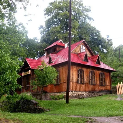 МузейМузей етнографії та краєзнавства Гуцульщини, ПідзахаричіПідзахаричіменше 1 км від центруМузей етнографії та краєзнавства Гуцульщини у селі Підзахаричі Чернівецької області був заснований у XX ст. і знаходиться у центрі села, неподалік від церкви.
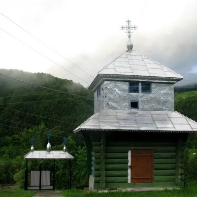 ЦеркваЦерква Святого Василія, ПідзахаричіПідзахаричіменше 1 км від центруЦерква святого Василія у селі Підзахаричі Чернівецької області спочатку була зведена у 1866 (за деякими іншими даними – у 1876 р.) у стилі гуцульської школи народної...
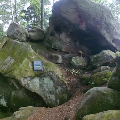 Історична пам’яткаПечера Довбуша, ПідзахаричіПідзахаричіменше 1 км від центруТутешні місця не обійшов увагою відважний ватажок опришків: недалеко від перевалу Німчич знаходилася печера Довбуша, яка служила притулком для повстанців.
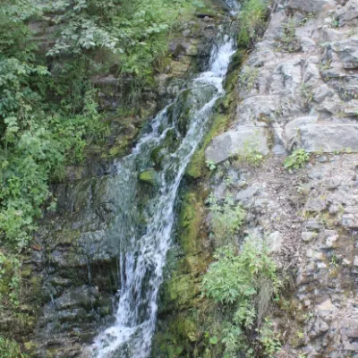 ВодоспадВодоспад СикавкаВеликий Рожин2,4 км від центруВодоспад Сикавка - водоспад, що розташований біля Сокільських скель – також між селами Тюдів та Великий Рожин.
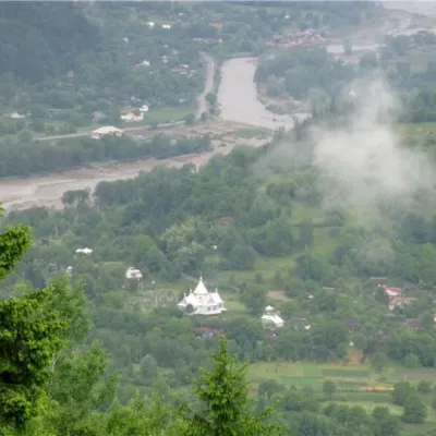 ПриродаПеревал Німчич, ПідзахаричіПідзахаричі3 км від центруПеревал Німчич, висотою 586.3 м над рівнем моря, знаходиться між Вижницьким (село Виженка) і Путильским (село Підзахаричі) районами Чернівецької області.
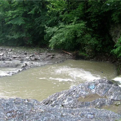 РічкаРічка ВиженкаВиженка3,3 км від центруРічка Виженка знаходиться у однойменному селі Чернівецької області. На річці Виженці знаходиться відомий водоспад Миква(Міква).
Крафт поруч
Усі крафтові місця ЕкофермиРавликова ферма «Прикарпатський равлик», БагнаБагна7 км від центруРавликова ферма «Прикарпатський равлик» — одне з небагатьох гастрономічних господарств Вижниччини, куди можна приїхати не лише по продукцію, а й на екскурсію.
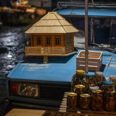 Ринки й ярмаркиНічний базар деревини, КутиКути8,9 км від центруНічний базар у Кутах — найколоритніший ринок дерев'яних виробів на Гуцульщині, який зникає разом зі світанком.
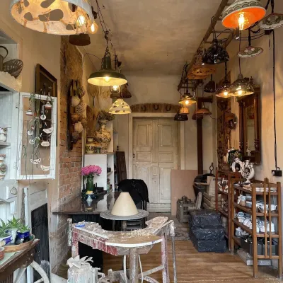 Крафтові крамниціМайстерня-крамниця авторської кераміки Firaworkshop, КосівКосів12 км від центруFiraworkshop — творча майстерня авторської кераміки в Косові, на вулиці Незалежності, 213, де можна і купити готові речі, і спробувати власноруч попрацювати з глиною.
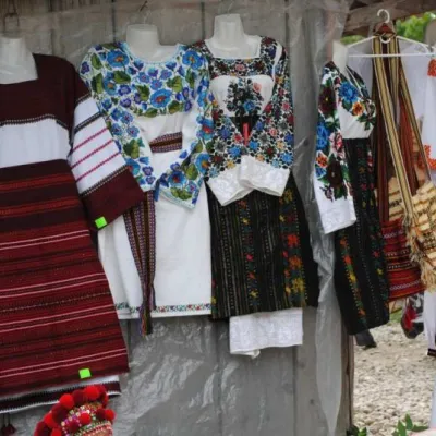 Ринки й ярмаркиКосівський базар (Смоднянський ринок), КосівКосів12 км від центруКосівський (Смоднянський) базар на Івано-Франківщині – це сховище народних традицій, той куточок Гуцульщини, який дійсно варто відвідати туристам і гостям, щоб до...
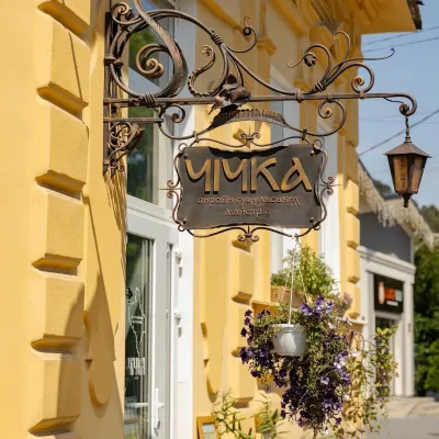 Крафтові крамниціКрамниця гуцульських виробів «Чічка», КосівКосів12 км від центру«Чічка» — крамниця сучасних гуцульських виробів ручної роботи в самому центрі Косова, на вулиці Незалежності, 76.
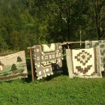 Ремесла й майстер-класиЦентр народного мистецтва «Гуцульська ґражда», ЯворівЯворів13 км від центруСело Яворів на Косівщині називають столицею гуцульського ліжникарства. Ліжники тут ткуть мало не в кожній другій хаті, а влітку вздовж дороги на тинах сушаться...
Де зупинитися
Готелі, садиби й котеджі в Pidzakharychi та околицях.
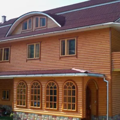 СадибаГостьовий будинок "Гірська казка" ПідзахаричіПідзахаричіменше 1 км від центруСаунаМангалКухняПоруч: печера Довбуша 1,2 кмводоспад Сикавка 1,5 км1 маршрут
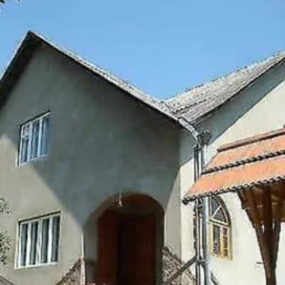 ГотельВідпочинок у МарічкиВижниця3,1 км від центруПриватна садиба "Відпочинок у Марічки" розташована у тихому мальовничому куточку селища Виженка. До послуг гостей пропонується проживання у двоповерховому будинку на 4...Поруч: водоспад Миква 200 мпечера Довбуша 3,0 км2 маршрутивід 1 060 грн за ніч
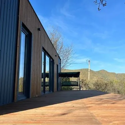 КотеджB-HouseКосів3,1 км від центруКотедж "B-House" - це новий сучасний будинок, побудований за новітніми технологіями, теплий взимку та прохолодний літом, кожна кімната має автономне управління теплом.Поруч: водоспад Сикавка 1,5 кмпечера Довбуша 2,5 км1 маршрутвід 3 840 грн за ніч
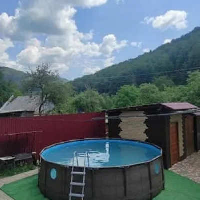 ГотельУ НаталкиВижниця3,2 км від центруБасейнСаунаПоруч: водоспад Миква 100 мпечера Довбуша 3,1 км2 маршрутивід 920 грн за ніч
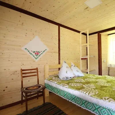 СадибаСадиба "У Сокола" Виженка (басейни і джерело)Виженка2,8 км від центруБасейнМангалКухняПоруч: водоспад Миква 800 мпечера Довбуша 2,9 км2 маршрути
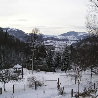 Лижний курортГірськолижні витяги і траси комплексу "Перевал Німчич" ПідзахаричіПідзахаричі3 км від центруБасейнСаунаПарковкаПоруч: Перевал Німчич 200 мпечера Довбуша 3,5 км2 маршрути
Маршрути поруч
Всі маршрути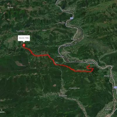 СкладнийДводеннийМаркованийпер. Німчич Протяте КамінняПрофіль висоти473–820 м20,9 кмнабір 1 063 м≈ 7,5 год ходуменше 1 км від центру
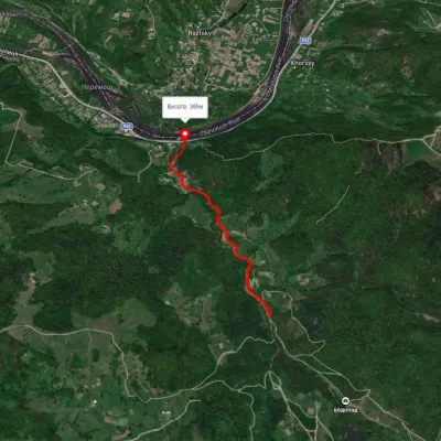 ЛегкийОдноденнийМаркованийСмугарські водоспадиПрофіль висоти395–483 м4 кмнабір 106 м≈ 1 год ходу3,5 км від центру
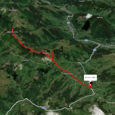 СереднійДводеннийБез маркуванняс. Буковець кільцевийчерез Писаний КаміньПрофіль висоти845–1 261 м12,4 кмнабір 823 м≈ 4,5 год ходу11 км від центру
Вершини поруч
Всі вершини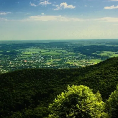 ВершинаГора Михалкова (Косів)Косіввисота 812 м10 км від центруГора Михалкова (Михалків), з висотою 812 метрів, - є частиною Покутських Карпат. Найвища точка міста Косів та села Город.
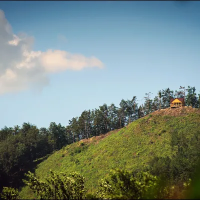 ВершинаГора Острий (Остра)Косіввисота 584 м12 км від центруЧервоний - дуже крутий підйом на чотирьох кінцівках (перейти від гори Михалків стежкою на Острий, але як і другий шлях краще йти із гідом).
 ВершинаЗамкова гора (Міська)Косіввисота 450 м13 км від центруГора ( в центрі Косова) висотою 450 метрів над рівнем моря. З вершини відкривається панорма міста.
