High-mountainous Lake Nesamovite (1750 m.a.s.l., Chornohora ridge)


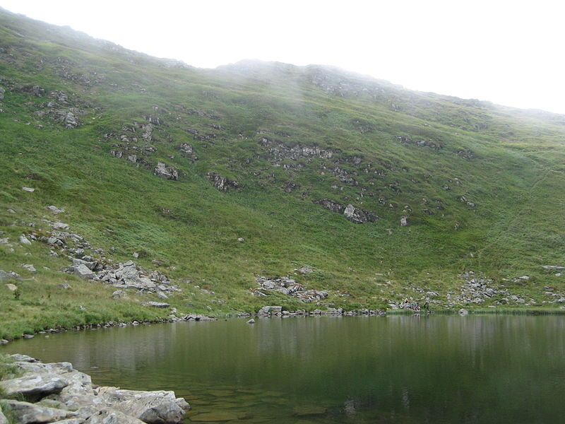
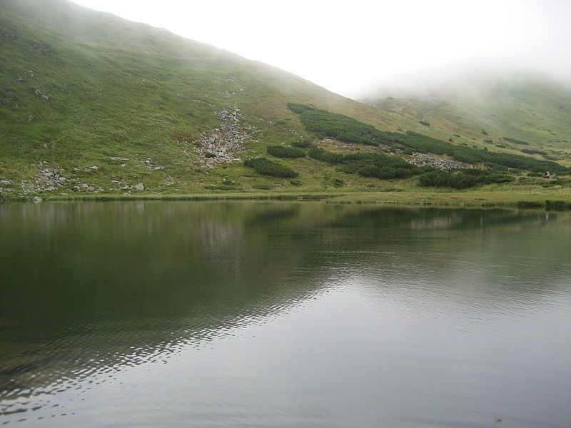
Nesamovyte is one of the highest lakes in the Ukrainian Carpathians (1750 m above sea level). It is located within the Nadvirna district of Ivano-Frankivsk region. It lies within the Carpathian National Park, in a glacial kar (depression) on the eastern slopes of Mount Turkul (Chornohora massif).
The lake is 88 m long and 45 m wide. The depth over the entire area varies between 1-1.5 m. The lake is of glacial origin. It is fed mainly by atmospheric precipitation. It freezes in winter. The bottom near the southern shores is covered with boulders, in the northern part sandy-silt deposits are common.
The southern and western shores are rocky: the products of rock slope decay fall on it. The moraine (a layer of rock that the glacier has collected on its way) along the opposite bank is covered with subalpine meadows, where mountain pine (juniper) and juniper grow. In recent years, Nesamovyte has been intensively overgrown with sedge.
Tourists often leave garbage on the shore or throw it into the water, which contributes to the rapid pollution of the lake's ecosystem and the growth of aquatic plants. The lake has no surface runoff, but several streams flow below the moraine rampart - tributaries of the Prut.
Interesting facts:
- The shape of Nesamovyte is somewhat reminiscent of Antarctica.
- Some geography books claim that Nesamovyte is located within the Zakarpattia region. However, the fact that the lake lies northeast of the main ridge of the Chornohora range (along which the administrative border between Zakarpattia and Ivano-Frankivsk regions runs) indicates that it belongs to Ivano-Frankivsk region. This is also confirmed by modern maps.
Mystical legends that Nesamovyte hides
Residents of mountainous areas say that the Carpathians are enchanted mountains, and there is no place, be it a body of water or a mountain peak, that has not been the subject of at least one legend. And since Lake Nesamovyte is the most mysterious, there are several legends about it. The first one says that the souls of sinners who committed suicide or took someone's life live in this reservoir. And if you throw a stone into the water, a rider on a black horse rides out and gallops over the local rocks, knocking out stones that turn into ice. Then sinners float out of the lake, collect this ice in bags and fly in the form of black clouds all over the Chornohora ridge. When they open the bags, hail falls to the ground.
The following legend tells of a girl who, traveling from one village to another, decided to plunge into the Nesamovyte, but unfortunately drowned. And now her soul does not honor bathers: if someone bathes in the lake, the weather immediately deteriorates.
Another legend says that at night the souls of the dead wake up in the lake and, if someone tries to dive into the pond in the dark, they can be dragged to the bottom. The only thing that can save you from death is the sound of trembitas.
And finally, there is a nice legend that says that if an unmarried man washes his face with water from Nesamovyty, he will definitely get married by the end of the year.
However, we cannot say that these are just legends. My friends told me that once, after swimming in the lake, the weather deteriorated very quickly. In about half an hour, black clouds came in, it started raining heavily, and lightning began to sparkle from all sides. But the legend that if you wash your face in Nesamovyte, you will find a mate does not work. Although, who knows...
However, not particularly superstitious tourists leave piles of garbage on the shore or, even worse, throw it into the lake. By the way, despite the almost wilderness, there are a lot of people here - travelers are attracted by the picturesque surroundings.
There is no need to make your own way to Lake Nesamovyty. There is a permanent scientific and educational trail 6 km long from the Zaroslyak tourist center. The lake itself is located on the territory of the Hoverla Nature Reserve and belongs to the Montenegrin ridge, which separates Ivano-Frankivsk and Zakarpattia regions. But the location of the lake on the northeast side indicates that it belongs to the former.
At a glance
- Type: lake
- Elevation: ≈1,750 m above sea level (digital elevation model)
- Range: Chornohora
- Nearest settlement: Vorokhta
- Coordinates: 48.12250, 24.53920
- Routes nearby on Karpaty.rocks: 93
How to get there
The nearest settlement in our data is Vorokhta. Get directions in Google Maps.
Routes nearby
Karpaty.rocks routes that pass within 1 km of this place, most viewed first. Length and ascent come from our track and a digital elevation model, time from Naismith's rule (without stops).
- Zaroslyak base, via Lake Nesamovyte to Mount Shpytsi — 9 km, ascent 778 m, ≈3.5 h of walking
- Zaroslyak base, via Mount Hoverla and Lake Nesamovyte to Zaroslyak base — 16.9 km, ascent 1,058 m, ≈6 h of walking, loop
- Lake Brebeneskul, via Mount Rebra and Mount Shpytsi to Lake Nesamovyte — 7 km, ascent 326 m, ≈2.5 h of walking
- Zaroslyak base, via Lake Nesamovyte and Mount Shpytsi to Lake Brebeneskul — 13.6 km, ascent 777 m, ≈4.5 h of walking
- Zaroslyak base – Lake Nesamovyte — 7.6 km, ascent 69 m, ≈2 h of walking
All routes nearby in the catalogue
When to go
A high-mountain lake: the paths are usually free of snow from June to September. In winter only with experience and winter gear.
Safety
In protected areas swimming, campfires and tents by the water may be prohibited — follow the rules of the park or reserve.
In an emergency call 101 or 112. Carpathian mountain rescue contacts.
FAQ — High-mountainous Lake Nesamovite
High-mountainous Lake Nesamovite: where is it and how to get there?
The nearest settlement in our data is Vorokhta (Chornohora range). Coordinates: 48.12250, 24.53920. Get directions in Google Maps.
High-mountainous Lake Nesamovite: at what elevation?
About 1,750 m above sea level, according to a digital elevation model.
High-mountainous Lake Nesamovite: which routes pass nearby?
The most viewed on Karpaty.rocks: Zaroslyak base, via Lake Nesamovyte to Mount Shpytsi (9 km); Zaroslyak base, via Mount Hoverla and Lake Nesamovyte to Zaroslyak base (16.9 km); Lake Brebeneskul, via Mount Rebra and Mount Shpytsi to Lake Nesamovyte (7 km).
High-mountainous Lake Nesamovite: when is the best time to go?
A high-mountain lake: the paths are usually free of snow from June to September. In winter only with experience and winter gear.
High-mountainous Lake Nesamovite: where to stay nearby?
Places to stay nearby (Vorokhta and around): hotels, guesthouses and cottages.
Comments
Travellers’ experience: reports, tips, questions.
No one has written here yet. Be the first — your experience helps others.
Location on the map
Fishing at Lake Nesamovyte
A high-mountain lake below Turkul on the Chornohora ridge (1,750 m) within the Carpathian National Nature Park.
Today, 15 November
There are no fish in the lake
- No fishNo fish live in Nesamovyte: the only vertebrates here are newts (Carpathian and alpine) and frogs, so there is nothing to fish for. Besides, any fishing is banned by law in the strictly protected zone of a national park — please keep the lake quiet.
Springs: Wikipedia (uk): Nesamovyte; Law on the Nature Reserve Fund of Ukraine, art. 16, 18, 21. Rules may change — check the current orders of the fisheries patrol.
Places to stay nearby
All stays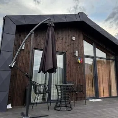 −50%CottageKrasnyk HillsVerkhovyna16 km from High-mountainous Lake Nesamovite (1750 m.a.s.l., Chornohora ridge)PoolBBQParkingNearby: Museum of mushrooms 700 mPolonyna Krinta 3.8 km14 trailsfrom 4 000 UAH per night
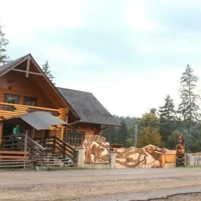 HotelBiia HoverlyVorokhta10 km from High-mountainous Lake Nesamovite (1750 m.a.s.l., Chornohora ridge)BBQParkingWi‑FiNearby: Mt Kukul 3.5 kmPolonyna Kukul 4.0 km4 trailsfrom 1 320 UAH per night
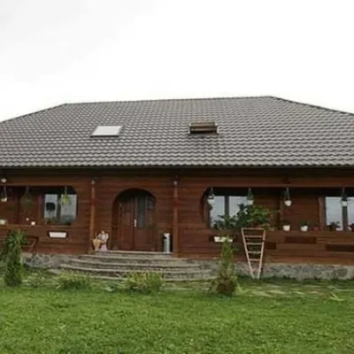 HotelPid Vukhatym KamenemDzembronia11 km from High-mountainous Lake Nesamovite (1750 m.a.s.l., Chornohora ridge)Hot tubBBQParkingNearby: Polonyna Psarivka 2.3 kmMt Smotrych 4.5 km33 trailsfrom 1 210 UAH per night
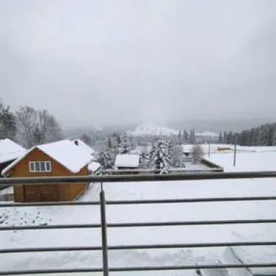 HotelBukov'yanVerkhovyna13 km from High-mountainous Lake Nesamovite (1750 m.a.s.l., Chornohora ridge)SaunaBBQParkingNearby: Mt Makovytsia 700 mKryvopillia Pass 800 m6 trailsfrom 2 070 UAH per night
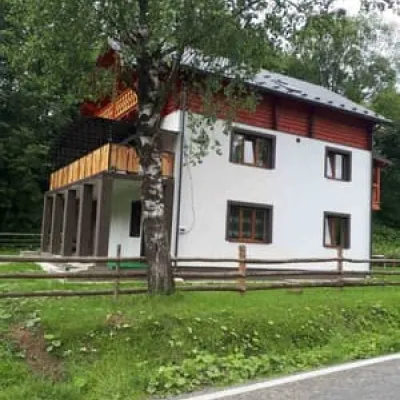 CottageSkita 2Verkhovyna14 km from High-mountainous Lake Nesamovite (1750 m.a.s.l., Chornohora ridge)BBQParkingWi‑FiNearby: Mt Makovytsia 2.3 kmPolonyna Dil 2.6 km8 trailsfrom 968 UAH per night
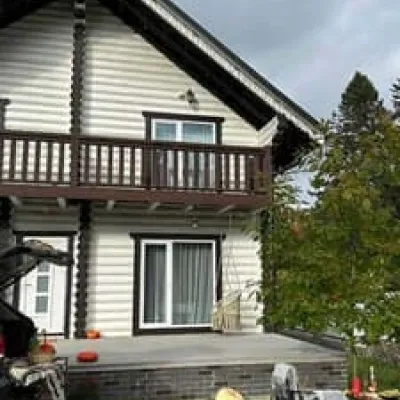 HotelChalet GaliciaVorokhta14 km from High-mountainous Lake Nesamovite (1750 m.a.s.l., Chornohora ridge)BBQParkingWi‑FiNearby: Mt Kukul 6.1 kmPolonyna Kukul 6.3 km6 trailsfrom 8 500 UAH per night
Trails nearby
All trails HardMulti-dayDilove village, Mount Pip Ivan Marmaroskyi, Mount Pip Ivan Chornohirskyi, Mount Hoverla and Mount Petros to Kvasy villageElevation profile346–2 035 m91.1 kmascent 5 806 munder 1 km from High-mountainous Lake Nesamovite (1750 m.a.s.l., Chornohora ridge)
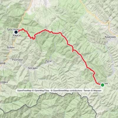 HardMulti-dayShybene village to Kvasy villagevia Mount Pip Ivan Chornohirskyi, Mount Hoverla +1Elevation profile535–2 061 m54.6 kmascent 2 765 munder 1 km from High-mountainous Lake Nesamovite (1750 m.a.s.l., Chornohora ridge)
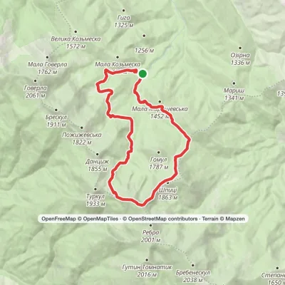 ModerateOne-dayMarkedZaroslyak base loopvia Lake Nesamovyte, Mount ShpytsiElevation profile1 130–1 929 m18.2 kmascent 838 m≈ 6 h walkingunder 1 km from High-mountainous Lake Nesamovite (1750 m.a.s.l., Chornohora ridge)
Nearby attractions
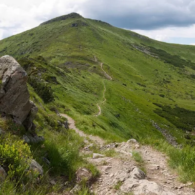 PeakMount TurkulBystretsaltitude 1 933 m · Chornohora rangeunder 1 km from High-mountainous Lake Nesamovite (1750 m.a.s.l., Chornohora ridge)93 trails to the topTurkul, 1933 meters high, is one of the peaks of the Ukrainian Carpathians, located in the Chornohora mountain range.
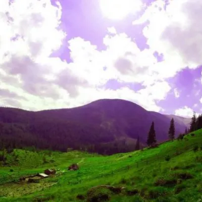 Mountain meadowPolonyna GadzhinaBystretsChornohora range2.1 km from High-mountainous Lake Nesamovite (1750 m.a.s.l., Chornohora ridge)It seemed that the Chornohora massif was literally crowded with people, but sometimes you can come across places that either locals or tourists who have eaten the dog...
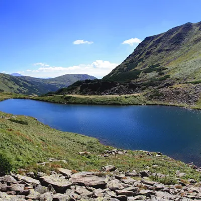 LakeLake BrebeneskulLuhy · Chornohora2.8 km from High-mountainous Lake Nesamovite (1750 m.a.s.l., Chornohora ridge)1 801 m above sea level2.8–3.2 m deepBrebeneskul is the highest mountain lake in the Ukrainian Carpathians (1801 m above sea level), a hydrological natural monument of local importance (registered as Lake...
Craft nearby
All craft places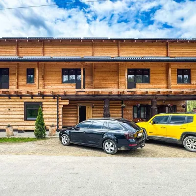 Koliby & Hutsul cuisineZRUB Ethno Restaurant, IltsiIltsi16 km from High-mountainous Lake Nesamovite (1750 m.a.s.l., Chornohora ridge)ZRUB Ethno Restaurant is a new log-built home of Hutsul cooking in the village of Iltsi, on the edge of Verkhovyna, the town often called the Hutsul capital.
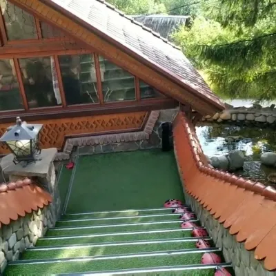 Koliby & Hutsul cuisineStara Vorokhta Restaurant, VorokhtaVorokhta19 km from High-mountainous Lake Nesamovite (1750 m.a.s.l., Chornohora ridge)Stara Vorokhta restaurant ("Old Vorokhta") is one of the best-known places for Hutsul food in Vorokhta: on Google Maps it is rated 4.6 from more than 6,300 reviews, a...
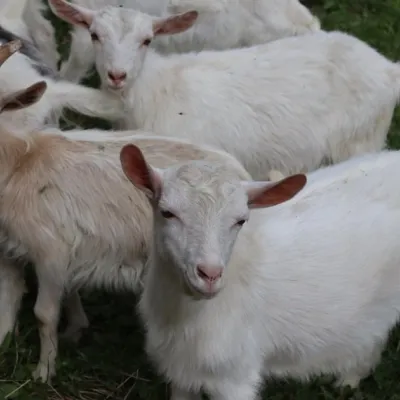 Eco farmsRozental Eco-Farm and Cheese Dairy, KvasyKvasy19 km from High-mountainous Lake Nesamovite (1750 m.a.s.l., Chornohora ridge)Beer and cider are brewed here, sheep's-milk ice cream is made, and in the Vaskul area above the village sits the Rozental eco-farm and cheese dairy.
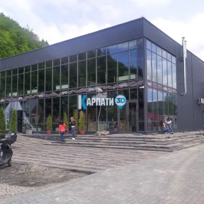 Craft beer & breweriesTsypa Brewery, KvasyKvasy20 km from High-mountainous Lake Nesamovite (1750 m.a.s.l., Chornohora ridge)The Tsypa Hutsul craft brewery in Kvasy is probably the best-known brewery in the Ukrainian Carpathians.
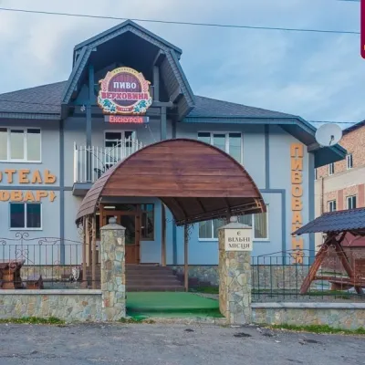 Craft beer & breweriesVerkhovyna Brewery at the Pyvovar Motel, VerkhovynaVerkhovyna20 km from High-mountainous Lake Nesamovite (1750 m.a.s.l., Chornohora ridge)Verkhovyna Brewery operates at the Pyvovar motel on the approach to Verkhovyna, the Hutsul capital of the Carpathians.
 Markets & fairsSouvenir Bazaar by the Ski Jumps, VorokhtaVorokhta20 km from High-mountainous Lake Nesamovite (1750 m.a.s.l., Chornohora ridge)The souvenir bazaar in Vorokhta is one of the busiest little trading spots in the mountain Hutsul region.
