Ask the AI guide:

Hiking routes

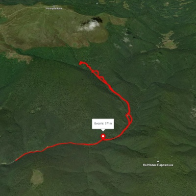
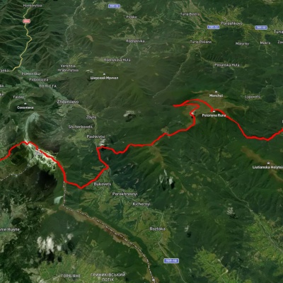
Lukovo village, via Mount Buzhora to Svaliava

Lukovo village, via Mount Buzhora to Svaliava

Three days or more
Unmarked
Passes through peaks: Buzhora Mountain
3D map
32 views
Length: 46.8km
Total ascent: 1967m
Total descent: 1933m
Minimum altitude: 165m
Maximum altitude: 1085m
More
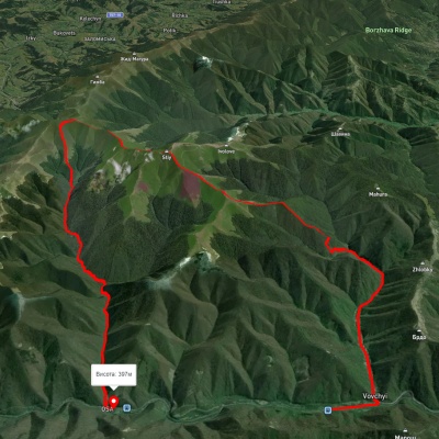
Pylypets village, via Mount Hemba, Mount Stiy and Vovchyi village to Svaliava
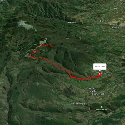
Pylypets village, via Mount Hemba, Mount Stiy and Vovchyi village to Svaliava

Three days or more
Unmarked
Passes through peaks: Mount Gemba, Mount Veliky Verkh, Mount Stii
3D map
35 views
Length: 40.2km
Total ascent: 1359m
Total descent: 1837m
Minimum altitude: 196m
Maximum altitude: 1657m
More
Pidhirne – Chorne Bahno – Kupinkuvate

Pidhirne – Chorne Bahno – Kupinkuvate

One-day routes
Has green marking.
3D map
28 views
Length: 10.8km
Total ascent: 287m
Total descent: 853m
Minimum altitude: 341m
Maximum altitude: 919m
More
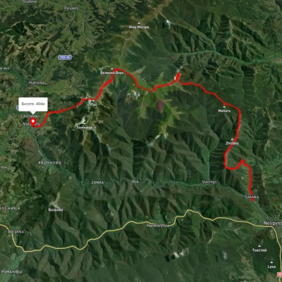
Sasivka village, via Mount Ivolove, Mount Stiy, Mount Velykyi Verkh, Shypit Waterfall and Mount Plai to Volovets
3D map
31 view
Length: 51.1km
Total ascent: 2798m
Total descent: 2549m
Minimum altitude: 240m
Maximum altitude: 1670m
More
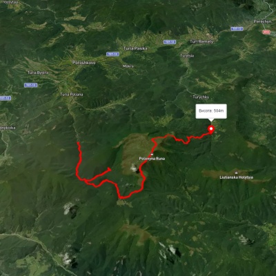
Sasivka village, via Mount Ivolove, Mount Stiy, the Mount Velykyi Verkh traverse and Mount Plai to Volovets
3D map
26 views
Length: 36.6km
Total ascent: 2208m
Total descent: 1966m
Minimum altitude: 247m
Maximum altitude: 1646m
More
Turia Poliana village, via Voievodyn Waterfall and Runa polonyna to Lumshory village
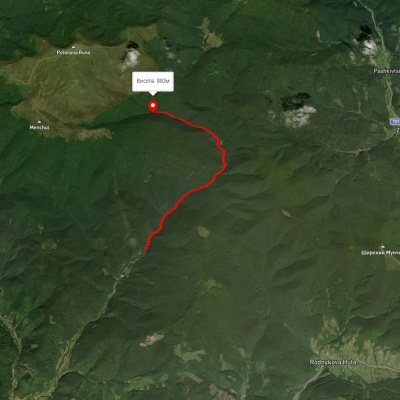
3D map
29 views
Length: 32.8km
Total ascent: 2101m
Total descent: 1578m
Minimum altitude: -28m
Maximum altitude: 1480m
More
Turia Poliana village – Voievodyn Waterfall
3D map
30 views
Length: 7km
Total ascent: 472m
Total descent: 25m
Minimum altitude: 430m
Maximum altitude: 877m
More
Turia Poliana village – Voievodyn Waterfall – Turia Poliana village
3D map
26 views
Length: 14.3km
Total ascent: 763m
Total descent: 801m
Minimum altitude: 489m
Maximum altitude: 1012m
More
Vovchyi village, via Mount Stiy, the Mount Velykyi Verkh traverse and along the Osa river to the railway station
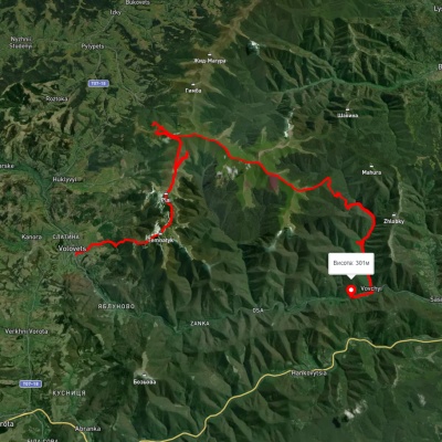
3D map
21 view
Length: 29km
Total ascent: 1906m
Total descent: 1836m
Minimum altitude: 289m
Maximum altitude: 1679m
More
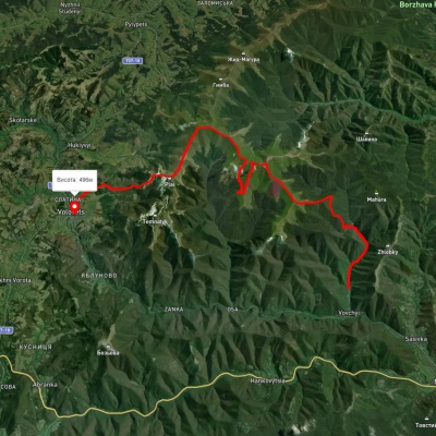
Volovets, via Mount Tsytska, Mount Temnatyk, Mount Plai, Mount Velykyi Verkh and Mount Stiy to Vovchyi village
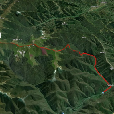
3D map
23 views
Length: 50.4km
Total ascent: 3297m
Total descent: 3446m
Minimum altitude: 276m
Maximum altitude: 1676m
More
Vovchyi village, via Mount Stiy to Mount Velykyi Verkh
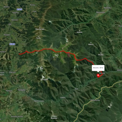
Vovchyi village, via Mount Stiy to Mount Velykyi Verkh

Two-day routes
Unmarked
Passes through peaks: Mount Stii, Mount Veliky Verkh
3D map
23 views
Length: 19.8km
Total ascent: 1534m
Total descent: 249m
Minimum altitude: 295m
Maximum altitude: 1671m
More
Podobovets village, via Mount Velykyi Verkh and Mount Stiy to Vovchyi village
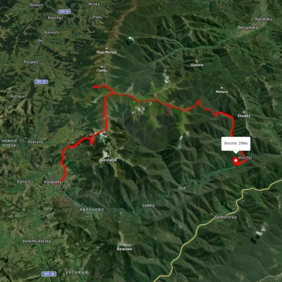
Podobovets village, via Mount Velykyi Verkh and Mount Stiy to Vovchyi village

Two-day routes
Unmarked
Passes through peaks: Mount Veliky Verkh, Mount Stii
3D map
25 views
Length: 21.7km
Total ascent: 1154m
Total descent: 1581m
Minimum altitude: 287m
Maximum altitude: 1665m
More
Volovets, via Mount Velykyi Verkh and Mount Stiy to Vovchyi village

Volovets, via Mount Velykyi Verkh and Mount Stiy to Vovchyi village
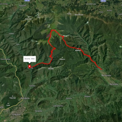
Three days or more
Unmarked
Passes through peaks: Mount Veliky Verkh, Mount Stii
3D map
23 views
Length: 35km
Total ascent: 2080m
Total descent: 2271m
Minimum altitude: 285m
Maximum altitude: 1649m
More
Berezniky village, via Mount Ivolove, Mount Stiy and Mount Zeneva to Vovchyi village

Berezniky village, via Mount Ivolove, Mount Stiy and Mount Zeneva to Vovchyi village
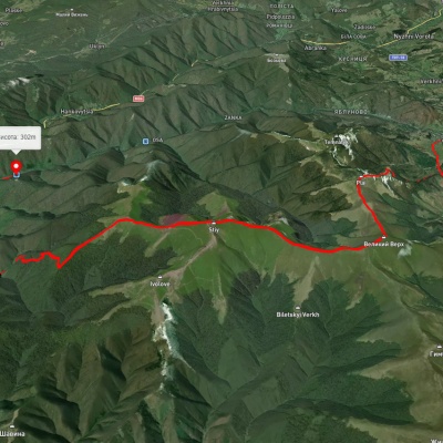
Three days or more
Unmarked
Passes through peaks: Mount Stii
3D map
26 views
Length: 28.5km
Total ascent: 1662m
Total descent: 1670m
Minimum altitude: 295m
Maximum altitude: 1661m
More
Volovets, via Mount Velykyi Verkh and Mount Stiy to Vovchyi village
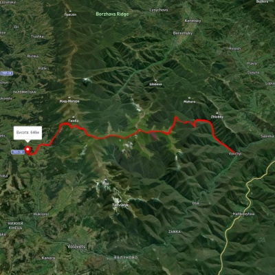
Volovets, via Mount Velykyi Verkh and Mount Stiy to Vovchyi village

Three days or more
Unmarked
Passes through peaks: Mount Veliky Verkh, Mount Stii
3D map
31 view
Length: 29.5km
Total ascent: 1569m
Total descent: 1744m
Minimum altitude: 290m
Maximum altitude: 1657m
More
Vovchyi village, via Mount Stiy to Podobovets village
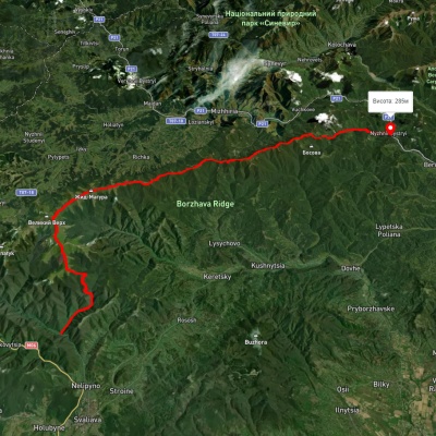
Vovchyi village, via Mount Stiy to Podobovets village

Three days or more
Unmarked
Passes through peaks: Mount Stii, Mount Veliky Verkh, Mount Gemba
3D map
27 views
Length: 25.5km
Total ascent: 1723m
Total descent: 1376m
Minimum altitude: 291m
Maximum altitude: 1645m
More
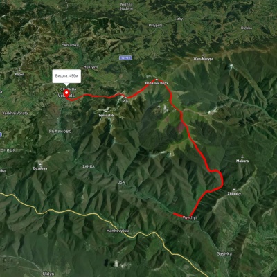
Vovchyi village, via Mount Stiy, Mount Zhyd-Mahura, Pryslip Pass, Kuk polonyna, Mount Korytyshche and Shyroke village to Nyzhnii Bystryi village
3D map
28 views
Length: 60.7km
Total ascent: 2680m
Total descent: 2655m
Minimum altitude: 285m
Maximum altitude: 1649m
More
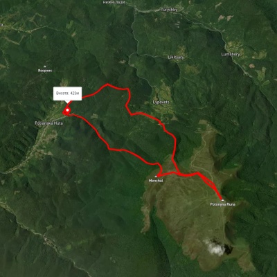
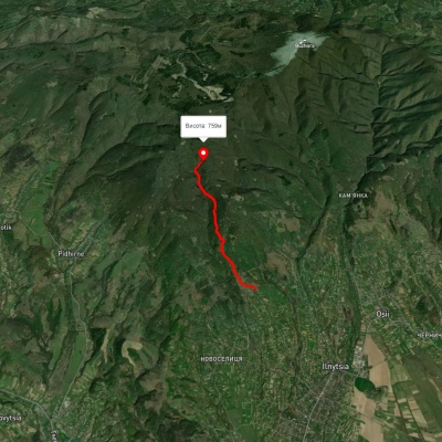
Volovets, via Mount Plai, Mount Velykyi Verkh, Mount Stiy and Mount Zeneva to Vovchyi village

Volovets, via Mount Plai, Mount Velykyi Verkh, Mount Stiy and Mount Zeneva to Vovchyi village
Three days or more
Unmarked
Passes through peaks: Mount Stii, Mount Veliky Verkh
3D map
20 views
Length: 26.6km
Total ascent: 1663m
Total descent: 1470m
Minimum altitude: 282m
Maximum altitude: 1659m
More
Polianska Huta village – Runa polonyna – Polianska Huta village
3D map
30 views
Length: 19.3km
Total ascent: 1282m
Total descent: 1282m
Minimum altitude: 425m
Maximum altitude: 1471m
More
Novoselytsia – Smerekovyi Stone

Novoselytsia – Smerekovyi Stone

One-day routes
Has green marking.
3D map
32 views
Length: 4.6km
Total ascent: 559m
Total descent: 107m
Minimum altitude: 331m
Maximum altitude: 783m
More
Vovchyi village, via Mount Zeneva to Mount Stiy

Vovchyi village, via Mount Zeneva to Mount Stiy

Ring routes
Unmarked
Passes through peaks: Mount Stii
3D map
18 views
Length: 22.9km
Total ascent: 1439m
Total descent: 1439m
Minimum altitude: 320m
Maximum altitude: 1663m
More
Vovchyi village, via Mount Stiy and Mount Velykyi Verkh to Volovets
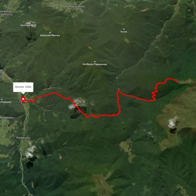
Vovchyi village, via Mount Stiy and Mount Velykyi Verkh to Volovets
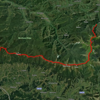
Three days or more
Unmarked
Passes through peaks: Mount Stii, Mount Veliky Verkh
3D map
21 view
Length: 29.9km
Total ascent: 2169m
Total descent: 2012m
Minimum altitude: 331m
Maximum altitude: 1635m
More
Zbyny – Voievodyn

Zbyny – Voievodyn

One-day routes
Has blue marking.
Passes through peaks: Mount Runa Ply
3D map
29 views
Length: 13.7km
Total ascent: 558m
Total descent: 1315m
Minimum altitude: 436m
Maximum altitude: 1220m
More
Vovchyi village, via Mount Stiy, Mount Hemba, Mount Zhyd-Mahura and Pryslip Pass to Mizhhiria
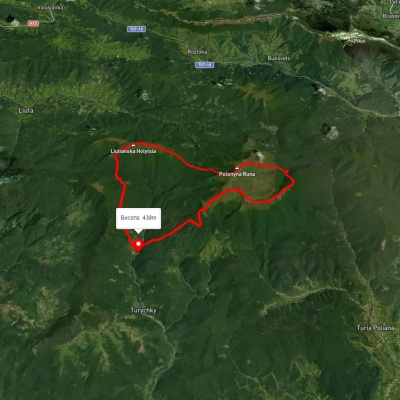
Vovchyi village, via Mount Stiy, Mount Hemba, Mount Zhyd-Mahura and Pryslip Pass to Mizhhiria

Three days or more
Unmarked
Passes through peaks: Mount Stii, Mount Veliky Verkh, Mount Gemba, Mount Zhid-Magura
3D map
20 views
Length: 45.1km
Total ascent: 2350m
Total descent: 1932m
Minimum altitude: 342m
Maximum altitude: 1668m
More
Lumshory village – Voievodyn Waterfall – Lumshory village
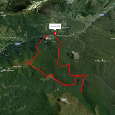
Lumshory village – Voievodyn Waterfall – Lumshory village

Ring routes
Unmarked
Passes through peaks: Mount Runa Ply, Mount Lyutyanskaya Golitsa
3D map
25 views
Length: 30.6km
Total ascent: 2248m
Total descent: 2247m
Minimum altitude: 441m
Maximum altitude: 1472m
More
Pashkivtsi village, via Mount Hostra, Preluka tract and Voievodyn Waterfall to Pashkivtsi village
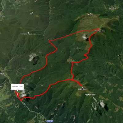
3D map
24 views
Length: 32.5km
Total ascent: 1830m
Total descent: 1601m
Minimum altitude: 191m
Maximum altitude: 1354m
More
Pashkivtsi village, via Mount Hostra Hora and Voievodyn Waterfall to Pashkivtsi village
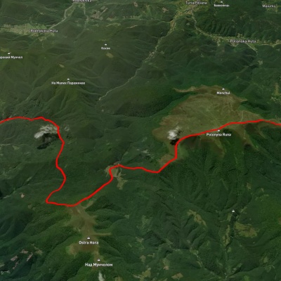
3D map
21 view
Length: 29.9km
Total ascent: 1819m
Total descent: 1819m
Minimum altitude: 458m
Maximum altitude: 1467m
More
Lumshory village, via Runa polonyna, Preluka tract, Mount Ostra Hora and Zbyny village to Zhdeniievo village
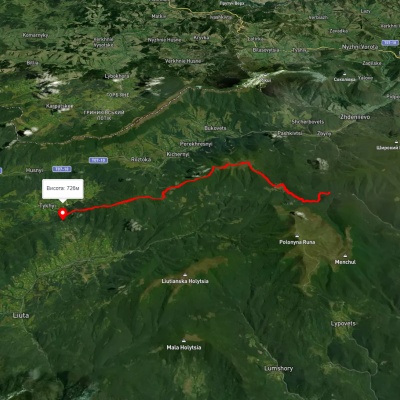
3D map
20 views
Length: 30km
Total ascent: 1519m
Total descent: 1591m
Minimum altitude: 390m
Maximum altitude: 1474m
More
Mount Hostra – Preluky

Mount Hostra – Preluky

Two-day routes
Has green marking.
Passes through peaks: Ostra Gora
3D map
25 views
Length: 19.4km
Total ascent: 1407m
Total descent: 1348m
Minimum altitude: 664m
Maximum altitude: 1385m
More
Lumshory village, via Runa polonyna, Voievodyn Waterfall, Preluka tract, Mount Ostra Hora, Pashkivtsi village and Mount Pikui to Bilasovytsia village
3D map
29 views
Length: 45.2km
Total ascent: 2956m
Total descent: 2866m
Minimum altitude: 461m
Maximum altitude: 1474m
More

The Carpathian Mountains are one of the most beautiful places in Ukraine, attracting people from all over the world. These mountains stretch in the southwest of the country and consist of several mountain ranges, including Montenegro, Svydovets, Gorgany, Marmarosy, Beskydy, and others. Hiking routes in the Carpathians are a great way to experience the beauty of the mountain scenery and enjoy the fresh air. We'll take a look at the most popular routes for beginners and experienced hikers.


The most popular hiking routes in the Carpathians

The route to Mount Hoverla

The route to Mount Hoverla is the most popular route among tourists who come to the Carpathians. It is the highest mountain in Ukraine with a height of 2061 meters. Although the route is not too difficult, tourists should be prepared for long walks. Travel time depends on the route chosen, but on average it takes 5 to 8 hours. The best time to climb Hoverla is in summer or early autumn, when the weather is not as harsh as in winter, when the mountain is covered with snow.

Route to the Pip Ivan Chornohirsky mountain

Mount Pip Ivan Chornohirsky is the third highest mountain in the Carpathians after Hoverla and Brebeneskul. The height of its peak is 2028 meters. Another name for the peak is Chorna Hora, which gave the name to the Chornohora mountain range of the same name. The route to Pip Ivan Chornohirsky is more difficult than to Hoverla. It can take from 8 to 10 hours, depending on the route chosen. Tourists should be prepared to cross steep rocky areas. At the top of the mountain there is a stone tower, an old observatory, which offers a beautiful view of the Carpathians and the Chornohora range.

How to choose a hiking route

First of all, you should determine the level of physical fitness and experience of hiking in the mountains. For beginners, it is recommended to choose easy routes that do not require the use of special equipment. Experienced hikers can choose more difficult routes that include rocky areas and require the use of safety equipment.

It is also worth considering the time of year, as hiking routes in the Carpathians can be dangerous in winter or spring during snowmelt. The safest time for hiking is summer and fall.

You should also consider the length of the route and its complexity. It is not recommended to choose routes that take more than 10 hours if you do not have sufficient experience and physical fitness. For beginners, it is better to choose routes that take from 3 to 6 hours.

When choosing a route, you should also take into account the availability of springs, places for tents, where you can rest and have a snack.

Frequently asked questions about hiking routes in the Carpathians

Do I need special equipment for hiking in the Carpathians?

Some routes in the Carpathians may require special equipment, such as carabiners, a safety belt, ropes, etc. If you do not have enough experience or do not know how to use such equipment, it is better to contact an experienced guide or instructor.

Can I go hiking in the Carpathians on my own?

Yes, you can go hiking in the Carpathians on your own, but you should have sufficient experience and knowledge of the weather conditions and landscape of the region. You also need to be prepared for possible dangers and know how to act in case of emergency.

Is it safe to hike in the Carpathians?

Hiking in the Carpathians can be dangerous, especially in spring and winter. The safest time for hiking is summer and fall, but you should always consider the weather conditions and check the forecast before setting out on the route.

Hiking in the Carpathians is a great way to spend time outdoors, enjoy the panoramas and see the incredible beauty of this region. However, you should be well prepared before setting out on the route, taking into account the complexity of the route, weather conditions, and your own physical abilities. It is better to choose routes according to your abilities and experience, and if necessary, contact an experienced guide or instructor. Remember to be safe and enjoy your outdoor adventures!

Carpathian GuideOnline

Ask a question about travelling in the Carpathians to start a conversation.