Chorna Tysa River
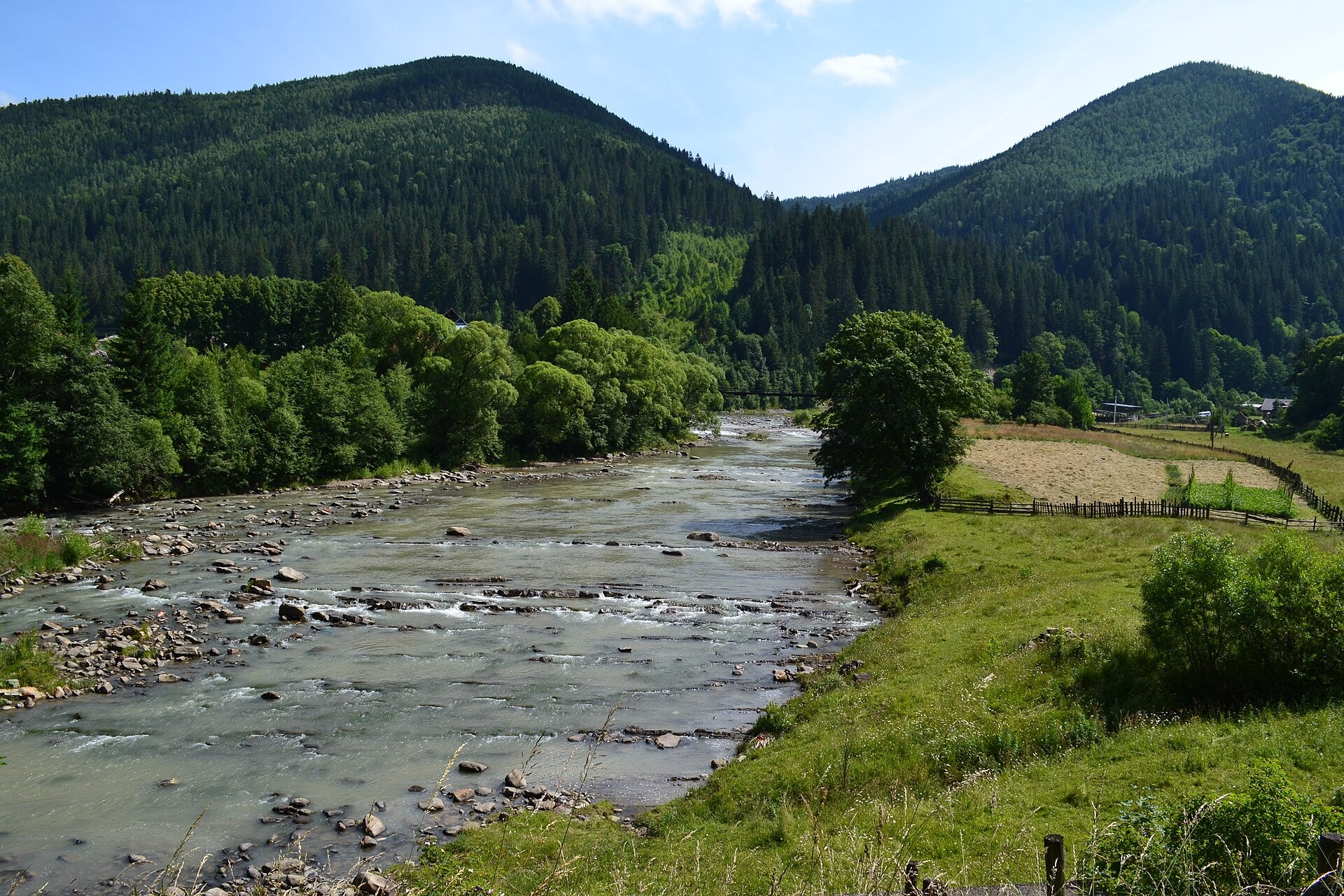
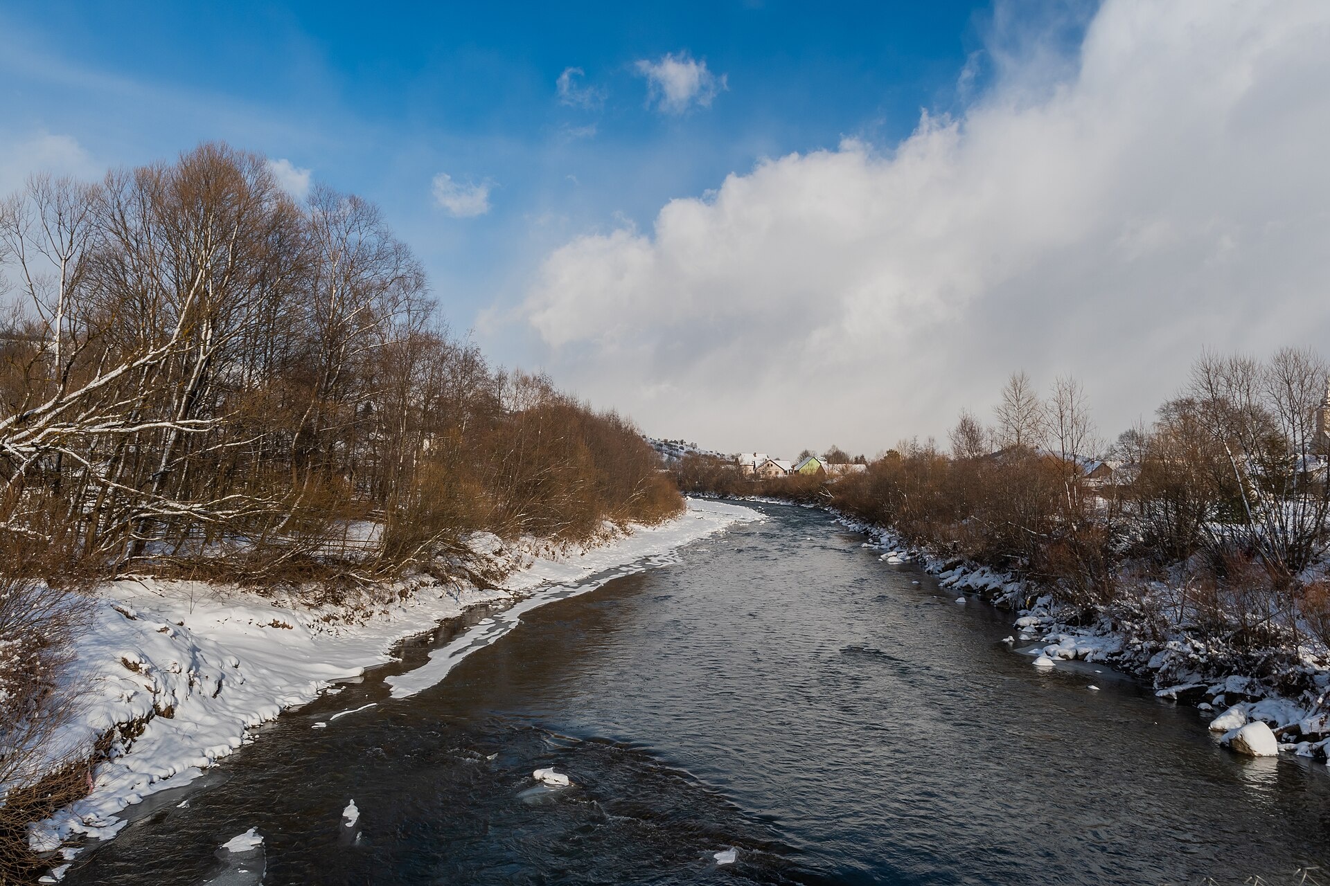
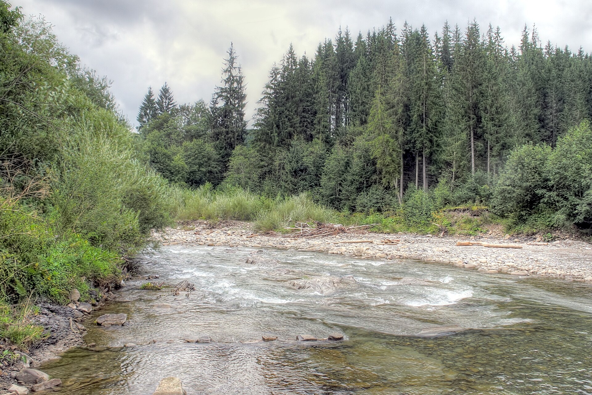
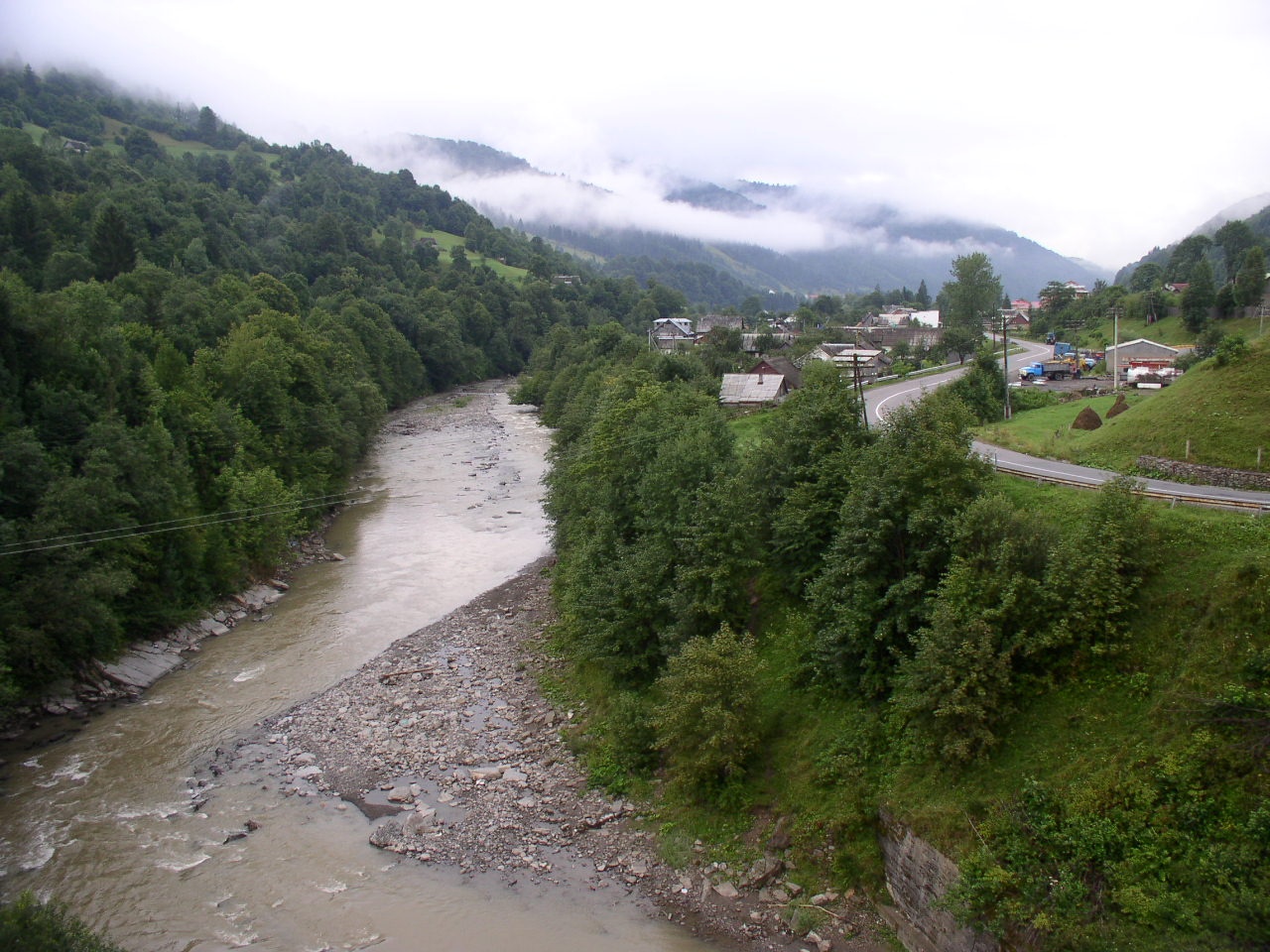
The Chorna Tysa is a mountain river in eastern Zakarpattia. It rises on the northern spurs of the Svydovets massif near the Okole Pass, at about 1,400 m, and flows through the village of Chorna Tysa, Yasinia and Kvasy to Rakhiv. On the edge of Rakhiv it meets the Bila Tysa, and the Tysa begins. The water is cold and fast, and the many rapids make the river popular for rafting.
- Length: 49 km
- Basin area: 315 km²
- Source: Svydovets, near the Okole Pass
- Mouth: confluence with the Bila Tysa in Rakhiv
In Yasinia, see the Strukivska Church of 1824, part of the UNESCO site “Wooden Tserkvas of the Carpathian Region”. Upstream, the village of Chorna Tysa has a ski resort, and the slopes of Svydovets rise above the valley.
The Chorna Tysa is a trout river: it and its tributaries are stocked every year with brown trout, as well as with grayling and Danube salmon, both in the Red Book. There are no permitted stretches during spawning, so the river is closed from 25 March to 15 May, and trout are closed from 10 October to 1 March. Details are in the fishing section. All the region’s waters are on the Fishing in the Carpathians page.
Photos: Клочко Ігор, CC BY-SA 4.0; Galvm, CC BY-SA 4.0; Raimond Spekking, CC BY-SA 4.0; Alex Zelenko, CC BY-SA 4.0 — Wikimedia Commons.
Location on the map
Fishing on the Chorna Tysa
The cold, rapid-strewn Chorna Tysa from Yasinia to Rakhiv is trout water, stocked every year. Grayling and Danube salmon live here too, but they are protected.
Can I fish now?
- Brown trout — closed until 1 MarchTrout spawning: closed from 10 October to 1 March in the Zakarpattia, Ivano-Frankivsk, Lviv and Chernivtsi regions.Each illegally caught fish costs UAH 7,225 in damages on top of the fine.
- Other species — allowed within the daily limitKeep to the minimum sizes and the daily limit; release protected species.
Limits and rules
The Chorna Tysa had no stretches on the 2026 list of places open during spawning, so it is not fished from 25 March to 15 May. In autumn the upper Tysa with the Chorna and Bila Tysa is a priority trout protection zone.
Carpathian Biosphere Reserve
The Svydovets massif of the Carpathian Biosphere Reserve lies above the Chorna Tysa valley. The river channel in Yasinia and Kvasy is not part of the reserve. Inside the reserve, recreational fishing is possible only at its trout farm as a paid service.
What to catch
 Brown troutthe whole river and tributaries · closed from 10 October to 1 Marchclosed until 1 March
 Chublower courseallowed
There is no scientific fish list for the Chorna Tysa itself. In 2024–2026 surveys ichthyologists found trout, grayling, chub, Carpathian barbel, spirlin, minnow and bullheads here. In 2025, besides grayling, 5,000 trout fry were released into the Svydovets, Hlody, Perespil and Trostianets tributaries.
 Grayling
 Danube salmon (huchen)
 Barbel
Red Book of Ukraine species: if one bites, unhook it carefully and release it. Taking one means a fine and compensation for damages.
Stocking 2025
1,400 young fish released into the river under the state stocking programme
Bite forecast in Yasinia
- TodaygoodSteady pressure, light wind1025 hPa · wind up to 12 km/h · 3…8 °C
- TomorrowfairPressure falling fast (−4.4 hPa in 6 h), light wind, partly cloudy1026 hPa · wind up to 12 km/h · 1…11 °C
- Thursday, 15 OctobergoodHigh pressure, light wind1025 hPa · wind up to 14 km/h · 5…8 °C
For species open now: chub. Brown trout closed. Based on pressure, wind, temperature and cloud — an estimate, not a guarantee.
Fishing spots 53
Places where you can drive up to the water: fish markers on the page map and the list below. Look at the satellite view before you go — the bank may be steep or overgrown.
Closed right now: brown trout — until 1 March.
- Dirt-road access on the Chorna TysaAbout 90 m to the water from a dirt road. Nearest village (straight line): Zhary, 12 km.
- Dirt-road access on the Chorna TysaAbout 100 m to the water from a dirt road. Nearest village (straight line): Klympushi, 12 km.
- Dirt-road access on the Chorna TysaAbout 110 m to the water from a dirt road. Nearest village (straight line): Chorna Tysa, 11 km.
- Dirt-road access on the Chorna TysaThe road comes almost to the water. Nearest village (straight line): Chorna Tysa, 10 km.
- By the bridge on the Chorna TysaThe road comes almost to the water. Bridge 110 m away. Nearest village (straight line): Chorna Tysa, 9.3 km.
- Stream mouth on the Chorna TysaThe road comes almost to the water. Nearest village (straight line): Chorna Tysa, 8.5 km.
- Mouth of the Apshynets tributary on the Chorna TysaAbout 100 m to the water from a dirt road. Bridge 110 m away. Nearest village (straight line): Chorna Tysa, 7.9 km.
- By the bridge on the Chorna TysaThe road comes almost to the water. Bridge 100 m away. Nearest village (straight line): Chorna Tysa, 7.1 km.
Show all spots (53)
- Stream mouth on the Chorna TysaThe road comes almost to the water. Bridge 60 m away. Nearest village (straight line): Chorna Tysa, 6.2 km.
- Dirt-road access on the Chorna TysaThe road comes almost to the water. Nearest village (straight line): Chorna Tysa, 5.4 km.
- Stream mouth, Chorna Tysa (4.9 km)About 70 m to the water from a dirt road. Bridge 70 m away. Nearest village (straight line): Chorna Tysa, 4.9 km.
- Dirt-road access, Chorna Tysa (4.3 km)About 30 m to the water from a dirt road. Nearest village (straight line): Chorna Tysa, 4.3 km.
- Dirt-road access, Chorna Tysa (3.4 km)The road comes almost to the water. Nearest village (straight line): Chorna Tysa, 3.4 km.
- Dirt-road access, Chorna Tysa (2.7 km)About 50 m to the water from a dirt road. Nearest village: Chorna Tysa, 2.7 km.
- Access from a village street, Chorna Tysa (1.9 km)The road comes almost to the water. Nearest village: Chorna Tysa, 1.9 km.
- Mouth of the Stanislav tributary, Chorna TysaAbout 40 m to the water from the street. Nearest village: Chorna Tysa, 1.3 km.
- By the road, Chorna TysaAbout 110 m to the water from the road. Village: Chorna Tysa.
- By the road, Chorna TysaAbout 130 m to the water from the road. Nearest village: Chorna Tysa, 710 m.
- Access from a village street, Chorna Tysa (1.5 km)The road comes almost to the water. Nearest village: Chorna Tysa, 1.5 km.
- Access from a village street, Stebnyi (2.0 km)About 50 m to the water from the street. Nearest village: Stebnyi, 2.0 km.
- By the road, Stebnyi (1.5 km)About 140 m to the water from the road. Nearest village: Stebnyi, 1.5 km.
- By the bridge, Stebnyi (1.5 km)The road comes almost to the water. A bridge is right here. Nearest village: Stebnyi, 1.5 km.
- Access from a village street, YasiniaAbout 50 m to the water from the street. Nearest village: Yasinia, 1.4 km.
- By the bridge, YasiniaThe road comes almost to the water. Bridge 110 m away. Village: Yasinia.
- By the bridge, YasiniaThe road comes almost to the water. Bridge 50 m away. Village: Yasinia.
- Access from a village street, YasiniaAbout 40 m to the water from the street. Nearest village: Yasinia, 1.3 km.
- Dirt-road access, Yasinia (2.1 km)About 40 m to the water from a dirt road. Nearest village: Yasinia, 2.1 km.
- By the bridge, Yasinia (2.9 km)The road comes almost to the water. Bridge 80 m away. Nearest village: Yasinia, 2.9 km.
- Dirt-road access, Yasinia (3.7 km)About 40 m to the water from a dirt road. Nearest village (straight line): Yasinia, 3.7 km.
- By the main road, Yasinia (4.6 km)About 40 m to the water from the main road. Nearest village (straight line): Yasinia, 4.6 km.
- By the bridge on the Chorna TysaAbout 50 m to the water from the main road. Bridge 80 m away. Nearest village (straight line): Yasinia, 5.5 km.
- By the main road, Keveliv (3.7 km)About 30 m to the water from the main road. Nearest village (straight line): Keveliv, 3.7 km.
- By the main road, Keveliv (2.9 km)The road comes almost to the water. Nearest village: Keveliv, 2.9 km.
- By the main road, Keveliv (2.1 km)The road comes almost to the water. Nearest village: Keveliv, 2.1 km.
- By the main road, KevelivThe road comes almost to the water. Nearest village: Keveliv, 1.5 km.
- By the main road, KevelivAbout 50 m to the water from the main road. Village: Keveliv.
- By the main road, KevelivThe road comes almost to the water. Village: Keveliv.
- By the main road, KevelivThe road comes almost to the water. Nearest village: Keveliv, 1.2 km.
- By the main road, Trostianets (1.5 km)About 110 m to the water from the main road. Nearest village: Trostianets, 1.5 km.
- Access from a village street, TrostianetsThe road comes almost to the water. Nearest village: Trostianets, 840 m.
- Stream mouth, TrostianetsAbout 40 m to the water from a dirt road. Nearest village: Trostianets, 910 m.
- Access road to the water, KvasyAbout 70 m to the water from an access road. Nearest village: Kvasy, 770 m.
- By the bridge, KvasyAbout 70 m to the water from a dirt road. Bridge 110 m away. Village: Kvasy.
- By the main road, KvasyAbout 70 m to the water from the main road. Nearest village: Kvasy, 1.1 km.
- Local-road access, Sitnyi (1.7 km)About 50 m to the water from a local road. Nearest village: Sitnyi, 1.7 km.
- By the main road, Sitnyi (2.1 km)About 80 m to the water from the main road. Nearest village: Sitnyi, 2.1 km.
- Dirt-road access, Bilyn (1.6 km)About 40 m to the water from a dirt road. Nearest village: Bilyn, 1.6 km.
- By the bridge, BilynAbout 30 m to the water from the main road. A bridge is right here. Village: Bilyn.
- Access from a village street, BilynAbout 40 m to the water from the street. Village: Bilyn.
- By the main road, BilynAbout 100 m to the water from the main road. Nearest village: Bilyn, 1.2 km.
- By the main road, Bilyn (1.9 km)About 40 m to the water from the main road. Nearest village: Bilyn, 1.9 km.
- By the main road, Novoselytsia (1.6 km)About 50 m to the water from the main road. Nearest village: Novoselytsia, 1.6 km.
- By the bridge, NovoselytsiaThe road comes almost to the water. Bridge 100 m away. Nearest village: Novoselytsia, 870 m.
Spots are marked from open data (roads and ways to the water, OpenStreetMap); if a spot is inconvenient or inaccessible, let us know. © OpenStreetMap, ODbL.
Springs: Recreational Fishing Rules (Order No. 700 of the Ministry of Agrarian Policy); Zakarpattia fisheries patrol: 2026 spawning ban and permitted stretches; Zakarpattia fisheries patrol: trout ban from 10 October 2026; Zakarpattia fisheries patrol: autumn trout spawning; Carpathian Biosphere Reserve: paid services order (2025); State Fisheries Agency: fish stocking, data.gov.ua (CC BY); Zakarpattia fisheries patrol: fish stocking report 2025; Zakarpattia fisheries patrol: fish stocking report 2023; Didenko O. et al. Fish occurrences in the Dnipro, Dnister and Tysa basins, 2024–2026 (GBIF, CC BY 4.0); Didenko O. et al. Records of fish in Ukraine, field studies 2008–2023 (GBIF, CC BY 4.0); Wikipedia (uk): Chorna Tysa; Wikipedia (uk): Strukivska Church; Weather forecast: MET Norway (CC BY 4.0). Rules may change — check the current orders of the fisheries patrol.
Comments
Where anglers can stay
Stays offering fishing within 2 km of the river
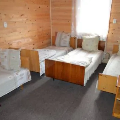 HotelRecreation Base "Edelweiss" Mykulychynunder 1 km from the riverSaunaParkingNearby: Strukivska Church 1.8 kmChurch of the Transfiguration 1.7 km36 trails
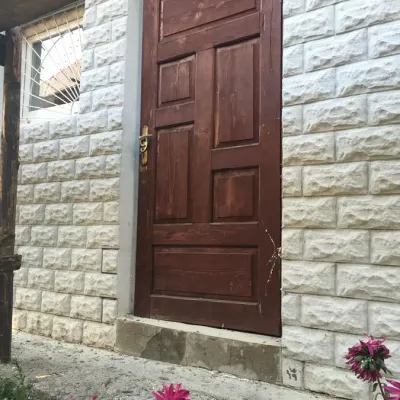 HotelHotel "Nad Tysoyu" Mykulychynunder 1 km from the riverSaunaSPABreakfastNearby: Mt Sheshul 8.3 kmNyzhnyi Huk waterfall 7.5 km42 trails
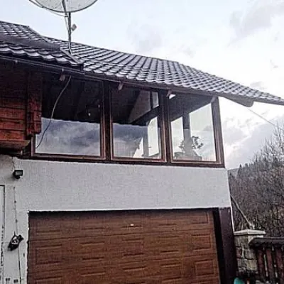 CottageCottage "Karpaty" Yasinyaunder 1 km from the riverSaunaBBQKitchenNearby: Strukivska Church 3.5 kmChurch of the Transfiguration 2.5 km38 trails
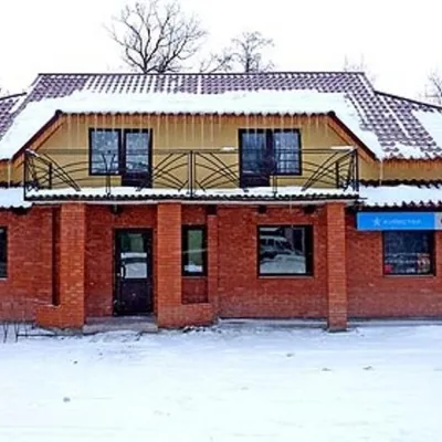 HomesteadGuest House "Kuvik" Yasinyaunder 1 km from the riverTransferNearby: Strukivska Church 1.8 kmChurch of the Transfiguration 1.6 km36 trails
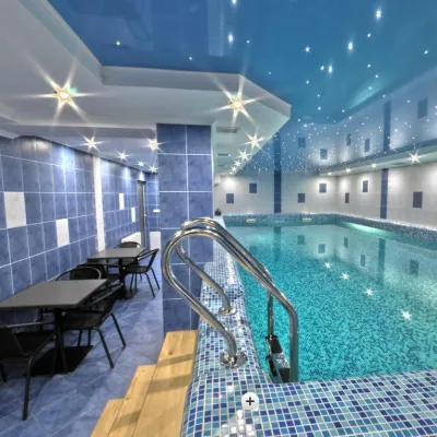 HotelHotel "Forward" Yasinyaunder 1 km from the riverPoolSaunaNearby: Strukivska Church 1.2 kmChurch of the Transfiguration 2.0 km43 trails
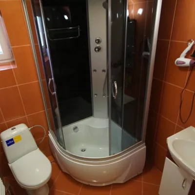 HotelMini-Hotel "Panorama Yasinya"under 1 km from the riverSaunaBBQKitchenNearby: Strukivska Church 3.2 kmChurch of the Transfiguration 2.5 km38 trails
Trails nearby
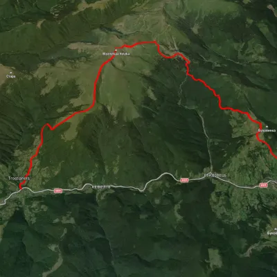 HardTwo-dayUnmarkedKvasy village to Yasiniavia Mount Blyznytsia, DragobratElevation profile558–1 859 m22.6 kmascent 1 609 m≈ 9 h walkingunder 1 km from Chorna Tysa River
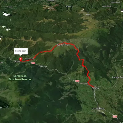 HardMulti-dayUnmarkedYasinia to Kvasy villagevia Dragobrat, Mount BlyznytsiaElevation profile532–1 849 m26.6 kmascent 1 670 m≈ 10 h walkingunder 1 km from Chorna Tysa River
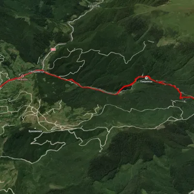 ModerateOne-dayUnmarkedYasinia DragobratElevation profile628–1 344 m13 kmascent 768 m≈ 5 h walkingunder 1 km from Chorna Tysa River
Nearby attractions
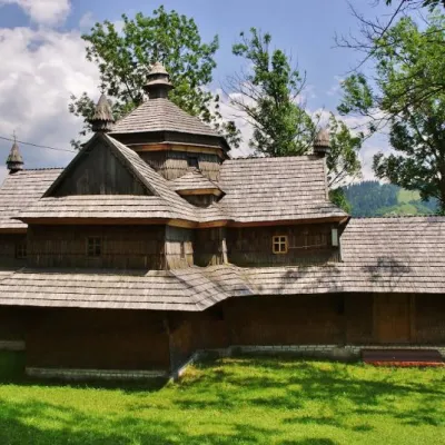 ChurchStrukivska (Ascension) Church, Yasiniaunder 1 km from Chorna Tysa RiverThe Church of the Ascension or Strukiv is the real pride of the village of Yasinia and the entire Hutsul region.
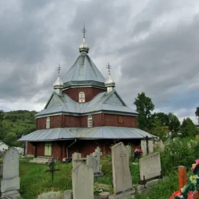 ChurchChurch of the Transfiguration, Lazeshchyna2.9 km from Chorna Tysa RiverBetween Yasinia and the next village, Lazeshchyna, in the Plytovatyi tract, stands the second Transcarpathian five-storey Hutsul church dedicated to the...
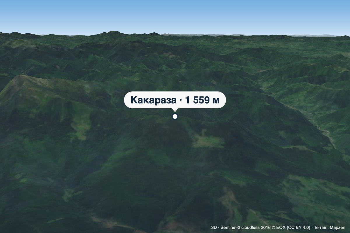 PeakMount Kakarazaaltitude 1 559 m · Chornohora range6.7 km from Chorna Tysa RiverKakaraza is a 1,559 m summit (1,558.7 m exactly) on the far north-western spur of Chornohora. It rises in the Rakhiv district of Zakarpattia Oblast, about 3 km south...