Stryi River
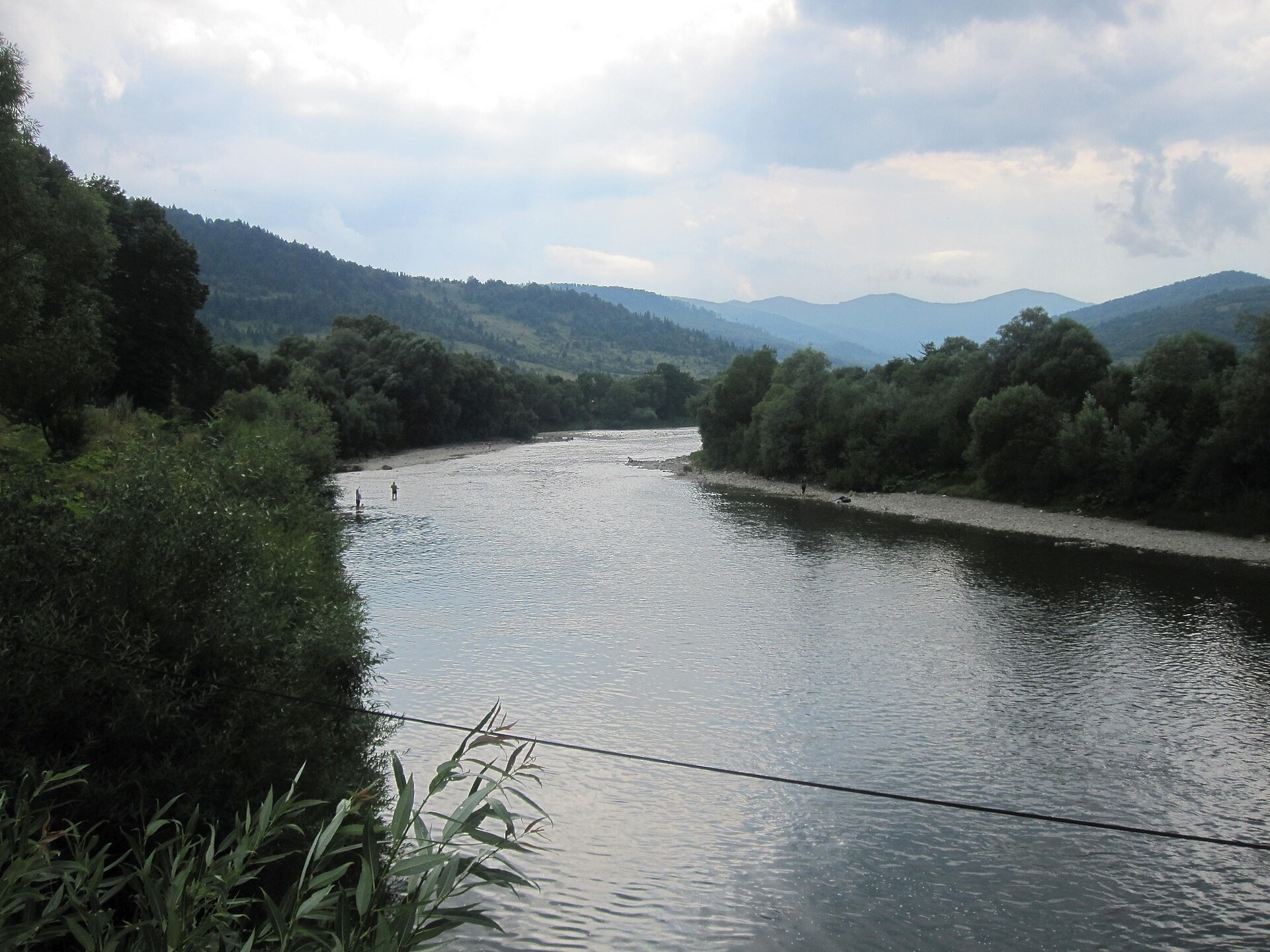
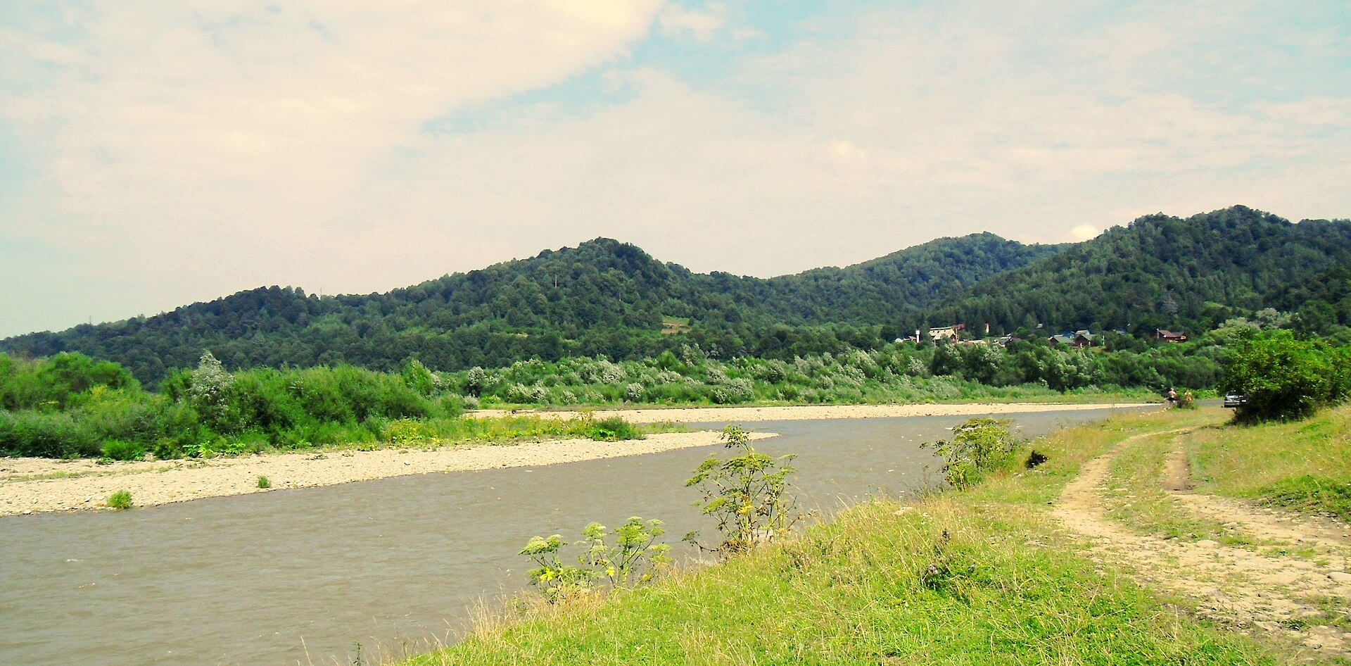
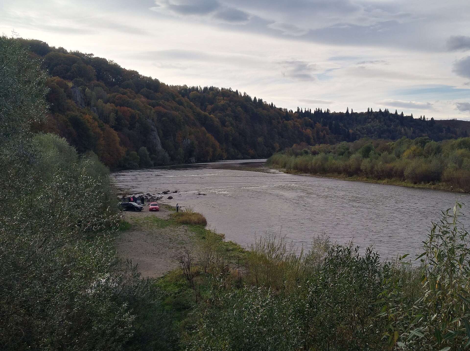
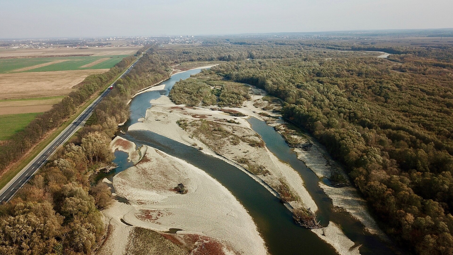
The Stryi is one of the largest Carpathian tributaries of the Dniester: 232 km from its source between Mount Yavirnyk and the Berdo ridge to its mouth 10 km east of Zhydachiv. It passes Turka, takes in the Opir near Mezhybrody, and flows past Rozghirche and the town of Stryi, which grew up on its banks.
The upper river is a fast mountain stream. Near the village of Rybnyk it forms striking meanders, flowing south, east, north and west within a few kilometres. From the Opir mouth at Mezhybrody to Rozghirche there is a popular grade 2 rafting run, and Rozghirche has a cliff monastery above the river. Part of the catchment lies in the Skolivski Beskydy National Nature Park.
Ichthyologists have recorded 27 fish species in the Stryi catchment. Scarce brown trout live upstream, chub along the whole river, asp in the middle and lower course and pike in the lowest reaches. Six species are in the Red Book, including grayling, barbel, dace and nase. Trout fry are released into the Stryi every year — over 16,000 in 2025. The spawning closure runs from 1 April to 10 June, and trout are protected from 10 October to 1 March. Details are in the fishing section; all waters are on Fishing in the Carpathians.
- Length: 232 km
- Catchment: 3,060 km²
- Source: between Mount Yavirnyk and the Berdo ridge
- Mouth: the Dniester 10 km east of Zhydachiv
- Oblast: Lviv
Photos: MSha, CC BY-SA 4.0; Bogdan Kosar, CC BY-SA 4.0; Visem, CC BY-SA 4.0; VargaA, CC BY-SA 4.0 — Wikimedia Commons.
Location on the map
Fishing on the Stryi
The Stryi is the largest Carpathian tributary of the Dniester, from Turka to Zhydachiv. Anglers catch trout in the upper reaches and chub, asp and pike in the middle and lower course.
Can I fish now?
- Brown trout — closed until 1 MarchTrout spawning: closed from 10 October to 1 March in the Zakarpattia, Ivano-Frankivsk, Lviv and Chernivtsi regions.Each illegally caught fish costs UAH 7,225 in damages on top of the fine.
- Other species — allowed within the daily limitKeep to the minimum sizes and the daily limit; release protected species.
Limits and rules
Of the 2025 fry, 12,800 were released by the state, and 2,000 (near the Lybokhora mouth) and 1,402 (near the Opir mouth) were funded by donations.
Skolivski Beskydy National Nature Park
The park covers parts of the Stryi and Opir catchments. In a national park recreational fishing is only possible on stretches of the regulated recreation zone; under the park’s price list (2021) fishing costs UAH 50 per rod. The park does not publish a list of stretches, so contact its administration before fishing.
What to catch
 Brown troutupper course: adults above Ropavske, scarce · closed from 10 October to 1 Marchclosed until 1 March
 Chubalong the whole riverallowed
 Aspmiddle and lower courseallowed
 Pikethe lowest reaches · closed from 15 February to 31 Marchallowed
The Institute of Hydrobiology (2017–2020) recorded 27 fish species in the Stryi catchment; six are in the Red Book: grayling, common and Carpathian barbel, dace, Russian spirlin and the Kessler’s gudgeon. Walecki’s barbel was also found in 2022. Grayling did not turn up in the researchers’ nets — anglers confirm it (upper river and the Opir, Zubrytsia and Rybnyk tributaries).
 Grayling
 Barbel
 Common dace
 Nase
NaseRed Book of Ukraine species: if one bites, unhook it carefully and release it. Taking one means a fine and compensation for damages.
Stocking 2025
16,202 young fish released into the river: state stocking and other sources
Water quality
Monitoring post in Verkhnie Syniovydne, last sampled on 17 August 2026.
- Dissolved oxygen9.4 mg O₂/lnorm at least 4
- Acidity, pH7.95norm 6.5–8.5
- BOD₅ (organic matter)1.1 mg O₂/lnorm up to 3
- Nitrates1 mg/lnorm up to 45
- Water temperature20 °C
All indicators are within the norms.
Bite forecast near Turka
- TodaygoodHigh pressure, light wind1026 hPa · wind up to 13 km/h · 4…7 °C
- TomorrowgoodHigh pressure, light wind, partly cloudy1026 hPa · wind up to 14 km/h · 2…10 °C
- Thursday, 15 OctobergoodHigh pressure, light wind, partly cloudy1026 hPa · wind up to 14 km/h · 4…6 °C
For species open now: chub, asp, pike. Brown trout closed. Based on pressure, wind, temperature and cloud — an estimate, not a guarantee.
Fishing spots 214
Places where you can drive up to the water: fish markers on the page map and the list below. Look at the satellite view before you go — the bank may be steep or overgrown.
Closed right now: brown trout — until 1 March.
- Local-road access, ZarichchiaAbout 90 m to the water from a local road. Nearest village: Zarichchia, 960 m.
- By the road, Losynets (1.7 km)About 90 m to the water from the road. Nearest village: Losynets, 1.7 km.
- By the road, IvashkivtsiAbout 120 m to the water from the road. Nearest village: Ivashkivtsi, 990 m.
- Stream mouth, IvashkivtsiAbout 40 m to the water from an access road. Bridge 90 m away. Nearest village: Ivashkivtsi, 1.0 km.
- Dirt-road access, Verkhniachka (4.6 km)The road comes almost to the water. Nearest village (straight line): Verkhniachka, 4.6 km.
- Local-road access, Verkhniachka (4.2 km)About 30 m to the water from a local road. Nearest village (straight line): Verkhniachka, 4.2 km.
- Local-road access, Verkhniachka (3.6 km)The road comes almost to the water. Nearest village (straight line): Verkhniachka, 3.6 km.
- Stream mouth, Verkhniachka (2.7 km)About 30 m to the water from a local road. Nearest village: Verkhniachka, 2.7 km.
Show all spots (214)
- Local-road access, Verkhniachka (1.8 km)The road comes almost to the water. Nearest village: Verkhniachka, 1.8 km.
- By the road, VerkhniachkaAbout 50 m to the water from the road. Nearest village: Verkhniachka, 1.1 km.
- By the bridge, VerkhniachkaThe road comes almost to the water. A bridge is right here. Nearest village: Verkhniachka, 860 m.
- Access road to the water, VerkhniachkaAbout 80 m to the water from an access road. Village: Verkhniachka.
- Access road to the water, VerkhniachkaAbout 40 m to the water from an access road. Village: Verkhniachka.
- Stream mouth, VerkhniachkaAbout 120 m to the water from the road. Nearest village: Verkhniachka, 1.2 km.
- Dirt-road access, Verkhniachka (2.0 km)The road comes almost to the water. Nearest village: Verkhniachka, 2.0 km.
- By the road, Verkhniachka (2.4 km)About 50 m to the water from the road. Nearest village: Verkhniachka, 2.4 km.
- By the road, Zhupany (1.9 km)About 140 m to the water from the road. Nearest village: Zhupany, 1.9 km.
- Stream mouth, ZhupanyAbout 30 m to the water from a dirt road. Nearest village: Zhupany, 1.5 km.
- Stream mouth, ZhupanyAbout 150 m to the water from the road. Nearest village: Zhupany, 1.2 km.
- Stream mouth, ZhupanyAbout 80 m to the water from a dirt road. Nearest village: Zhupany, 1.5 km.
- Access road to the water, Zhupany (1.8 km)About 120 m to the water from an access road. Nearest village: Zhupany, 1.8 km.
- Dirt-road access, Zhupany (2.0 km)About 150 m to the water from a dirt road. Nearest village: Zhupany, 2.0 km.
- By the road, Zhupany (2.8 km)About 120 m to the water from the road. Nearest village: Zhupany, 2.8 km.
- By the road, Klymets (1.8 km)About 120 m to the water from the road. Nearest village: Klymets, 1.8 km.
- Access road to the water, Klymets (2.0 km)About 30 m to the water from an access road. Nearest village: Klymets, 2.0 km.
- Access from a village street, Klymets (1.5 km)About 150 m to the water from the street. Nearest village: Klymets, 1.5 km.
- Dirt-road access, Klymets (1.8 km)About 100 m to the water from a dirt road. Nearest village: Klymets, 1.8 km.
- Dirt-road access, Klymets (2.7 km)About 130 m to the water from a dirt road. Nearest village: Klymets, 2.7 km.
- Dirt-road access, Klymets (2.8 km)About 30 m to the water from a dirt road. Nearest village: Klymets, 2.8 km.
- Dirt-road access, Klymets (2.8 km)About 90 m to the water from a dirt road. Nearest village: Klymets, 2.8 km.
- Dirt-road access, Ivashkivtsi (2.4 km)About 80 m to the water from a dirt road. Nearest village: Ivashkivtsi, 2.4 km.
- Dirt-road access, Ivashkivtsi (1.6 km)About 130 m to the water from a dirt road. Nearest village: Ivashkivtsi, 1.6 km.
- Stream mouth, IvashkivtsiAbout 50 m to the water from the road. Nearest village: Ivashkivtsi, 980 m.
- By the road, IvashkivtsiAbout 90 m to the water from the road. Village: Ivashkivtsi.
- By the main road, IvashkivtsiAbout 100 m to the water from the main road. Nearest village: Ivashkivtsi, 970 m.
- Tributary mouth, Ivashkivtsi (2.1 km)About 120 m to the water from a dirt road. Nearest village: Ivashkivtsi, 2.1 km.
- Stream mouth, Matkiv (1.9 km)About 140 m to the water from the main road. Nearest village: Matkiv, 1.9 km.
- Access road to the water, MatkivAbout 40 m to the water from an access road. Nearest village: Matkiv, 1.4 km.
- Mouth of the Smozhenka tributary, MokhnateAbout 30 m to the water from a dirt road. Nearest village: Mokhnate, 920 m.
- By the road, MatkivThe road comes almost to the water. Nearest village: Matkiv, 1.1 km.
- Stream mouth, MatkivAbout 50 m to the water from the street. Village: Matkiv.
- Stream mouth, MatkivAbout 140 m to the water from a dirt road. Nearest village: Matkiv, 1.1 km.
- Stream mouth, Verhnii KinetsAbout 120 m to the water from the road. Village: Verhnii Kinets.
- By the bridge, Verhnii KinetsAbout 40 m to the water from the street. Bridge 50 m away. Nearest village: Verhnii Kinets, 770 m.
- Mouth of the Lybokhora tributary, Verkhnie VysotskeAbout 140 m to the water from the road. Nearest village: Verkhnie Vysotske, 1.5 km.
- By the bridge, Verkhnie VysotskeAbout 110 m to the water from the road. A bridge is right here. Village: Verkhnie Vysotske.
- Stream mouth, Verkhnie VysotskeAbout 50 m to the water from the street. Nearest village: Verkhnie Vysotske, 820 m.
- Access from a village street, Nyzhnii KinetsAbout 50 m to the water from the street. Nearest village: Nyzhnii Kinets, 810 m.
- By the road, Nyzhnii KinetsAbout 60 m to the water from the road. Village: Nyzhnii Kinets.
- By the road, Nyzhnii KinetsAbout 100 m to the water from the road. Nearest village: Nyzhnii Kinets, 740 m.
- Access road to the water, Zakychera (1.5 km)About 80 m to the water from an access road. Nearest village: Zakychera, 1.5 km.
- Access from a village street, Zakychera (1.6 km)About 40 m to the water from the street. Nearest village: Zakychera, 1.6 km.
- By the road, Komarnyky (1.6 km)About 40 m to the water from the road. Nearest village: Komarnyky, 1.6 km.
- By the road, KomarnykyAbout 90 m to the water from the road. Village: Komarnyky.
- Stream mouth, KomarnykyAbout 90 m to the water from the street. Nearest village: Komarnyky, 870 m.
- Access road to the water, Zvorets (1.8 km)About 80 m to the water from an access road. Nearest village: Zvorets, 1.8 km.
- By the road, Nyzhnie Vysotske (1.9 km)About 50 m to the water from the road. Nearest village: Nyzhnie Vysotske, 1.9 km.
- By the bridge, Nyzhnie VysotskeAbout 90 m to the water from the road. Bridge 90 m away. Village: Nyzhnie Vysotske.
- Stream mouth, ZarichchiaAbout 100 m to the water from a local road. Village: Zarichchia.
- Mouth of the Yablunivka tributary, ZarichchiaAbout 140 m to the water from a local road. Nearest village: Zarichchia, 900 m.
- Local-road access, ShtukovetsAbout 80 m to the water from a local road. Nearest village: Shtukovets, 1.0 km.
- Local-road access, RopavskeAbout 120 m to the water from a local road. Village: Ropavske.
- Dirt-road access, RopavskeAbout 60 m to the water from a dirt road. Nearest village: Ropavske, 790 m.
- Stream mouth, Ropavske (1.5 km)The road comes almost to the water. Nearest village: Ropavske, 1.5 km.
- Dirt-road access, LiktivAbout 60 m to the water from a dirt road. Nearest village: Liktiv, 1.4 km.
- Access from a village street, LiktivAbout 40 m to the water from the street. Nearest village: Liktiv, 810 m.
- Stream mouth, LiktivThe road comes almost to the water. Nearest village: Liktiv, 1.5 km.
- Dirt-road access, LiktivAbout 40 m to the water from a dirt road. Nearest village: Liktiv, 1.1 km.
- Access from a village street, LiktivAbout 100 m to the water from the street. Nearest village: Liktiv, 1.3 km.
- Access road to the water, IlnykAbout 40 m to the water from an access road. Nearest village: Ilnyk, 1.3 km.
- By the bridge, IlnykAbout 60 m to the water from the road. Bridge 60 m away. Village: Ilnyk.
- Access from a village street, IlnykAbout 80 m to the water from the street. Nearest village: Ilnyk, 1.0 km.
- By the road, Ilnyk (1.9 km)About 60 m to the water from the road. Nearest village: Ilnyk, 1.9 km.
- By the road, Losynets (2.0 km)About 40 m to the water from the road. Nearest village: Losynets, 2.0 km.
- By the bridge, LosynetsAbout 90 m to the water from the road. Bridge 90 m away. Nearest village: Losynets, 1.2 km.
- Access road to the water, Losynets (1.7 km)The road comes almost to the water. Nearest village: Losynets, 1.7 km.
- By the road, Zavadivka (1.6 km)About 40 m to the water from the road. Nearest village: Zavadivka, 1.6 km.
- Stream mouth, ZvirynetsAbout 80 m to the water from the street. Bridge 80 m away. Village: Zvirynets.
- By the road, ZavadivkaAbout 40 m to the water from the road. Village: Zavadivka.
- By the bridge, ZavadivkaAbout 50 m to the water from the street. Bridge 90 m away. Nearest village: Zavadivka, 1.2 km.
- By the main road, Turka (2.4 km)About 120 m to the water from the main road. Nearest village: Turka, 2.4 km.
- Stream mouth, Yavora (2.5 km)About 90 m to the water from an access road. Nearest village: Yavora, 2.5 km.
- By the road, Yavora (1.8 km)About 90 m to the water from the road. Nearest village: Yavora, 1.8 km.
- Dirt-road access, Stodilka (2.0 km)About 40 m to the water from a dirt road. Nearest village: Stodilka, 2.0 km.
- By the road, StodilkaAbout 100 m to the water from the road. Nearest village: Stodilka, 1.1 km.
- Dirt-road access, StodilkaAbout 80 m to the water from a dirt road. Village: Stodilka.
- By the road, YavoraAbout 140 m to the water from the road. Nearest village: Yavora, 780 m.
- Access road to the water, StodilkaAbout 120 m to the water from an access road. Nearest village: Stodilka, 1.3 km.
- Stream mouth, Yavora (2.0 km)About 140 m to the water from the road. Nearest village: Yavora, 2.0 km.
- Stream mouth, Isai (2.4 km)About 50 m to the water from the road. Bridge 80 m away. Nearest village: Isai, 2.4 km.
- By the road, IsaiAbout 70 m to the water from the road. Nearest village: Isai, 1.4 km.
- By the bridge, IsaiAbout 50 m to the water from the street. Bridge 50 m away. Village: Isai.
- By the road, IsaiAbout 120 m to the water from the road. Nearest village: Isai, 990 m.
- Stream mouth, Isai (2.1 km)About 130 m to the water from the road. Nearest village: Isai, 2.1 km.
- By the road, Yasenytsia (2.0 km)About 100 m to the water from the road. Nearest village: Yasenytsia, 2.0 km.
- By the road, YasenytsiaAbout 140 m to the water from the road. Nearest village: Yasenytsia, 1.1 km.
- Mouth of the Yasinka tributary, YasenytsiaAbout 150 m to the water from the road. Nearest village: Yasenytsia, 1.3 km.
- By the road, Yasenytsia (1.7 km)About 150 m to the water from the road. Nearest village: Yasenytsia, 1.7 km.
- Dirt-road access, Yasenytsia (2.0 km)About 80 m to the water from a dirt road. Nearest village: Yasenytsia, 2.0 km.
- Access road to the water, LastivkaThe road comes almost to the water. Nearest village: Lastivka, 1.4 km.
- Access road to the water, LastivkaAbout 60 m to the water from an access road. Nearest village: Lastivka, 1.4 km.
- Dirt-road access, LastivkaThe road comes almost to the water. Village: Lastivka.
- By the bridge, LastivkaAbout 40 m to the water from the street. Bridge 90 m away. Village: Lastivka.
- Dirt-road access, LastivkaAbout 110 m to the water from a dirt road. Nearest village: Lastivka, 1.1 km.
- Dirt-road access, Korytyshche (1.5 km)About 100 m to the water from a dirt road. Nearest village: Korytyshche, 1.5 km.
- Dirt-road access, KorytyshcheAbout 90 m to the water from a dirt road. Nearest village: Korytyshche, 970 m.
- By the road, KorytyshcheAbout 110 m to the water from the road. Village: Korytyshche.
- Stream mouth, KorytyshcheAbout 50 m to the water from a dirt road. Nearest village: Korytyshche, 1.1 km.
- Local-road access, Korytyshche (1.9 km)About 40 m to the water from a local road. Nearest village: Korytyshche, 1.9 km.
- By the road, PidsukheAbout 40 m to the water from the road. Nearest village: Pidsukhe, 1.1 km.
- By the bridge, PidsukheAbout 60 m to the water from a local road. Bridge 60 m away. Village: Pidsukhe.
- Dirt-road access, PidsukheAbout 40 m to the water from a dirt road. Nearest village: Pidsukhe, 750 m.
- Stream mouth, Novyi Kropyvnyk (1.9 km)About 40 m to the water from an access road. Nearest village: Novyi Kropyvnyk, 1.9 km.
- Dirt-road access, Novyi KropyvnykThe road comes almost to the water. Nearest village: Novyi Kropyvnyk, 950 m.
- By the road, Novyi KropyvnykAbout 80 m to the water from the road. Village: Novyi Kropyvnyk.
- Dirt-road access, Novyi KropyvnykAbout 80 m to the water from a dirt road. Nearest village: Novyi Kropyvnyk, 1.4 km.
- Stream mouth, RybnykAbout 130 m to the water from the road. Nearest village: Rybnyk, 1.2 km.
- By the road, Pereprostynia (1.6 km)About 40 m to the water from the road. Nearest village: Pereprostynia, 1.6 km.
- By the road, PereprostyniaAbout 60 m to the water from the road. Nearest village: Pereprostynia, 940 m.
- Stream mouth, PereprostyniaAbout 60 m to the water from the street. Nearest village: Pereprostynia, 850 m.
- Access road to the water, DovheAbout 120 m to the water from an access road. Nearest village: Dovhe, 1.3 km.
- Access road to the water, RybnykAbout 110 m to the water from an access road. Nearest village: Rybnyk, 1.2 km.
- Dirt-road access, RybnykAbout 110 m to the water from a dirt road. Village: Rybnyk.
- By the road, RybnykAbout 120 m to the water from the road. Village: Rybnyk.
- Dirt-road access, RybnykAbout 50 m to the water from a dirt road. Nearest village: Rybnyk, 1.5 km.
- By the road, DovheAbout 40 m to the water from the road. Village: Dovhe.
- Local-road access, DovheAbout 80 m to the water from a local road. Village: Dovhe.
- Local-road access, DovheAbout 60 m to the water from a local road. Nearest village: Dovhe, 1.4 km.
- Local-road access, Sopit (2.1 km)About 40 m to the water from a local road. Nearest village: Sopit, 2.1 km.
- Stream mouth, SopitAbout 70 m to the water from an access road. Nearest village: Sopit, 1.5 km.
- Local-road access, SopitAbout 50 m to the water from a local road. Nearest village: Sopit, 1.4 km.
- Local-road access, SopitAbout 40 m to the water from a local road. Nearest village: Sopit, 930 m.
- Dirt-road access, SopitAbout 50 m to the water from a dirt road. Nearest village: Sopit, 1.0 km.
- Dirt-road access, Pidhorodtsi (1.8 km)About 80 m to the water from a dirt road. Nearest village: Pidhorodtsi, 1.8 km.
- Dirt-road access, PidhorodtsiAbout 50 m to the water from a dirt road. Nearest village: Pidhorodtsi, 820 m.
- Access from a village street, PidhorodtsiAbout 90 m to the water from the street. Village: Pidhorodtsi.
- Dirt-road access, Pidhorodtsi (1.6 km)About 40 m to the water from a dirt road. Nearest village: Pidhorodtsi, 1.6 km.
- Dirt-road access, Pidhorodtsi (2.5 km)About 80 m to the water from a dirt road. Nearest village: Pidhorodtsi, 2.5 km.
- By the road, Pidhorodtsi (3.2 km)About 40 m to the water from the road. Nearest village (straight line): Pidhorodtsi, 3.2 km.
- Dirt-road access, Krushelnytsia (3.0 km)About 90 m to the water from a dirt road. Nearest village (straight line): Krushelnytsia, 3.0 km.
- Stream mouth, Krushelnytsia (2.4 km)About 40 m to the water from a dirt road. Bridge 60 m away. Nearest village: Krushelnytsia, 2.4 km.
- Dirt-road access, Krushelnytsia (1.6 km)About 50 m to the water from a dirt road. Nearest village: Krushelnytsia, 1.6 km.
- Local-road access, KrushelnytsiaAbout 70 m to the water from a local road. Nearest village: Krushelnytsia, 1.0 km.
- Mouth of the Krushelnytsia tributary, KrushelnytsiaAbout 70 m to the water from the street. Bridge 80 m away. Village: Krushelnytsia.
- Dirt-road access, KrushelnytsiaAbout 90 m to the water from a dirt road. Nearest village: Krushelnytsia, 1.1 km.
- By the road, KorchynAbout 110 m to the water from the road. Nearest village: Korchyn, 940 m.
- By the road, KorchynAbout 130 m to the water from the road. Village: Korchyn.
- Stream mouth, KorchynAbout 50 m to the water from a dirt road. Nearest village: Korchyn, 1.4 km.
- Access road to the water, Korchyn (2.4 km)About 140 m to the water from an access road. Nearest village: Korchyn, 2.4 km.
- Local-road access, Verkhnie Synovydne (2.2 km)About 50 m to the water from a local road. Nearest village: Verkhnie Synovydne, 2.2 km.
- Dirt-road access, Verkhnie SynovydneAbout 60 m to the water from a dirt road. Nearest village: Verkhnie Synovydne, 1.5 km.
- Dirt-road access, Verkhnie SynovydneThe road comes almost to the water. Nearest village: Verkhnie Synovydne, 1.1 km.
- Dirt-road access, Verkhnie SynovydneAbout 100 m to the water from a dirt road. Nearest village: Verkhnie Synovydne, 710 m.
- Stream mouth, MezhybrodyAbout 50 m to the water from a local road. Village: Mezhybrody.
- Dirt-road access, MezhybrodyAbout 120 m to the water from a dirt road. Village: Mezhybrody.
- Dirt-road access, TyshivnytsiaAbout 70 m to the water from a dirt road. Village: Tyshivnytsia.
- Dirt-road access, TyshivnytsiaAbout 140 m to the water from a dirt road. Nearest village: Tyshivnytsia, 1.1 km.
- Dirt-road access, Nyzhnie Synovydne (1.6 km)About 120 m to the water from a dirt road. Nearest village: Nyzhnie Synovydne, 1.6 km.
- Dirt-road access, Nyzhnie Synovydne (1.8 km)About 80 m to the water from a dirt road. Nearest village: Nyzhnie Synovydne, 1.8 km.
- Dirt-road access, Nyzhnie Synovydne (1.9 km)About 90 m to the water from a dirt road. Nearest village: Nyzhnie Synovydne, 1.9 km.
- Dirt-road access, Rozhirche (1.8 km)About 140 m to the water from a dirt road. Nearest village: Rozhirche, 1.8 km.
- Dirt-road access, RozhircheAbout 140 m to the water from a dirt road. Nearest village: Rozhirche, 1.4 km.
- Dirt-road access, RozhircheAbout 80 m to the water from a dirt road. Nearest village: Rozhirche, 1.1 km.
- Dirt-road access, Rozhirche (1.6 km)About 80 m to the water from a dirt road. Nearest village: Rozhirche, 1.6 km.
- Dirt-road access, Liubyntsi (1.7 km)About 140 m to the water from a dirt road. Nearest village: Liubyntsi, 1.7 km.
- Dirt-road access, Semyhyniv (1.8 km)About 60 m to the water from a dirt road. Nearest village: Semyhyniv, 1.8 km.
- Dirt-road access, SemyhynivAbout 100 m to the water from a dirt road. Nearest village: Semyhyniv, 1.1 km.
- Dirt-road access, SemyhynivAbout 90 m to the water from a dirt road. Nearest village: Semyhyniv, 1.1 km.
- Dirt-road access, Hirne (1.5 km)About 140 m to the water from a dirt road. Nearest village: Hirne, 1.5 km.
- By the main road, HirneAbout 120 m to the water from the main road. Village: Hirne.
- By the main road, Hirne (1.9 km)About 150 m to the water from the main road. Nearest village: Hirne, 1.9 km.
- Dirt-road access, Koniukhiv (1.6 km)About 70 m to the water from a dirt road. Nearest village: Koniukhiv, 1.6 km.
- Dirt-road access, Koniukhiv (1.6 km)About 80 m to the water from a dirt road. Nearest village: Koniukhiv, 1.6 km.
- Dirt-road access, DulibyAbout 110 m to the water from a dirt road. Nearest village: Duliby, 1.5 km.
- Dirt-road access, DulibyAbout 120 m to the water from a dirt road. Nearest village: Duliby, 1.2 km.
- By the main road, DulibyAbout 100 m to the water from the main road. Nearest village: Duliby, 930 m.
- Dirt-road access, MartsynivkaAbout 150 m to the water from a dirt road. Village: Martsynivka.
- Dirt-road access, SlobidkaAbout 130 m to the water from a dirt road. Nearest village: Slobidka, 780 m.
- Dirt-road access, ZvarychiAbout 110 m to the water from a dirt road. Nearest village: Zvarychi, 960 m.
- By the bridge, ZvarychiAbout 130 m to the water from a dirt road. Bridge 80 m away. Village: Zvarychi.
- Dirt-road access, DobrianyAbout 140 m to the water from a dirt road. Nearest village: Dobriany, 1.5 km.
- Dirt-road access, PishchanyAbout 120 m to the water from a dirt road. Nearest village: Pishchany, 770 m.
- Dirt-road access, LuhAbout 100 m to the water from a dirt road. Nearest village: Luh, 890 m.
- Dirt-road access, StryhantsiAbout 140 m to the water from a dirt road. Nearest village: Stryhantsi, 1.3 km.
- Access road to the water, KutyAbout 80 m to the water from an access road. Nearest village: Kuty, 730 m.
- Access road to the water, KutyAbout 120 m to the water from an access road. Nearest village: Kuty, 940 m.
- Access from a village street, KutyAbout 90 m to the water from the street. Nearest village: Kuty, 760 m.
- Local-road access, Pchany (1.9 km)About 100 m to the water from a local road. Nearest village: Pchany, 1.9 km.
- Dirt-road access, Volytsia-Hnizdychivska (1.5 km)About 140 m to the water from a dirt road. Nearest village: Volytsia-Hnizdychivska, 1.5 km.
- Access from a village street, Korolivka (1.8 km)About 110 m to the water from the street. Nearest village: Korolivka, 1.8 km.
- Dirt-road access, Korolivka (1.7 km)About 60 m to the water from a dirt road. Nearest village: Korolivka, 1.7 km.
- Dirt-road access, Korolivka (1.6 km)About 130 m to the water from a dirt road. Nearest village: Korolivka, 1.6 km.
- Dirt-road access, DulibyAbout 70 m to the water from a dirt road. Nearest village: Duliby, 990 m.
- Dirt-road access, DulibyAbout 100 m to the water from a dirt road. Nearest village: Duliby, 1.1 km.
- Dirt-road access, MyrtiukyAbout 90 m to the water from a dirt road. Nearest village: Myrtiuky, 1.1 km.
- Dirt-road access, KorolivkaAbout 40 m to the water from a dirt road. Nearest village: Korolivka, 1.5 km.
- Dirt-road access, Zhydachiv (1.5 km)About 40 m to the water from a dirt road. Nearest village: Zhydachiv, 1.5 km.
- Dirt-road access, ZhydachivThe road comes almost to the water. Nearest village: Zhydachiv, 1.5 km.
- Dirt-road access, ZhydachivAbout 60 m to the water from a dirt road. Village: Zhydachiv.
- Dirt-road access, IvanivtsiAbout 90 m to the water from a dirt road. Nearest village: Ivanivtsi, 920 m.
- Dirt-road access, IvanivtsiAbout 80 m to the water from a dirt road. Nearest village: Ivanivtsi, 1.1 km.
- Dirt-road access, IvanivtsiAbout 40 m to the water from a dirt road. Nearest village: Ivanivtsi, 1.1 km.
- Dirt-road access, ZarichchiaAbout 100 m to the water from a dirt road. Nearest village: Zarichchia, 850 m.
- Dirt-road access, ZarichchiaAbout 80 m to the water from a dirt road. Nearest village: Zarichchia, 860 m.
- Dirt-road access, Zhydachiv (1.6 km)About 50 m to the water from a dirt road. Nearest village: Zhydachiv, 1.6 km.
- Dirt-road access, Zhydachiv (1.5 km)About 80 m to the water from a dirt road. Nearest village: Zhydachiv, 1.5 km.
- Dirt-road access, Mezhyrichchia (1.5 km)About 70 m to the water from a dirt road. Nearest village: Mezhyrichchia, 1.5 km.
- Tributary mouth, MezhyrichchiaThe road comes almost to the water. Nearest village: Mezhyrichchia, 1.1 km.
- Dirt-road access, MezhyrichchiaAbout 90 m to the water from a dirt road. Nearest village: Mezhyrichchia, 1.2 km.
- Dirt-road access, Mezhyrichchia (1.6 km)About 90 m to the water from a dirt road. Nearest village: Mezhyrichchia, 1.6 km.
- Dirt-road access, Mezhyrichchia (1.6 km)About 50 m to the water from a dirt road. Nearest village: Mezhyrichchia, 1.6 km.
- Dirt-road access, Mezhyrichchia (2.0 km)About 100 m to the water from a dirt road. Nearest village: Mezhyrichchia, 2.0 km.
- By the main road, ZaliskyAbout 130 m to the water from the main road. Nearest village: Zalisky, 1.4 km.
- Dirt-road access, Mezhyrichchia (1.7 km)About 140 m to the water from a dirt road. Nearest village: Mezhyrichchia, 1.7 km.
Spots are marked from open data (roads and ways to the water, OpenStreetMap); if a spot is inconvenient or inaccessible, let us know. © OpenStreetMap, ODbL.
Springs: Recreational Fishing Rules (Order No. 700 of the Ministry of Agrarian Policy); State Fisheries Agency, Ivano-Frankivsk: trout spawning; State Fisheries Agency, Ivano-Frankivsk: spawning ban; Law on the Nature Reserve Fund of Ukraine, art. 16, 18, 21; Wikipedia (uk): Stryi (river); Abramiuk I. et al. Fish fauna of the Stryi river catchment (Fisheries Science of Ukraine, 2020); Hupalo O. et al. Fish fauna of the Stryi and the upper and middle Dniester (TNPU Scientific Notes, 2022); State Fisheries Agency: About the Stryi river and its inhabitants (2021); Skolivski Beskydy National Park: paid services (2021); State Fisheries Agency: fish stocking, data.gov.ua (CC BY); Didenko O. et al. Fish occurrences in the Dnipro, Dnister and Tysa basins, 2024–2026 (GBIF, CC BY 4.0); Kharchenko V. et al. Records of protected animal species in Ukraine (GBIF, CC BY 4.0); Red Book of Ukraine animal list (Ministry of Environment Order No. 29, 2021); State Water Agency: water monitoring (CC BY); Weather forecast: MET Norway (CC BY 4.0). Rules may change — check the current orders of the fisheries patrol.
Comments
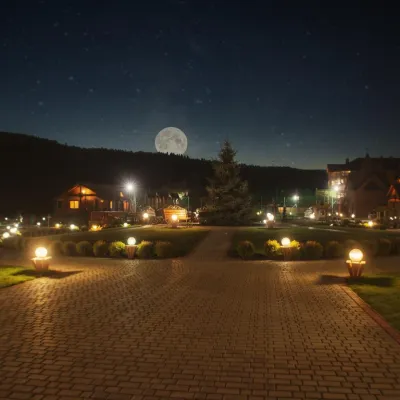
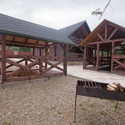
Where anglers can stay
Stays offering fishing within 2 km of the river
Trails nearby
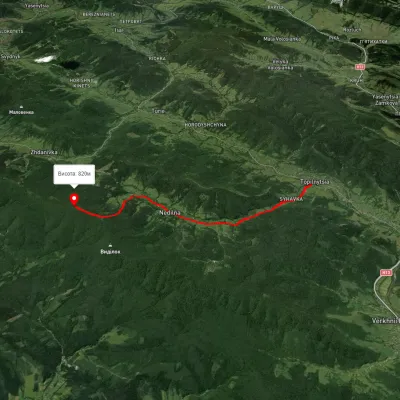 ModerateOne-dayMarkedNedilna Tower of MemoryElevation profile440–823 m9 kmascent 598 m≈ 3.5 h walking16 km from Stryi River
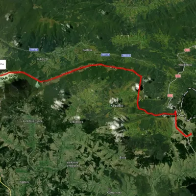 HardMulti-dayUnmarkedSianky village to Mount Pikuivia Mount Starostyna, Mount Velykyi VerkhElevation profile845–1 404 m31.9 kmascent 945 m≈ 10 h walking18 km from Stryi River
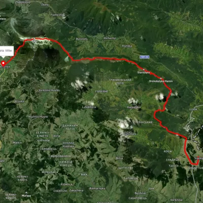 HardMulti-dayUnmarkedSianky village to Bilasovytsia villagevia the Verkhovyna Watershed ridge, Mount PikuiElevation profile558–1 388 m40.9 kmascent 1 396 m≈ 13 h walking18 km from Stryi River
Nearby attractions
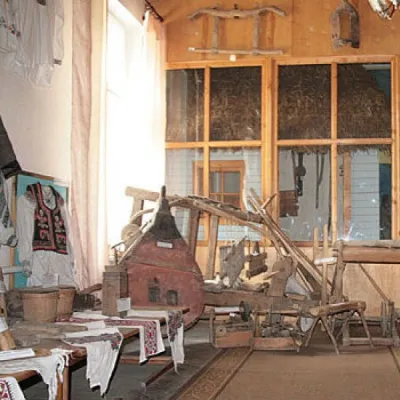 MuseumMuseum Boykivshchyna, Turkaunder 1 km from Stryi RiverThe Boikivshchyna Folk Museum was established in 1987 in Turka by library workers and operated as a department of the library at the time.
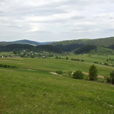 PeakMount Rozluchaltitude 933 m7.1 km from Stryi RiverRozluch is a 933 m mountain in the Upper Dniester Beskids, the highest point of the Rozluch ridge. It lies in the Sambir (formerly Turka) district of Lviv Oblast,...
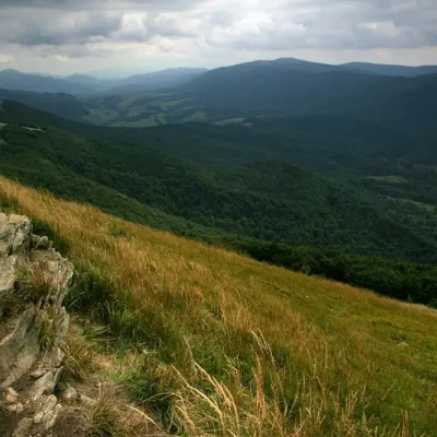 NatureRazlucha Ridge7.1 km from Stryi RiverThe ridge is located near the source of the Dniester River. TheRozlucha ridge is suitable for families.